

$2,350 / Month
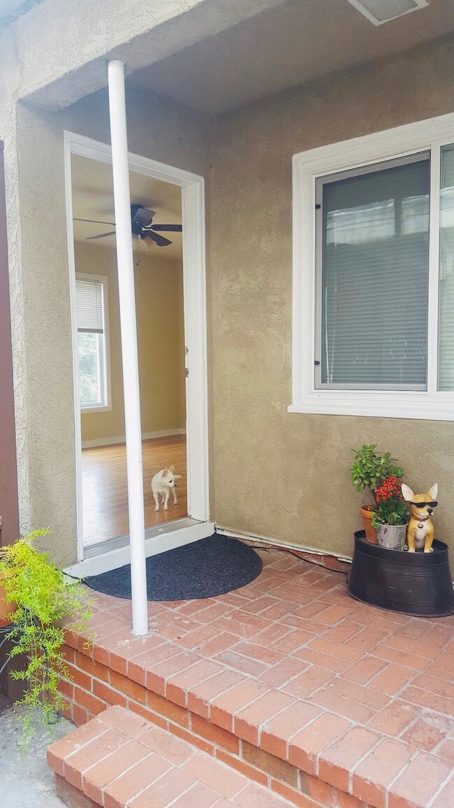
5015 MacArthur Blvd
Oakland, CA 94619
2 Weeks Ago
Favorites
5015 MacArthur Blvd

Favorites
Check Back Soon for Upcoming Availability
| Beds | Baths | Average SF |
|---|---|---|
| 2 Bedrooms 2 Bedrooms 2 Br | 1 Bath 1 Bath 1 Ba | — |
About This Property
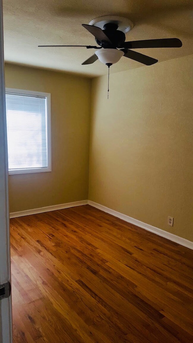
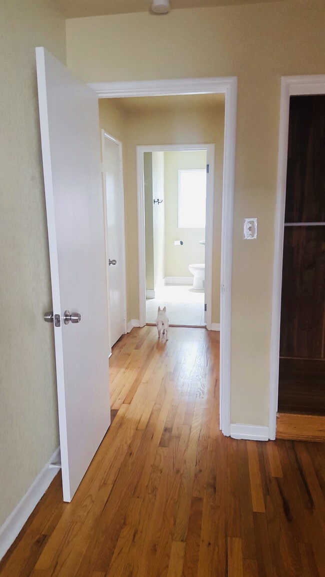
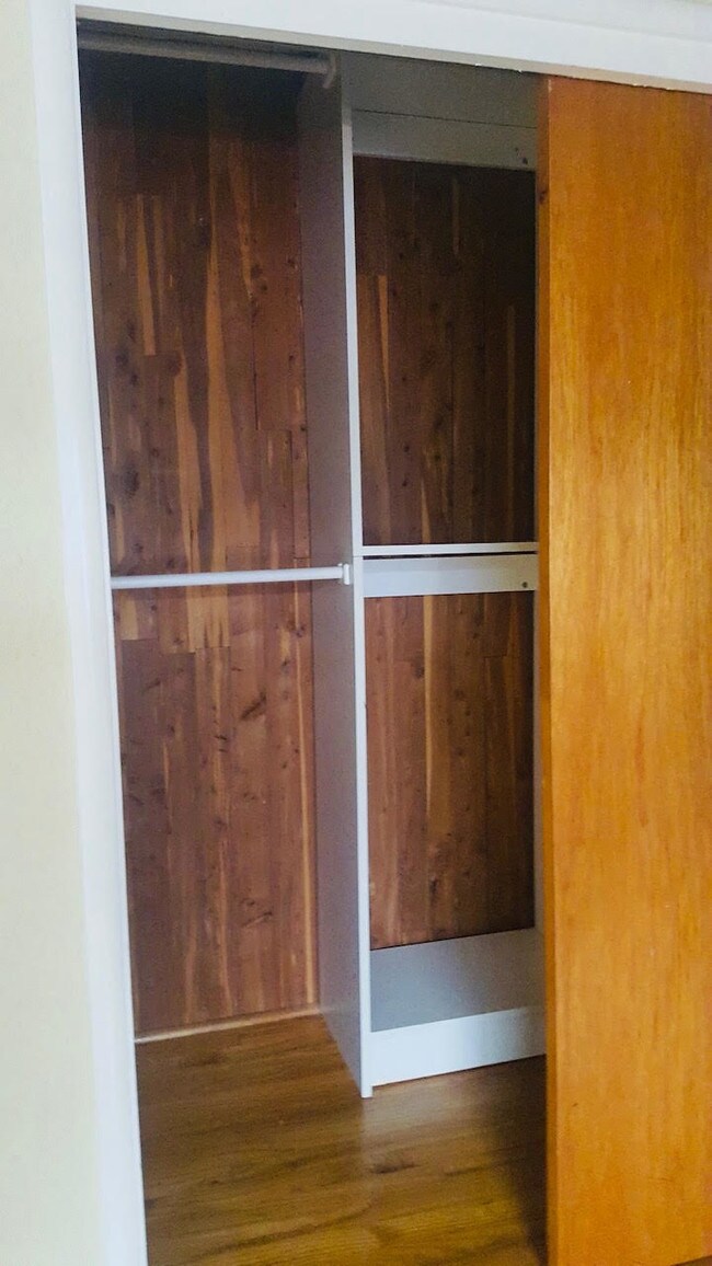
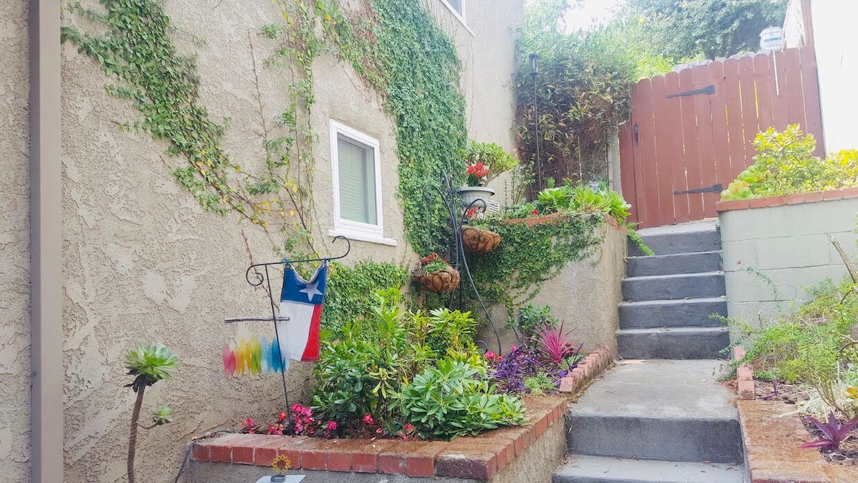
Spacious naturally lit duplex set up and off the street in secluded setting. Hardwood and tile floors throughout. Stove, refrigerator, and microwave hood in kitchen. Garage parking included for one car. Laundry on site. Garbage included. Section 8 considered. Steps away from public transit. Right at 580 freeway access and minutes from hwy 13 and casual carpool. Close to tons of eateries and shops in Laurel District and close to Redwood & Dimond shopping as well.
5015 MacArthur Blvd is a townhome located in Alameda County and the 94619 ZIP Code. This area is served by the Oakland Unified attendance zone.
Location
Get Directions
Middle East Oakland sits as a collection of neighborhoods west of Interstate 580, including Havenscourt, Lockwood Gardens, Maxwell Park, Melrose, Millsmont, Oakmore, Ridgemont, and Seminary.
The area features a variety of residential homes that have developed over 100 years. Mills College rests centrally to Middle East Oakland, with some students living within the area. Many residents choose Middle East Oakland for easy commuting access into downtown Oakland, Oracle Arena, and the Oakland International Airport.
Middle East Oakland lies six miles southeast to downtown Oakland and 15 miles east of San Francisco.
Learn more about living in Middle East OaklandBelow are rent ranges for similar nearby apartments
Education
| Colleges & Universities | Distance | ||
|---|---|---|---|
| Colleges & Universities | Distance | ||
| Walk: | 7 min | 0.4 mi | |
| Drive: | 8 min | 5.1 mi | |
| Drive: | 10 min | 5.5 mi | |
| Drive: | 9 min | 5.6 mi |
5015 MacArthur Blvd is within 7 minutes or 0.4 mile from Mills College. It is also near Laney College and Lincoln University, Oakland.
Schools


Public Elementary & Middle School
Grades K-8
656 Students
Nearby
Charter Elementary & Middle School
Grades K-8
224 Students
Nearby
Charter High School
Grades 9-12
351 Students
Nearby
Private Elementary, Middle & High School
Grades PK-10
16 Students
Nearby
Private Elementary, Middle & High School
Grades K-12
Nearby
Private Elementary School
Grades K-5
87 Students
Nearby
Private Middle School
Grades 6-8
124 Students
Nearby
School data provided by
 The GreatSchools Rating helps parents compare schools within a state based on a variety of school quality indicators and provides a helpful picture of how effectively each school serves all of its students. Ratings are on a scale of 1 (below average) to 10 (above average) and can include test scores, college readiness, academic progress, advanced courses, equity, discipline and attendance data. We also advise parents to visit schools, consider other information on school performance and programs, and consider family needs as part of the school selection process.
View GreatSchools Rating Methodology
Data provided by GreatSchools.org © 2025. All rights reserved.
View GreatSchools Rating Methodology
Data provided by GreatSchools.org © 2025. All rights reserved.
Transportation options available in Oakland include Fruitvale Station, located 2.7 miles from 5015 MacArthur Blvd. 5015 MacArthur Blvd is near Metro Oakland International, located 6.4 miles or 11 minutes away, and San Francisco International, located 27.2 miles or 39 minutes away.
| Transit / Subway | Distance | ||
|---|---|---|---|
| Transit / Subway | Distance | ||
|
|
Drive: | 5 min | 2.7 mi |
|
|
Drive: | 6 min | 3.0 mi |
|
|
Drive: | 11 min | 5.4 mi |
|
|
Drive: | 9 min | 5.5 mi |
|
|
Drive: | 8 min | 5.7 mi |
| Commuter Rail | Distance | ||
|---|---|---|---|
| Commuter Rail | Distance | ||
|
|
Drive: | 10 min | 6.0 mi |
|
|
Drive: | 11 min | 8.2 mi |
|
|
Drive: | 14 min | 10.3 mi |
|
|
Drive: | 17 min | 11.8 mi |
| Drive: | 17 min | 11.8 mi |
| Airports | Distance | ||
|---|---|---|---|
| Airports | Distance | ||
|
Metro Oakland International
|
Drive: | 11 min | 6.4 mi |
|
San Francisco International
|
Drive: | 39 min | 27.2 mi |
Time and distance from 5015 MacArthur Blvd.
| Shopping Centers | Distance | ||
|---|---|---|---|
| Shopping Centers | Distance | ||
| Walk: | 18 min | 1.0 mi | |
| Drive: | 4 min | 1.4 mi | |
| Drive: | 3 min | 1.4 mi |
5015 MacArthur Blvd has 3 shopping centers within 1.4 miles, which is about a 3-minute walk. The miles and minutes will be for the farthest away property.
| Parks and Recreation | Distance | ||
|---|---|---|---|
| Parks and Recreation | Distance | ||
|
Roberts Regional Recreation Area
|
Drive: | 9 min | 3.7 mi |
|
Redwood Regional Park
|
Drive: | 9 min | 4.0 mi |
|
Chabot Space & Science Center
|
Drive: | 12 min | 4.4 mi |
|
Joaquin Miller Park
|
Drive: | 11 min | 4.5 mi |
|
Leona Canyon Regional Open Space Preserve
|
Drive: | 10 min | 5.1 mi |
5015 MacArthur Blvd has 5 parks within 5.1 miles, including Roberts Regional Recreation Area, Joaquin Miller Park, and Chabot Space & Science Center.
| Hospitals | Distance | ||
|---|---|---|---|
| Hospitals | Distance | ||
| Drive: | 5 min | 2.7 mi | |
| Drive: | 4 min | 3.0 mi | |
| Drive: | 11 min | 4.7 mi |
5015 MacArthur Blvd has 3 hospitals within 4.7 miles, the nearest is Telecare Heritage Psychiatric Health Facility which is 2.7 miles away and a 5 minute drive.
| Military Bases | Distance | ||
|---|---|---|---|
| Military Bases | Distance | ||
| Drive: | 18 min | 8.9 mi | |
| Drive: | 18 min | 10.7 mi |
5015 MacArthur Blvd is 8.9 miles from Alameda/US Naval Air Station Alameda, and is convenient to other military bases, including Oakland Army Base.
You May Also Like
Similar Rentals Nearby


What Are Walk Score®, Transit Score®, and Bike Score® Ratings?
Walk Score® measures the walkability of any address. Transit Score® measures access to public transit. Bike Score® measures the bikeability of any address.
What is a Sound Score Rating?
A Sound Score Rating aggregates noise caused by vehicle traffic, airplane traffic and local sources
5015 MacArthur Blvd
Oakland, CA 94619