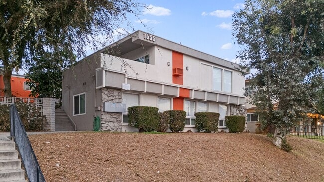
501 Tamarind Way Unit A
West Covina, CA 91791

Check Back Soon for Upcoming Availability
| Beds | Baths | Average SF |
|---|---|---|
| 2 Bedrooms 2 Bedrooms 2 Br | 3 Baths 3 Baths 3 Ba | 1,585 SF |
Fees and Policies
The fees below are based on community-supplied data and may exclude additional fees and utilities.
- Parking
-
Other--
Details
Utilities Included
-
Trash Removal
Property Information
-
Furnished Units Available
About This Property
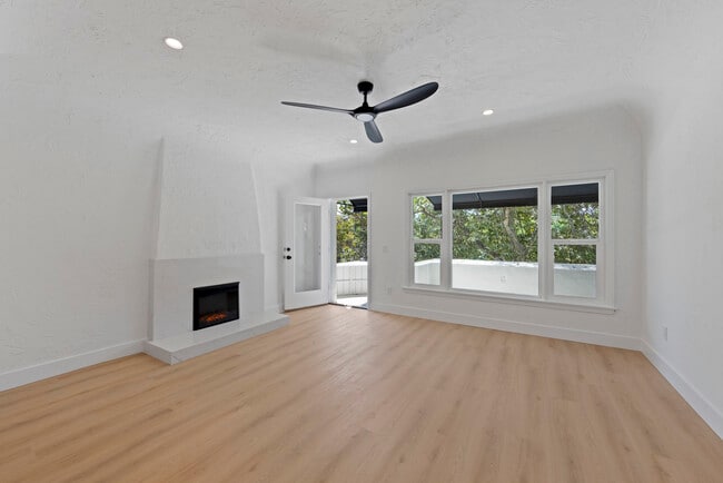
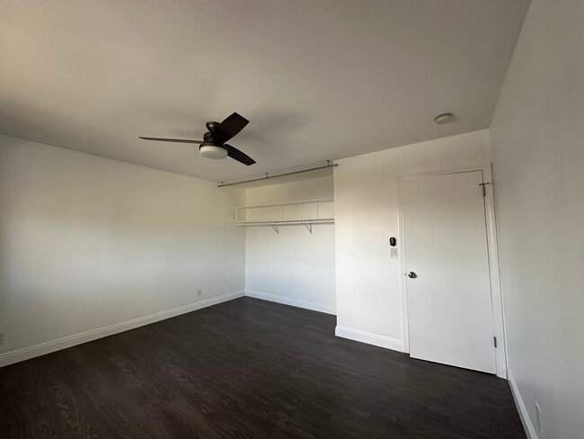
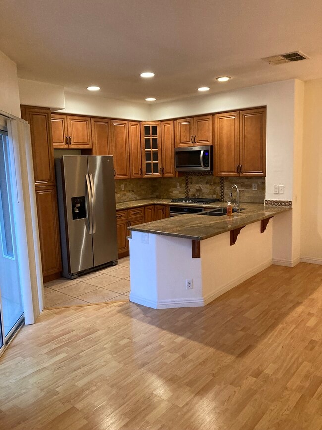
Brand new model home, dual suites condo in the convenient location of West Covina close to Fwy 10, shopping malls, banks, local restaurants, and schools. Fully furnished. The end unit with much of natural light. Contemporary features of 9' ceilings, rooftop solar system, hot water recirculating pump, tankless water heater, fire sprinkler system, and Ring doorbell camera system installed. Modernized kitchen with brand new appliances including 6-burner stove with gas range, microwave, dishwasher, and french doors refrigerator. New closet stacked washer and dryer installed on the bedroom floor. One loft on the main floor with laminate flooring. The open living space and great kitchen on the second floor(Laminate flooring). Two suites with shower and tub bathrooms on the third floor. 2 car parking spaces.
501 Tamarind Way is a condo located in Los Angeles County and the 91791 ZIP Code. This area is served by the Covina-Valley Unified attendance zone.
Condo Features
- Air Conditioning
- Heating
- Furnished
Covina-Valley is a large area south of Arrow Highway, about 20 miles east of Downtown Los Angeles. The town is densely populated with modern amenities and several businesses scattered throughout. Renters have a large rental market with a variety of apartments and spacious single-family homes to choose from. Warehouses, manufacturing plants, and offices are situated in the northwestern corner of town while shopping centers are located along the main thoroughfares. Although the neighborhood is accessible to the big city to the west, outdoor recreation is abundant in and around town. Santa Fe Dam Recreation Area is north of town while the San Jose Hills are nestled in the southern portion of town. More great features just outside of town include California State Polytechnic University, Mount San Antonio College, and Brackett Field Airport.
Learn more about living in Covina-ValleyBelow are rent ranges for similar nearby apartments
| Beds | Average Size | Lowest | Typical | Premium |
|---|---|---|---|---|
| Studio Studio Studio | 401-412 Sq Ft | $1,500 | $2,400 | $3,395 |
| 1 Bed 1 Bed 1 Bed | 687-688 Sq Ft | $1,350 | $2,200 | $4,033 |
| 2 Beds 2 Beds 2 Beds | 1018-1019 Sq Ft | $1,950 | $2,642 | $4,395 |
| 3 Beds 3 Beds 3 Beds | 1257-1259 Sq Ft | $1,500 | $3,326 | $4,500 |
| 4 Beds 4 Beds 4 Beds | 2837 Sq Ft | $875 | $4,769 | $9,000 |
- Air Conditioning
- Heating
- Furnished
| Colleges & Universities | Distance | ||
|---|---|---|---|
| Colleges & Universities | Distance | ||
| Drive: | 10 min | 5.0 mi | |
| Drive: | 10 min | 5.2 mi | |
| Drive: | 10 min | 6.1 mi | |
| Drive: | 11 min | 7.3 mi |
 The GreatSchools Rating helps parents compare schools within a state based on a variety of school quality indicators and provides a helpful picture of how effectively each school serves all of its students. Ratings are on a scale of 1 (below average) to 10 (above average) and can include test scores, college readiness, academic progress, advanced courses, equity, discipline and attendance data. We also advise parents to visit schools, consider other information on school performance and programs, and consider family needs as part of the school selection process.
View GreatSchools Rating Methodology
Data provided by GreatSchools.org © 2025. All rights reserved.
Transportation options available in West Covina include Azusa Downtown Station, located 4.2 miles from 501 Tamarind Way Unit A. 501 Tamarind Way Unit A is near Ontario International, located 20.1 miles or 26 minutes away, and Long Beach (Daugherty Field), located 29.6 miles or 39 minutes away.
| Transit / Subway | Distance | ||
|---|---|---|---|
| Transit / Subway | Distance | ||
| Drive: | 7 min | 4.2 mi | |
| Drive: | 10 min | 4.9 mi | |
| Drive: | 11 min | 5.3 mi | |
| Drive: | 13 min | 8.2 mi | |
| Drive: | 15 min | 9.6 mi |
| Commuter Rail | Distance | ||
|---|---|---|---|
| Commuter Rail | Distance | ||
|
|
Drive: | 5 min | 2.3 mi |
|
|
Drive: | 6 min | 3.4 mi |
|
|
Drive: | 12 min | 8.5 mi |
|
|
Drive: | 15 min | 8.6 mi |
|
|
Drive: | 17 min | 11.9 mi |
| Airports | Distance | ||
|---|---|---|---|
| Airports | Distance | ||
|
Ontario International
|
Drive: | 26 min | 20.1 mi |
|
Long Beach (Daugherty Field)
|
Drive: | 39 min | 29.6 mi |
Time and distance from 501 Tamarind Way Unit A.
| Shopping Centers | Distance | ||
|---|---|---|---|
| Shopping Centers | Distance | ||
| Walk: | 4 min | 0.2 mi | |
| Walk: | 4 min | 0.3 mi | |
| Walk: | 4 min | 0.3 mi |
| Parks and Recreation | Distance | ||
|---|---|---|---|
| Parks and Recreation | Distance | ||
|
Covina Park
|
Drive: | 3 min | 1.6 mi |
|
Galster Wilderness Park Nature Center
|
Drive: | 6 min | 3.1 mi |
|
Santa Fe Dam Recreation Area
|
Drive: | 17 min | 5.8 mi |
|
Santa Fe Dam Nature Center
|
Drive: | 17 min | 5.8 mi |
|
Frank G. Bonelli Regional Park
|
Drive: | 14 min | 8.2 mi |
| Hospitals | Distance | ||
|---|---|---|---|
| Hospitals | Distance | ||
| Drive: | 4 min | 1.8 mi | |
| Drive: | 6 min | 3.4 mi | |
| Drive: | 7 min | 4.0 mi |
| Military Bases | Distance | ||
|---|---|---|---|
| Military Bases | Distance | ||
| Drive: | 40 min | 31.6 mi |
You May Also Like
Similar Rentals Nearby
What Are Walk Score®, Transit Score®, and Bike Score® Ratings?
Walk Score® measures the walkability of any address. Transit Score® measures access to public transit. Bike Score® measures the bikeability of any address.
What is a Sound Score Rating?
A Sound Score Rating aggregates noise caused by vehicle traffic, airplane traffic and local sources


