
The Journal
36 Journal Sq,
Jersey City, NJ 07306
$3,225 - $7,100
Studio - 3 Beds
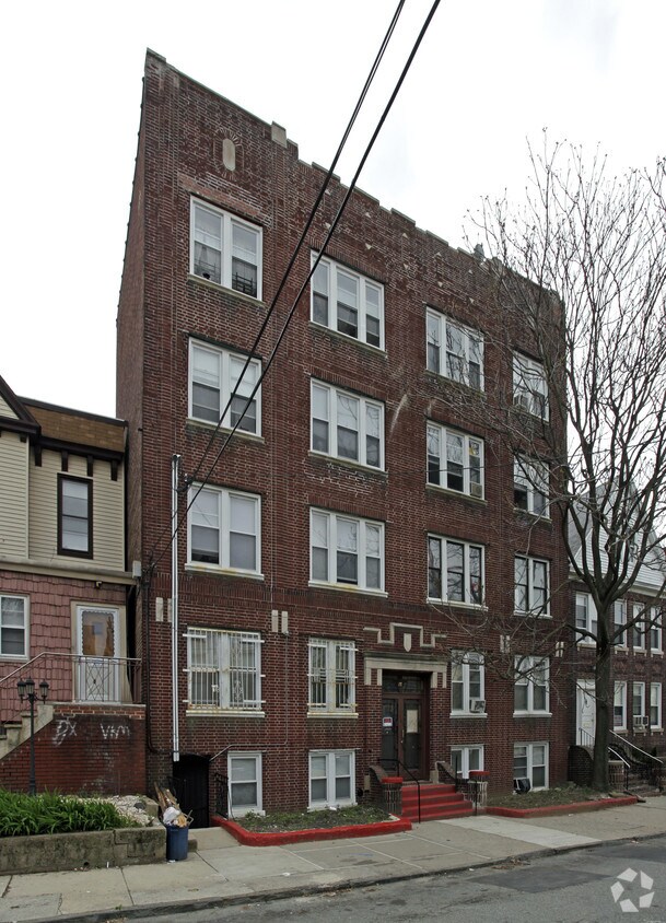
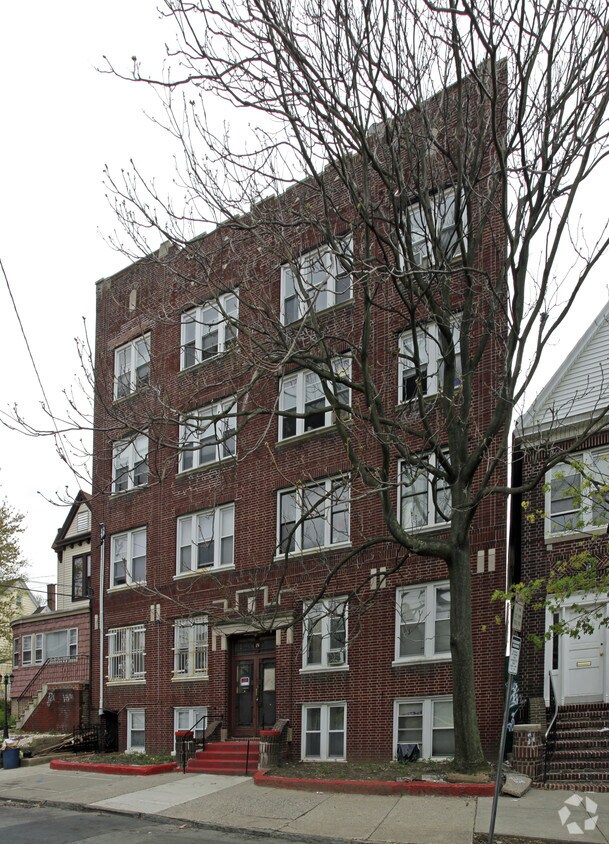

Discover your new home at 5 Van Houten Ave. This community is located in the Hackensack River Waterfront area of Jersey City. The leasing staff is ready to show off our wonderful community. Start living the good life at 5 Van Houten Ave. Contact us or stop in to discuss your new apartment.
5 Van Houten Ave is an apartment community located in Hudson County and the 07305 ZIP Code. This area is served by the Jersey City Public School District attendance zone.
Located on the west side of Jersey City, the Hackensack River Waterfront offers residents a suburban home environment with plenty of beautiful outdoor spaces to explore. The community boasts a broad range of apartments, condos, and townhomes available for rent in a scenic locale.
Although the community is largely residential, the Hackensack River Waterfront also provides excellent shopping and dining options at Hudson Mall, along with easy access to a vibrant stretch of diverse eateries, boutiques, and bars on West Side Avenue. The expansive Lincoln Park borders the community to the north, offering multi-use trails, athletic facilities, wildlife habitats, artistic statues, and a dog park close to home. Liberty State Park is also just a short drive away.
The community’s close proximity to New Jersey City University and Saint Peter’s University makes it a top choice for many students, faculty, and staff.
Learn more about living in Hackensack River WaterfrontCompare neighborhood and city base rent averages by bedroom.
| Hackensack River Waterfront | Jersey City, NJ | |
|---|---|---|
| Studio | $2,051 | $2,723 |
| 1 Bedroom | $2,363 | $3,212 |
| 2 Bedrooms | $3,295 | $4,307 |
| 3 Bedrooms | $2,100 | $5,117 |
| Colleges & Universities | Distance | ||
|---|---|---|---|
| Colleges & Universities | Distance | ||
| Walk: | 8 min | 0.4 mi | |
| Drive: | 4 min | 1.8 mi | |
| Drive: | 5 min | 2.4 mi | |
| Drive: | 17 min | 8.2 mi |


Transportation options available in Jersey City include West Side Avenue, located 0.8 mile from 5 Van Houten Ave. 5 Van Houten Ave is near Newark Liberty International, located 7.2 miles or 12 minutes away, and LaGuardia, located 17.0 miles or 35 minutes away.
| Transit / Subway | Distance | ||
|---|---|---|---|
| Transit / Subway | Distance | ||
|
|
Walk: | 15 min | 0.8 mi |
|
|
Walk: | 17 min | 0.9 mi |
|
|
Walk: | 17 min | 0.9 mi |
|
|
Drive: | 3 min | 1.2 mi |
|
|
Drive: | 4 min | 1.8 mi |
| Commuter Rail | Distance | ||
|---|---|---|---|
| Commuter Rail | Distance | ||
|
|
Drive: | 5 min | 2.4 mi |
|
|
Drive: | 7 min | 3.4 mi |
|
|
Drive: | 9 min | 3.9 mi |
|
|
Drive: | 10 min | 5.5 mi |
|
|
Drive: | 11 min | 5.7 mi |
| Airports | Distance | ||
|---|---|---|---|
| Airports | Distance | ||
|
Newark Liberty International
|
Drive: | 12 min | 7.2 mi |
|
LaGuardia
|
Drive: | 35 min | 17.0 mi |
Scores provided by
Traffic
BusyAirport
CalmBusinesses
BusyScores provided by
HowLoud What is a Sound Score Rating? A Sound Score Rating aggregates noise caused by vehicle traffic, airplane traffic and local sources. How It WorksTime and distance from 5 Van Houten Ave.
| Shopping Centers | Distance | ||
|---|---|---|---|
| Shopping Centers | Distance | ||
| Walk: | 12 min | 0.6 mi | |
| Walk: | 14 min | 0.7 mi | |
| Walk: | 16 min | 0.9 mi |
| Parks and Recreation | Distance | ||
|---|---|---|---|
| Parks and Recreation | Distance | ||
|
Stephen Gregg Park
|
Drive: | 5 min | 2.4 mi |
|
Liberty Science Center
|
Drive: | 6 min | 2.6 mi |
|
Liberty Landing Marina
|
Drive: | 8 min | 3.3 mi |
|
Ellis Island National Monument
|
Drive: | 12 min | 3.7 mi |
|
Statue of Liberty
|
Drive: | 12 min | 3.7 mi |
| Hospitals | Distance | ||
|---|---|---|---|
| Hospitals | Distance | ||
| Drive: | 6 min | 2.6 mi | |
| Drive: | 7 min | 3.4 mi | |
| Drive: | 7 min | 3.8 mi |
| Military Bases | Distance | ||
|---|---|---|---|
| Military Bases | Distance | ||
| Drive: | 9 min | 3.8 mi | |
| Drive: | 18 min | 9.2 mi | |
| Drive: | 27 min | 12.1 mi |
What Are Walk Score®, Transit Score®, and Bike Score® Ratings?
Walk Score® measures the walkability of any address. Transit Score® measures access to public transit. Bike Score® measures the bikeability of any address.
What is a Sound Score Rating?
A Sound Score Rating aggregates noise caused by vehicle traffic, airplane traffic and local sources.


