
Presidential Towers
555 W Madison St,
Chicago, IL 60661
$1,763 - $5,140
Studio - 2 Beds
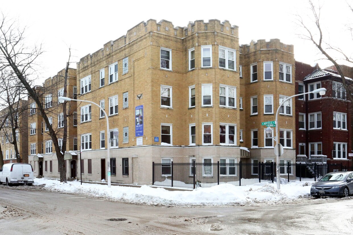
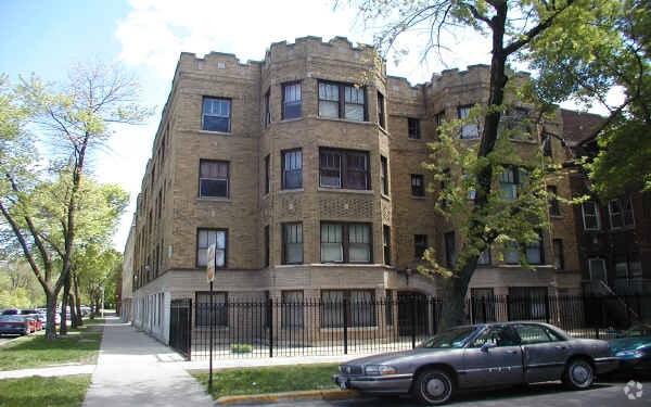
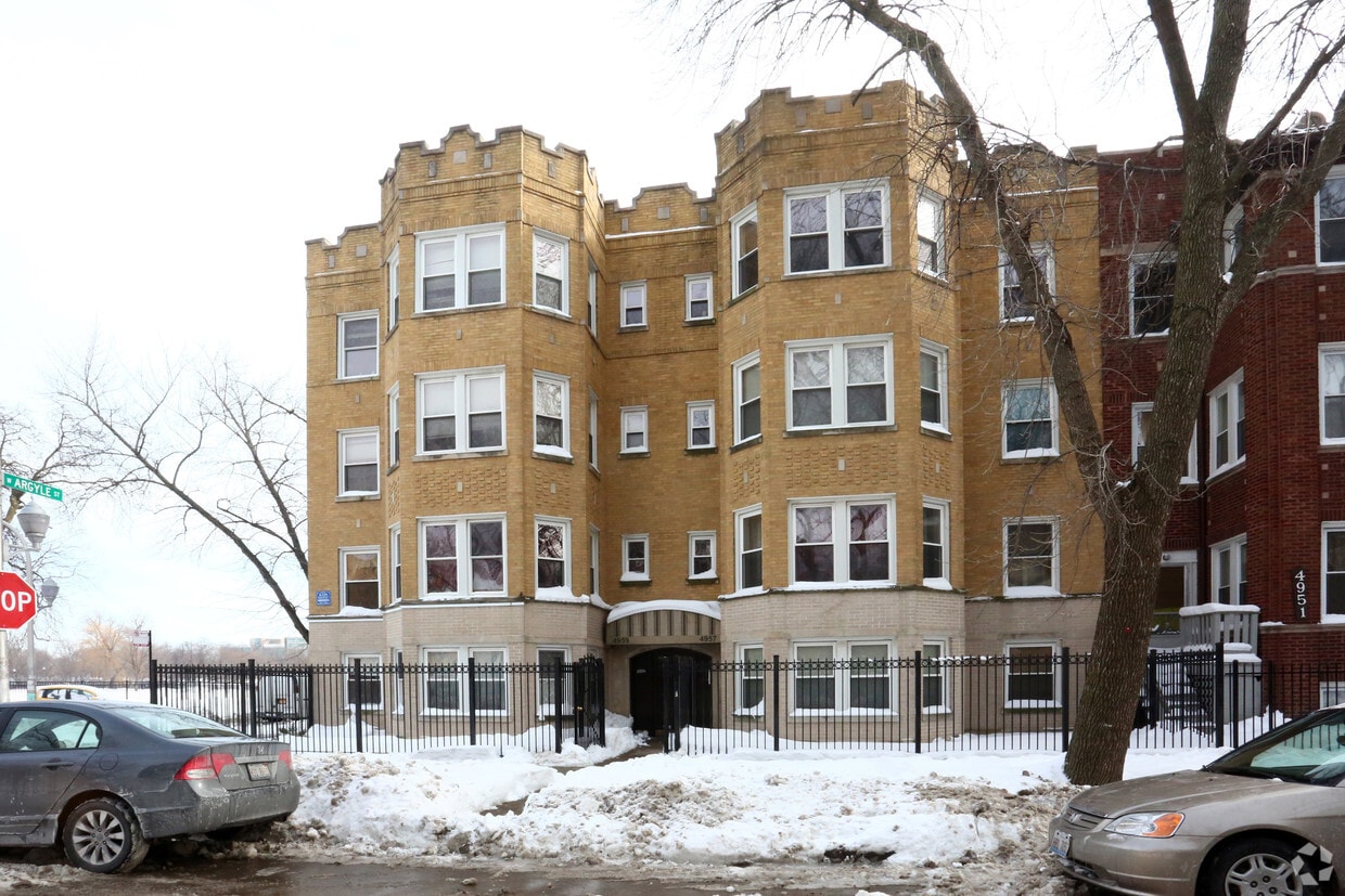
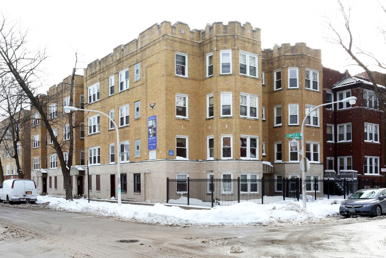
Find a new place to live at 4957-4959 N Albany Ave. The location of this community is at 4957-4959 N. Albany Ave in Chicago. Come for a visit to check out the apartment floorplan options. A selection of amenities is waiting for you at this community. Some of these include: smoke free options, high-speed internet access, and convenient on-site parking options. Stop by 4957-4959 N Albany Ave today.
4957-4959 N Albany Ave is an apartment community located in Cook County and the 60625 ZIP Code. This area is served by the Chicago Public Schools attendance zone.
High Speed Internet Access
Refrigerator
Tub/Shower
Smoke Free
The Albany Park community is a melting pot of culture in Chicago. As one of the city’s most diverse neighborhoods, students served by the Chicago Public Schools system speak more than 40 languages in the classroom. Originally settled in 1893, streetcars helped aid the neighborhood’s growth and development just three years later.
Its massive support of public transit is aided by Brown and Blue Line Stations throughout the community. Residents adore its many bus stops as well as proximity to Interstate 94. You can pretty much find any type of cuisine in Albany Park – no passport needed since it is right in your own backyard! You’ll also find many community gardens and recreational parks for your enjoyment.
Learn more about living in Albany ParkCompare neighborhood and city base rent averages by bedroom.
| Albany Park | Chicago, IL | |
|---|---|---|
| Studio | $904 | $1,634 |
| 1 Bedroom | $978 | $2,031 |
| 2 Bedrooms | $1,394 | $2,548 |
| 3 Bedrooms | $1,716 | $3,055 |
| Colleges & Universities | Distance | ||
|---|---|---|---|
| Colleges & Universities | Distance | ||
| Walk: | 7 min | 0.4 mi | |
| Drive: | 4 min | 1.7 mi | |
| Drive: | 7 min | 2.9 mi | |
| Drive: | 7 min | 3.3 mi |


Transportation options available in Chicago include Kedzie Station (Brown Line), located 0.5 mile from 4957-4959 N Albany Ave. 4957-4959 N Albany Ave is near Chicago O'Hare International, located 11.3 miles or 19 minutes away, and Chicago Midway International, located 14.5 miles or 28 minutes away.
| Transit / Subway | Distance | ||
|---|---|---|---|
| Transit / Subway | Distance | ||
|
|
Walk: | 10 min | 0.5 mi |
|
|
Walk: | 11 min | 0.6 mi |
|
|
Walk: | 13 min | 0.7 mi |
|
|
Drive: | 4 min | 1.1 mi |
|
|
Drive: | 3 min | 1.3 mi |
| Commuter Rail | Distance | ||
|---|---|---|---|
| Commuter Rail | Distance | ||
|
|
Drive: | 6 min | 2.3 mi |
|
|
Drive: | 5 min | 2.7 mi |
|
|
Drive: | 6 min | 3.1 mi |
| Drive: | 7 min | 3.3 mi | |
|
|
Drive: | 7 min | 3.7 mi |
| Airports | Distance | ||
|---|---|---|---|
| Airports | Distance | ||
|
Chicago O'Hare International
|
Drive: | 19 min | 11.3 mi |
|
Chicago Midway International
|
Drive: | 28 min | 14.5 mi |
Scores provided by
Traffic
ActiveAirport
CalmBusinesses
ActiveScores provided by
HowLoud What is a Sound Score Rating? A Sound Score Rating aggregates noise caused by vehicle traffic, airplane traffic and local sources. How It WorksTime and distance from 4957-4959 N Albany Ave.
| Shopping Centers | Distance | ||
|---|---|---|---|
| Shopping Centers | Distance | ||
| Walk: | 5 min | 0.3 mi | |
| Walk: | 10 min | 0.5 mi | |
| Walk: | 11 min | 0.6 mi |
| Parks and Recreation | Distance | ||
|---|---|---|---|
| Parks and Recreation | Distance | ||
|
Gompers Park
|
Drive: | 4 min | 1.8 mi |
|
Winnemac Park
|
Drive: | 4 min | 1.8 mi |
|
North Park Village Nature Center
|
Drive: | 4 min | 2.2 mi |
|
Chase Park
|
Drive: | 5 min | 2.3 mi |
|
Labagh Woods
|
Drive: | 8 min | 3.2 mi |
| Hospitals | Distance | ||
|---|---|---|---|
| Hospitals | Distance | ||
| Walk: | 11 min | 0.6 mi | |
| Drive: | 6 min | 2.4 mi | |
| Drive: | 7 min | 3.2 mi |
| Military Bases | Distance | ||
|---|---|---|---|
| Military Bases | Distance | ||
| Drive: | 28 min | 18.9 mi |
What Are Walk Score®, Transit Score®, and Bike Score® Ratings?
Walk Score® measures the walkability of any address. Transit Score® measures access to public transit. Bike Score® measures the bikeability of any address.
What is a Sound Score Rating?
A Sound Score Rating aggregates noise caused by vehicle traffic, airplane traffic and local sources.
4957-4959 N Albany Ave
Chicago, IL 60625


