1 / 26


| Beds | Baths | Average SF |
|---|---|---|
| 2 Bedrooms 2 Bedrooms 2 Br | 1 Bath 1 Bath 1 Ba | 900 SF |
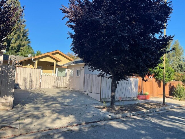
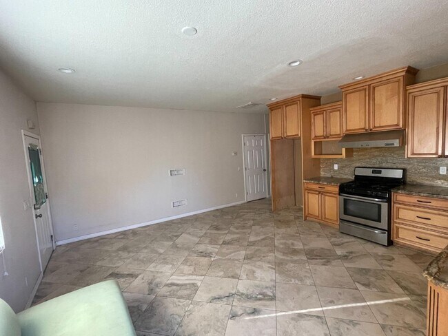
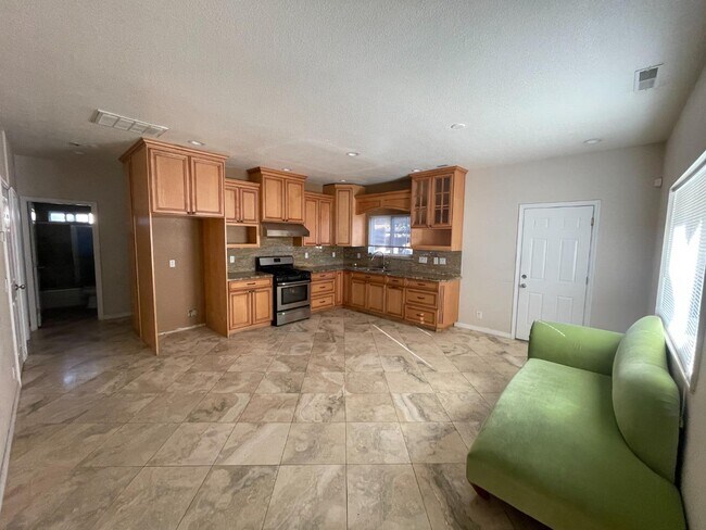
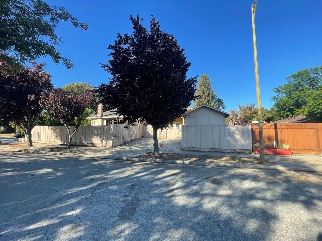
A rare find rental opportunity! Location, location, location. This is an attached home situated in the boundaries of Santa Teresa Residential Neighborhood. It has 2 bedrooms, 1 bathroom, 10x10 storage, side patio, 2 car driveway. Close to coyote trail, Shady Oaks Park, The Plex, freeway 101, 85 and more!
495 Hassinger Rd is a house located in Santa Clara County and the 95111 ZIP Code. This area is served by the Oak Grove Elementary School District attendance zone.
San Jose is the largest city in the San Francisco Bay Area and the beating heart of Silicon Valley, where major tech companies including Adobe, Cisco, and PayPal have long called home. Spanning 182 square miles at the southern end of the bay, it carries real weight as both an economic engine and a cultural center, anchored further by San Jose State University, whose downtown campus shapes much of the city's creative and intellectual energy. Founded in 1777 as California's first city, San Jose balances deep historical roots with an unmistakably forward-facing identity.
Neighborhoods here vary considerably in character. Willow Glen draws renters with tree-lined streets and a walkable village atmosphere along Lincoln Avenue, while the SoFA District and downtown offer a denser, arts-forward setting near SAP Center and The Tech Interactive. Almaden Valley sits closer to open hillside terrain, and Japantown preserves a distinct historic identity just north of downtown.
Learn more about living in San Jose| Colleges & Universities | Distance | ||
|---|---|---|---|
| Colleges & Universities | Distance | ||
| Drive: | 12 min | 5.9 mi | |
| Drive: | 15 min | 9.8 mi | |
| Drive: | 18 min | 12.3 mi | |
| Drive: | 20 min | 14.2 mi |


Transportation options available in San Jose include Santa Teresa Station, located 3.4 miles from 495 Hassinger Rd. 495 Hassinger Rd is near Norman Y Mineta San Jose International, located 13.4 miles or 18 minutes away.
| Transit / Subway | Distance | ||
|---|---|---|---|
| Transit / Subway | Distance | ||
|
|
Drive: | 8 min | 3.4 mi |
|
|
Drive: | 6 min | 3.6 mi |
| Drive: | 6 min | 3.7 mi | |
|
|
Drive: | 6 min | 4.2 mi |
| Drive: | 8 min | 5.4 mi |
| Commuter Rail | Distance | ||
|---|---|---|---|
| Commuter Rail | Distance | ||
| Drive: | 5 min | 2.5 mi | |
| Drive: | 8 min | 4.2 mi | |
| Drive: | 15 min | 9.1 mi | |
| Drive: | 16 min | 10.5 mi | |
| Drive: | 16 min | 10.6 mi |
| Airports | Distance | ||
|---|---|---|---|
| Airports | Distance | ||
|
Norman Y Mineta San Jose International
|
Drive: | 18 min | 13.4 mi |
Scores provided by
Traffic
-Airport
-Businesses
-Scores provided by
HowLoud What is a Sound Score Rating? A Sound Score Rating aggregates noise caused by vehicle traffic, airplane traffic and local sources. How It WorksTime and distance from 495 Hassinger Rd.
| Shopping Centers | Distance | ||
|---|---|---|---|
| Shopping Centers | Distance | ||
| Walk: | 12 min | 0.6 mi | |
| Walk: | 17 min | 0.9 mi | |
| Drive: | 3 min | 1.4 mi |
| Parks and Recreation | Distance | ||
|---|---|---|---|
| Parks and Recreation | Distance | ||
|
Hellyer County Park
|
Drive: | 6 min | 3.0 mi |
|
Coyote Creek Parkway
|
Drive: | 9 min | 5.0 mi |
|
Almaden Lake Park
|
Drive: | 9 min | 5.3 mi |
|
Santa Teresa County Park
|
Drive: | 14 min | 5.9 mi |
|
Lake Cunningham Park
|
Drive: | 12 min | 7.9 mi |
| Hospitals | Distance | ||
|---|---|---|---|
| Hospitals | Distance | ||
| Drive: | 4 min | 2.3 mi | |
| Drive: | 5 min | 2.5 mi | |
| Drive: | 14 min | 9.5 mi |
| Military Bases | Distance | ||
|---|---|---|---|
| Military Bases | Distance | ||
| Drive: | 29 min | 21.4 mi | |
| Drive: | 66 min | 51.4 mi | |
| Drive: | 84 min | 66.7 mi |


What Are Walk Score®, Transit Score®, and Bike Score® Ratings?
Walk Score® measures the walkability of any address. Transit Score® measures access to public transit. Bike Score® measures the bikeability of any address.
What is a Sound Score Rating?
A Sound Score Rating aggregates noise caused by vehicle traffic, airplane traffic and local sources.
495 Hassinger Rd
San Jose, CA 95111