

$4,000 / Month
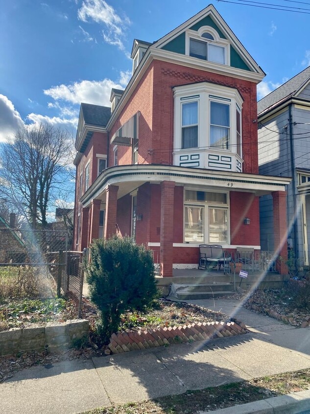
49 Parker St
Cincinnati, OH 45219
2 Weeks Ago
Favorites
49 Parker St

Favorites
Check Back Soon for Upcoming Availability
| Beds | Baths | Average SF |
|---|---|---|
| 5 Bedrooms 5 Bedrooms 5 Br | 3 Baths 3 Baths 3 Ba | 2,900 SF |
About This Property
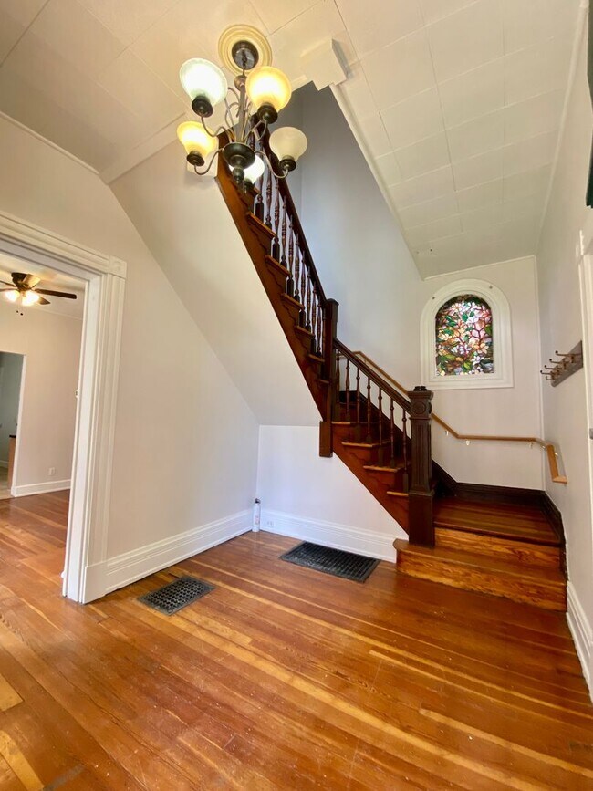
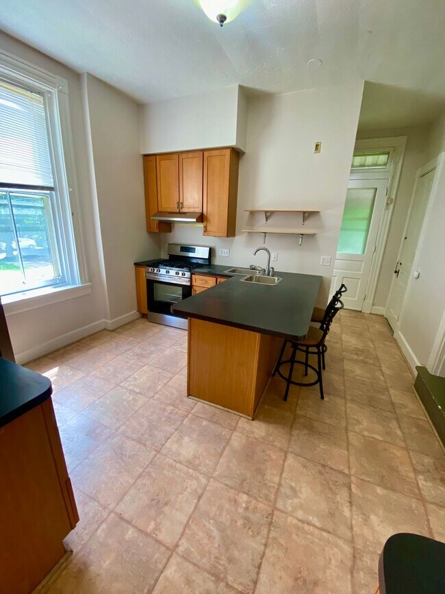
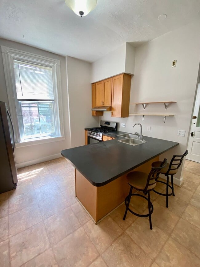
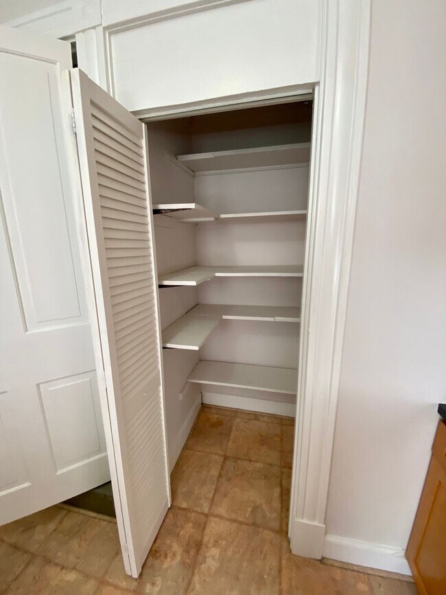
PRE LEASE FOR 2025/2026 You do not want to miss out on this BEAUTIFUL 5 bedroom, 3 full bath unit over 2800 sq. ft. just minutes from UC Campus on one of the most desired streets, PARKER! This rental underwent light renovations with fresh paint top to bottom, finished third floor and a brand new bathroom! Great location, large rooms, high ceilings, stainless steel appliances and laundry included in unit! This unit also comes with central air, remodeled bathrooms, hardwood floor throughout a 2nd floor kitchenette and a fenced in backyard! Tenants pay all utilities. Co-signers Preferred. What are you waiting for? Schedule a tour today by TEXTING our leasing office at for fastest response! We can accommodate later move in dates within the first two weeks of August 2025. Please allow a minimum of 24hr lead time for showings as this unit is occupied.
49 Parker St is a house located in Hamilton County and the 45219 ZIP Code. This area is served by the Cincinnati Public Schools attendance zone.
Location
Get Directions
In Clifton there’s plenty to do and see. The rolling hills, lush parks and green spaces, hip shopping, and affordable apartments create a vibrancy in Clifton that can’t be ignored.
In addition to its active art scene, the neighborhood is encompassing of Mount Storm Park, Edgewood Grove Park, and the Cincinnati State Technical and Community College. Locals enjoy the direct access to Interstate 75, making commutes in and around the city a breeze.
Clifton is just north of the 90-acre Burnet Woods Park and the University of Cincinnati campus. When you have a craving for something sweet or savory, head on over to the Clifton Gaslight District for every kind of cuisine imaginable. Clifton sits atop a hill overlooking the Northside, and Ludlow Avenue has been dubbed Cincinnati’s first “Main Street.
Learn more about living in CliftonBelow are rent ranges for similar nearby apartments
| Beds | Average Size | Lowest | Typical | Premium |
|---|---|---|---|---|
| Studio Studio Studio | 471-474 Sq Ft | $695 | $1,039 | $1,479 |
| 1 Bed 1 Bed 1 Bed | 677 Sq Ft | $720 | $1,150 | $3,890 |
| 2 Beds 2 Beds 2 Beds | 1011-1012 Sq Ft | $800 | $1,639 | $4,250 |
| 3 Beds 3 Beds 3 Beds | 1188-1195 Sq Ft | $899 | $1,698 | $7,500 |
| 4 Beds 4 Beds 4 Beds | 1603-1608 Sq Ft | $585 | $1,754 | $29,400 |
Education
| Colleges & Universities | Distance | ||
|---|---|---|---|
| Colleges & Universities | Distance | ||
| Drive: | 4 min | 1.2 mi | |
| Drive: | 4 min | 1.6 mi | |
| Drive: | 10 min | 3.3 mi | |
| Drive: | 11 min | 3.7 mi |
49 Parker St is within 4 minutes or 1.2 miles from University of Cincinnati. It is also near Univ. of Cincinnati, Medical and Cincinnati State.
Schools


Public Elementary, Middle & High School
Grades 5-12
2,582 Students
Attendance Zone
Public Elementary School
Grades PK-6
236 Students
Attendance Zone
Public Middle & High School
Grades 7-12
1,155 Students
Attendance Zone
Private Elementary, Middle & High School
Grades K-12
131 Students
Nearby
Private Elementary & Middle School
Grades PK-8
195 Students
Nearby
School data provided by
 The GreatSchools Rating helps parents compare schools within a state based on a variety of school quality indicators and provides a helpful picture of how effectively each school serves all of its students. Ratings are on a scale of 1 (below average) to 10 (above average) and can include test scores, college readiness, academic progress, advanced courses, equity, discipline and attendance data. We also advise parents to visit schools, consider other information on school performance and programs, and consider family needs as part of the school selection process.
View GreatSchools Rating Methodology
Data provided by GreatSchools.org © 2025. All rights reserved.
View GreatSchools Rating Methodology
Data provided by GreatSchools.org © 2025. All rights reserved.
Transportation options available in Cincinnati include Brewery District Station, Elm & Henry, located 0.5 mile from 49 Parker St. 49 Parker St is near Cincinnati/Northern Kentucky International, located 15.9 miles or 31 minutes away.
| Transit / Subway | Distance | ||
|---|---|---|---|
| Transit / Subway | Distance | ||
| Walk: | 10 min | 0.5 mi | |
| Walk: | 11 min | 0.6 mi | |
| Walk: | 13 min | 0.7 mi | |
| Drive: | 3 min | 1.1 mi | |
| Drive: | 4 min | 1.4 mi |
| Commuter Rail | Distance | ||
|---|---|---|---|
| Commuter Rail | Distance | ||
|
|
Drive: | 7 min | 2.3 mi |
| Airports | Distance | ||
|---|---|---|---|
| Airports | Distance | ||
|
Cincinnati/Northern Kentucky International
|
Drive: | 31 min | 15.9 mi |
Time and distance from 49 Parker St.
| Shopping Centers | Distance | ||
|---|---|---|---|
| Shopping Centers | Distance | ||
| Drive: | 5 min | 1.6 mi | |
| Drive: | 6 min | 1.9 mi | |
| Drive: | 6 min | 2.3 mi |
49 Parker St has 3 shopping centers within 2.3 miles, which is about a 6-minute drive. The miles and minutes will be for the farthest away property.
| Parks and Recreation | Distance | ||
|---|---|---|---|
| Parks and Recreation | Distance | ||
|
William H. Taft National Historic Site
|
Drive: | 4 min | 1.3 mi |
|
Trailside Nature Center
|
Drive: | 4 min | 1.6 mi |
|
Cincinnati Zoo and Botanical Garden
|
Drive: | 4 min | 1.6 mi |
|
Burnet Woods
|
Drive: | 5 min | 1.8 mi |
|
Duke Energy Children's Museum
|
Drive: | 7 min | 2.3 mi |
49 Parker St has 5 parks within 2.3 miles, including William H. Taft National Historic Site, Trailside Nature Center, and Burnet Woods.
| Hospitals | Distance | ||
|---|---|---|---|
| Hospitals | Distance | ||
| Drive: | 3 min | 1.1 mi | |
| Drive: | 4 min | 1.6 mi | |
| Drive: | 4 min | 1.7 mi |
49 Parker St has 3 hospitals within 1.7 miles, the nearest is Christ Hospital which is 1.1 miles away and a 3 minute drive.
| Military Bases | Distance | ||
|---|---|---|---|
| Military Bases | Distance | ||
| Drive: | 71 min | 52.4 mi | |
| Drive: | 77 min | 57.5 mi | |
| Drive: | 79 min | 60.7 mi |
49 Parker St has 3 military bases within 60.7 miles, the nearest is Gentile Air Force Station which is 52.4 miles away and a 71 minute drive.
You May Also Like
Similar Rentals Nearby


What Are Walk Score®, Transit Score®, and Bike Score® Ratings?
Walk Score® measures the walkability of any address. Transit Score® measures access to public transit. Bike Score® measures the bikeability of any address.
What is a Sound Score Rating?
A Sound Score Rating aggregates noise caused by vehicle traffic, airplane traffic and local sources
49 Parker St
Cincinnati, OH 45219