
Presidential Towers
555 W Madison St,
Chicago, IL 60661
$1,631 - $6,387
Studio - 2 Beds

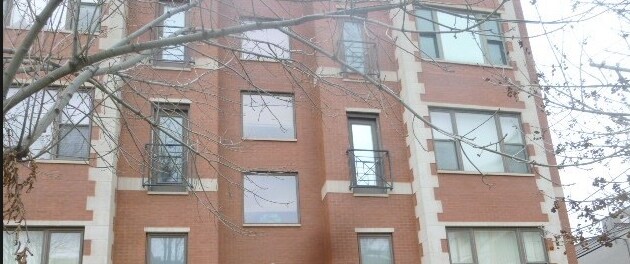
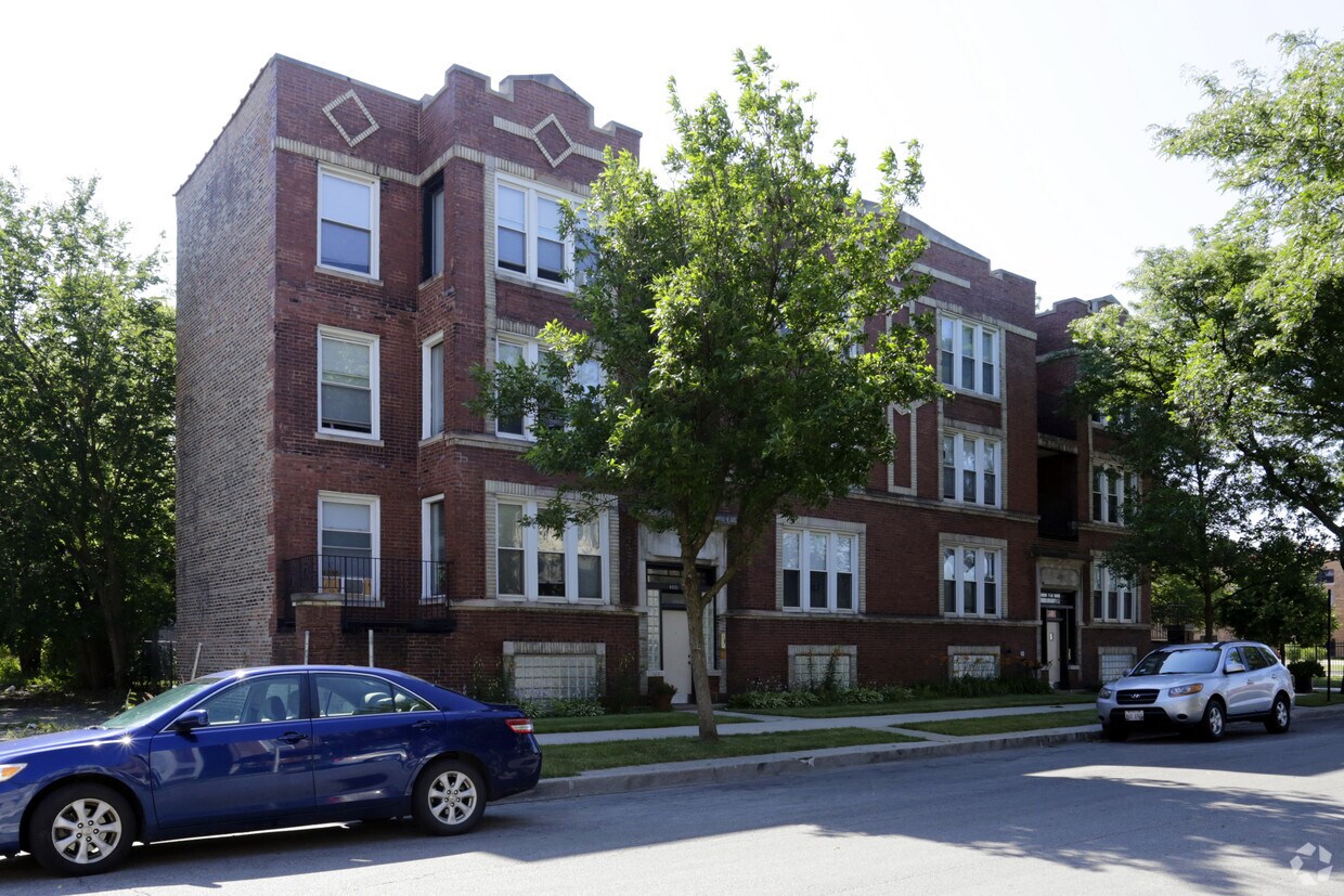
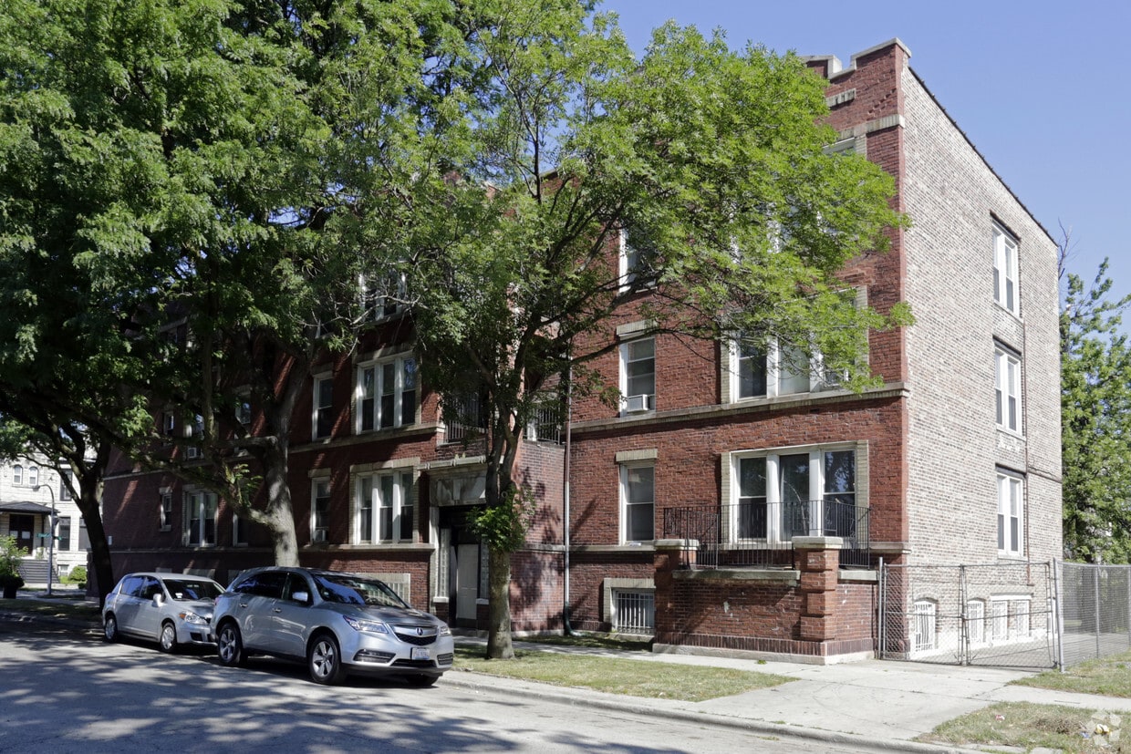
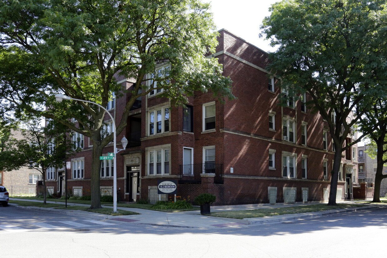
Discover your new home at 4851 S Evans Ave in Chicago, IL. This community is located on S. Evans Ave in the 60615 area of Chicago. Here at this community, the leasing staff is ready to match you with the perfect place to live. Be sure to view the available floorplans. At 4851 S Evans Ave you're right at home.
4851 S Evans Ave is an apartment community located in Cook County and the 60615 ZIP Code. This area is served by the Chicago Public Schools attendance zone.
Air Conditioning
Dishwasher
Hardwood Floors
Refrigerator
About five miles south of Downtown Chicago, Bronzeville is a historic district containing six structures on the National Register of Historic Places. Prominent figures such as Gwendolyn Brooks, Sam Cooke, Ida B. Wells, and Louis Armstrong helped shape Bronzeville into the cultural and progressive community it is today.
Public art fills the streets of Bronzeville, from vibrant murals to elaborate sculptures, most of which line Dr. Martin Luther King Jr. Drive. Lakefront recreation abounds at Burnham Park. The Illinois Institute of Technology lends unique architecture and intellectual pursuits to the neighborhood. Lake Meadows Shopping Center provides an outdoor haven for all kinds of retail delights.
Bronzeville is also notable for its proximity to major amenities such as Guaranteed Rate Field, Washington Park, the University of Chicago, Museum of Science and Industry Chicago, McCormick Place, and Arie Crown Theatre.
Learn more about living in BronzevilleCompare neighborhood and city base rent averages by bedroom.
| Bronzeville | Chicago, IL | |
|---|---|---|
| Studio | $1,176 | $1,644 |
| 1 Bedroom | $1,283 | $2,046 |
| 2 Bedrooms | $1,568 | $2,581 |
| 3 Bedrooms | $1,814 | $3,091 |
| Colleges & Universities | Distance | ||
|---|---|---|---|
| Colleges & Universities | Distance | ||
| Drive: | 3 min | 1.7 mi | |
| Drive: | 6 min | 2.9 mi | |
| Drive: | 10 min | 5.4 mi | |
| Drive: | 11 min | 6.0 mi |


Transportation options available in Chicago include 51St Street Station, located 0.8 mile from 4851 S Evans Ave. 4851 S Evans Ave is near Chicago Midway International, located 8.4 miles or 16 minutes away, and Chicago O'Hare International, located 23.8 miles or 38 minutes away.
| Transit / Subway | Distance | ||
|---|---|---|---|
| Transit / Subway | Distance | ||
|
|
Walk: | 15 min | 0.8 mi |
|
|
Walk: | 16 min | 0.9 mi |
|
|
Drive: | 3 min | 1.3 mi |
|
|
Drive: | 4 min | 1.4 mi |
|
|
Drive: | 14 min | 8.0 mi |
| Commuter Rail | Distance | ||
|---|---|---|---|
| Commuter Rail | Distance | ||
|
|
Drive: | 2 min | 1.1 mi |
|
|
Drive: | 3 min | 1.5 mi |
|
|
Drive: | 4 min | 2.0 mi |
|
|
Drive: | 5 min | 2.6 mi |
|
|
Drive: | 6 min | 2.7 mi |
| Airports | Distance | ||
|---|---|---|---|
| Airports | Distance | ||
|
Chicago Midway International
|
Drive: | 16 min | 8.4 mi |
|
Chicago O'Hare International
|
Drive: | 38 min | 23.8 mi |
Scores provided by
Traffic
-Airport
-Businesses
-Scores provided by
HowLoud What is a Sound Score Rating? A Sound Score Rating aggregates noise caused by vehicle traffic, airplane traffic and local sources. How It WorksTime and distance from 4851 S Evans Ave.
| Shopping Centers | Distance | ||
|---|---|---|---|
| Shopping Centers | Distance | ||
| Walk: | 6 min | 0.3 mi | |
| Walk: | 17 min | 0.9 mi |
| Parks and Recreation | Distance | ||
|---|---|---|---|
| Parks and Recreation | Distance | ||
|
Washington Park
|
Drive: | 3 min | 1.5 mi |
|
Ellis Park
|
Drive: | 3 min | 1.6 mi |
|
Fuller Park
|
Drive: | 4 min | 1.8 mi |
|
Midway Plaisance Park
|
Drive: | 4 min | 1.9 mi |
|
Museum of Science and Industry
|
Drive: | 5 min | 2.3 mi |
| Hospitals | Distance | ||
|---|---|---|---|
| Hospitals | Distance | ||
| Walk: | 11 min | 0.6 mi | |
| Drive: | 3 min | 1.4 mi | |
| Drive: | 7 min | 3.4 mi |
| Military Bases | Distance | ||
|---|---|---|---|
| Military Bases | Distance | ||
| Drive: | 46 min | 31.4 mi | |
| Drive: | 52 min | 35.2 mi | |
| Drive: | 63 min | 40.2 mi |
What Are Walk Score®, Transit Score®, and Bike Score® Ratings?
Walk Score® measures the walkability of any address. Transit Score® measures access to public transit. Bike Score® measures the bikeability of any address.
What is a Sound Score Rating?
A Sound Score Rating aggregates noise caused by vehicle traffic, airplane traffic and local sources.
4851 S Evans Ave
Chicago, IL 60615


