
Presidential Towers
555 W Madison St,
Chicago, IL 60661
$1,631 - $6,387
Studio - 2 Beds
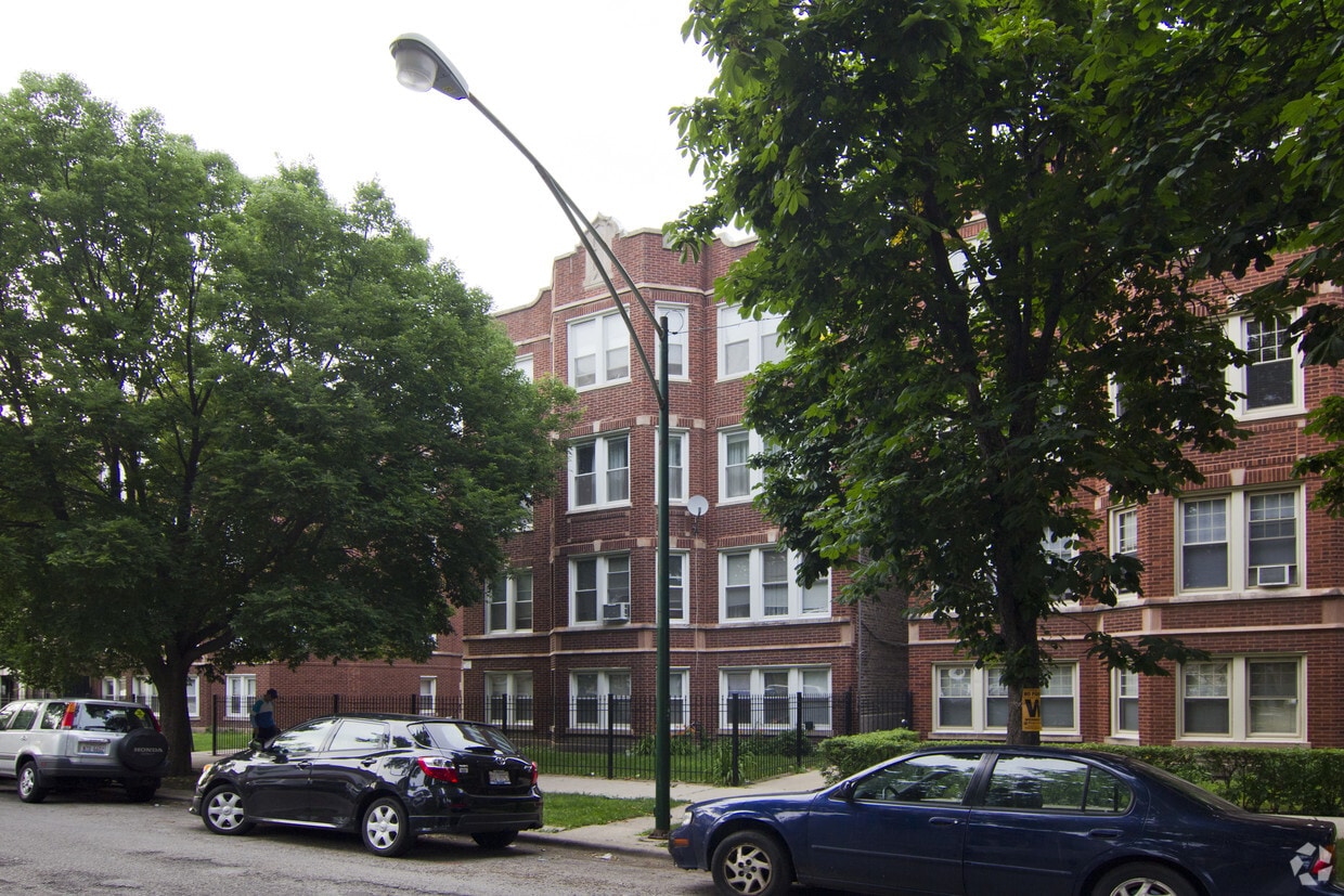
Find your new home at 4844-4850 W Henderson in Chicago, IL. The 4844-4850 W. Henderson location in Chicago's 60641 Zip code is an ideal place for residents. Make a visit to see the current floorplan options. This community offers you a wide selection of amenities and features. These include: high-speed internet access and smoke free options. It's time to get moving on finding your next place. Contact or stop by 4844-4850 W Henderson to talk about leasing your next apartment!
4844-4850 W Henderson is an apartment community located in Cook County and the 60641 ZIP Code. This area is served by the Chicago Public Schools attendance zone.
High Speed Internet Access
Refrigerator
Tub/Shower
Smoke Free
The Cragin neighborhood of Chicago, also known as Belmont-Cragin, sits halfway between Diversey and Fullerton Avenue, just over nine miles northwest of Downtown Chicago. Sitting eight miles northwest of the Loop, Cragin, once a hub of Chicago industry, now combines a suburban pace of life with urban conveniences. Locally owned restaurants, bars, and coffee shops are scattered around the neighborhood’s walkable layout. Contemporary apartment developments have popped up as more residents flock to areas outside Chicago. You’ll find mid-rise apartments in modern styles and long-standing rentals as well. Access to Interstate 90 and Chicago’s Blue Line makes it easy to commute into and out of the city.
Learn more about living in CraginCompare neighborhood and city base rent averages by bedroom.
| Cragin | Chicago, IL | |
|---|---|---|
| Studio | $857 | $1,644 |
| 1 Bedroom | $895 | $2,046 |
| 2 Bedrooms | $1,322 | $2,581 |
| 3 Bedrooms | $1,816 | $3,091 |
| Colleges & Universities | Distance | ||
|---|---|---|---|
| Colleges & Universities | Distance | ||
| Drive: | 8 min | 3.5 mi | |
| Drive: | 9 min | 3.6 mi | |
| Drive: | 10 min | 4.5 mi | |
| Drive: | 11 min | 5.0 mi |


Transportation options available in Chicago include Belmont Station (Blue Line), located 2.2 miles from 4844-4850 W Henderson. 4844-4850 W Henderson is near Chicago O'Hare International, located 10.8 miles or 19 minutes away, and Chicago Midway International, located 11.8 miles or 23 minutes away.
| Transit / Subway | Distance | ||
|---|---|---|---|
| Transit / Subway | Distance | ||
|
|
Drive: | 5 min | 2.2 mi |
|
|
Drive: | 5 min | 2.5 mi |
|
|
Drive: | 6 min | 2.7 mi |
|
|
Drive: | 6 min | 2.7 mi |
|
|
Drive: | 6 min | 2.8 mi |
| Commuter Rail | Distance | ||
|---|---|---|---|
| Commuter Rail | Distance | ||
|
|
Walk: | 18 min | 1.0 mi |
|
|
Drive: | 4 min | 1.5 mi |
|
|
Drive: | 4 min | 1.8 mi |
|
|
Drive: | 6 min | 2.1 mi |
|
|
Drive: | 5 min | 2.5 mi |
| Airports | Distance | ||
|---|---|---|---|
| Airports | Distance | ||
|
Chicago O'Hare International
|
Drive: | 19 min | 10.8 mi |
|
Chicago Midway International
|
Drive: | 23 min | 11.8 mi |
Scores provided by
Traffic
-Airport
-Businesses
-Scores provided by
HowLoud What is a Sound Score Rating? A Sound Score Rating aggregates noise caused by vehicle traffic, airplane traffic and local sources. How It WorksTime and distance from 4844-4850 W Henderson.
| Shopping Centers | Distance | ||
|---|---|---|---|
| Shopping Centers | Distance | ||
| Walk: | 8 min | 0.4 mi | |
| Walk: | 10 min | 0.5 mi |
| Parks and Recreation | Distance | ||
|---|---|---|---|
| Parks and Recreation | Distance | ||
|
Kilbourn Park
|
Walk: | 13 min | 0.7 mi |
|
Portage Park
|
Drive: | 6 min | 2.6 mi |
|
Labagh Woods
|
Drive: | 8 min | 3.0 mi |
|
Riis Park
|
Drive: | 6 min | 3.0 mi |
|
Gompers Park
|
Drive: | 7 min | 3.2 mi |
| Hospitals | Distance | ||
|---|---|---|---|
| Hospitals | Distance | ||
| Drive: | 4 min | 1.7 mi | |
| Drive: | 9 min | 3.9 mi | |
| Drive: | 9 min | 4.1 mi |
| Military Bases | Distance | ||
|---|---|---|---|
| Military Bases | Distance | ||
| Drive: | 27 min | 18.4 mi | |
| Drive: | 44 min | 28.3 mi | |
| Drive: | 40 min | 29.3 mi |
What Are Walk Score®, Transit Score®, and Bike Score® Ratings?
Walk Score® measures the walkability of any address. Transit Score® measures access to public transit. Bike Score® measures the bikeability of any address.
What is a Sound Score Rating?
A Sound Score Rating aggregates noise caused by vehicle traffic, airplane traffic and local sources.


