
Presidential Towers
555 W Madison St,
Chicago, IL 60661
$1,800 - $5,000
Studio - 2 Beds
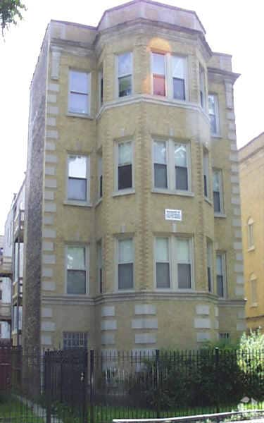

At 4825-4831 S Springfield Ave in Chicago, IL, you've discovered your new place. The location in Chicago's 60632 area has much to offer its residents. The leasing staff is waiting to show you all that this community has in store. Make a visit to view the available floorplans. Contact us or stop by today.
4825-4831 S Springfield Ave is an apartment community located in Cook County and the 60632 ZIP Code. This area is served by the Chicago Public Schools attendance zone.
Tub/Shower
Heating
Oven
Range
Archer Heights is a 20-minute drive southwest of downtown Chicago or a 10-minute drive northeast of Chicago Midway International Airport. Residents can also hop onto the Orange Line at the Pulaski station for a rapid transit option that heads downtown or to Midway Airport. Many of the homes and apartments in Archer Heights arose in the 20th century. Like many nearby Chicago neighborhoods, Archer Heights underwent its largest expansion after World War II.
Play basketball, baseball, football, or soccer with your family at Archer Park, and let the kids cool down in the interactive water spray area. This 13-acre park in the heart of Archer Heights hosts after-school programs during the school year and a day camp over the summer.
You'll find a variety of restaurants in Archer Heights. Locals rave about Birrieria Zaragoza on Pulaski Road, a small restaurant featured on TV shows such as "Bizarre Foods" and "Taco Trip.
Learn more about living in Archer Heights| Colleges & Universities | Distance | ||
|---|---|---|---|
| Colleges & Universities | Distance | ||
| Drive: | 7 min | 3.6 mi | |
| Drive: | 12 min | 6.0 mi | |
| Drive: | 12 min | 6.3 mi | |
| Drive: | 13 min | 6.4 mi |


Transportation options available in Chicago include Pulaski Station (Orange Line), located 0.5 mile from 4825-4831 S Springfield Ave. 4825-4831 S Springfield Ave is near Chicago Midway International, located 2.3 miles or 5 minutes away, and Chicago O'Hare International, located 20.8 miles or 37 minutes away.
| Transit / Subway | Distance | ||
|---|---|---|---|
| Transit / Subway | Distance | ||
|
|
Walk: | 9 min | 0.5 mi |
|
|
Drive: | 2 min | 1.3 mi |
|
|
Drive: | 5 min | 2.3 mi |
|
|
Drive: | 4 min | 2.3 mi |
|
|
Drive: | 6 min | 2.8 mi |
| Commuter Rail | Distance | ||
|---|---|---|---|
| Commuter Rail | Distance | ||
|
|
Drive: | 8 min | 4.2 mi |
|
|
Drive: | 9 min | 4.7 mi |
|
|
Drive: | 10 min | 5.0 mi |
|
|
Drive: | 13 min | 6.0 mi |
|
|
Drive: | 13 min | 6.3 mi |
| Airports | Distance | ||
|---|---|---|---|
| Airports | Distance | ||
|
Chicago Midway International
|
Drive: | 5 min | 2.3 mi |
|
Chicago O'Hare International
|
Drive: | 37 min | 20.8 mi |
Scores provided by
Traffic
-Airport
-Businesses
-Scores provided by
HowLoud What is a Sound Score Rating? A Sound Score Rating aggregates noise caused by vehicle traffic, airplane traffic and local sources. How It WorksTime and distance from 4825-4831 S Springfield Ave.
| Shopping Centers | Distance | ||
|---|---|---|---|
| Shopping Centers | Distance | ||
| Walk: | 11 min | 0.6 mi | |
| Walk: | 11 min | 0.6 mi | |
| Walk: | 12 min | 0.6 mi |
| Parks and Recreation | Distance | ||
|---|---|---|---|
| Parks and Recreation | Distance | ||
|
McKinley Park
|
Drive: | 5 min | 2.6 mi |
|
Gage Park
|
Drive: | 6 min | 3.1 mi |
|
Marquette Park
|
Drive: | 7 min | 3.8 mi |
|
Douglas Park and Community Center
|
Drive: | 10 min | 4.9 mi |
|
Ogden Park
|
Drive: | 12 min | 6.1 mi |
| Hospitals | Distance | ||
|---|---|---|---|
| Hospitals | Distance | ||
| Drive: | 9 min | 4.2 mi | |
| Drive: | 9 min | 4.4 mi | |
| Drive: | 12 min | 5.7 mi |
What Are Walk Score®, Transit Score®, and Bike Score® Ratings?
Walk Score® measures the walkability of any address. Transit Score® measures access to public transit. Bike Score® measures the bikeability of any address.
What is a Sound Score Rating?
A Sound Score Rating aggregates noise caused by vehicle traffic, airplane traffic and local sources.


