$3,995 / Month
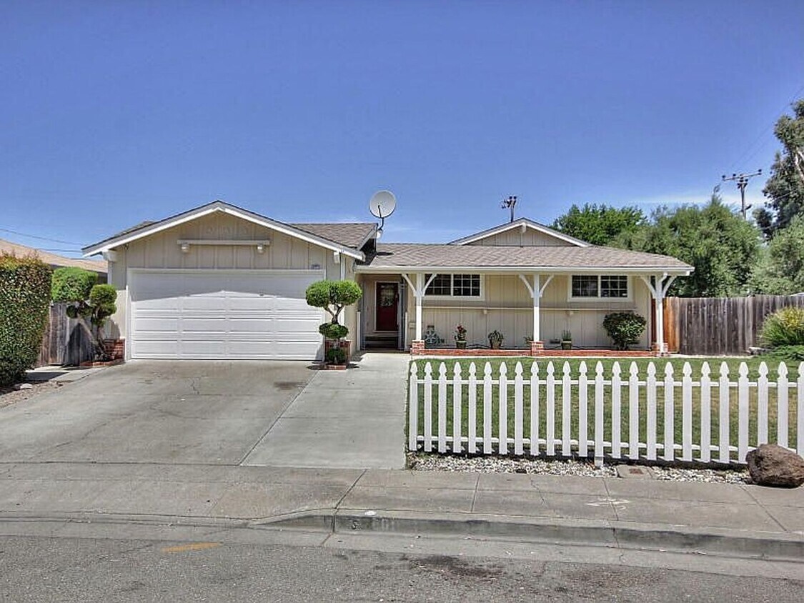
4801 Seneca Park Ave
Fremont, CA 94538
2 Weeks Ago
Favorites
4801 Seneca Park Ave

Favorites
Check Back Soon for Upcoming Availability
| Beds | Baths | Average SF |
|---|---|---|
| 4 Bedrooms 4 Bedrooms 4 Br | 2.5 Baths 2.5 Baths 2.5 Ba | 1,600 SF |
About This Property
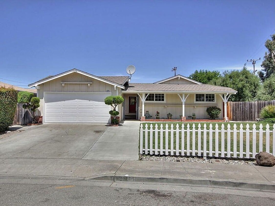
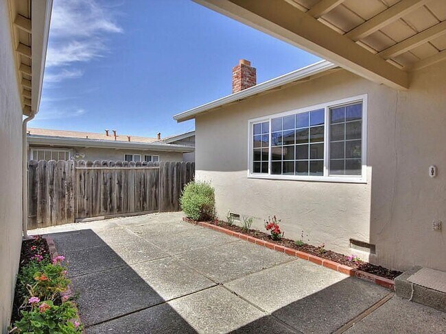
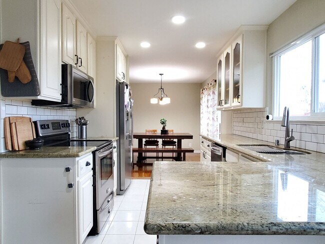
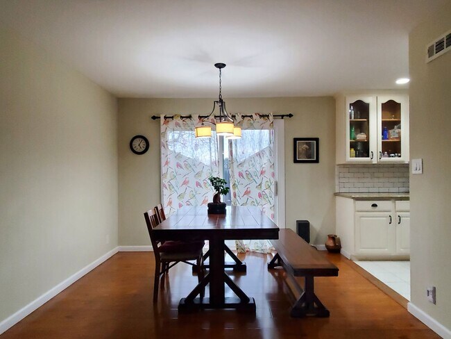
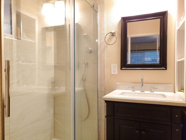
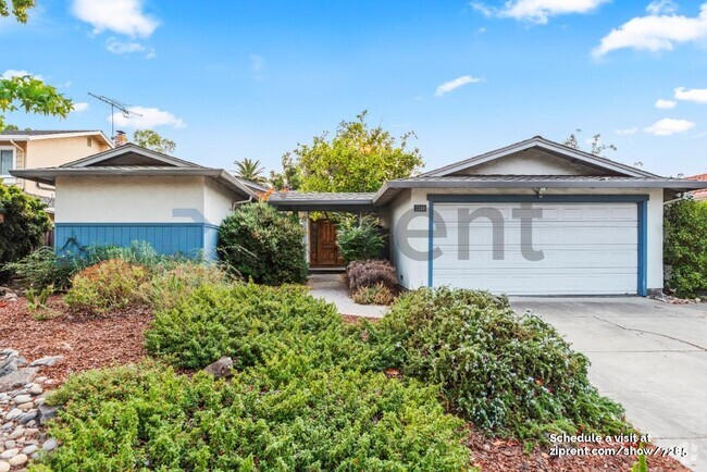
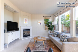
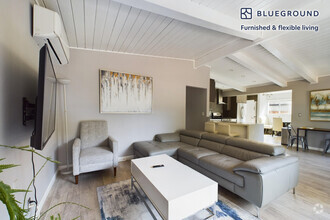
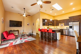
4801 Seneca Park Ave, Fremont, CA 94538 (Frimmer/Automall Parkway) Spacious single story home with 4 bedrooms, 2.5 bathrooms, and a detached 2 car garage. The home is higlighted with a private and gated courtyard, remodeled kitchen, updated bathrooms, and a very cute backyard. The home includes central A/C, wood flooring throughout and fresh paint. The kitchen has lots of cabinet space with a pantry, granite counters, subway tile backsplash, and stainless steel appliances. Cute backyard with a large patio and grass area. Laundry room includes a front loading washer and dryer. Schools include Millard Elementary, Walters Junior High, and Kennedy High School (resident to verify). The home is centrally located minutes from 880 and close to parks, banks, shopping, and groceries. Gardener is included in the rent. One year lease required. No pets except for required service animals. Cal DRE# 01998337
4801 Seneca Park Ave is a house located in Alameda County and the 94538 ZIP Code. This area is served by the Fremont Unified attendance zone.
Location
Get Directions
Blacow is a suburban neighborhood about three miles south of Downtown Fremont. Blacow is family-friendly with several good schools, childcare centers, and parks. Along with large neighborhood parks, Blacow residents have access to amazing green spaces as well, including the Don Edwards San Francisco Bay National Wildlife Refuge and the Coyote Creek Lagoon Trail. This beautiful neighborhood is quiet and has mid-range to upscale single-family homes and apartments available for rent. Although residents certainly enjoy proximity to Downtown Fremont’s excellent shopping, dining, and cultural scenes, Blacow is convenient to several large commercial centers like NewPark Mall and Pacific Commons Shopping Center, which provides suburban staples including a movie theater, department stores, and chain restaurants. The south side of the neighborhood borders Interstate 880 allowing for easier commutes throughout the Bay Area and Silicon Valley.
Learn more about living in BlacowBelow are rent ranges for similar nearby apartments
Education
| Colleges & Universities | Distance | ||
|---|---|---|---|
| Colleges & Universities | Distance | ||
| Drive: | 6 min | 3.4 mi | |
| Drive: | 8 min | 4.2 mi | |
| Drive: | 15 min | 10.4 mi | |
| Drive: | 26 min | 18.6 mi |
4801 Seneca Park Ave is within 6 minutes or 3.4 miles from Ohlone College, Newark. It is also near Ohlone College, Fremont Campus and Palmer College of Chiropractic West Campus.
Schools


Public Elementary School
Grades K-5
343 Students
Nearby
Public Elementary School
Grades 1-5
495 Students
Attendance Zone
Public Middle School
Grades 6-8
1,071 Students
Attendance Zone
Public High School
Grades 9-12
1,347 Students
Attendance Zone
Private Elementary & Middle School
Grades PK-8
194 Students
Nearby
Private Elementary, Middle & High School
Grades K-12
Nearby
Private Elementary & Middle School
Grades K-8
411 Students
Nearby
School data provided by
 The GreatSchools Rating helps parents compare schools within a state based on a variety of school quality indicators and provides a helpful picture of how effectively each school serves all of its students. Ratings are on a scale of 1 (below average) to 10 (above average) and can include test scores, college readiness, academic progress, advanced courses, equity, discipline and attendance data. We also advise parents to visit schools, consider other information on school performance and programs, and consider family needs as part of the school selection process.
View GreatSchools Rating Methodology
View GreatSchools Rating Methodology
Transportation options available in Fremont include Warm Springs / South Fremont, located 2.5 miles from 4801 Seneca Park Ave. 4801 Seneca Park Ave is near Norman Y Mineta San Jose International, located 14.5 miles or 19 minutes away, and Metro Oakland International, located 23.3 miles or 30 minutes away.
| Transit / Subway | Distance | ||
|---|---|---|---|
| Transit / Subway | Distance | ||
|
|
Drive: | 5 min | 2.5 mi |
|
|
Drive: | 7 min | 3.4 mi |
|
|
Drive: | 14 min | 8.9 mi |
|
|
Drive: | 13 min | 9.7 mi |
|
|
Drive: | 14 min | 10.4 mi |
| Commuter Rail | Distance | ||
|---|---|---|---|
| Commuter Rail | Distance | ||
| Drive: | 9 min | 4.4 mi | |
| Drive: | 16 min | 12.1 mi | |
| Drive: | 21 min | 15.2 mi | |
| Drive: | 21 min | 15.7 mi | |
| Drive: | 23 min | 17.2 mi |
| Airports | Distance | ||
|---|---|---|---|
| Airports | Distance | ||
|
Norman Y Mineta San Jose International
|
Drive: | 19 min | 14.5 mi |
|
Metro Oakland International
|
Drive: | 30 min | 23.3 mi |
Time and distance from 4801 Seneca Park Ave.
| Shopping Centers | Distance | ||
|---|---|---|---|
| Shopping Centers | Distance | ||
| Walk: | 9 min | 0.5 mi | |
| Walk: | 10 min | 0.5 mi | |
| Drive: | 2 min | 1.1 mi |
4801 Seneca Park Ave has 3 shopping centers within 1.1 miles, which is about a 2-minute walk. The miles and minutes will be for the farthest away property.
| Parks and Recreation | Distance | ||
|---|---|---|---|
| Parks and Recreation | Distance | ||
|
Central Park (Lake Elizabeth)
|
Drive: | 8 min | 3.5 mi |
|
Niles Canyon Railway
|
Drive: | 11 min | 5.9 mi |
|
Niles Community Park
|
Drive: | 13 min | 6.4 mi |
|
Quarry Lakes Regional Recreation Area
|
Drive: | 11 min | 7.2 mi |
|
Alameda Creek Regional Trail
|
Drive: | 11 min | 7.4 mi |
4801 Seneca Park Ave has 5 parks within 7.4 miles, including Central Park (Lake Elizabeth), Niles Canyon Railway, and Quarry Lakes Regional Recreation Area.
| Hospitals | Distance | ||
|---|---|---|---|
| Hospitals | Distance | ||
| Drive: | 6 min | 2.8 mi | |
| Drive: | 8 min | 3.7 mi |
4801 Seneca Park Ave is 2.8 miles from Kaiser Foundation Hospital - Fremont, and is convenient to other hospitals, including Washington Hospital.
| Military Bases | Distance | ||
|---|---|---|---|
| Military Bases | Distance | ||
| Drive: | 24 min | 17.2 mi |
4801 Seneca Park Ave is 17.2 miles and a 24 minute drive from Ames Research Center.
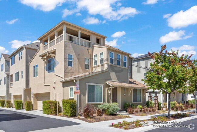
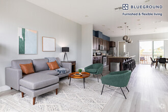
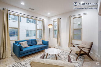
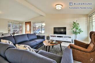
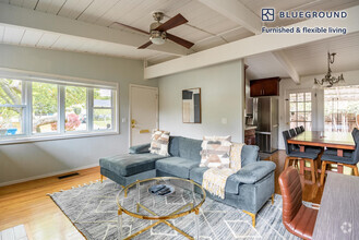
You May Also Like
Similar Rentals Nearby

What Are Walk Score®, Transit Score®, and Bike Score® Ratings?
Walk Score® measures the walkability of any address. Transit Score® measures access to public transit. Bike Score® measures the bikeability of any address.
What is a Sound Score Rating?
A Sound Score Rating aggregates noise caused by vehicle traffic, airplane traffic and local sources
4801 Seneca Park Ave
Fremont, CA 94538