
The Clara
5150 Calle del Sol,
Santa Clara, CA 95054
$3,521 - $13,431 Total Monthly Price
Studio - 3 Beds

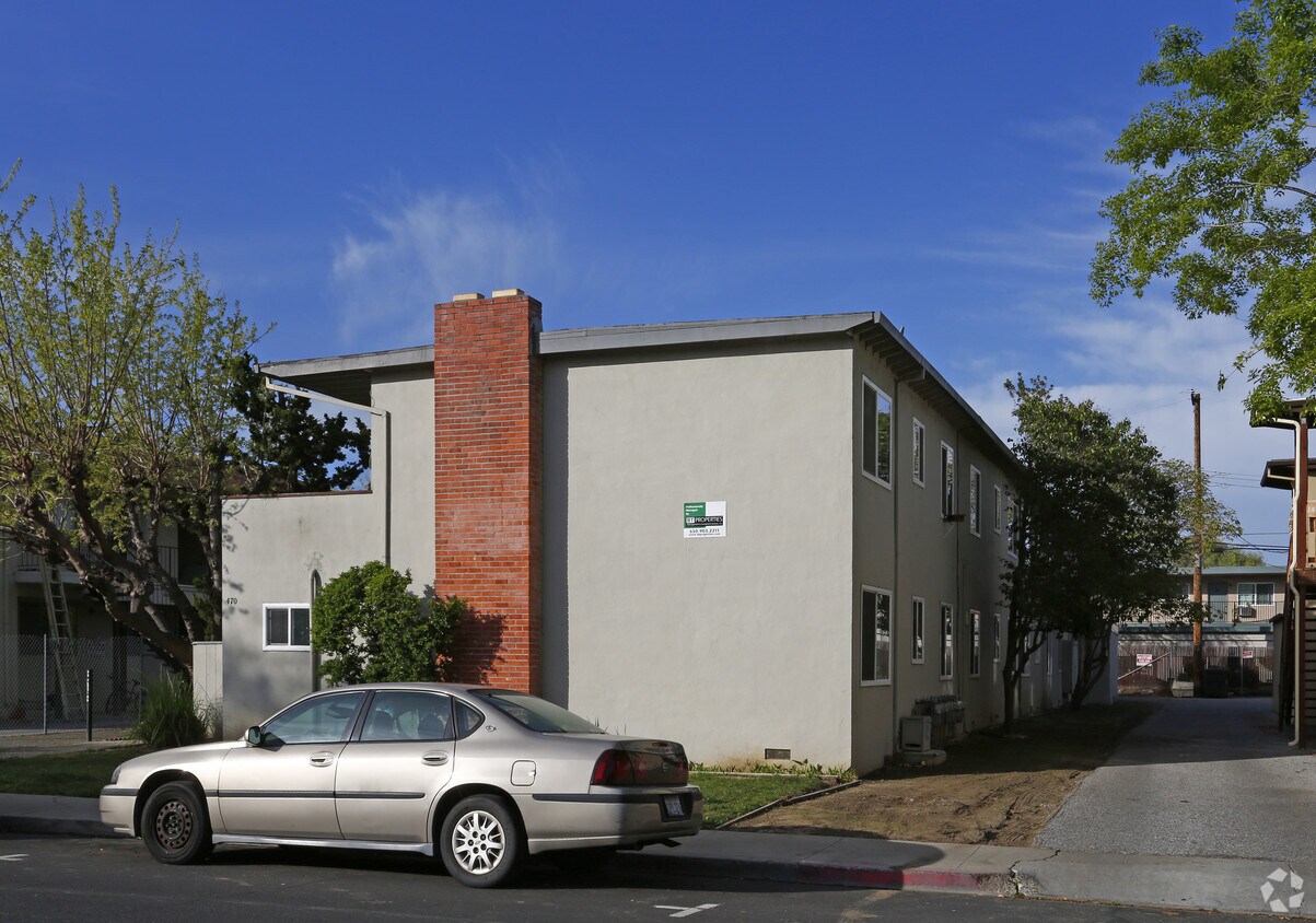
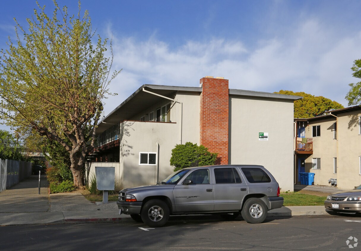
Experience Santa Clara living at 470 California St. You'll find this community in the Outer Santa Clara area of Santa Clara. The professional leasing staff will assist you in finding your ideal place. Choose from 1 to 2 bedroom floor plans and then swing by for a visit to see them in person. Drop by the leasing office to learn more about our community and find your new place at 470 California St.
470 California St is an apartment community located in Santa Clara County and the 95050 ZIP Code. This area is served by the Santa Clara Unified School District attendance zone.
Santa Clara combines technological innovation with historical charm. Located in Silicon Valley, the city hosts major employers like Intel, Nvidia, and Applied Materials, while offering diverse housing options throughout its neighborhoods. The rental market reflects strong demand, with average rents ranging from $2,780 for studios to $3,851 for two-bedroom units. The area around Santa Clara University adds educational energy to the community, while the district near Levi's Stadium offers convenient access to NFL games and events.
Santa Clara residents enjoy California's Great America theme park and the Mission Santa Clara de Asís, which dates to 1777 and inspired the city's "Mission City" nickname. The Mediterranean climate features summer temperatures around 82°F with mild winters, perfect for exploring local parks and trails. The city operates its own electric utility, Silicon Valley Power, providing residents with lower electricity rates compared to neighboring communities.
Learn more about living in Santa Clara| Colleges & Universities | Distance | ||
|---|---|---|---|
| Colleges & Universities | Distance | ||
| Drive: | 5 min | 1.9 mi | |
| Drive: | 8 min | 3.1 mi | |
| Drive: | 12 min | 5.5 mi | |
| Drive: | 12 min | 6.3 mi |


Transportation options available in Santa Clara include Diridon Station, located 3.5 miles from 470 California St. 470 California St is near Norman Y Mineta San Jose International, located 2.4 miles or 6 minutes away, and San Francisco International, located 34.5 miles or 45 minutes away.
| Transit / Subway | Distance | ||
|---|---|---|---|
| Transit / Subway | Distance | ||
| Drive: | 9 min | 3.5 mi | |
| Drive: | 8 min | 3.8 mi | |
| Drive: | 8 min | 3.8 mi | |
| Drive: | 9 min | 4.5 mi | |
|
|
Drive: | 9 min | 4.7 mi |
| Commuter Rail | Distance | ||
|---|---|---|---|
| Commuter Rail | Distance | ||
| Drive: | 4 min | 1.7 mi | |
| Drive: | 4 min | 1.7 mi | |
| Drive: | 7 min | 2.9 mi | |
| Drive: | 8 min | 3.6 mi | |
| Drive: | 9 min | 3.6 mi |
| Airports | Distance | ||
|---|---|---|---|
| Airports | Distance | ||
|
Norman Y Mineta San Jose International
|
Drive: | 6 min | 2.4 mi |
|
San Francisco International
|
Drive: | 45 min | 34.5 mi |
Scores provided by
Traffic
-Airport
-Businesses
-Scores provided by
HowLoud What is a Sound Score Rating? A Sound Score Rating aggregates noise caused by vehicle traffic, airplane traffic and local sources. How It WorksTime and distance from 470 California St.
| Shopping Centers | Distance | ||
|---|---|---|---|
| Shopping Centers | Distance | ||
| Walk: | 16 min | 0.9 mi | |
| Walk: | 20 min | 1.1 mi | |
| Drive: | 3 min | 1.3 mi |
| Parks and Recreation | Distance | ||
|---|---|---|---|
| Parks and Recreation | Distance | ||
|
McEnery Park
|
Drive: | 9 min | 4.0 mi |
|
Guadalupe River Park and Gardens
|
Drive: | 9 min | 4.4 mi |
|
Children's Discovery Museum of San Jose
|
Drive: | 10 min | 4.5 mi |
|
The Tech Museum of Innovation
|
Drive: | 10 min | 4.6 mi |
|
Orchard City Green
|
Drive: | 9 min | 4.8 mi |
| Hospitals | Distance | ||
|---|---|---|---|
| Hospitals | Distance | ||
| Drive: | 5 min | 2.8 mi | |
| Drive: | 7 min | 3.0 mi | |
| Drive: | 8 min | 3.1 mi |
| Military Bases | Distance | ||
|---|---|---|---|
| Military Bases | Distance | ||
| Drive: | 20 min | 11.2 mi | |
| Drive: | 59 min | 45.2 mi | |
| Drive: | 60 min | 45.4 mi |
Fitness Center Pool In Unit Washer & Dryer High-Speed Internet Stainless Steel Appliances Package Service
What Are Walk Score®, Transit Score®, and Bike Score® Ratings?
Walk Score® measures the walkability of any address. Transit Score® measures access to public transit. Bike Score® measures the bikeability of any address.
What is a Sound Score Rating?
A Sound Score Rating aggregates noise caused by vehicle traffic, airplane traffic and local sources.
470 California St
Santa Clara, CA 95050


