
Union Mill Run
1762 Walker Ave,
Union Township, NJ 07083
$1,799 - $2,640
1-2 Beds

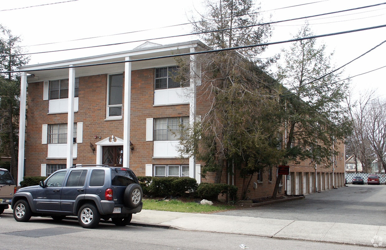
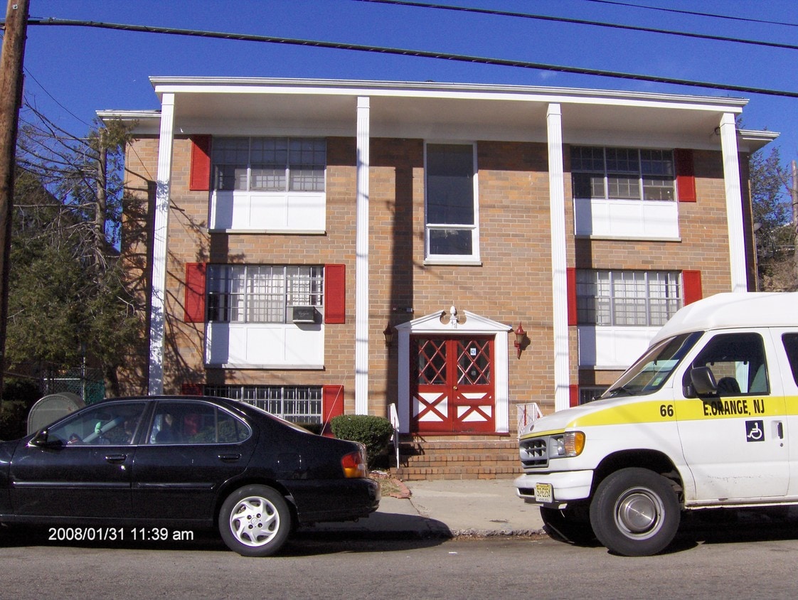

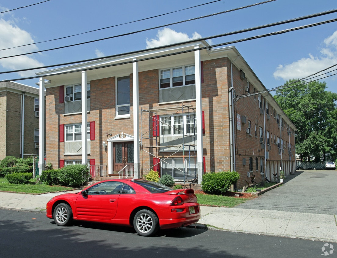
Experience Irvington living at 47 Linden Ave. The 07111 location in Irvington has much to offer its residents. The professional leasing team is ready and waiting to show you our community. Come for a visit to check out the current floorplan options. Stop by the leasing office to talk about leasing your new apartment.
47 Linden Ave is an apartment community located in Essex County and the 07111 ZIP Code. This area is served by the Irvington Board Of Education School District attendance zone.
Air Conditioning
High Speed Internet Access
Hardwood Floors
Smoke Free
Irvington earned its name in 1850 when residents, eager to distance their town from the song "Camptown Races," renamed it in honor of author Washington Irving. That sense of civic pride still runs through this compact Essex County township, which packs a dense, active atmosphere into just three square miles. Sitting directly west of Newark and about 15 miles from New York City, Irvington draws people who want access to a major metro area without paying big-city prices. Springfield Avenue and Clinton Avenue serve as the town's commercial backbones, lined with specialty shops and neighborhood eateries reflecting the community's broad cultural influences.
The housing stock here skews toward no-frills apartments, multi-family buildings, and modest townhomes, with established apartment communities spread across tree-lined residential blocks. Renters appreciate the relative affordability compared to neighboring communities like Maplewood or South Orange.
Learn more about living in Irvington| Colleges & Universities | Distance | ||
|---|---|---|---|
| Colleges & Universities | Distance | ||
| Drive: | 7 min | 2.8 mi | |
| Drive: | 6 min | 3.3 mi | |
| Drive: | 7 min | 3.4 mi | |
| Drive: | 7 min | 3.8 mi |


Transportation options available in Irvington include Warren Street, located 3.3 miles from 47 Linden Ave. 47 Linden Ave is near Newark Liberty International, located 6.6 miles or 10 minutes away, and LaGuardia, located 25.8 miles or 44 minutes away.
| Transit / Subway | Distance | ||
|---|---|---|---|
| Transit / Subway | Distance | ||
|
|
Drive: | 6 min | 3.3 mi |
|
|
Drive: | 7 min | 3.4 mi |
|
|
Drive: | 6 min | 3.4 mi |
|
|
Drive: | 7 min | 3.5 mi |
|
|
Drive: | 8 min | 4.0 mi |
| Commuter Rail | Distance | ||
|---|---|---|---|
| Commuter Rail | Distance | ||
|
|
Drive: | 7 min | 2.9 mi |
|
|
Drive: | 8 min | 3.0 mi |
|
|
Drive: | 6 min | 3.3 mi |
|
|
Drive: | 10 min | 3.6 mi |
|
|
Drive: | 7 min | 3.6 mi |
| Airports | Distance | ||
|---|---|---|---|
| Airports | Distance | ||
|
Newark Liberty International
|
Drive: | 10 min | 6.6 mi |
|
LaGuardia
|
Drive: | 44 min | 25.8 mi |
Scores provided by
Traffic
-Airport
-Businesses
-Scores provided by
HowLoud What is a Sound Score Rating? A Sound Score Rating aggregates noise caused by vehicle traffic, airplane traffic and local sources. How It WorksTime and distance from 47 Linden Ave.
| Shopping Centers | Distance | ||
|---|---|---|---|
| Shopping Centers | Distance | ||
| Walk: | 9 min | 0.5 mi | |
| Walk: | 10 min | 0.5 mi | |
| Drive: | 3 min | 1.4 mi |
| Parks and Recreation | Distance | ||
|---|---|---|---|
| Parks and Recreation | Distance | ||
|
Newark Museum and Dreyfuss Planetarium
|
Drive: | 7 min | 3.7 mi |
|
Branch Brook Park
|
Drive: | 11 min | 5.1 mi |
|
Edison National Historic Site
|
Drive: | 12 min | 5.9 mi |
|
Greenwood Gardens
|
Drive: | 15 min | 6.5 mi |
|
Turtle Back Zoo
|
Drive: | 15 min | 7.6 mi |
| Hospitals | Distance | ||
|---|---|---|---|
| Hospitals | Distance | ||
| Drive: | 4 min | 2.0 mi | |
| Drive: | 5 min | 2.5 mi | |
| Drive: | 5 min | 2.6 mi |
| Military Bases | Distance | ||
|---|---|---|---|
| Military Bases | Distance | ||
| Drive: | 15 min | 10.4 mi | |
| Drive: | 21 min | 11.5 mi | |
| Drive: | 19 min | 11.9 mi |
What Are Walk Score®, Transit Score®, and Bike Score® Ratings?
Walk Score® measures the walkability of any address. Transit Score® measures access to public transit. Bike Score® measures the bikeability of any address.
What is a Sound Score Rating?
A Sound Score Rating aggregates noise caused by vehicle traffic, airplane traffic and local sources.
47 Linden Ave
Irvington, NJ 07111


