
$2,150
/ Month
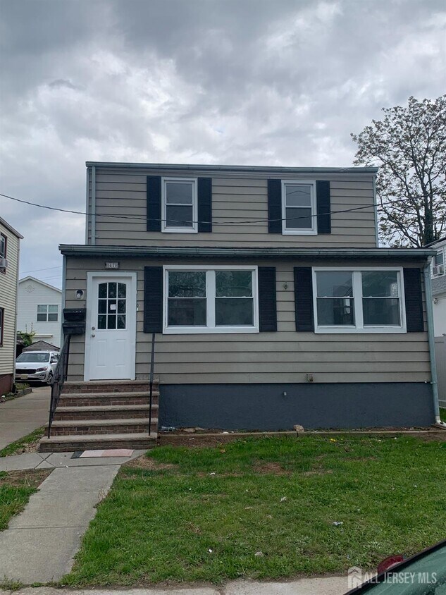
47 Holly St Unit 2
Carteret, NJ 07008
Favorites
908-494-9734
-
Bedrooms
2
-
Bathrooms
1
-
Square Feet
1,696 sq ft
-
Available
Available Now
Highlights
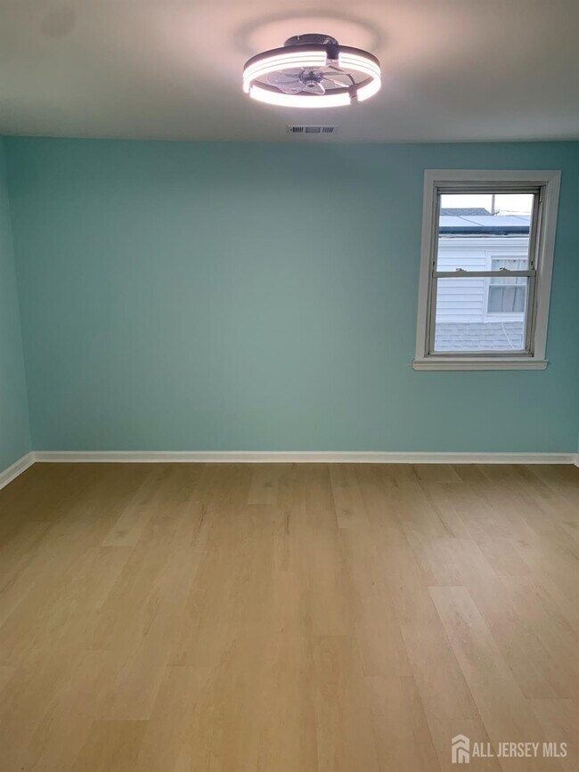
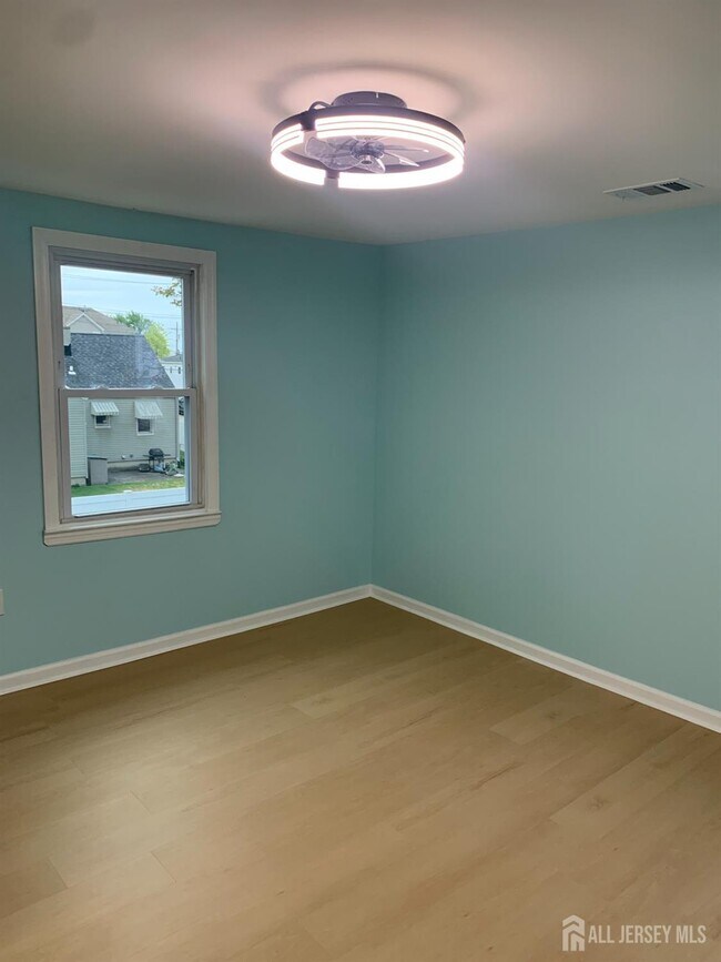
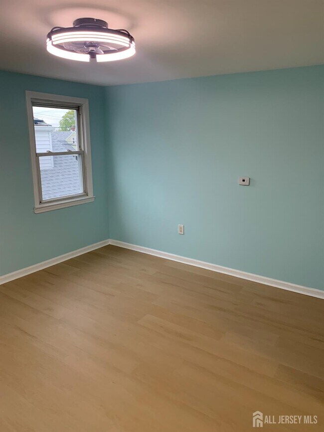
- Wood Flooring
- Attic
- Granite Countertops
- Den
- 2 Car Detached Garage
- Eat-In Kitchen
47 Holly St Unit 2

Favorites
About This Home
12 Month Lease
,
Available Now
Newly renovated 2-bedroom second-floor apartment plus additional flex room and separate living room,ideal for a home office or versatile use. Features include central air,stainless steel appliances,and modern finishes throughout. Unit includes access to attic space,one parking space on a shared driveway,and additional storage in two garages. Conveniently located just minutes from NJ Transit bus service to NYC,with easy access to the waterfront and the upcoming Carteret Ferry Service. Great location for commuters.
47 Holly St is an apartment community located in Middlesex County and the 07008 ZIP Code.
* Price shown is base rent. Excludes user-selected optional fees and variable or usage-based fees and required charges due at or prior to move-in or at move-out. Price, availability, fees, and any applicable rent special are subject to change without notice.
* Square footage definitions vary. Displayed square footage is approximate.
Home Details
Year Built
Built in 1920
Bedrooms and Bathrooms
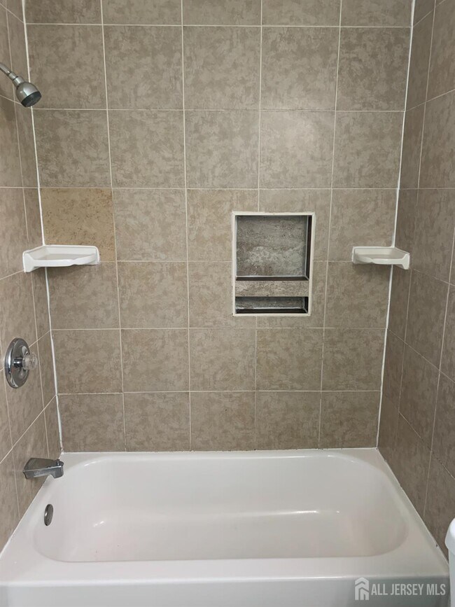
1 Full Bathroom
2 Bedrooms
Home Design
Apartment
Home Security
Fire and Smoke Detector
Interior Spaces
Wood Flooring
Den
Living Room
Storage
1,696 Sq Ft Home
1-Story Property
Kitchen
Granite Countertops
Eat-In Kitchen
Stove
Self-Cleaning Oven
Listing and Financial Details
12 Month Lease Term
Tenant pays for grounds care, electricity, gas, snow removal, hot water
Lot Details
4,299 Sq Ft Lot
Lot Dimensions are 100.00 x 42.00
Parking
2 Car Detached Garage
Assigned Parking
Open Parking
Driveway
Utilities
Forced Air Heating and Cooling System
Gas Water Heater
Community Details
Overview
Carteret Subdivision
Association fees include water
Pet Policy
No Pets Allowed
Fees and Policies
The fees listed below are community-provided and may exclude utilities or add-ons. All payments are made directly to the property and are non-refundable unless otherwise specified.
-
Garage Lot
Property Fee Disclaimer: Based on community-supplied data and independent market research. Subject to change without notice. May exclude fees for mandatory or optional services and usage-based utilities.
Details
Utilities Included
-
Water
Lease Options
-
12 Months
Contact
- Listed by MARGARET R. LENOFF | LUZZATO REALTY
- Phone Number
- Contact
-
Source
 CENTRAL JERSEY MULTIPLE LISTING SYSTEM, INC
The CENTRAL JERSEY MULTIPLE LISTING SYSTEM, INC does not warrant the accuracy, quality, reliability, suitability, completeness, usefulness or effectiveness of any information provided. The information being provided is for consumers' personal, non-commercial use and may not be used for any purpose other than to identify properties the consumer may be interested in purchasing or renting. Copyright 2026, CENTRAL JERSEY MULTIPLE LISTING SYSTEM, INC. All rights reserved. “The CENTRAL JERSEY MULTIPLE LISTING SYSTEM, INC retains all rights, title and interest in and to its trademarks, service marks and copyrighted material.
Location
Get Directions
Carteret, a borough in northeastern Middlesex County, sits along the Arthur Kill waterway and bills itself as the "Center of it All," a nod to its central location just 22 miles from Manhattan and 10 miles from Newark. Named after Sir George Carteret, one of the earliest proprietors of the province of New Jersey, the borough has a rich history dating back to its founding in 1906. Renters looking at apartments for rent in Carteret will find a well-connected community with easy access to major employment hubs, green spaces, and everyday conveniences all within a compact five-square-mile area.
Renters in Carteret can choose from a mix of apartments, condos, townhomes, and houses spread across established residential neighborhoods. Washington Avenue features brick-paved sidewalks and locally-owned shops and cafes, while Roosevelt Avenue offers a more contemporary mix of dining and retail.
Learn more about living in Carteret
Amenities
- Air Conditioning
- Oven
- Range
- Refrigerator
- Hardwood Floors
- Den
- Attic
- Storage Space
Expenses
Utilities Included
Water
Included
Education
| Colleges & Universities | Distance | ||
|---|---|---|---|
| Colleges & Universities | Distance | ||
| Drive: | 16 min | 7.8 mi | |
| Drive: | 19 min | 9.4 mi | |
| Drive: | 21 min | 10.7 mi | |
| Drive: | 25 min | 13.6 mi |
47 Holly St Unit 2 is within 16 minutes or 7.8 miles from Union County Coll., Elizabeth. It is also near Kean University and Coll. of Staten Island, CUNY.
Transportation options available in Carteret include 8Th Street Light Rail Station, located 12.3 miles from 47 Holly St Unit 2. 47 Holly St Unit 2 is near Newark Liberty International, located 13.9 miles or 24 minutes away, and LaGuardia, located 31.2 miles or 53 minutes away.
| Transit / Subway | Distance | ||
|---|---|---|---|
| Transit / Subway | Distance | ||
| Drive: | 22 min | 12.3 mi | |
|
|
Drive: | 24 min | 13.5 mi |
|
|
Drive: | 23 min | 15.2 mi |
|
|
Drive: | 22 min | 15.2 mi |
| Commuter Rail | Distance | ||
|---|---|---|---|
| Commuter Rail | Distance | ||
|
|
Drive: | 6 min | 3.1 mi |
|
|
Drive: | 10 min | 4.3 mi |
|
|
Drive: | 11 min | 4.8 mi |
|
|
Drive: | 19 min | 9.6 mi |
|
|
Drive: | 21 min | 11.0 mi |
| Airports | Distance | ||
|---|---|---|---|
| Airports | Distance | ||
|
Newark Liberty International
|
Drive: | 24 min | 13.9 mi |
|
LaGuardia
|
Drive: | 53 min | 31.2 mi |
Getting Around
 What do Walkability, Transit, Drivability, and Bikeability mean?
Walkability measures the walking distance to day-to-day needs.
Transit measures access to public transportation.
Drivability measures congestion, parking availability, and access to major roads.
Bikeability measures the suitability for cycling.
How It Works
What do Walkability, Transit, Drivability, and Bikeability mean?
Walkability measures the walking distance to day-to-day needs.
Transit measures access to public transportation.
Drivability measures congestion, parking availability, and access to major roads.
Bikeability measures the suitability for cycling.
How It Works
Fairly Walkable
Walkability
50
/ 100
Limited Public Transit
Transit
30
/ 100
Moderately Drivable
Drivability
60
/ 100
Fairly Bikeable
Bikeability
40
/ 100
Scores provided by
Active
Soundscore™
73
/ 100
Traffic
ActiveAirport
CalmBusinesses
CalmScores provided by
HowLoud What is a Sound Score Rating? A Sound Score Rating aggregates noise caused by vehicle traffic, airplane traffic and local sources. How It WorksTime and distance from 47 Holly St Unit 2.
| Shopping Centers | Distance | ||
|---|---|---|---|
| Shopping Centers | Distance | ||
| Drive: | 4 min | 1.4 mi | |
| Drive: | 5 min | 1.6 mi | |
| Drive: | 4 min | 1.8 mi |
47 Holly St Unit 2 has 3 shopping centers within 1.8 miles, which is about a 4-minute drive. The miles and minutes will be for the farthest away property.
| Parks and Recreation | Distance | ||
|---|---|---|---|
| Parks and Recreation | Distance | ||
|
Liberty State Park
|
Drive: | 7 min | 2.4 mi |
|
Hawk Rise Sanctuary
|
Drive: | 13 min | 5.7 mi |
|
Bloomingdale Park
|
Drive: | 17 min | 8.6 mi |
|
Clay Pit Ponds State Park Preserve
|
Drive: | 20 min | 9.1 mi |
|
Freshkills Park
|
Drive: | 22 min | 12.0 mi |
47 Holly St Unit 2 has 5 parks within 12.0 miles, including Liberty State Park, Hawk Rise Sanctuary, and Bloomingdale Park.
| Hospitals | Distance | ||
|---|---|---|---|
| Hospitals | Distance | ||
| Drive: | 14 min | 5.7 mi | |
| Drive: | 12 min | 6.1 mi | |
| Drive: | 16 min | 7.5 mi |
47 Holly St Unit 2 has 3 hospitals within 7.5 miles, the nearest is Robert Wood Johnson University Hospital at Rahway which is 5.7 miles away and a 14 minute drive.
| Military Bases | Distance | ||
|---|---|---|---|
| Military Bases | Distance | ||
| Drive: | 21 min | 8.7 mi | |
| Drive: | 24 min | 9.5 mi | |
| Drive: | 29 min | 15.3 mi |
47 Holly St Unit 2 has 3 military bases within 15.3 miles, the nearest is Ash Brook Reservation which is 8.7 miles away and a 21 minute drive.
You May Also Like
How do I access Social Services in New Jersey?
Statewide service is free, confidential, multilingual and always open. Three easy ways to reach Social Services in NJ: Dial 2-1-1; text your zip code to 898-211; or chat at https://www.nj211.org
Similar Rentals Nearby


What Are Walk Score®, Transit Score®, and Bike Score® Ratings?
Walk Score® measures the walkability of any address. Transit Score® measures access to public transit. Bike Score® measures the bikeability of any address.
What is a Sound Score Rating?
A Sound Score Rating aggregates noise caused by vehicle traffic, airplane traffic and local sources.
47 Holly St
Carteret, NJ 07008