
Urbn Edge
3510 Union St,
Flushing, NY 11354
$3,050 - $3,700 Total Monthly Price
1-2 Beds 12 Month Lease
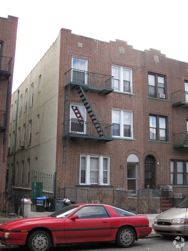
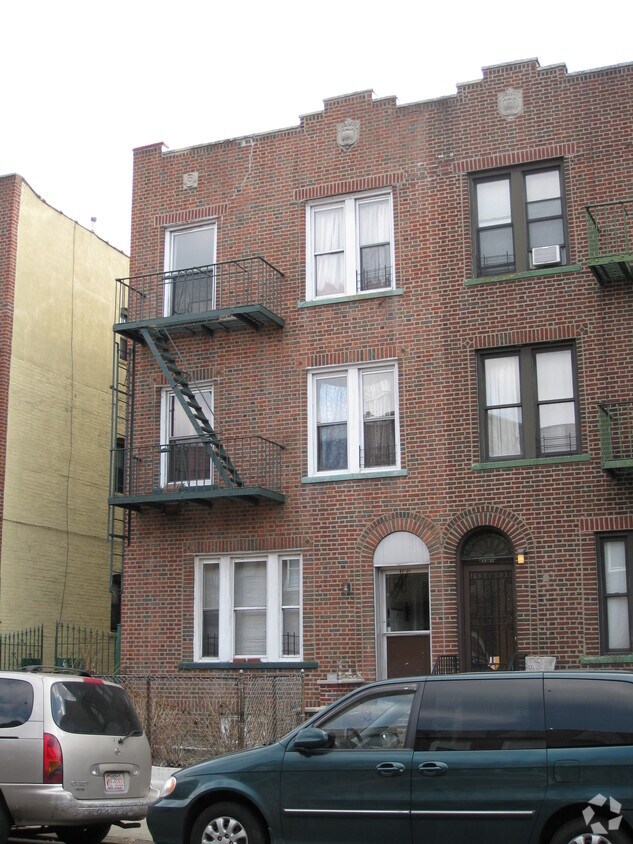
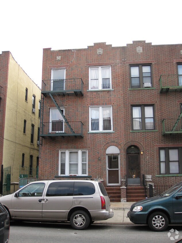

Find your new home at 47-21 45th St. You'll find this community in the Sunnyside area of Flushing. The professional leasing team is available to help you find your dream apartment. It's time to find your new home. Contact or stop by 47-21 45th St to schedule a tour!
47-21 45th St is an apartment community located in Queens County and the 11377 ZIP Code. This area is served by the New York City Geographic District #30 attendance zone.
Flushing is one of Queens' most commercially active neighborhoods, home to the fourth-largest central business district in all of New York City. Its core intersection at Main Street and Roosevelt Avenue ranks among the busiest in the city, and the energy that radiates outward from there reflects just how much this neighborhood has to offer. Anchored by Queens Botanical Garden and the sprawling Flushing Meadows–Corona Park, the area balances dense urban activity with genuine green space. The New York Mets call this neighborhood home at Citi Field, and USTA Billie Jean King National Tennis Center hosts the U.S. Open each summer nearby. Flushing dates to 1645, making it one of the oldest settlements in the region, and that deep history gives the neighborhood a sense of permanence that newer developments can't replicate.
Learn more about living in FlushingCompare neighborhood and city base rent averages by bedroom.
| Northwestern Queens | Flushing, NY | |
|---|---|---|
| Studio | $2,216 | $1,771 |
| 1 Bedroom | $2,297 | $2,058 |
| 2 Bedrooms | $3,286 | $2,492 |
| 3 Bedrooms | $4,369 | $2,871 |
| Colleges & Universities | Distance | ||
|---|---|---|---|
| Colleges & Universities | Distance | ||
| Walk: | 18 min | 0.9 mi | |
| Drive: | 8 min | 3.6 mi | |
| Drive: | 8 min | 3.7 mi | |
| Drive: | 8 min | 3.9 mi |


Transportation options available in Flushing include 46 Street-Bliss Street, located 0.3 mile from 47-21 45th St. 47-21 45th St is near LaGuardia, located 4.3 miles or 10 minutes away, and John F Kennedy International, located 13.6 miles or 21 minutes away.
| Transit / Subway | Distance | ||
|---|---|---|---|
| Transit / Subway | Distance | ||
|
|
Walk: | 4 min | 0.3 mi |
|
|
Walk: | 10 min | 0.5 mi |
|
|
Walk: | 10 min | 0.5 mi |
|
|
Walk: | 17 min | 0.9 mi |
|
|
Drive: | 4 min | 1.4 mi |
| Commuter Rail | Distance | ||
|---|---|---|---|
| Commuter Rail | Distance | ||
|
|
Walk: | 20 min | 1.1 mi |
|
|
Drive: | 5 min | 1.8 mi |
|
|
Drive: | 7 min | 2.2 mi |
|
|
Drive: | 9 min | 3.9 mi |
|
|
Drive: | 10 min | 4.1 mi |
| Airports | Distance | ||
|---|---|---|---|
| Airports | Distance | ||
|
LaGuardia
|
Drive: | 10 min | 4.3 mi |
|
John F Kennedy International
|
Drive: | 21 min | 13.6 mi |
Scores provided by
Traffic
-Airport
-Businesses
-Scores provided by
HowLoud What is a Sound Score Rating? A Sound Score Rating aggregates noise caused by vehicle traffic, airplane traffic and local sources. How It WorksTime and distance from 47-21 45th St.
| Shopping Centers | Distance | ||
|---|---|---|---|
| Shopping Centers | Distance | ||
| Walk: | 18 min | 0.9 mi | |
| Walk: | 19 min | 1.0 mi | |
| Drive: | 5 min | 1.1 mi |
| Parks and Recreation | Distance | ||
|---|---|---|---|
| Parks and Recreation | Distance | ||
|
Travers Park
|
Drive: | 6 min | 2.3 mi |
|
Queensbridge Park
|
Drive: | 6 min | 2.4 mi |
|
Gantry Plaza State Park
|
Drive: | 6 min | 2.5 mi |
|
McCarren Park
|
Drive: | 7 min | 2.5 mi |
|
Socrates Sculpture Park
|
Drive: | 7 min | 2.9 mi |
| Hospitals | Distance | ||
|---|---|---|---|
| Hospitals | Distance | ||
| Drive: | 4 min | 2.0 mi | |
| Drive: | 8 min | 3.6 mi | |
| Drive: | 10 min | 3.6 mi |
| Military Bases | Distance | ||
|---|---|---|---|
| Military Bases | Distance | ||
| Drive: | 21 min | 8.7 mi | |
| Drive: | 20 min | 9.9 mi | |
| Drive: | 30 min | 14.9 mi |
What Are Walk Score®, Transit Score®, and Bike Score® Ratings?
Walk Score® measures the walkability of any address. Transit Score® measures access to public transit. Bike Score® measures the bikeability of any address.
What is a Sound Score Rating?
A Sound Score Rating aggregates noise caused by vehicle traffic, airplane traffic and local sources.


