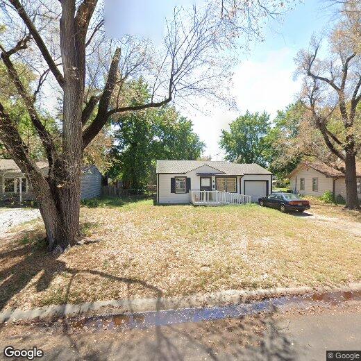

4681 S Sycamore Ave
4681 S Sycamore Ave
Wichita, KS 67217
2 Weeks Ago
|
Edit
Favorites
4681 S Sycamore Ave

Favorites
Check Back Soon for Upcoming Availability
| Beds | Baths | Average SF |
|---|---|---|
| 2 Bedrooms 2 Bedrooms 2 Br | 1 Bath 1 Bath 1 Ba | — |
4681 S Sycamore Ave,
Wichita,
KS
67217
Stretching along the Arkansas River, Wichita is the largest city in the state and offers a slower pace of life without sacrificing things to do or places to be. Nicknamed the "Air Capital of the World," Wichita is home to major aerospace names like Textron Aviation and Spirit AeroSystems. Neighborhoods like the Old Town district draw people in with restored 19th-century brick warehouses filled with coffee shops, bars, and the Museum of World Treasures. Over in Riverside, you'll find Botanica Wichita, the Wichita Art Museum, and easy access to Riverside Park.
Wichita State University is on the northeast side of the city and adds academic energy to the town, while the Downtown corridor keeps things lively year-round near INTRUST Bank Arena and the Arkansas River path. The annual Wichita River Festival draws thousands to celebrate along the water with live music and activities that get the whole community involved.
Learn more about living in Wichita
Education
| Colleges & Universities | Distance | ||
|---|---|---|---|
| Colleges & Universities | Distance | ||
| Drive: | 14 min | 8.0 mi | |
| Drive: | 15 min | 8.2 mi | |
| Drive: | 18 min | 11.2 mi | |
| Drive: | 38 min | 32.9 mi |
4681 S Sycamore Ave is within 15 minutes or 8.2 miles from Friends University. It is also near Newman University and Wichita State University.
Walkability Near 4681 S Sycamore Ave Wichita, KS 67217
Getting Around
 What do Walkability, Transit, Drivability, and Bikeability mean?
Walkability measures the walking distance to day-to-day needs.
Transit measures access to public transportation.
Drivability measures congestion, parking availability, and access to major roads.
Bikeability measures the suitability for cycling.
How It Works
What do Walkability, Transit, Drivability, and Bikeability mean?
Walkability measures the walking distance to day-to-day needs.
Transit measures access to public transportation.
Drivability measures congestion, parking availability, and access to major roads.
Bikeability measures the suitability for cycling.
How It Works
Somewhat Walkable
Walkability
30
/ 100
Limited Public Transit
Transit
30
/ 100
Exceptionally Drivable
Drivability
100
/ 100
Fairly Bikeable
Bikeability
50
/ 100
Scores provided by
-
Soundscore™
-
/ 100
Traffic
-Airport
-Businesses
-Scores provided by
HowLoud What is a Sound Score Rating? A Sound Score Rating aggregates noise caused by vehicle traffic, airplane traffic and local sources. How It WorksYou May Also Like
Similar Rentals Nearby


What Are Walk Score®, Transit Score®, and Bike Score® Ratings?
Walk Score® measures the walkability of any address. Transit Score® measures access to public transit. Bike Score® measures the bikeability of any address.
What is a Sound Score Rating?
A Sound Score Rating aggregates noise caused by vehicle traffic, airplane traffic and local sources.

4681 S Sycamore Ave
Wichita, KS 67217