
$2,050 / Month
468 Military E
Benicia, CA 94510
2 Weeks Ago
Favorites
468 Military E

Favorites
Check Back Soon for Upcoming Availability
| Beds | Baths | Average SF |
|---|---|---|
| 2 Bedrooms 2 Bedrooms 2 Br | 1 Bath 1 Bath 1 Ba | — |
About This Property
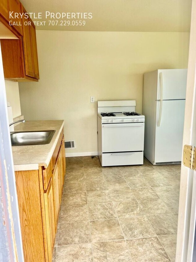
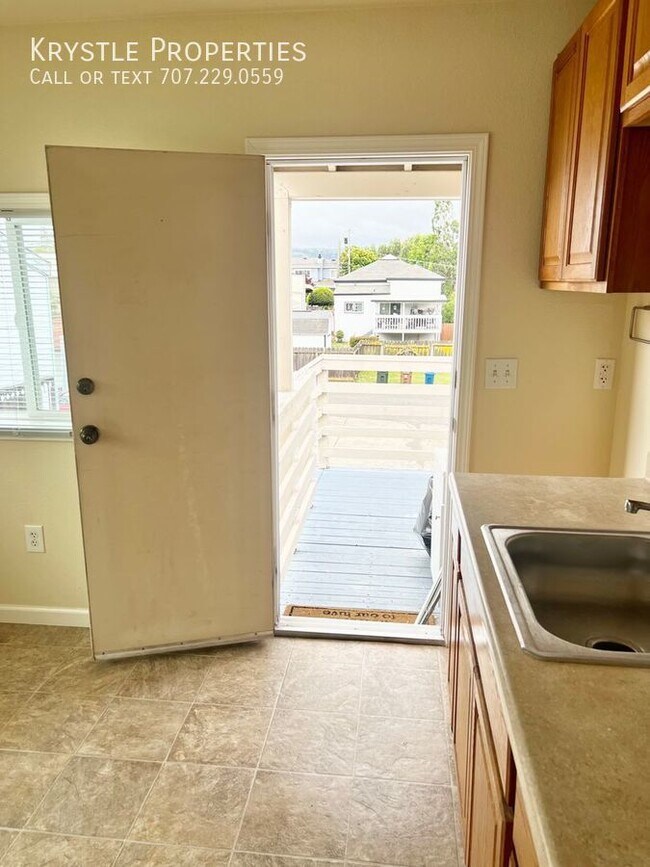
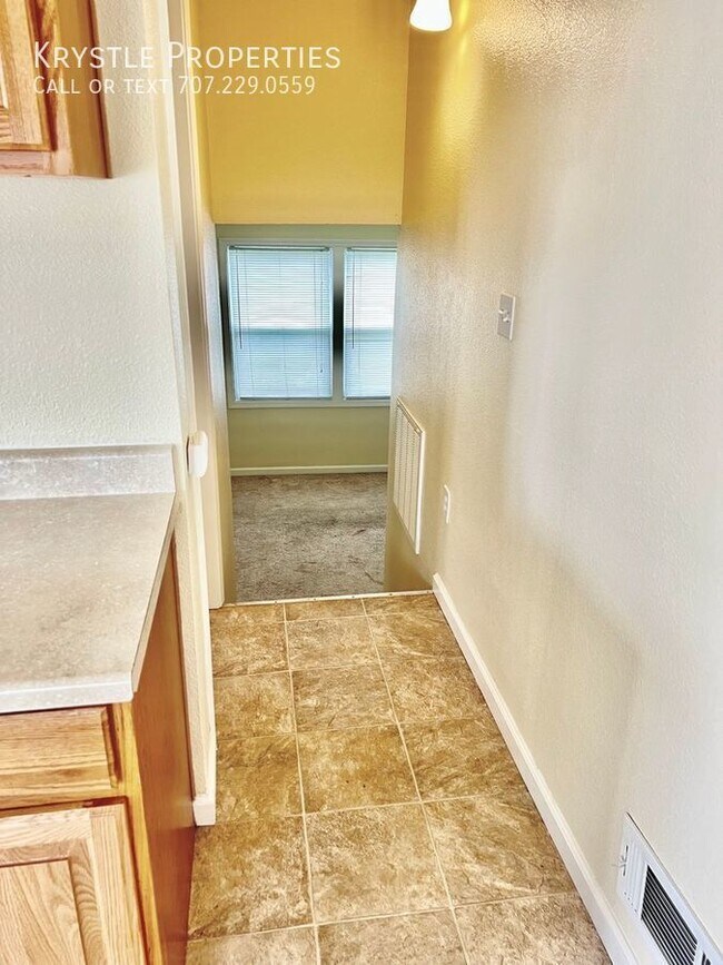
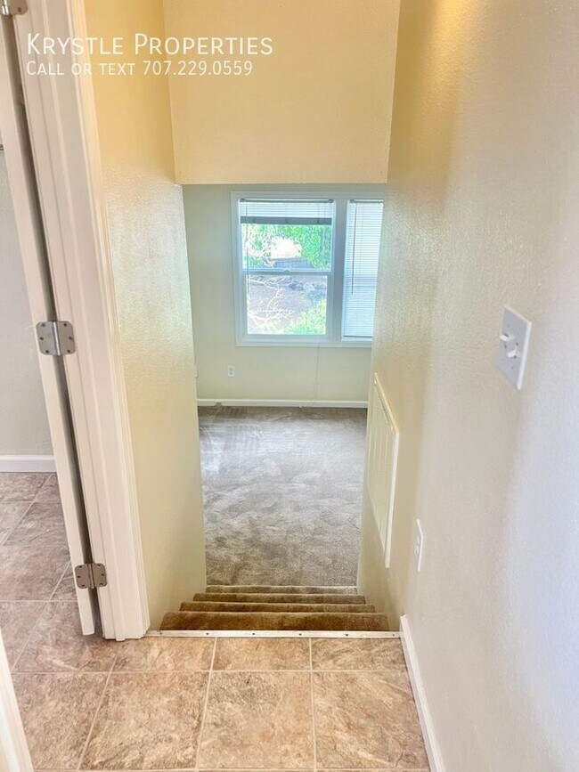
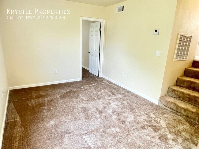
---- SCHEDULE A SHOWING ONLINE AT: ---- ****Presented exclusively by Krystle Properties **** Check out this recently upgraded apartment located in Benicia! Quick access to I-680 and 780 and just 0.6 miles to Benicia's First Street - filled with a variety of restaurants, shopping and night life. This is an upper-level unit with storage and off-street parking. Water and sewer are included in the monthly rent. * Sorry no pets at this one. ** Please submit all applications to Krystle Properties. We do not accept Zillow or outside vendor applications. REQUIREMENTS: ~FICO score of 680+optimal; 640-679 may require cosigner or higher deposit ~FICO below 640 may be automatic denial ~Good rental references ~Verifiable income of 3 times the rent ~NO EVICTIONS To apply, visit: krystleproperties (dot) com / apply To schedule an appointment to view the interior and to verify listing information, call , or visit krystleproperties (dot) com / vacancies. Due to third party listing errors and to receive most up to date and accurate information, please refer to our website at KrystleProperties (dot) com All Krystle Properties residents are automatically enrolled in the Resident Benefits Package (RBP) for additional $40.95/month which includes renters insurance, HVAC air filter delivery (for applicable properties), credit building to help boost your credit score with timely rent payments, $1M Identity Protection, move-in concierge service making utility connection and home service setup a breeze during your move-in, our best-in-class resident rewards program, and much more! More details upon application. Sewer Water
468 Military E is a house located in Solano County and the 94510 ZIP Code. This area is served by the Benicia Unified attendance zone.
Location
Get Directions
Situated along the Carquinez Strait in the San Francisco Bay Area, Benicia is a scenic waterfront city rich in history, cultural amenities, and sweeping vistas. Benicia boasts an irresistible historic charm, especially in its quaint downtown area, which is brimming with one-of-a-kind shops, delectable eateries, and vibrant artists’ studios.
Founded in 1847, Benicia once served as California’s state capital for 13 months, and now touts the only state capitol building outside of Sacramento. Residents and visitors alike can uncover much of Benicia’s past at the Benicia Historical Museum.
Nearly 500 acres of parkland provides ample green space and tranquil trails for all kinds of outdoor recreation. Benicia’s thriving arts community creates a broad range of art, from glass art and sculptures to theatrical plays and music. Benicia’s friendly community comes together for a variety of events, like the Downtown Farmers Market, Opening Day on the Strait, and artist studio open houses.
Learn more about living in Benicia
Education
| Colleges & Universities | Distance | ||
|---|---|---|---|
| Colleges & Universities | Distance | ||
| Drive: | 14 min | 8.9 mi | |
| Drive: | 20 min | 11.5 mi | |
| Drive: | 22 min | 15.6 mi | |
| Drive: | 24 min | 17.8 mi |
468 Military E is within 14 minutes or 8.9 miles from Diablo Valley, Pleasant Hill. It is also near Touro University California and Solano Community College.
Schools


Public Elementary School
Grades K-5
440 Students
Nearby
Public Elementary School
Grades K-5
420 Students
Attendance Zone
Public Middle School
Grades 6-8
986 Students
Attendance Zone
Public High School
Grades 9-12
1,432 Students
Attendance Zone
Private Elementary & Middle School
Grades PK-8
389 Students
Nearby
Private Elementary & Middle School
Grades PK-8
330 Students
Nearby
Private Middle & High School
Grades 7-12
Nearby
School data provided by
 The GreatSchools Rating helps parents compare schools within a state based on a variety of school quality indicators and provides a helpful picture of how effectively each school serves all of its students. Ratings are on a scale of 1 (below average) to 10 (above average) and can include test scores, college readiness, academic progress, advanced courses, equity, discipline and attendance data. We also advise parents to visit schools, consider other information on school performance and programs, and consider family needs as part of the school selection process.
View GreatSchools Rating Methodology
Data provided by GreatSchools.org © 2025. All rights reserved.
View GreatSchools Rating Methodology
Data provided by GreatSchools.org © 2025. All rights reserved.
Transportation options available in Benicia include North Concord Martinez Station, located 10.0 miles from 468 Military E. 468 Military E is near Metro Oakland International, located 36.4 miles or 48 minutes away, and San Francisco International, located 47.5 miles or 64 minutes away.
| Transit / Subway | Distance | ||
|---|---|---|---|
| Transit / Subway | Distance | ||
|
|
Drive: | 15 min | 10.0 mi |
|
|
Drive: | 15 min | 10.0 mi |
|
|
Drive: | 16 min | 10.5 mi |
|
|
Drive: | 16 min | 11.8 mi |
| Commuter Rail | Distance | ||
|---|---|---|---|
| Commuter Rail | Distance | ||
|
|
Drive: | 8 min | 5.0 mi |
|
|
Drive: | 25 min | 19.7 mi |
| Drive: | 28 min | 21.4 mi | |
|
|
Drive: | 32 min | 25.5 mi |
|
|
Drive: | 34 min | 27.3 mi |
| Airports | Distance | ||
|---|---|---|---|
| Airports | Distance | ||
|
Metro Oakland International
|
Drive: | 48 min | 36.4 mi |
|
San Francisco International
|
Drive: | 64 min | 47.5 mi |
Time and distance from 468 Military E.
| Shopping Centers | Distance | ||
|---|---|---|---|
| Shopping Centers | Distance | ||
| Walk: | 4 min | 0.3 mi | |
| Walk: | 10 min | 0.5 mi | |
| Walk: | 12 min | 0.6 mi |
468 Military E has 3 shopping centers within 0.6 mile, which is about a 12-minute walk. The miles and minutes will be for the farthest away property.
| Parks and Recreation | Distance | ||
|---|---|---|---|
| Parks and Recreation | Distance | ||
|
Benicia Capitol State Historic Park
|
Walk: | 17 min | 0.9 mi |
|
Martinez Regional Shoreline
|
Drive: | 10 min | 4.4 mi |
|
Benicia State Recreation Area
|
Drive: | 9 min | 4.7 mi |
|
Alhambra Creek Watershed
|
Drive: | 7 min | 5.0 mi |
|
Carquinez Strait Regional Shoreline
|
Drive: | 18 min | 11.8 mi |
468 Military E has 5 parks within 11.8 miles, including Benicia Capitol State Historic Park, Benicia State Recreation Area, and Martinez Regional Shoreline.
| Hospitals | Distance | ||
|---|---|---|---|
| Hospitals | Distance | ||
| Drive: | 9 min | 5.6 mi | |
| Drive: | 12 min | 8.4 mi | |
| Drive: | 13 min | 9.5 mi |
468 Military E has 3 hospitals within 9.5 miles, the nearest is Contra Costa Regional Medical Center which is 5.6 miles away and a 9 minute drive.
| Military Bases | Distance | ||
|---|---|---|---|
| Military Bases | Distance | ||
| Drive: | 3 min | 1.4 mi | |
| Drive: | 29 min | 12.7 mi |
468 Military E is 1.4 miles from Armory Vallejo, and is convenient to other military bases, including US Naval Station Port Chicago.
You May Also Like
Similar Rentals Nearby


What Are Walk Score®, Transit Score®, and Bike Score® Ratings?
Walk Score® measures the walkability of any address. Transit Score® measures access to public transit. Bike Score® measures the bikeability of any address.
What is a Sound Score Rating?
A Sound Score Rating aggregates noise caused by vehicle traffic, airplane traffic and local sources

468 Military E
Benicia, CA 94510