
$985
/ Month
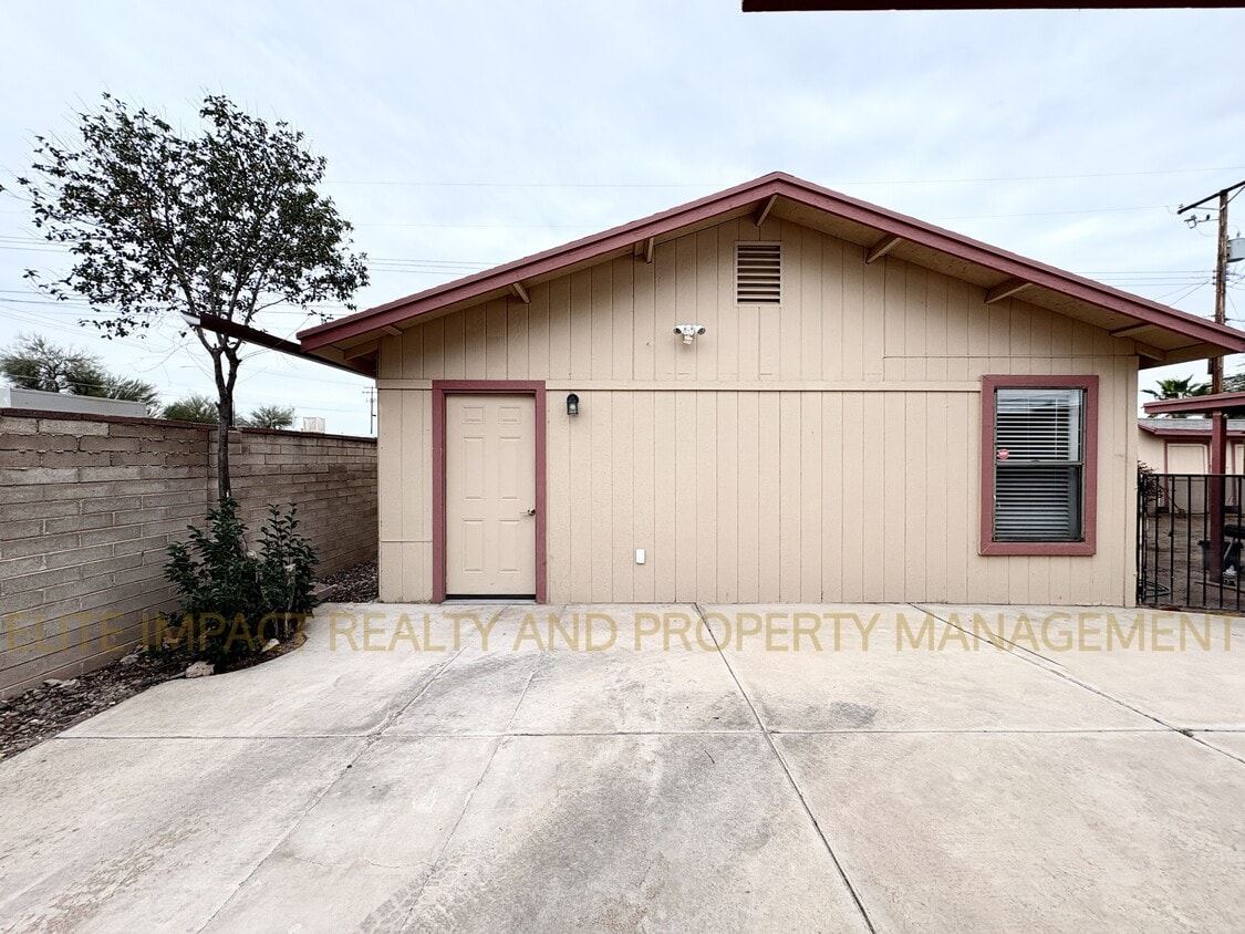
4650 E Calle Aurora
Tucson, AZ 85711
Today
|
Edit
Favorites
520-540-9512
-
Bedrooms
1
-
Bathrooms
1
-
Square Feet
576 sq ft
-
Available
Available Now
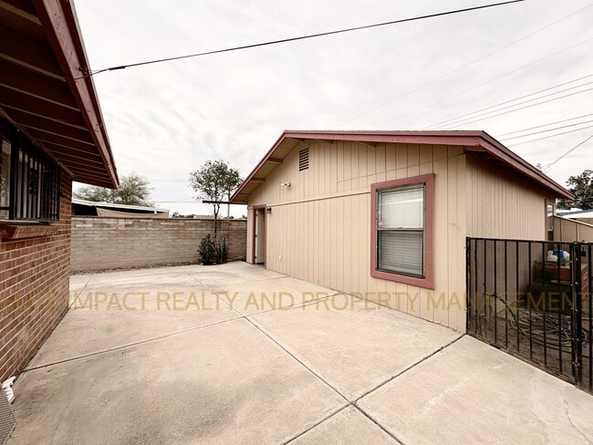
4650 E Calle Aurora

Favorites
About This Home
$985 deposit,
Available Now
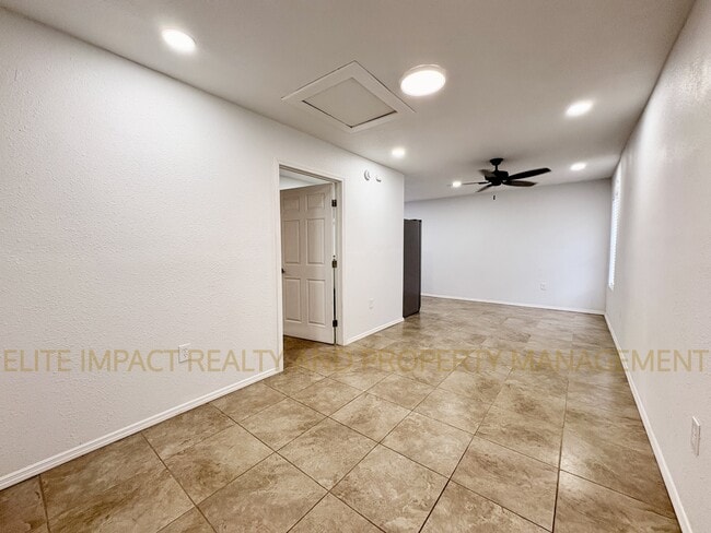
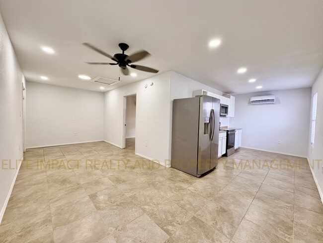
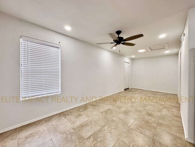
Welcome home! This cozy 1bed/1bath is ready for you! Close to Davis-Monthan, Shopping malls, plenty of restaurants and more. Walk into a spacious living area that flows seamlessly into the kitchen, complete with stainless steel appliances (Less than 2 years old!). Heated and cooled with energy efficient mini splits for your comfort. No carpet! W/S/T Included in rent! Don't miss out! Call/text for showings.
4650 E Calle Aurora is a house located in Pima County and the 85711 ZIP Code. This area is served by the Tucson Unified District attendance zone.
* Price shown is base rent. Excludes user-selected optional fees and variable or usage-based fees and required charges due at or prior to move-in or at move-out. Price, availability, fees, and any applicable rent special are subject to change without notice.
* Square footage definitions vary. Displayed square footage is approximate.
Fees and Policies
The fees listed below are community-provided and may exclude utilities or add-ons. All payments are made directly to the property and are non-refundable unless otherwise specified. Use the Cost Calculator to determine costs based on your needs.
-
One-Time Basics
-
Due at Move-In
-
Security Deposit - RefundableCharged per unit.$985
-
-
Due at Move-In
Property Fee Disclaimer: Based on community-supplied data and independent market research. Subject to change without notice. May exclude fees for mandatory or optional services and usage-based utilities.
House Features
- Air Conditioning
- Range
- Refrigerator
Contact
- Listed by Leasing Agent
- Phone Number
- Contact
Location
Get Directions
Perched at the north end of Davis-Monthan Air Force Base, Roberts provides a convenient location in southeastern Tucson, roughly two miles from downtown and about four miles from the University of Arizona. Tucson International Airport is just six miles southwest of Roberts.
With gorgeous mountain views and filled with palm trees, Roberts starts along East 29th Street and extends south to Golf Links Road. The Aviation Bikeway extends through the southern end of the neighborhood. Reid Park is adjacent to Roberts. This large, popular park includes a playground, a dog park, the Reid Park Rose Garden, hiking trails, a recreation center, Hi Corbett Field, and the Reid Park Zoo. The Randolph Golf Course is next to the park.
Considered pedestrian-friendly and convenient, Roberts is a popular Tucson neighborhood and apartments are snapped up quickly. The neighborhood provides some shops and restaurants, along with the popular hangout, Runway Bar & Grill.
Learn more about living in Roberts
Amenities
- Air Conditioning
- Range
- Refrigerator
Education
| Colleges & Universities | Distance | ||
|---|---|---|---|
| Colleges & Universities | Distance | ||
| Drive: | 14 min | 6.8 mi | |
| Drive: | 14 min | 7.2 mi | |
| Drive: | 14 min | 7.4 mi | |
| Drive: | 15 min | 7.6 mi |
4650 E Calle Aurora is within 14 minutes or 7.2 miles from University of Arizona. It is also near Pima C.C., East Campus and Pima C.C., Downtown Campus.
Schools


Public Elementary & Middle School
Grades PK-8
285 Students
Attendance Zone
Public Elementary & Middle School
Grades PK-8
612 Students
Attendance Zone
Public Middle & High School
Grades 8-12
1,107 Students
Attendance Zone
Public Middle & High School
Grades 8-12
982 Students
Attendance Zone
Public Middle & High School
Grades 6-12
1,162 Students
Attendance Zone
Private Elementary & Middle School
Grades PK-8
262 Students
Nearby
Private Middle & High School
Grades 8-12
10 Students
Nearby
School data provided by
 The GreatSchools Rating helps parents compare schools within a state based on a variety of school quality indicators and provides a helpful picture of how effectively each school serves all of its students. Ratings are on a scale of 1 (below average) to 10 (above average) and can include test scores, college readiness, academic progress, advanced courses, equity, discipline and attendance data. We also advise parents to visit schools, consider other information on school performance and programs, and consider family needs as part of the school selection process.
View GreatSchools Rating Methodology
Data provided by GreatSchools.org © 2026. All rights reserved.
View GreatSchools Rating Methodology
Data provided by GreatSchools.org © 2026. All rights reserved.
Transportation options available in Tucson include Sl/2Nd St/Cherry Av, located 6.5 miles from 4650 E Calle Aurora. 4650 E Calle Aurora is near Tucson International, located 8.4 miles or 15 minutes away.
| Transit / Subway | Distance | ||
|---|---|---|---|
| Transit / Subway | Distance | ||
| Drive: | 13 min | 6.5 mi | |
| Drive: | 12 min | 6.6 mi | |
| Drive: | 14 min | 6.6 mi | |
| Drive: | 13 min | 6.6 mi | |
| Drive: | 13 min | 6.9 mi |
| Commuter Rail | Distance | ||
|---|---|---|---|
| Commuter Rail | Distance | ||
|
|
Drive: | 10 min | 6.0 mi |
| Airports | Distance | ||
|---|---|---|---|
| Airports | Distance | ||
|
Tucson International
|
Drive: | 15 min | 8.4 mi |
Time and distance from 4650 E Calle Aurora.
| Shopping Centers | Distance | ||
|---|---|---|---|
| Shopping Centers | Distance | ||
| Walk: | 14 min | 0.8 mi | |
| Drive: | 3 min | 1.2 mi | |
| Drive: | 4 min | 1.3 mi |
4650 E Calle Aurora has 3 shopping centers within 1.3 miles, which is about a 4-minute drive. The miles and minutes will be for the farthest away property.
| Parks and Recreation | Distance | ||
|---|---|---|---|
| Parks and Recreation | Distance | ||
|
Freedom Park
|
Walk: | 14 min | 0.7 mi |
|
Reid Park Zoo
|
Drive: | 7 min | 2.5 mi |
|
Gene C. Reid Park
|
Drive: | 8 min | 2.7 mi |
|
Terra Del Sol Park
|
Drive: | 9 min | 3.8 mi |
|
Miramonte Park
|
Drive: | 9 min | 3.8 mi |
4650 E Calle Aurora has 5 parks within 3.8 miles, including Freedom Park, Gene C. Reid Park, and Reid Park Zoo.
| Hospitals | Distance | ||
|---|---|---|---|
| Hospitals | Distance | ||
| Drive: | 7 min | 4.1 mi | |
| Drive: | 9 min | 4.3 mi | |
| Drive: | 10 min | 4.7 mi |
4650 E Calle Aurora has 3 hospitals within 4.7 miles, the nearest is Banner - University Medical Center South Campus which is 4.1 miles away and a 7 minute drive.
| Military Bases | Distance | ||
|---|---|---|---|
| Military Bases | Distance | ||
| Drive: | 11 min | 6.1 mi | |
| Drive: | 16 min | 8.4 mi | |
| Drive: | 84 min | 71.3 mi |
4650 E Calle Aurora has 3 military bases within 71.3 miles, the nearest is Davis Monthan Air Force Base which is 6.1 miles away and a 11 minute drive.
You May Also Like
Similar Rentals Nearby


What Are Walk Score®, Transit Score®, and Bike Score® Ratings?
Walk Score® measures the walkability of any address. Transit Score® measures access to public transit. Bike Score® measures the bikeability of any address.
What is a Sound Score Rating?
A Sound Score Rating aggregates noise caused by vehicle traffic, airplane traffic and local sources
4650 E Calle Aurora
Tucson, AZ 85711