
$1,300
/ Month
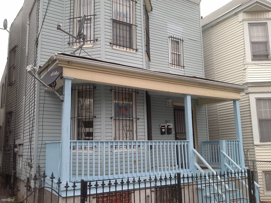
463 S 15th St
Newark, NJ 07103
2 Weeks Ago
|
Edit
Favorites
463 S 15th St

Favorites
Check Back Soon for Upcoming Availability
| Beds | Baths | Average SF |
|---|---|---|
| 3 Bedrooms 3 Bedrooms 3 Br | 1 Bath 1 Bath 1 Ba | 1,968 SF |
About This Property
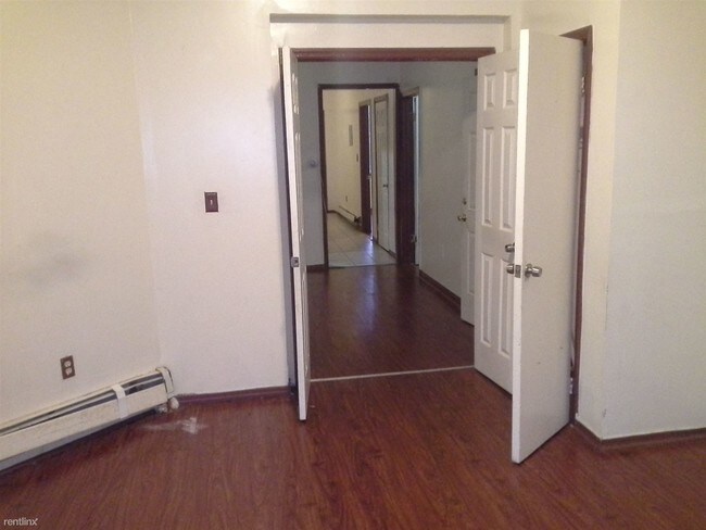
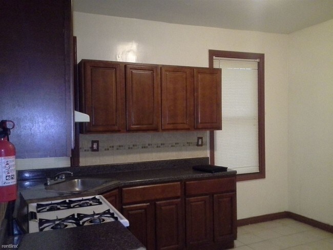
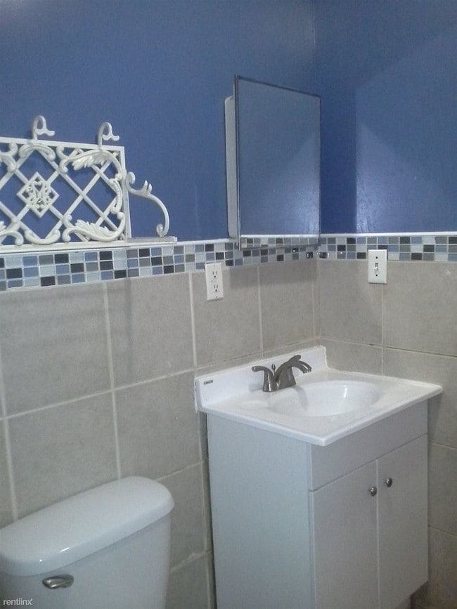
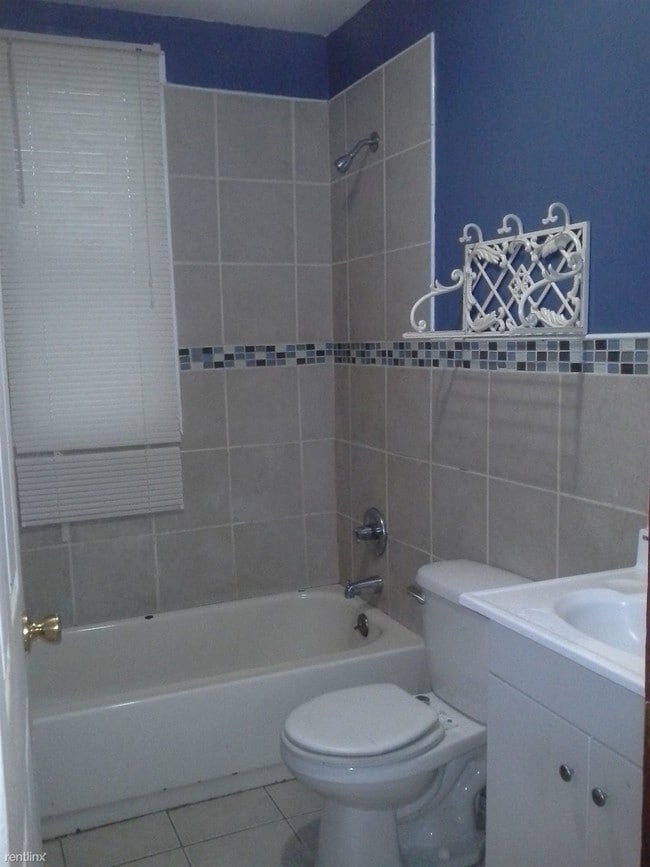
(347) 790-1448 - Spacious 3 bedroom Apartment with Large Master - Must see !!! Gorgeous 3 Bedroom Great Space Laminate flooring and Ceramic tiles Throughout apartment- Beautiful Kitchen with Elegant Bathroom- 1.5 Months Security Deposit. No broker fee- Utilities NOT included - Small pets w/deposit - Section 8 - NOTE: Electronic Application Required for Viewing Apply at Turbo Tenant: http://rent.turbotenant.com/properties/463-south-15th-street (RLNE3231051) Other Amenities - Other- Fenced Yard. Appliances - Range, Oven. Lease lengths - Month to Month. Details regarding this property's Utilities - Water Included. Pet policies - Small Dogs Allowed, Cats Allowed.
463 S 15th St is a condo located in Essex County and the 07103 ZIP Code. This area is served by the The Newark Public School District attendance zone.
463 S 15th St,
Newark,
NJ
07103
The West Side of Newark is a well-established, urban community. Situated just west of downtown, the historic West Side County Park anchors the community and draws in locals for baseball and other recreation in the city’s Central Ward. Residents of this community enjoy plentiful public transportation, an array of amenities along Springfield Avenue, and various apartments and condos for rent. West Side is very pedestrian friendly, with many residents walking from place to place. Great public schools, universities, and neighborhood parks can be found around the West Side of Newark.
Learn more about living in West SideBelow are rent ranges for similar nearby apartments
Education
| Colleges & Universities | Distance | ||
|---|---|---|---|
| Colleges & Universities | Distance | ||
| Drive: | 4 min | 2.0 mi | |
| Drive: | 4 min | 2.0 mi | |
| Drive: | 4 min | 2.4 mi | |
| Drive: | 7 min | 2.6 mi |
463 S 15th St is within 4 minutes or 2.0 miles from Essex County College. It is also near N.J. Inst. of Technology and Rutgers, Newark Campus.
Schools


Public Elementary, Middle & High School
Grades K-12
Attendance Zone
Public Elementary & Middle School
Grades PK-8
326 Students
Attendance Zone
Public Elementary & Middle School
Grades PK-8
101 Students
Attendance Zone
Public Middle & High School
Grades 6-12
938 Students
Attendance Zone
Public High School
Grades 9-12
141 Students
Attendance Zone
Public High School
Grades 9-12
609 Students
Attendance Zone
Private Elementary & Middle School
Grades PK-8
Nearby
Private Elementary School
Grades PK-5
Nearby
Private Middle & High School
Grades 6-12
Nearby
School data provided by
 The GreatSchools Rating helps parents compare schools within a state based on a variety of school quality indicators and provides a helpful picture of how effectively each school serves all of its students. Ratings are on a scale of 1 (below average) to 10 (above average) and can include test scores, college readiness, academic progress, advanced courses, equity, discipline and attendance data. We also advise parents to visit schools, consider other information on school performance and programs, and consider family needs as part of the school selection process.
View GreatSchools Rating Methodology
Data provided by GreatSchools.org © 2026. All rights reserved.
View GreatSchools Rating Methodology
Data provided by GreatSchools.org © 2026. All rights reserved.
Transportation options available in Newark include Warren Street, located 1.8 miles from 463 S 15th St. 463 S 15th St is near Newark Liberty International, located 6.5 miles or 12 minutes away, and LaGuardia, located 29.0 miles or 45 minutes away.
| Transit / Subway | Distance | ||
|---|---|---|---|
| Transit / Subway | Distance | ||
|
|
Drive: | 4 min | 1.8 mi |
|
|
Drive: | 4 min | 1.8 mi |
|
|
Drive: | 4 min | 1.9 mi |
|
|
Drive: | 4 min | 2.1 mi |
|
|
Drive: | 5 min | 2.3 mi |
| Commuter Rail | Distance | ||
|---|---|---|---|
| Commuter Rail | Distance | ||
|
|
Drive: | 4 min | 2.0 mi |
|
|
Drive: | 5 min | 2.5 mi |
|
|
Drive: | 5 min | 2.6 mi |
|
|
Drive: | 5 min | 2.6 mi |
|
|
Drive: | 12 min | 4.9 mi |
| Airports | Distance | ||
|---|---|---|---|
| Airports | Distance | ||
|
Newark Liberty International
|
Drive: | 12 min | 6.5 mi |
|
LaGuardia
|
Drive: | 45 min | 29.0 mi |
Walkability Near 463 S 15th St Newark, NJ 07103
Getting Around
 What do Walkability, Transit, Drivability, and Bikeability mean?
Walkability measures the walking distance to day-to-day needs.
Transit measures access to public transportation.
Drivability measures congestion, parking availability, and access to major roads.
Bikeability measures the suitability for cycling.
How It Works
What do Walkability, Transit, Drivability, and Bikeability mean?
Walkability measures the walking distance to day-to-day needs.
Transit measures access to public transportation.
Drivability measures congestion, parking availability, and access to major roads.
Bikeability measures the suitability for cycling.
How It Works
Exceptionally Walkable
Walkability
90
/ 100
Strong Public Transit
Transit
80
/ 100
Fairly Drivable
Drivability
50
/ 100
Moderately Bikeable
Bikeability
60
/ 100
Scores provided by
-
Soundscore™
-
/ 100
Traffic
-Airport
-Businesses
-Scores provided by
HowLoud What is a Sound Score Rating? A Sound Score Rating aggregates noise caused by vehicle traffic, airplane traffic and local sources. How It WorksTime and distance from 463 S 15th St.
| Shopping Centers | Distance | ||
|---|---|---|---|
| Shopping Centers | Distance | ||
| Drive: | 3 min | 1.1 mi | |
| Drive: | 2 min | 1.3 mi | |
| Drive: | 3 min | 1.3 mi |
463 S 15th St has 3 shopping centers within 1.3 miles, which is about a 3-minute drive. The miles and minutes will be for the farthest away property.
| Parks and Recreation | Distance | ||
|---|---|---|---|
| Parks and Recreation | Distance | ||
|
Newark Museum and Dreyfuss Planetarium
|
Drive: | 4 min | 2.3 mi |
|
Branch Brook Park
|
Drive: | 8 min | 3.5 mi |
|
Edison National Historic Site
|
Drive: | 10 min | 4.7 mi |
|
Kearny Marsh
|
Drive: | 12 min | 5.6 mi |
|
Turtle Back Zoo
|
Drive: | 13 min | 6.5 mi |
463 S 15th St has 5 parks within 6.5 miles, including Newark Museum and Dreyfuss Planetarium, Branch Brook Park, and Edison National Historic Site.
| Hospitals | Distance | ||
|---|---|---|---|
| Hospitals | Distance | ||
| Walk: | 18 min | 0.9 mi | |
| Drive: | 3 min | 1.5 mi | |
| Drive: | 4 min | 2.3 mi |
463 S 15th St has 3 hospitals within 2.3 miles, the nearest is The University Hospital which is 0.9 mile away and a 18 minute walk.
| Military Bases | Distance | ||
|---|---|---|---|
| Military Bases | Distance | ||
| Drive: | 17 min | 10.4 mi | |
| Drive: | 24 min | 13.4 mi | |
| Drive: | 33 min | 18.5 mi |
463 S 15th St has 3 military bases within 18.5 miles, the nearest is Military Ocean Terminal which is 10.4 miles away and a 17 minute drive.
You May Also Like
How do I access Social Services in New Jersey?
Statewide service is free, confidential, multilingual and always open. Three easy ways to reach Social Services in NJ: Dial 2-1-1; text your zip code to 898-211; or chat at https://www.nj211.org
Similar Rentals Nearby


What Are Walk Score®, Transit Score®, and Bike Score® Ratings?
Walk Score® measures the walkability of any address. Transit Score® measures access to public transit. Bike Score® measures the bikeability of any address.
What is a Sound Score Rating?
A Sound Score Rating aggregates noise caused by vehicle traffic, airplane traffic and local sources.

463 S 15th St
Newark, NJ 07103