
The Journal
36 Journal Sq,
Jersey City, NJ 07306
$3,095 - $7,100
Studio - 3 Beds

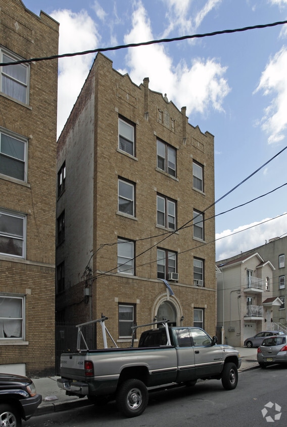
Visit 46 Vroom St in Jersey City, NJ. This property is situated in the McGinley Square area of Jersey City. Let the leasing team show you everything this community has in store. Compare 1 to 3 bedroom floor plans. Start living the good life at 46 Vroom St. Contact us or stop by the leasing office to see available floor plans.
46 Vroom St is an apartment community located in Hudson County and the 07306 ZIP Code. This area is served by the Jersey City Public School District attendance zone.
Air Conditioning
Refrigerator
Disposal
Heating
Signs reading "The Heart of Jersey City: McGinley Square" line the streets of this bustling neighborhood. The up-and-coming area of Jersey City houses small businesses, diverse eateries, and large franchises alike. The streets buzz with commuters on their way to work, students heading to class, and locals running daily errands.
Saint Peter's College allots for much of historic McGinley Square. An active redevelopment plan and local organizations aim to make the neighborhood a highly desirable place to live by upgrading older buildings and bringing in new businesses, condos, and entertainment centers.
Locals can enjoy proximity to New York City and Downtown Jersey City while enjoying a more affordable cost of living. Unique shops, diverse cuisine, and a host of dynamic recreational parks await you in this thriving community.
Learn more about living in McGinley SquareCompare neighborhood and city base rent averages by bedroom.
| McGinley Square | Jersey City, NJ | |
|---|---|---|
| Studio | $1,980 | $2,723 |
| 1 Bedroom | $1,976 | $3,231 |
| 2 Bedrooms | $2,625 | $4,337 |
| 3 Bedrooms | $2,700 | $5,121 |
| Colleges & Universities | Distance | ||
|---|---|---|---|
| Colleges & Universities | Distance | ||
| Walk: | 8 min | 0.5 mi | |
| Walk: | 9 min | 0.5 mi | |
| Drive: | 5 min | 2.2 mi | |
| Drive: | 11 min | 3.6 mi |


Transportation options available in Jersey City include Martin Luther King Drive, located 1.5 miles from 46 Vroom St. 46 Vroom St is near Newark Liberty International, located 9.1 miles or 13 minutes away, and LaGuardia, located 13.9 miles or 31 minutes away.
| Transit / Subway | Distance | ||
|---|---|---|---|
| Transit / Subway | Distance | ||
|
|
Drive: | 4 min | 1.5 mi |
|
|
Drive: | 4 min | 1.7 mi |
|
|
Drive: | 4 min | 1.7 mi |
|
|
Drive: | 4 min | 1.7 mi |
|
|
Drive: | 5 min | 2.1 mi |
| Commuter Rail | Distance | ||
|---|---|---|---|
| Commuter Rail | Distance | ||
|
|
Walk: | 9 min | 0.5 mi |
|
|
Drive: | 4 min | 1.7 mi |
|
|
Drive: | 5 min | 2.2 mi |
|
|
Drive: | 6 min | 2.3 mi |
|
|
Drive: | 6 min | 2.5 mi |
| Airports | Distance | ||
|---|---|---|---|
| Airports | Distance | ||
|
Newark Liberty International
|
Drive: | 13 min | 9.1 mi |
|
LaGuardia
|
Drive: | 31 min | 13.9 mi |
Scores provided by
Traffic
-Airport
-Businesses
-Scores provided by
HowLoud What is a Sound Score Rating? A Sound Score Rating aggregates noise caused by vehicle traffic, airplane traffic and local sources. How It WorksTime and distance from 46 Vroom St.
| Shopping Centers | Distance | ||
|---|---|---|---|
| Shopping Centers | Distance | ||
| Walk: | 19 min | 1.0 mi | |
| Drive: | 4 min | 1.6 mi | |
| Drive: | 4 min | 1.9 mi |
| Parks and Recreation | Distance | ||
|---|---|---|---|
| Parks and Recreation | Distance | ||
|
Liberty Science Center
|
Drive: | 6 min | 2.0 mi |
|
Liberty Landing Marina
|
Drive: | 7 min | 2.4 mi |
|
Ellis Island National Monument
|
Drive: | 11 min | 3.3 mi |
|
Laurel Hill Park
|
Drive: | 11 min | 4.2 mi |
|
Hudson River Park
|
Drive: | 13 min | 4.7 mi |
| Hospitals | Distance | ||
|---|---|---|---|
| Hospitals | Distance | ||
| Drive: | 3 min | 1.2 mi | |
| Drive: | 3 min | 1.3 mi | |
| Drive: | 7 min | 2.8 mi |
| Military Bases | Distance | ||
|---|---|---|---|
| Military Bases | Distance | ||
| Drive: | 14 min | 6.1 mi | |
| Drive: | 11 min | 6.5 mi |
What Are Walk Score®, Transit Score®, and Bike Score® Ratings?
Walk Score® measures the walkability of any address. Transit Score® measures access to public transit. Bike Score® measures the bikeability of any address.
What is a Sound Score Rating?
A Sound Score Rating aggregates noise caused by vehicle traffic, airplane traffic and local sources.
46 Vroom St
Jersey City, NJ 07306


