
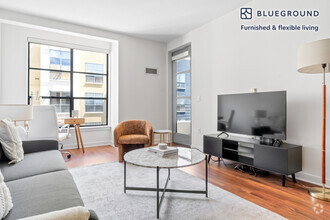
$4,250 / Month
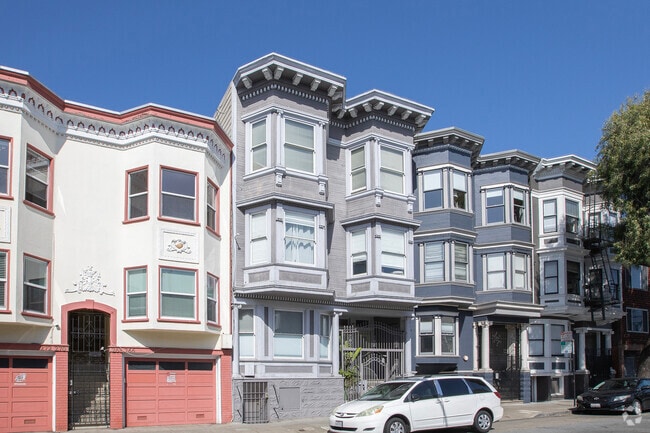
455 Upper Terrace Unit 6
San Francisco, CA 94117
Today
Favorites
415-867-7636
-
Bedrooms
2
-
Bathrooms
2
-
Square Feet
1,033 sq ft
-
Available
Available May 23
455 Upper Terrace Unit 6

Favorites
About This Home
$4,500 deposit,
Available May 23
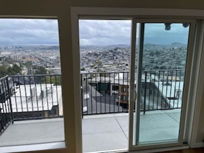
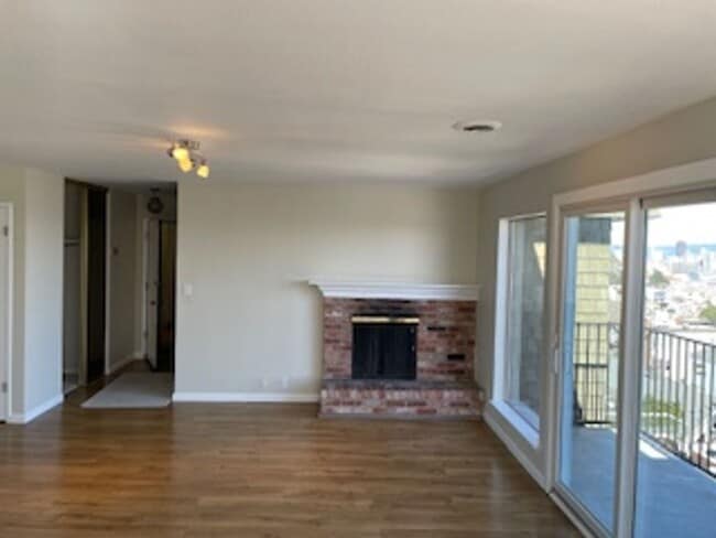
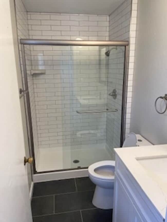
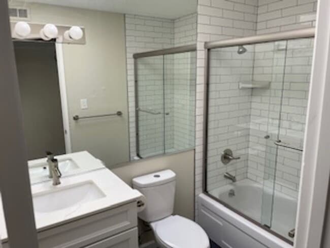
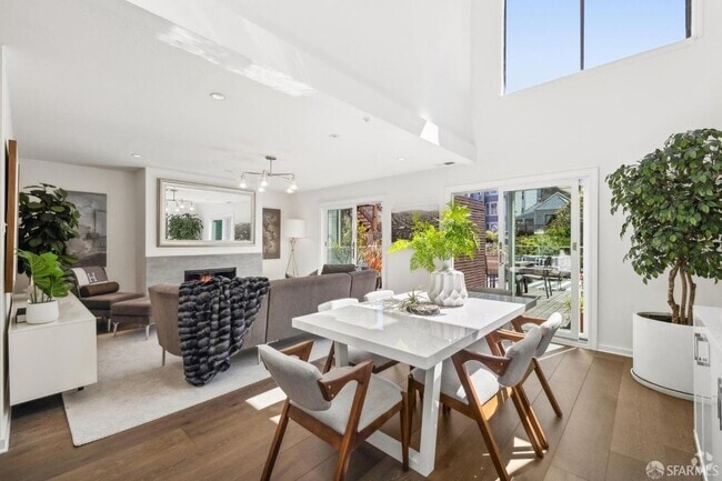
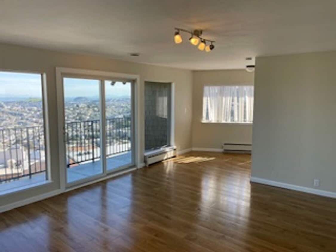
Welcome to Upper Terrace on Mt. Olympus at the top of Ashbury Heights! This beautiful 2BD/2BA has sweeping views of the South Bay from a private deck off the living room/dining room. The bathrooms and kitchen have recently been upgraded and there is a parking spot big enough for a SUV plus a 5' x 5' storage space included! Shared laundry in the building.
455 Upper Terrace is a condo located in San Francisco County and the 94117 ZIP Code. This area is served by the San Francisco Unified attendance zone.
* Price shown is base rent and may not include non-optional fees and utilities.
Price, availability, fees, and any applicable rent special are subject to change without notice.
* Square footage definitions vary. Displayed square footage is approximate.
Contact
- Listed by LKJ Realty | LKJ Realty
- Phone Number
- Contact
Location
Get Directions
Cole Valley nestles up against the southwest corner of Golden Gate Park in San Francisco. This tiny neighborhood contains mostly residential Victorian homes, with a small, densely packed three-block commercial district along Cole Street. Commuters use the mass transit station in the center of the district to reach downtown San Francisco in less than 20 minutes, and then they return home to Cole Valley's small-town atmosphere.
This neighborhood's small size means every corner of the community is within walking distance from your rental home. After work, relax and take in spectacular views of San Francisco from Tank Hill Park, which rises 600 feet above the city at the end of Belgrave Avenue. On weekends, enjoy Florentine Eggs Benedict for brunch at Zazie or have coffee with friends on Cafe Reverie's patio.
Learn more about living in Cole Valley
Education
| Colleges & Universities | Distance | ||
|---|---|---|---|
| Colleges & Universities | Distance | ||
| Drive: | 5 min | 2.0 mi | |
| Drive: | 6 min | 2.0 mi | |
| Drive: | 7 min | 2.3 mi | |
| Drive: | 12 min | 3.8 mi |
455 Upper Terrace Unit 6 is within 5 minutes or 2.0 miles from University of San Francisco. It is also near UC San Francisco, Parnassus and UC San Francisco, Mount Zion.
Schools


Public Elementary School
Grades K-5
Nearby
Public Elementary School
Grades K-5
253 Students
Attendance Zone
Public Middle School
Grades 6-8
504 Students
Attendance Zone
Public High School
Grades 9-12
549 Students
Attendance Zone
Public High School
Grades 9-12
1,041 Students
Attendance Zone
Private Elementary, Middle & High School
Grades 2-12
8 Students
Nearby
Private Middle School
Grades 6-8
Nearby
Private High School
Grades 9-12
421 Students
Nearby
School data provided by
 The GreatSchools Rating helps parents compare schools within a state based on a variety of school quality indicators and provides a helpful picture of how effectively each school serves all of its students. Ratings are on a scale of 1 (below average) to 10 (above average) and can include test scores, college readiness, academic progress, advanced courses, equity, discipline and attendance data. We also advise parents to visit schools, consider other information on school performance and programs, and consider family needs as part of the school selection process.
View GreatSchools Rating Methodology
View GreatSchools Rating Methodology
Transportation options available in San Francisco include Carl And Cole, located 0.6 mile from 455 Upper Terrace Unit 6. 455 Upper Terrace Unit 6 is near San Francisco International, located 15.0 miles or 25 minutes away, and Metro Oakland International, located 22.4 miles or 36 minutes away.
| Transit / Subway | Distance | ||
|---|---|---|---|
| Transit / Subway | Distance | ||
|
|
Walk: | 11 min | 0.6 mi |
|
|
Drive: | 3 min | 1.2 mi |
|
|
Drive: | 3 min | 1.2 mi |
|
|
Drive: | 4 min | 1.4 mi |
|
|
Drive: | 4 min | 1.4 mi |
| Commuter Rail | Distance | ||
|---|---|---|---|
| Commuter Rail | Distance | ||
| Drive: | 9 min | 3.5 mi | |
| Drive: | 10 min | 4.4 mi | |
| Drive: | 14 min | 7.1 mi | |
| Drive: | 20 min | 11.6 mi | |
| Drive: | 22 min | 13.5 mi |
| Airports | Distance | ||
|---|---|---|---|
| Airports | Distance | ||
|
San Francisco International
|
Drive: | 25 min | 15.0 mi |
|
Metro Oakland International
|
Drive: | 36 min | 22.4 mi |
Time and distance from 455 Upper Terrace Unit 6.
| Shopping Centers | Distance | ||
|---|---|---|---|
| Shopping Centers | Distance | ||
| Walk: | 17 min | 0.9 mi | |
| Drive: | 6 min | 1.8 mi | |
| Drive: | 6 min | 2.3 mi |
455 Upper Terrace Unit 6 has 3 shopping centers within 2.3 miles, which is about a 6-minute walk. The miles and minutes will be for the farthest away property.
| Parks and Recreation | Distance | ||
|---|---|---|---|
| Parks and Recreation | Distance | ||
|
Buena Vista Park
|
Walk: | 8 min | 0.5 mi |
|
Randall Museum
|
Walk: | 10 min | 0.5 mi |
|
Conservatory of Flowers
|
Drive: | 5 min | 1.8 mi |
|
California Academy of Sciences
|
Drive: | 8 min | 2.6 mi |
|
Steinhart Aquarium
|
Drive: | 8 min | 2.6 mi |
455 Upper Terrace Unit 6 has 5 parks within 2.6 miles, including Buena Vista Park, Randall Museum, and Conservatory of Flowers.
| Hospitals | Distance | ||
|---|---|---|---|
| Hospitals | Distance | ||
| Walk: | 15 min | 0.8 mi | |
| Drive: | 3 min | 1.4 mi | |
| Drive: | 3 min | 1.4 mi |
455 Upper Terrace Unit 6 has 3 hospitals within 1.4 miles, the nearest is California Pacific Medical Center - Davies Campus which is 0.8 mile away and a 15 minute walk.
| Military Bases | Distance | ||
|---|---|---|---|
| Military Bases | Distance | ||
| Drive: | 13 min | 4.7 mi | |
| Drive: | 14 min | 5.2 mi |
455 Upper Terrace Unit 6 is 4.7 miles from East Fort Miley, and is convenient to other military bases, including West Fort Miley.
You May Also Like
Similar Rentals Nearby
-
-
-
-
-
-
-
-
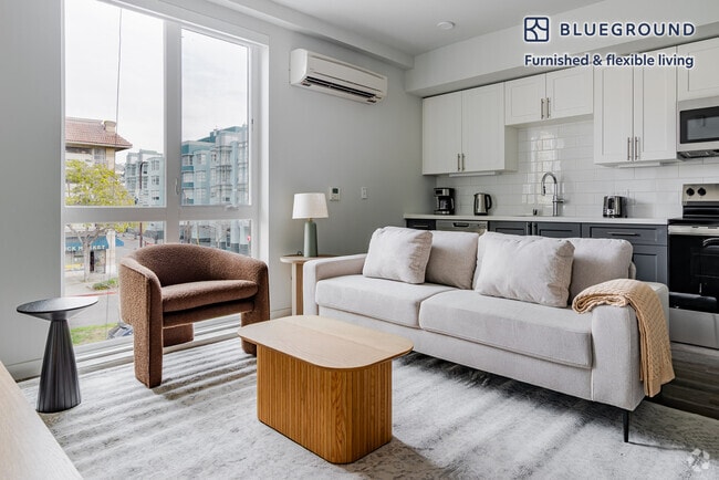
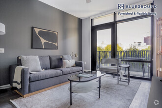
 $4,9102 Beds, 2 Baths, 1,090 sq ftApartment for Rent
 -
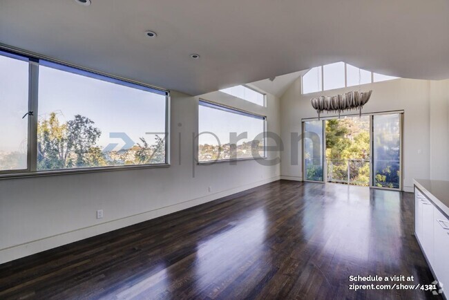
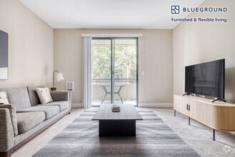
 $5,4902 Beds, 2 Baths, 1,043 sq ftApartment for Rent
 -
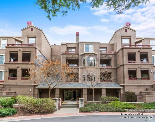
 $3,9102 Beds, 2 Baths, 1,171 sq ftApartment for Rent
What Are Walk Score®, Transit Score®, and Bike Score® Ratings?
Walk Score® measures the walkability of any address. Transit Score® measures access to public transit. Bike Score® measures the bikeability of any address.
What is a Sound Score Rating?
A Sound Score Rating aggregates noise caused by vehicle traffic, airplane traffic and local sources
455 Upper Terrace
San Francisco, CA 94117