
4531 W Citrus Way
Glendale, AZ 85301
-
Bedrooms
3
-
Bathrooms
2
-
Square Feet
1,592 sq ft
-
Available
Available Aug 1
Highlights
- Pets Allowed
- Pool

About This Home
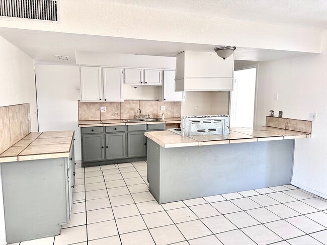
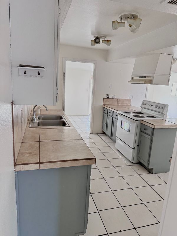
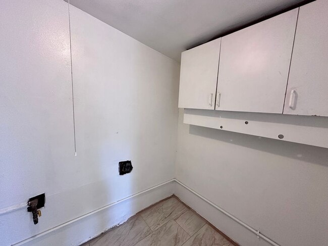
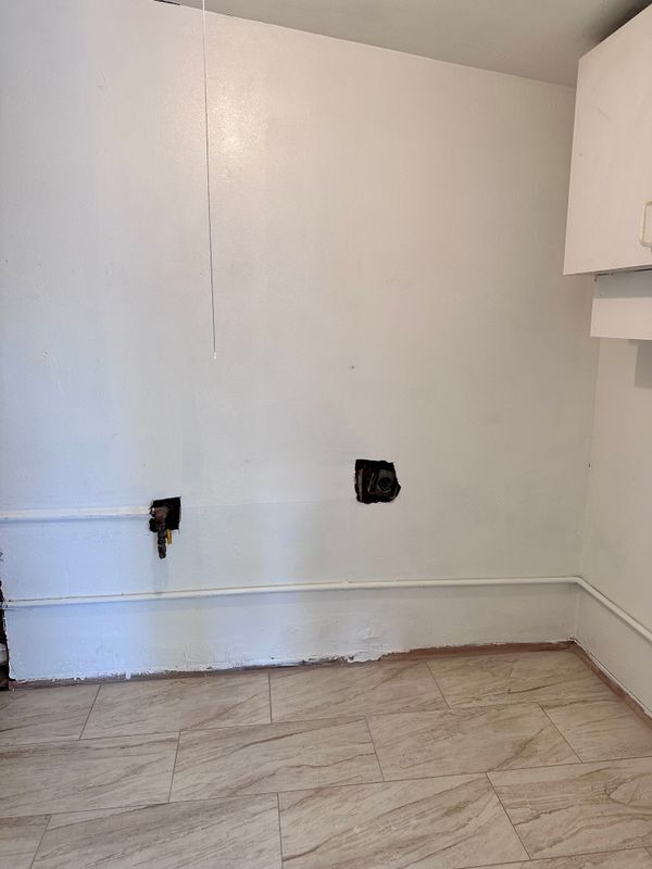
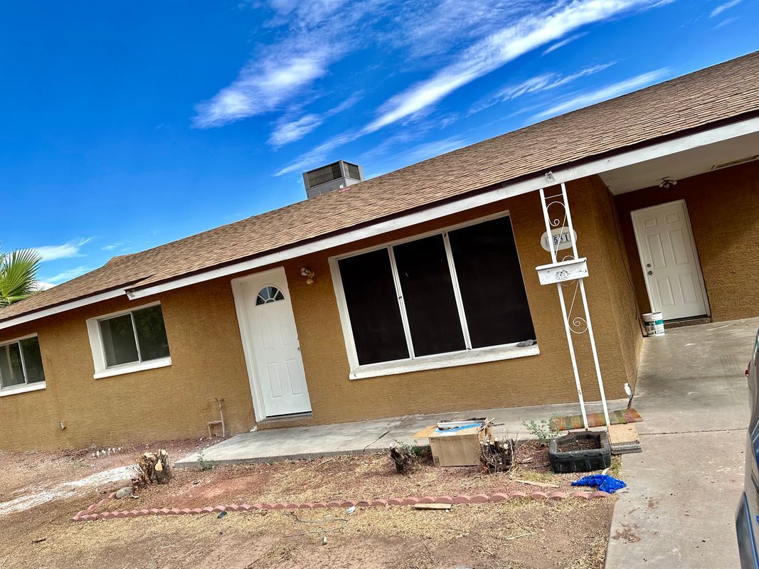
Welcome to your new home in beautiful Glendale, AZ! This charming single-family residence boasts 1,592 square feet of living space, featuring three bedrooms and two bathrooms. Perfectly designed for comfort, the layout includes a private pool that invites relaxation and outdoor enjoyment. Enjoy the spacious front yard and an open-concept kitchen equipped with modern appliances and ample cabinetry. Enjoy a private swimming pool. Key features of this property include a dedicated laundry area and updated bathrooms with convenient fixtures. Each bedroom offers large windows, ceiling fans, and generous closet space. You'll find nearby restaurants and shopping, with La Pradera Park and Rose Lane Park within walking distance. Utilities such as cable, internet, and garbage collection are not included, but central heating and cooling ensure comfort year-round. Bring your pets and experience the vibrant community that Glendale has to offer. Don’t miss out—schedule a viewing today and discover the perfect place to call home!
4531 W Citrus Way is a house located in Maricopa County and the 85301 ZIP Code. This area is served by the Glendale Elementary District attendance zone.
House Features
- Air Conditioning
- Dishwasher
- Renters Insurance Program
- Pool
Fees and Policies
The fees below are based on community-supplied data and may exclude additional fees and utilities.
- Dogs Allowed
-
Fees not specified
- Cats Allowed
-
Fees not specified
Details
Lease Options
-
12 Months
Contact
- Phone Number
- Website View Property Website
- Contact
-
Source

- Air Conditioning
- Dishwasher
- Renters Insurance Program
- Pool
Westside is a neighborhood within Glendale, which was voted “Arizona’s Antique Capital” by Sunset magazine and USA Today. Many higher education schools are located near Westside, including Glendale Community College, Carrington College, and Arizona State University West campus. You’ll discover numerous pocket parks in the area, plus larger ones like Glendale Heroes Regional Park and Grand Canal Linear Park. Shopping and dining destinations are plentiful, especially at Arrowhead Towne Center Mall.
Learn more about living in Westside| Colleges & Universities | Distance | ||
|---|---|---|---|
| Colleges & Universities | Distance | ||
| Drive: | 8 min | 2.8 mi | |
| Drive: | 12 min | 5.0 mi | |
| Drive: | 11 min | 5.7 mi | |
| Drive: | 11 min | 5.7 mi |


View GreatSchools Rating Methodology
Data provided by GreatSchools.org © 2025. All rights reserved.
Transportation options available in Glendale include Montebello/19Th Ave, located 4.0 miles from 4531 W Citrus Way. 4531 W Citrus Way is near Phoenix Sky Harbor International, located 14.0 miles or 24 minutes away, and Phoenix-Mesa Gateway, located 40.8 miles or 57 minutes away.
| Transit / Subway | Distance | ||
|---|---|---|---|
| Transit / Subway | Distance | ||
|
|
Drive: | 8 min | 4.0 mi |
|
|
Drive: | 8 min | 4.0 mi |
|
|
Drive: | 10 min | 4.9 mi |
|
|
Drive: | 11 min | 5.2 mi |
|
|
Drive: | 11 min | 5.6 mi |
| Commuter Rail | Distance | ||
|---|---|---|---|
| Commuter Rail | Distance | ||
|
|
Drive: | 57 min | 41.9 mi |
| Airports | Distance | ||
|---|---|---|---|
| Airports | Distance | ||
|
Phoenix Sky Harbor International
|
Drive: | 24 min | 14.0 mi |
|
Phoenix-Mesa Gateway
|
Drive: | 57 min | 40.8 mi |
Time and distance from 4531 W Citrus Way.
| Shopping Centers | Distance | ||
|---|---|---|---|
| Shopping Centers | Distance | ||
| Walk: | 4 min | 0.2 mi | |
| Walk: | 14 min | 0.7 mi | |
| Walk: | 14 min | 0.7 mi |
| Parks and Recreation | Distance | ||
|---|---|---|---|
| Parks and Recreation | Distance | ||
|
Maryvale Park
|
Drive: | 6 min | 2.9 mi |
|
El Oso Park
|
Drive: | 14 min | 6.5 mi |
|
Steele Indian School Park
|
Drive: | 15 min | 7.0 mi |
|
Acoma Park
|
Drive: | 13 min | 7.0 mi |
|
North Mountain Park
|
Drive: | 18 min | 8.9 mi |
| Hospitals | Distance | ||
|---|---|---|---|
| Hospitals | Distance | ||
| Drive: | 8 min | 3.7 mi | |
| Drive: | 9 min | 4.3 mi | |
| Drive: | 11 min | 5.4 mi |
| Military Bases | Distance | ||
|---|---|---|---|
| Military Bases | Distance | ||
| Drive: | 24 min | 11.5 mi | |
| Drive: | 25 min | 13.9 mi | |
| Drive: | 101 min | 74.1 mi |
You May Also Like
What Are Walk Score®, Transit Score®, and Bike Score® Ratings?
Walk Score® measures the walkability of any address. Transit Score® measures access to public transit. Bike Score® measures the bikeability of any address.
What is a Sound Score Rating?
A Sound Score Rating aggregates noise caused by vehicle traffic, airplane traffic and local sources
4531 W Citrus Way
Glendale, AZ 85301