$5,000 / Month
45248 Navigation St Unit #302
Fremont, CA 94539
Today
Favorites
408-459-6721
-
Bedrooms
3
-
Bathrooms
2.5
-
Square Feet
1,887 sq ft
-
Available
Available Now
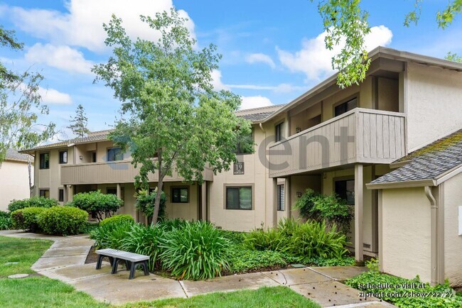
45248 Navigation St Unit #302

Favorites
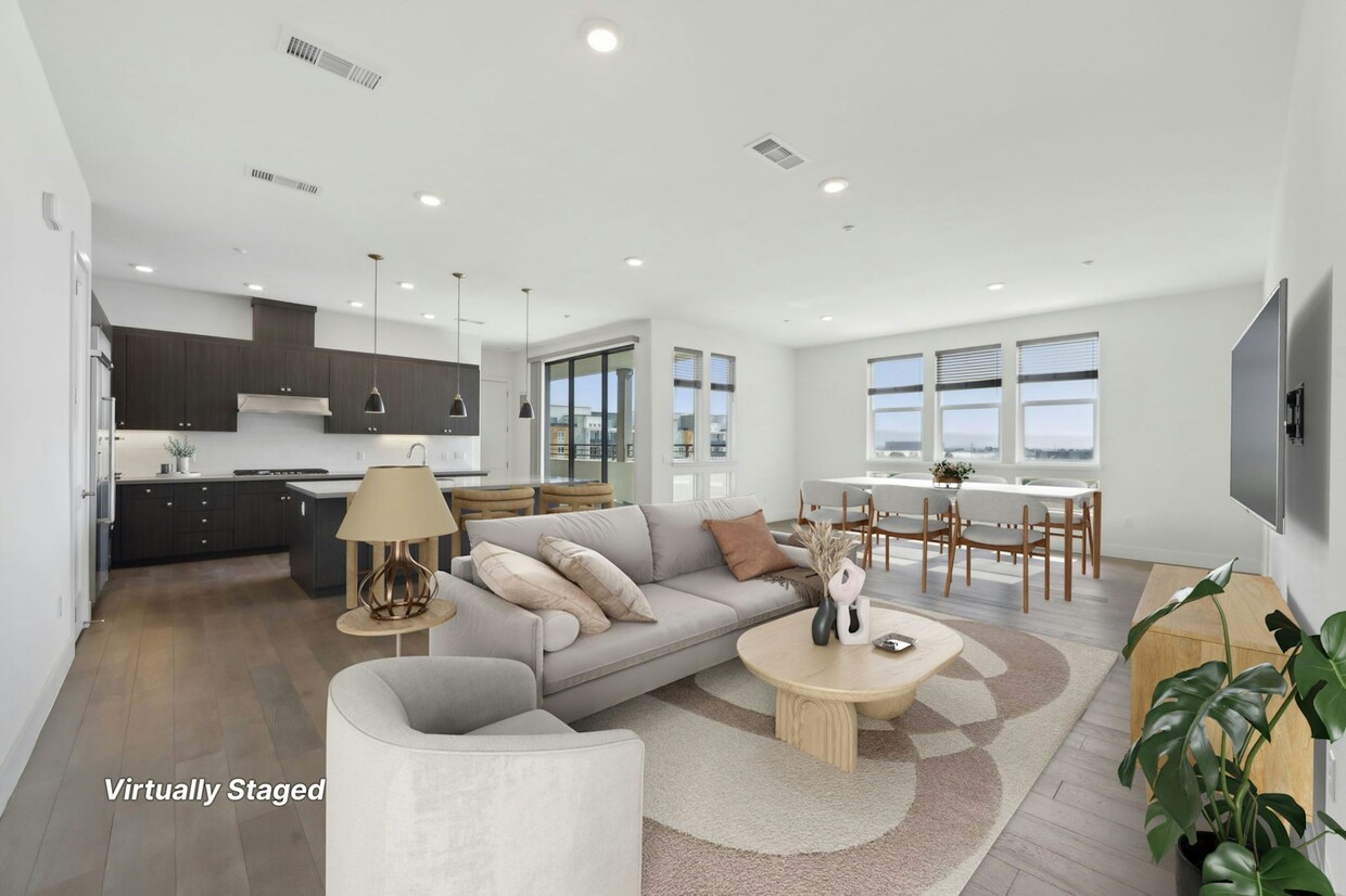
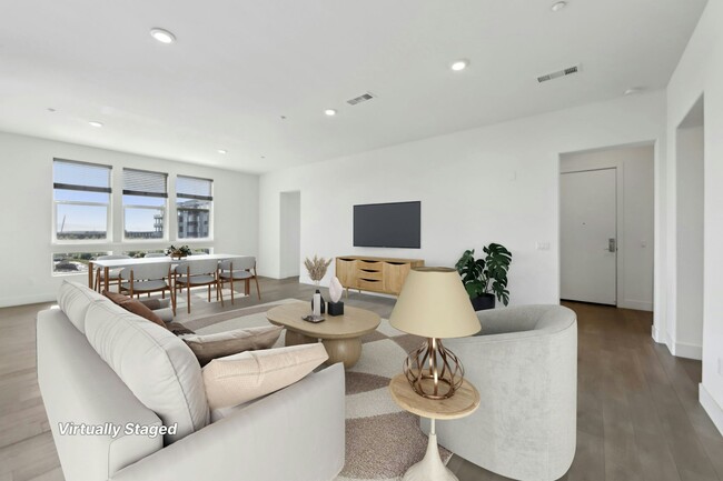
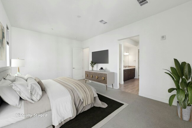
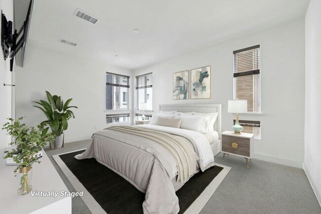
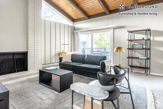
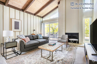
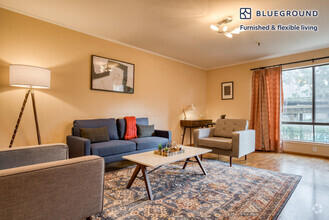
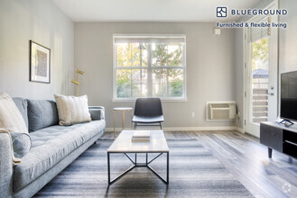
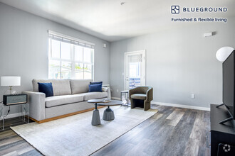
About This Home
12 Month Lease,
$5,500 deposit,
Available Now
Enjoy the new Metro Crossing Community close to everything you need to enjoy life! This home is located in Russell Square, the most prestigious area of this new Toll Brothers community. Enter this home through into the large living area with lots of natural light and room to enjoy your home. The open floor plan kitchen is ideal for entertaining or spending time with the family while cooking your gourmet meals. The master suite boasts a 13' x 19' area with a tub, shower and large walk-in closet. The other bedrooms are large at 12' x 10' and 11' x 12'. The 300 square foot outside living area boasts room for grilling and hanging out in front of the built in fireplace. The third floor location provides a sweeping view of Fremont and the bay. 2 Blocks from the Warm Springs/South Fremont BART station, I-880 and I-680 to get you back home from work quickly after a day at work or play
45248 Navigation St is a condo located in Alameda County and the 94539 ZIP Code.
* Price shown is base rent and may not include non-optional fees and utilities.
Price, availability, fees, and any applicable rent special are subject to change without notice.
* Square footage definitions vary. Displayed square footage is approximate.
Condo Features
Washer/Dryer
Air Conditioning
Dishwasher
Microwave
- Washer/Dryer
- Air Conditioning
- Dishwasher
- Disposal
- Microwave
- Range
- Refrigerator
- Pool
Fees and Policies
The fees below are based on community-supplied data and may exclude additional fees and utilities.
- Dogs Allowed
-
Fees not specified
- Cats Allowed
-
Fees not specified
Details
Lease Options
-
12 Months
Contact
- Listed by Tuscana Properties Booking Agent
- Phone Number
- Contact
Location
Get Directions
Amenities
- Washer/Dryer
- Air Conditioning
- Dishwasher
- Disposal
- Microwave
- Range
- Refrigerator
- Pool
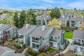
Baylands is a commercial hub about six miles south of Downtown Fremont. Along with housing several light industry companies and business parks, Baylands residents have easy access to several large shopping centers and plazas including NewPark Mall and the Pacific Commons Shopping Center. Nestled along the San Francisco Bay, locals are close to some of the best outdoor recreation opportunities in the area. Explore the Coyote Lake Lagoon Trail, admire migrating birds at the Don Edwards San Francisco Bay National Wildlife Refuge, or go hang gliding at the Mission Peak Regional Preserve. Similar to other Fremont neighborhoods, rentals in this bayside locale are mid-range to upscale boasting sleek condos and luxury apartments.
Great for commuters, Baylands is highly accessible. Interstate 880 runs on the eastern edge of the neighborhood, making it easy to commute north to the San Francisco Bay area or south to San Jose and Silicon Valley.
Learn more about living in Baylands
Education
| Colleges & Universities | Distance | ||
|---|---|---|---|
| Colleges & Universities | Distance | ||
| Drive: | 7 min | 2.7 mi | |
| Drive: | 9 min | 4.8 mi | |
| Drive: | 14 min | 8.9 mi | |
| Drive: | 20 min | 13.7 mi |
45248 Navigation St Unit #302 is within 7 minutes or 2.7 miles from Ohlone College, Fremont Campus. It is also near Ohlone College, Newark and Palmer College of Chiropractic West Campus.
Transportation options available in Fremont include Warm Springs / South Fremont, located 0.4 mile from 45248 Navigation St Unit #302. 45248 Navigation St Unit #302 is near Norman Y Mineta San Jose International, located 13.0 miles or 18 minutes away, and Metro Oakland International, located 24.7 miles or 33 minutes away.
| Transit / Subway | Distance | ||
|---|---|---|---|
| Transit / Subway | Distance | ||
|
|
Walk: | 8 min | 0.4 mi |
|
|
Drive: | 11 min | 5.1 mi |
|
|
Drive: | 12 min | 7.6 mi |
|
|
Drive: | 12 min | 7.7 mi |
|
|
Drive: | 12 min | 8.2 mi |
| Commuter Rail | Distance | ||
|---|---|---|---|
| Commuter Rail | Distance | ||
| Drive: | 13 min | 6.0 mi | |
| Drive: | 15 min | 10.5 mi | |
| Drive: | 19 min | 13.5 mi | |
| Drive: | 20 min | 13.7 mi | |
| Drive: | 21 min | 14.2 mi |
| Airports | Distance | ||
|---|---|---|---|
| Airports | Distance | ||
|
Norman Y Mineta San Jose International
|
Drive: | 18 min | 13.0 mi |
|
Metro Oakland International
|
Drive: | 33 min | 24.7 mi |
Time and distance from 45248 Navigation St Unit #302.
| Shopping Centers | Distance | ||
|---|---|---|---|
| Shopping Centers | Distance | ||
| Walk: | 13 min | 0.7 mi | |
| Walk: | 17 min | 0.9 mi | |
| Drive: | 3 min | 1.2 mi |
45248 Navigation St Unit #302 has 3 shopping centers within 1.2 miles, which is about a 3-minute walk. The miles and minutes will be for the farthest away property.
| Parks and Recreation | Distance | ||
|---|---|---|---|
| Parks and Recreation | Distance | ||
|
Central Park (Lake Elizabeth)
|
Drive: | 11 min | 5.2 mi |
|
Niles Community Park
|
Drive: | 16 min | 7.6 mi |
|
Mission Peak Regional Preserve
|
Drive: | 22 min | 8.0 mi |
|
Alviso Marina County Park
|
Drive: | 13 min | 9.1 mi |
|
Ed Levin County Park
|
Drive: | 19 min | 10.1 mi |
45248 Navigation St Unit #302 has 5 parks within 10.1 miles, including Central Park (Lake Elizabeth), Mission Peak Regional Preserve, and Niles Community Park.
| Hospitals | Distance | ||
|---|---|---|---|
| Hospitals | Distance | ||
| Drive: | 9 min | 4.5 mi | |
| Drive: | 11 min | 5.4 mi |
45248 Navigation St Unit #302 is 4.5 miles from Kaiser Foundation Hospital - Fremont, and is convenient to other hospitals, including Washington Hospital.
| Military Bases | Distance | ||
|---|---|---|---|
| Military Bases | Distance | ||
| Drive: | 24 min | 15.7 mi |
45248 Navigation St Unit #302 is 15.7 miles and a 24 minute drive from Ames Research Center.
You May Also Like
Similar Rentals Nearby
-
-
 $4,4703 Beds, 2 Baths, 1,345 sq ftApartment for Rent
 -
 $5,9203 Beds, 2 Baths, 1,355 sq ftApartment for Rent
 -
 $4,0203 Beds, 2 Baths, 1,300 sq ftApartment for Rent
 -
 $4,6503 Beds, 2 Baths, 1,300 sq ftApartment for Rent
 -
 $5,2703 Beds, 2 Baths, 1,396 sq ftApartment for Rent
 -
 $4,2903 Beds, 3 Baths, 1,280 sq ftApartment for Rent
 -
 $4,6903 Beds, 2 Baths, 1,316 sq ftApartment for Rent
 -
 $3,7003 Beds, 2 Baths, 1,257 sq ftCondo for Rent
 -
 $3,7003 Beds, 2 Baths, 1,257 sq ftCondo for Rent
What Are Walk Score®, Transit Score®, and Bike Score® Ratings?
Walk Score® measures the walkability of any address. Transit Score® measures access to public transit. Bike Score® measures the bikeability of any address.
What is a Sound Score Rating?
A Sound Score Rating aggregates noise caused by vehicle traffic, airplane traffic and local sources

45248 Navigation St
Fremont, CA 94539