
$1,580 / Month
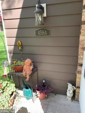
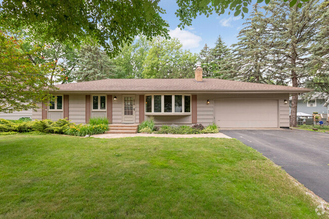
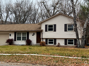
4516 Cinnamon Ridge Trail
Eagan, MN 55122
2 Weeks Ago
Favorites
4516 Cinnamon Ridge Trail

Favorites
Check Back Soon for Upcoming Availability
| Beds | Baths | Average SF |
|---|---|---|
| 2 Bedrooms 2 Bedrooms 2 Br | 1 Bath 1 Bath 1 Ba | 870 SF |
Fees and Policies
The fees below are based on community-supplied data and may exclude additional fees and utilities.
- Dogs Allowed
-
Fees not specified
- Cats Allowed
-
Fees not specified
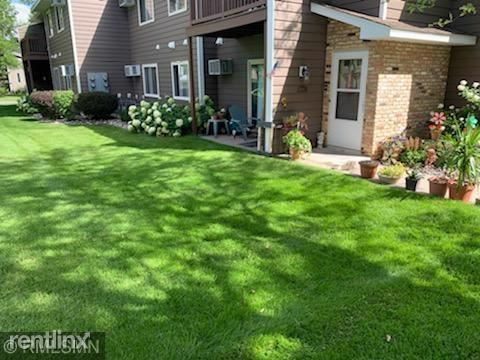
About This Property
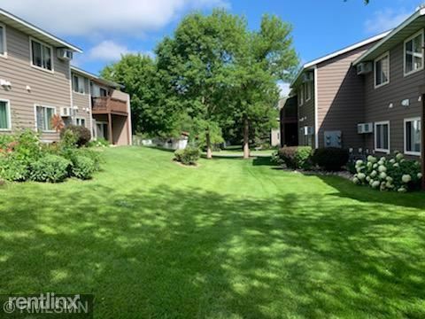
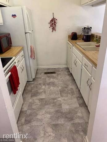
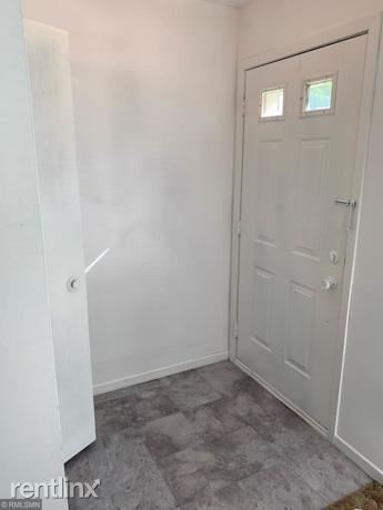
(844) 326-7613 - Quiet 2 bedroom with a great outdoor area. Close proximity to dinning, movies, shopping and more. Located 10 minutes from the airport. Needs new carpet. (RLNE6083216) Other Amenities: Pool. Pet policies: Small Dogs Allowed, Cats Allowed, Other, Large Dogs Allowed.
4516 Cinnamon Ridge Trail is a house located in Dakota County and the 55122 ZIP Code. This area is served by the Rosemount-Apple Valley-Eagan attendance zone.
Unique Features
- Pets -
Location
Get Directions
Green spaces and recreation areas are all over Eagan, and the southern border of the city is formed by Lebanon Hills Regional Park, which incorporates the Minnesota Zoo and Valleywood Golf Course. Eagan is home to Rasmussen College and Argosy University, with a branch campus of the University of Minnesota just south of town as well.
Eagan is right across the river from the Mall of America and Minneapolis -Saint Paul International Airport, and roughly 15 minutes away from downtown St. Paul and Minneapolis by car (rail service is also available via Minnesota Valley Transit). The close proximity to the Twin Cities combined with the excellent public schools and low crime rate make apartment s in Eagan great for commuters and families.
Learn more about living in Eagan
Amenities
- Pets -
Education
| Colleges & Universities | Distance | ||
|---|---|---|---|
| Colleges & Universities | Distance | ||
| Drive: | 9 min | 5.7 mi | |
| Drive: | 16 min | 9.5 mi | |
| Drive: | 22 min | 12.3 mi | |
| Drive: | 21 min | 12.6 mi |
4516 Cinnamon Ridge Trail is within 9 minutes or 5.7 miles from Argosy University, Twin Cities. It is also near Normandale Community College and Inver Hills Community College.
Schools


Public Elementary School
Grades PK-5
373 Students
Nearby
Public Elementary School
Grades PK-5
596 Students
Attendance Zone
Public Middle School
Grades 6-8
894 Students
Attendance Zone
Public High School
Grades 9-12
2,308 Students
Attendance Zone
Private Elementary, Middle & High School
Grades PK-12
233 Students
Nearby
Private Elementary & Middle School
Grades PK-8
46 Students
Nearby
Private Elementary & Middle School
Grades PK-8
315 Students
Nearby
Private Elementary School
Grades K-6
21 Students
Nearby
Private Elementary School
Grades K
9 Students
Nearby
School data provided by
 The GreatSchools Rating helps parents compare schools within a state based on a variety of school quality indicators and provides a helpful picture of how effectively each school serves all of its students. Ratings are on a scale of 1 (below average) to 10 (above average) and can include test scores, college readiness, academic progress, advanced courses, equity, discipline and attendance data. We also advise parents to visit schools, consider other information on school performance and programs, and consider family needs as part of the school selection process.
View GreatSchools Rating Methodology
View GreatSchools Rating Methodology
Transportation options available in Eagan include Mall Of America Station, located 5.9 miles from 4516 Cinnamon Ridge Trail. 4516 Cinnamon Ridge Trail is near Minneapolis-St Paul International/Wold-Chamberlain, located 8.2 miles or 15 minutes away.
| Transit / Subway | Distance | ||
|---|---|---|---|
| Transit / Subway | Distance | ||
|
|
Drive: | 10 min | 5.9 mi |
|
|
Drive: | 10 min | 6.1 mi |
|
|
Drive: | 10 min | 6.3 mi |
|
|
Drive: | 10 min | 6.5 mi |
|
John P Humphrey Interlocking
|
Drive: | 12 min | 7.3 mi |
| Commuter Rail | Distance | ||
|---|---|---|---|
| Commuter Rail | Distance | ||
|
|
Drive: | 21 min | 15.4 mi |
|
|
Drive: | 26 min | 17.0 mi |
|
|
Drive: | 34 min | 25.0 mi |
|
|
Drive: | 49 min | 36.1 mi |
|
|
Drive: | 50 min | 37.8 mi |
| Airports | Distance | ||
|---|---|---|---|
| Airports | Distance | ||
|
Minneapolis-St Paul International/Wold-Chamberlain
|
Drive: | 15 min | 8.2 mi |
Time and distance from 4516 Cinnamon Ridge Trail.
| Shopping Centers | Distance | ||
|---|---|---|---|
| Shopping Centers | Distance | ||
| Walk: | 16 min | 0.8 mi | |
| Walk: | 21 min | 1.1 mi | |
| Walk: | 26 min | 1.4 mi |
4516 Cinnamon Ridge Trail has 3 shopping centers within 1.4 miles, which is about a 26-minute walk. The miles and minutes will be for the farthest away property.
| Parks and Recreation | Distance | ||
|---|---|---|---|
| Parks and Recreation | Distance | ||
|
Minnesota Valley National Wildlife Refuge
|
Drive: | 6 min | 2.5 mi |
|
Minnesota Zoo
|
Drive: | 11 min | 4.9 mi |
|
Sea Life Minnesota
|
Drive: | 9 min | 5.8 mi |
|
Minnesota Valley Wetland Management District
|
Drive: | 12 min | 6.9 mi |
|
Buck Hill
|
Drive: | 11 min | 7.5 mi |
4516 Cinnamon Ridge Trail has 5 parks within 7.5 miles, including Minnesota Valley National Wildlife Refuge, Minnesota Zoo, and Sea Life Minnesota.
| Hospitals | Distance | ||
|---|---|---|---|
| Hospitals | Distance | ||
| Drive: | 9 min | 5.2 mi | |
| Drive: | 17 min | 12.0 mi |
4516 Cinnamon Ridge Trail is 5.2 miles from Fairview Ridges Hospital, and is convenient to other hospitals, including Fairview Southdale Hospital.
| Military Bases | Distance | ||
|---|---|---|---|
| Military Bases | Distance | ||
| Drive: | 16 min | 11.3 mi |
4516 Cinnamon Ridge Trail is 11.3 miles and a 16 minute drive from Fort Snelling Military Reservation.
You May Also Like
Similar Rentals Nearby

What Are Walk Score®, Transit Score®, and Bike Score® Ratings?
Walk Score® measures the walkability of any address. Transit Score® measures access to public transit. Bike Score® measures the bikeability of any address.
What is a Sound Score Rating?
A Sound Score Rating aggregates noise caused by vehicle traffic, airplane traffic and local sources
4516 Cinnamon Ridge Trail
Eagan, MN 55122