
$3,950
/ Month
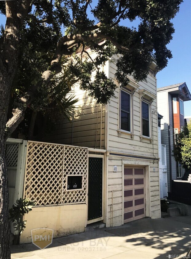
450 29th St
San Francisco, CA 94131
2 Weeks Ago
Favorites
450 29th St

Favorites
Check Back Soon for Upcoming Availability
| Beds | Baths | Average SF |
|---|---|---|
| 2 Bedrooms 2 Bedrooms 2 Br | 1 Bath 1 Bath 1 Ba | 1,689 SF |
Fees and Policies
The fees below are based on community-supplied data and may exclude additional fees and utilities.
- Parking
-
Surface Lot--
-
Other--
-
Garage--
About This Property
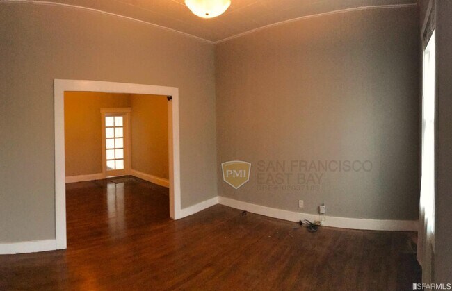
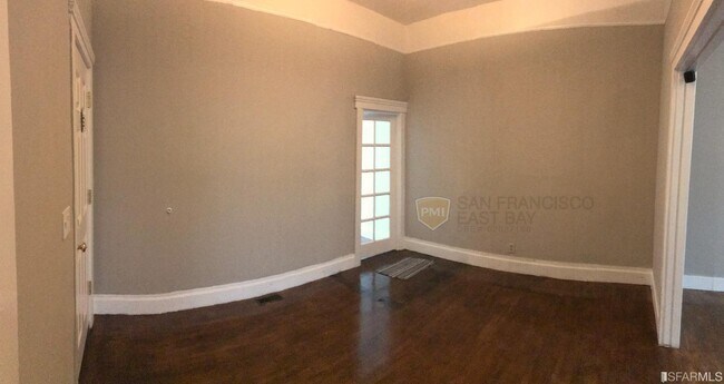
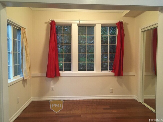
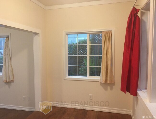
Bright 2bd / 1ba house with soaring 10ft ceilings, skylights, refinished hardwood floors and large eat in kitchen with new dishwasher in traditional turn of the century San Francisco building. The bathroom features a tub and shower, toilet and sink with build in cabinets and towel closet. Sunny outdoor Patio with shared backyard. Private washer & dryer located in the laundry room situated below the front side of the house. To round out this unique place, it is located a quick 7 min walk to Muni and the Castro bus leaves half a block away. Easy freeway access to 280 and 101 at the south end of the San Francisco transit system.
450 29th St is a house located in San Francisco County and the 94131 ZIP Code. This area is served by the San Francisco Unified attendance zone.
House Features
Air Conditioning
Hardwood Floors
Granite Countertops
Tub/Shower
- Air Conditioning
- Smoke Free
- Tub/Shower
- Sprinkler System
- Granite Countertops
- Oven
- Range
- Breakfast Nook
- Hardwood Floors
- Carpet
- Patio
Location
Get Directions
Noe Valley is in central San Francisco, encompassed by modern comforts. Many renters choose Noe Valley apartments because of the convenient access to city transit. The SFMTA Light Rails pick up along Church Street, and BART 24th Street Mission Station is a short walk away.
Most of the neighborhood’s bars, eateries, and bakeries are found along 24th Street. A couple of green spaces are in Noe Valley, such as Upper Noe Recreation Center and Noe Valley Courts. Residents enjoy hiking along the trails at nearby Twin Peaks and perusing the luxury jewelry shops and boutiques in town3.
Learn more about living in Noe ValleyBelow are rent ranges for similar nearby apartments
Amenities
- Air Conditioning
- Smoke Free
- Tub/Shower
- Sprinkler System
- Granite Countertops
- Oven
- Range
- Breakfast Nook
- Hardwood Floors
- Carpet
- Patio
Education
| Colleges & Universities | Distance | ||
|---|---|---|---|
| Colleges & Universities | Distance | ||
| Drive: | 6 min | 2.8 mi | |
| Drive: | 10 min | 3.3 mi | |
| Drive: | 9 min | 3.4 mi | |
| Drive: | 9 min | 5.9 mi |
450 29th St is within 6 minutes or 2.8 miles from City College of San Francisco. It is also near California College of the Arts and UC San Francisco, Parnassus.
Schools


Public Elementary School
Grades K-5
Nearby
Public Elementary School
Grades K-5
488 Students
Attendance Zone
Public Middle School
Grades 6-8
485 Students
Attendance Zone
Public High School
Grades 9-12
320 Students
Nearby
Private Elementary & Middle School
Grades PK-8
476 Students
Nearby
Private Elementary & Middle School
Grades K-8
Nearby
Private High School
Grades 9-12
364 Students
Nearby
School data provided by
 The GreatSchools Rating helps parents compare schools within a state based on a variety of school quality indicators and provides a helpful picture of how effectively each school serves all of its students. Ratings are on a scale of 1 (below average) to 10 (above average) and can include test scores, college readiness, academic progress, advanced courses, equity, discipline and attendance data. We also advise parents to visit schools, consider other information on school performance and programs, and consider family needs as part of the school selection process.
View GreatSchools Rating Methodology
Data provided by GreatSchools.org © 2025. All rights reserved.
View GreatSchools Rating Methodology
Data provided by GreatSchools.org © 2025. All rights reserved.
Transportation options available in San Francisco include Church And 29Th Street, located 0.2 mile from 450 29th St. 450 29th St is near San Francisco International, located 12.9 miles or 21 minutes away, and Metro Oakland International, located 23.2 miles or 38 minutes away.
| Transit / Subway | Distance | ||
|---|---|---|---|
| Transit / Subway | Distance | ||
|
|
Walk: | 3 min | 0.2 mi |
|
|
Walk: | 4 min | 0.3 mi |
| Walk: | 5 min | 0.3 mi | |
|
|
Walk: | 7 min | 0.4 mi |
|
|
Walk: | 8 min | 0.4 mi |
| Commuter Rail | Distance | ||
|---|---|---|---|
| Commuter Rail | Distance | ||
| Drive: | 11 min | 4.8 mi | |
| Drive: | 9 min | 5.0 mi | |
| Drive: | 9 min | 6.0 mi | |
| Drive: | 9 min | 6.1 mi | |
| Drive: | 11 min | 7.0 mi |
| Airports | Distance | ||
|---|---|---|---|
| Airports | Distance | ||
|
San Francisco International
|
Drive: | 21 min | 12.9 mi |
|
Metro Oakland International
|
Drive: | 38 min | 23.2 mi |
Time and distance from 450 29th St.
| Shopping Centers | Distance | ||
|---|---|---|---|
| Shopping Centers | Distance | ||
| Walk: | 13 min | 0.7 mi | |
| Walk: | 16 min | 0.8 mi | |
| Drive: | 5 min | 1.7 mi |
450 29th St has 3 shopping centers within 1.7 miles, which is about a 5-minute walk. The miles and minutes will be for the farthest away property.
| Parks and Recreation | Distance | ||
|---|---|---|---|
| Parks and Recreation | Distance | ||
|
Buena Vista Park
|
Drive: | 7 min | 2.2 mi |
|
Randall Museum
|
Drive: | 7 min | 2.4 mi |
|
Conservatory of Flowers
|
Drive: | 9 min | 3.6 mi |
|
California Academy of Sciences
|
Drive: | 12 min | 4.4 mi |
|
Steinhart Aquarium
|
Drive: | 12 min | 4.4 mi |
450 29th St has 5 parks within 4.4 miles, including Randall Museum, Buena Vista Park, and Conservatory of Flowers.
| Hospitals | Distance | ||
|---|---|---|---|
| Hospitals | Distance | ||
| Walk: | 14 min | 0.8 mi | |
| Drive: | 4 min | 1.5 mi | |
| Drive: | 5 min | 2.0 mi |
450 29th St has 3 hospitals within 2.0 miles, the nearest is California Pacific Medical Center - Mission Bernal which is 0.8 mile away and a 14 minute walk.
| Military Bases | Distance | ||
|---|---|---|---|
| Military Bases | Distance | ||
| Drive: | 18 min | 6.5 mi | |
| Drive: | 18 min | 7.0 mi |
450 29th St is 6.5 miles from East Fort Miley, and is convenient to other military bases, including West Fort Miley.
You May Also Like
Similar Rentals Nearby


What Are Walk Score®, Transit Score®, and Bike Score® Ratings?
Walk Score® measures the walkability of any address. Transit Score® measures access to public transit. Bike Score® measures the bikeability of any address.
What is a Sound Score Rating?
A Sound Score Rating aggregates noise caused by vehicle traffic, airplane traffic and local sources

450 29th St
San Francisco, CA 94131