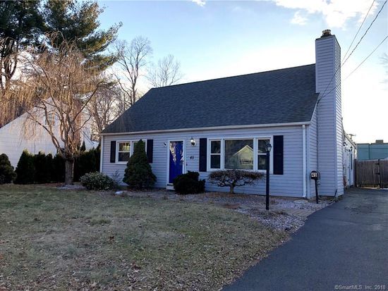

45 wrights ln
45 wrights ln
GLASTONBURY, CT 06033
2 Weeks Ago
|
Edit
Favorites
45 wrights ln

Favorites
Check Back Soon for Upcoming Availability
| Beds | Baths | Average SF |
|---|---|---|
| 1 Bedroom 1 Bedroom 1 Br | 1 Bath 1 Bath 1 Ba | — |
45 wrights ln,
GLASTONBURY,
CT
06033
Located just a few minutes south of Hartford along Route 2, Glastonbury is an upscale community with a great family-friendly atmosphere. The local schools earn high ratings, the crime rate is far below the state and national averages, and public parks abound all over town (including several scenic areas on the banks of the Connecticut River).
The town’s history as an industrial hub is still visible in many of the local buildings—the old soap factory in particular has been repurposed into high-end condominiums. The town likes to have a good time, and community events like the Apple Harvest Festival and the Glastonbury Art Walk draw big crowds from all around the area.
Learn more about living in Glastonbury
Education
| Colleges & Universities | Distance | ||
|---|---|---|---|
| Colleges & Universities | Distance | ||
| Drive: | 8 min | 3.3 mi | |
| Drive: | 14 min | 5.4 mi | |
| Drive: | 10 min | 5.7 mi | |
| Drive: | 14 min | 7.4 mi |
45 wrights ln is within 8 minutes or 3.3 miles from Goodwin College. It is also near Manchester Community College and University of Connecticut.
Walkability Near 45 wrights ln GLASTONBURY, CT 06033
Getting Around
 What do Walkability, Transit, Drivability, and Bikeability mean?
Walkability measures the walking distance to day-to-day needs.
Transit measures access to public transportation.
Drivability measures congestion, parking availability, and access to major roads.
Bikeability measures the suitability for cycling.
How It Works
What do Walkability, Transit, Drivability, and Bikeability mean?
Walkability measures the walking distance to day-to-day needs.
Transit measures access to public transportation.
Drivability measures congestion, parking availability, and access to major roads.
Bikeability measures the suitability for cycling.
How It Works
Moderately Walkable
Walkability
60
/ 100
Limited Public Transit
Transit
30
/ 100
Exceptionally Drivable
Drivability
100
/ 100
Fairly Bikeable
Bikeability
50
/ 100
Scores provided by
-
Soundscore™
-
/ 100
Traffic
-Airport
-Businesses
-Scores provided by
HowLoud What is a Sound Score Rating? A Sound Score Rating aggregates noise caused by vehicle traffic, airplane traffic and local sources. How It WorksYou May Also Like
Similar Rentals Nearby
-
-

-

-

-

-

-

-
 3 Beds, 2 Baths, 1,372 sq ft$3,500Total Monthly PriceTotal Monthly Price NewPrices include all required monthly fees.47 Crestwood Dr
 -
 2 Beds, 1 Bath, 928 sq ft$1,950Total Monthly PriceTotal Monthly Price NewPrices include all required monthly fees.7 Grandview Dr
 -
 4 Beds, 2 Baths, 1,750 sq ft$2,650Total Monthly PriceTotal Monthly Price NewPrices include all required monthly fees.955 Main St
What Are Walk Score®, Transit Score®, and Bike Score® Ratings?
Walk Score® measures the walkability of any address. Transit Score® measures access to public transit. Bike Score® measures the bikeability of any address.
What is a Sound Score Rating?
A Sound Score Rating aggregates noise caused by vehicle traffic, airplane traffic and local sources.

45 wrights ln
GLASTONBURY, CT 06033