
$2,875 / Month
4499 Via Marisol Via
Los Angeles, CA 90042
1 Day Ago
Favorites
310-839-8970
-
Bedrooms
2
-
Bathrooms
2
-
Square Feet
1,047 sq ft
-
Available
Available Now
4499 Via Marisol Via

Favorites
About This Home
$2,875 deposit,
Available Now
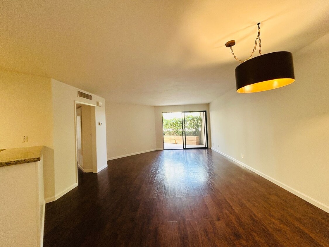
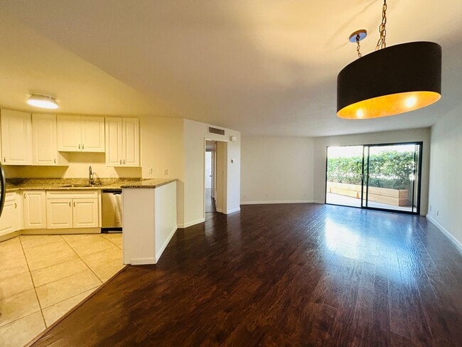
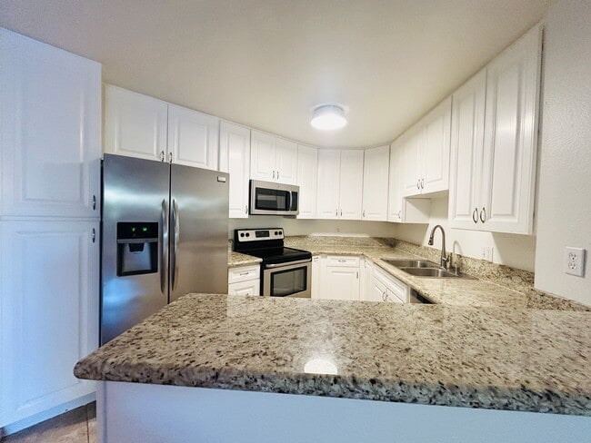
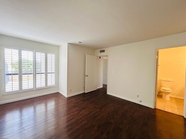
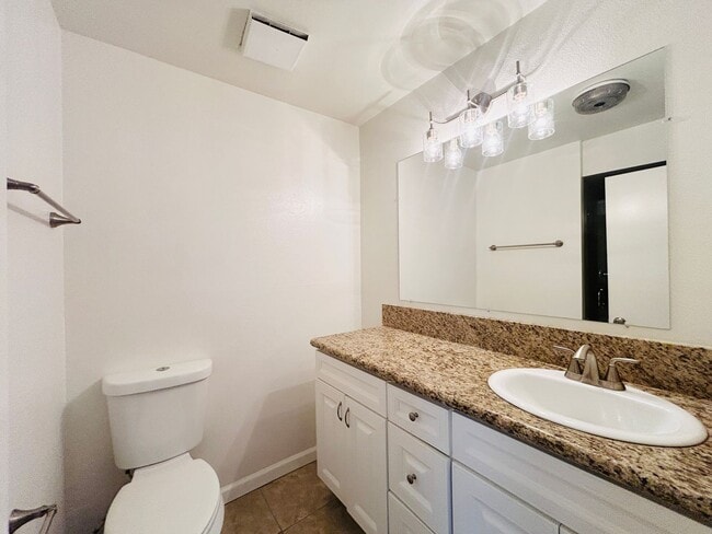
You’ll be pleasantly surprised by this spacious two-bedroom with an open concept. The living room opens to the kitchen. The kitchen includes a fridge, stove, dishwasher, and microwave. Access the balcony from the living room and bedroom. Just off the hallway is a bathroom with a combination shower and tub and side-by-side washer and dryer. The primary bedroom is at the end of the hallway. It has an en-suite bathroom with a standalone shower. Take advantage of the community's facilities, which include a recreation center and sparkling pool. conveniently close to restaurants, shops, and parks. Terms: Minimum one-year lease term. The security deposit is equal to one month's rent on approved credit. Pets allowed with breed and weight restrictions. Please contact Martisa at or to schedule a showing!
4499 Via Marisol Via is a house located in Los Angeles County and the 90042 ZIP Code. This area is served by the Los Angeles Unified attendance zone.
* Price shown is base rent and may not include non-optional fees and utilities.
Price, availability, fees, and any applicable rent special are subject to change without notice.
* Square footage definitions vary. Displayed square footage is approximate.
Contact
- Listed by Pacific Shore Property Management | Pacific Shore Property Management
- Phone Number
- Contact
Location
Get Directions
A quiet suburb outside of Los Angeles, Monterey Hills is known for its rolling hills, winding residential streets, and elevated city views. Check out Elephant Hill, a popular place to bike or hike that offers beautiful views of the neighborhood. Herman Park is nestled along Highway 110 in the north end of the neighborhood, offering tennis courts, playgrounds, and a dog park. And for more outdoor recreation, visit the biking paths and hiking trails at Ernest E. Debs Regional Park, bordering Monterey Hills.
Monterey Hills is a more secluded part of Northeast Los Angeles with larger lots, single-family homes, and tree-lined streets. However, if you cross over Highway 110, you’ll find theatres, restaurants, services, and more. Monterey Hills is located just seven miles northeast of Downtown Los Angeles and eight miles east of major attractions such as Griffith Park, the Los Angeles Zoo, the Greek Theatre, and Glendale Galleria.
Learn more about living in Monterey Hills
Education
| Colleges & Universities | Distance | ||
|---|---|---|---|
| Colleges & Universities | Distance | ||
| Drive: | 9 min | 3.7 mi | |
| Drive: | 8 min | 3.9 mi | |
| Drive: | 7 min | 4.1 mi | |
| Drive: | 11 min | 4.2 mi |
4499 Via Marisol Via is within 9 minutes or 3.7 miles from Occidental College. It is also near Cal State Los Angeles and Art Center College of Design.
Schools


Public Elementary School
Grades K-5
181 Students
Attendance Zone
Charter Elementary School
Grades K-5
75 Students
Nearby
Public Middle School
Grades 6-8
904 Students
Attendance Zone
Public Middle & High School
Grades 6-12
1,389 Students
Attendance Zone
Private Elementary & Middle School
Grades K-8
125 Students
Nearby
Private Elementary, Middle & High School
Grades K-12
93 Students
Nearby
Private Elementary School
Grades PK-5
131 Students
Nearby
School data provided by
 The GreatSchools Rating helps parents compare schools within a state based on a variety of school quality indicators and provides a helpful picture of how effectively each school serves all of its students. Ratings are on a scale of 1 (below average) to 10 (above average) and can include test scores, college readiness, academic progress, advanced courses, equity, discipline and attendance data. We also advise parents to visit schools, consider other information on school performance and programs, and consider family needs as part of the school selection process.
View GreatSchools Rating Methodology
Data provided by GreatSchools.org © 2025. All rights reserved.
View GreatSchools Rating Methodology
Data provided by GreatSchools.org © 2025. All rights reserved.
Transportation options available in Los Angeles include Highland Park Station, located 1.5 miles from 4499 Via Marisol Via. 4499 Via Marisol Via is near Bob Hope, located 17.9 miles or 26 minutes away, and Los Angeles International, located 21.0 miles or 33 minutes away.
| Transit / Subway | Distance | ||
|---|---|---|---|
| Transit / Subway | Distance | ||
|
|
Drive: | 4 min | 1.5 mi |
|
|
Drive: | 6 min | 2.7 mi |
|
|
Drive: | 6 min | 3.0 mi |
|
|
Drive: | 5 min | 3.1 mi |
|
|
Drive: | 7 min | 3.7 mi |
| Commuter Rail | Distance | ||
|---|---|---|---|
| Commuter Rail | Distance | ||
|
|
Drive: | 11 min | 5.9 mi |
|
|
Drive: | 13 min | 6.0 mi |
|
|
Drive: | 12 min | 7.2 mi |
| Drive: | 15 min | 10.0 mi | |
|
|
Drive: | 21 min | 10.2 mi |
| Airports | Distance | ||
|---|---|---|---|
| Airports | Distance | ||
|
Bob Hope
|
Drive: | 26 min | 17.9 mi |
|
Los Angeles International
|
Drive: | 33 min | 21.0 mi |
Time and distance from 4499 Via Marisol Via.
| Shopping Centers | Distance | ||
|---|---|---|---|
| Shopping Centers | Distance | ||
| Drive: | 3 min | 1.3 mi | |
| Drive: | 4 min | 1.8 mi | |
| Drive: | 4 min | 2.0 mi |
4499 Via Marisol Via has 3 shopping centers within 2.0 miles, which is about a 4-minute drive. The miles and minutes will be for the farthest away property.
| Parks and Recreation | Distance | ||
|---|---|---|---|
| Parks and Recreation | Distance | ||
|
Audubon Center at Debs Park
|
Drive: | 4 min | 2.0 mi |
|
Chavez Ravine Arboretum
|
Drive: | 10 min | 5.7 mi |
|
Elysian Park
|
Drive: | 13 min | 5.7 mi |
|
Elyria Canyon Park
|
Drive: | 11 min | 6.0 mi |
|
Marsh Park
|
Drive: | 12 min | 6.3 mi |
4499 Via Marisol Via has 5 parks within 6.3 miles, including Audubon Center at Debs Park, Elyria Canyon Park, and Elysian Park.
| Hospitals | Distance | ||
|---|---|---|---|
| Hospitals | Distance | ||
| Drive: | 7 min | 3.6 mi | |
| Drive: | 9 min | 3.7 mi | |
| Drive: | 7 min | 4.5 mi |
4499 Via Marisol Via has 3 hospitals within 4.5 miles, the nearest is Keck Hospital of USC which is 3.6 miles away and a 7 minute drive.
| Military Bases | Distance | ||
|---|---|---|---|
| Military Bases | Distance | ||
| Drive: | 31 min | 22.6 mi | |
| Drive: | 42 min | 27.1 mi |
4499 Via Marisol Via is 22.6 miles from Los Angeles Air Force Base, and is convenient to other military bases, including Los Alamitos Army Airfield.
You May Also Like
Similar Rentals Nearby


What Are Walk Score®, Transit Score®, and Bike Score® Ratings?
Walk Score® measures the walkability of any address. Transit Score® measures access to public transit. Bike Score® measures the bikeability of any address.
What is a Sound Score Rating?
A Sound Score Rating aggregates noise caused by vehicle traffic, airplane traffic and local sources

4499 Via Marisol Via
Los Angeles, CA 90042