

$1,400
/ Month
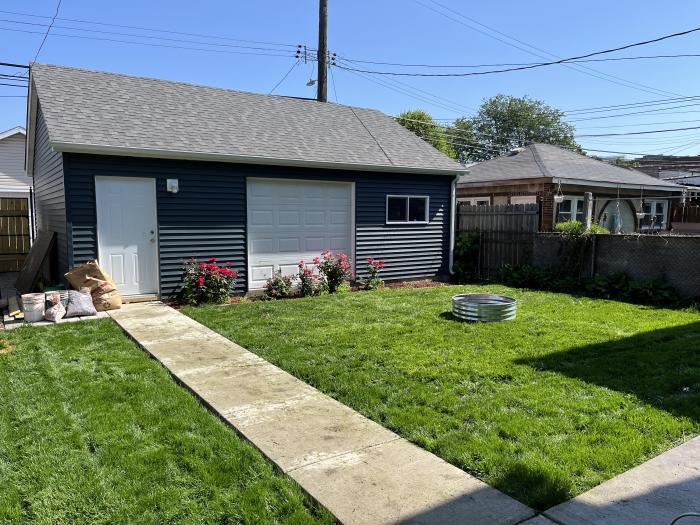
4434 W Altgeld St Unit G
Chicago, IL 60639
2 Weeks Ago
|
Edit
Favorites
4434 W Altgeld St Unit G

Favorites
Check Back Soon for Upcoming Availability
| Beds | Baths | Average SF |
|---|---|---|
| 2 Bedrooms 2 Bedrooms 2 Br | 1 Bath 1 Bath 1 Ba | 1,000 SF |
About This Property
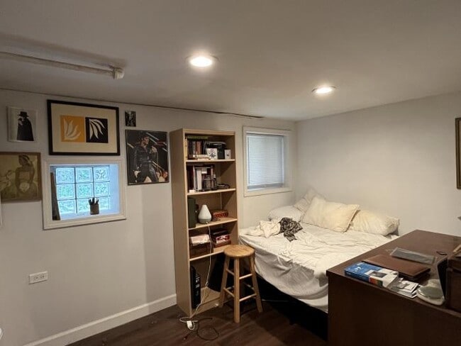
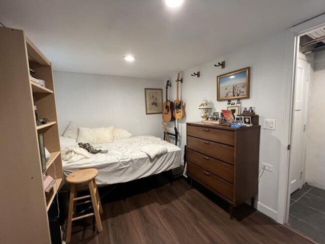
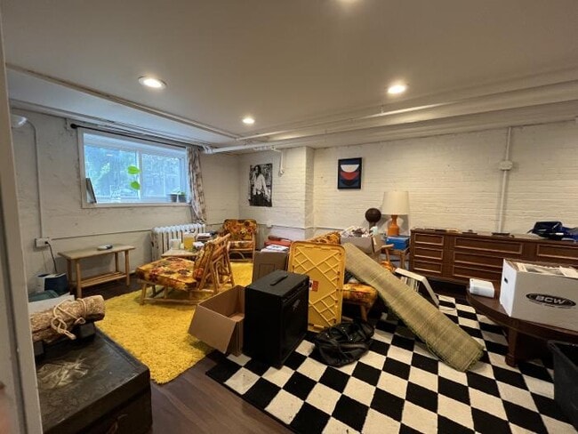
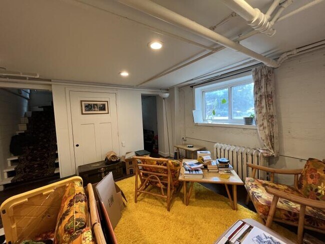
APS53452935 - large 2bd/1ba apartment in beautiful hermosa just west of logan square. building sits on extra large lot on beautiful tree lined street which even has a chick coop. truly feels like a park. brand new kitchen has tons of counter space, new fridge, and very neat 1940s vintage stove. brand new bathroom with tub & rain head shower. all new windows. heat and gas included.
4434 W Altgeld St is a condo located in Cook County and the 60639 ZIP Code. This area is served by the Chicago Public Schools attendance zone.
4434 W Altgeld St,
Chicago,
IL
60639
Located in the Avondale section of northwest Chicago just eight miles from the city center, Belmont Gardens has it all. Its location near the Pulaski Corridor and other popular neighborhoods has contributed to its popularity. Belmont Gardens features rentals to fit any potential resident, including walk-up apartments or townhomes in long-standing brick buildings.
West Diversey Avenue and Fullerton Avenue feature local restaurants, breakfast spots, cocktail bars, and Mexican eateries all within walking distance of one another. At the heart of the neighborhood is Kelvyn William Park, a popular gathering spot for residents during the warmer months of the year.
Learn more about living in Belmont GardensBelow are rent ranges for similar nearby apartments
Education
| Colleges & Universities | Distance | ||
|---|---|---|---|
| Colleges & Universities | Distance | ||
| Drive: | 8 min | 3.5 mi | |
| Drive: | 11 min | 5.0 mi | |
| Drive: | 12 min | 5.4 mi | |
| Drive: | 12 min | 5.5 mi |
4434 W Altgeld St Unit G is within 8 minutes or 3.5 miles from DeVry University-Illinois. It is also near Wilbur Wright College and North Park University.
Schools


Public Elementary School
Grades PK-5
Attendance Zone
Public Middle & High School
Grades 6-12
Attendance Zone
Public High School
Grades 9-12
Attendance Zone
Private Elementary & Middle School
Grades K-8
Nearby
School data provided by
 The GreatSchools Rating helps parents compare schools within a state based on a variety of school quality indicators and provides a helpful picture of how effectively each school serves all of its students. Ratings are on a scale of 1 (below average) to 10 (above average) and can include test scores, college readiness, academic progress, advanced courses, equity, discipline and attendance data. We also advise parents to visit schools, consider other information on school performance and programs, and consider family needs as part of the school selection process.
View GreatSchools Rating Methodology
Data provided by GreatSchools.org © 2026. All rights reserved.
View GreatSchools Rating Methodology
Data provided by GreatSchools.org © 2026. All rights reserved.
Transportation options available in Chicago include Belmont Station (Blue Line), located 2.2 miles from 4434 W Altgeld St Unit G. 4434 W Altgeld St Unit G is near Chicago Midway International, located 11.4 miles or 21 minutes away, and Chicago O'Hare International, located 12.7 miles or 22 minutes away.
| Transit / Subway | Distance | ||
|---|---|---|---|
| Transit / Subway | Distance | ||
|
|
Drive: | 5 min | 2.2 mi |
|
|
Drive: | 5 min | 2.2 mi |
|
|
Drive: | 5 min | 2.4 mi |
|
|
Drive: | 6 min | 2.8 mi |
|
|
Drive: | 7 min | 3.1 mi |
| Commuter Rail | Distance | ||
|---|---|---|---|
| Commuter Rail | Distance | ||
|
|
Walk: | 14 min | 0.7 mi |
|
|
Drive: | 4 min | 1.3 mi |
|
|
Drive: | 5 min | 2.2 mi |
|
|
Drive: | 6 min | 2.5 mi |
|
|
Drive: | 6 min | 2.7 mi |
| Airports | Distance | ||
|---|---|---|---|
| Airports | Distance | ||
|
Chicago Midway International
|
Drive: | 21 min | 11.4 mi |
|
Chicago O'Hare International
|
Drive: | 22 min | 12.7 mi |
Walkability Near 4434 W Altgeld St Chicago, IL 60639
Getting Around
 What do Walkability, Transit, Drivability, and Bikeability mean?
Walkability measures the walking distance to day-to-day needs.
Transit measures access to public transportation.
Drivability measures congestion, parking availability, and access to major roads.
Bikeability measures the suitability for cycling.
How It Works
What do Walkability, Transit, Drivability, and Bikeability mean?
Walkability measures the walking distance to day-to-day needs.
Transit measures access to public transportation.
Drivability measures congestion, parking availability, and access to major roads.
Bikeability measures the suitability for cycling.
How It Works
Exceptionally Walkable
Walkability
90
/ 100
Good Public Transit
Transit
60
/ 100
Fairly Drivable
Drivability
50
/ 100
Moderately Bikeable
Bikeability
60
/ 100
Scores provided by
-
Soundscore™
-
/ 100
Traffic
-Airport
-Businesses
-Scores provided by
HowLoud What is a Sound Score Rating? A Sound Score Rating aggregates noise caused by vehicle traffic, airplane traffic and local sources. How It WorksTime and distance from 4434 W Altgeld St Unit G.
| Shopping Centers | Distance | ||
|---|---|---|---|
| Shopping Centers | Distance | ||
| Walk: | 5 min | 0.3 mi | |
| Walk: | 9 min | 0.5 mi | |
| Walk: | 12 min | 0.7 mi |
4434 W Altgeld St Unit G has 3 shopping centers within 0.7 mile, which is about a 12-minute walk. The miles and minutes will be for the farthest away property.
| Parks and Recreation | Distance | ||
|---|---|---|---|
| Parks and Recreation | Distance | ||
|
Kilbourn Park
|
Drive: | 5 min | 1.4 mi |
|
LaFollette Park
|
Drive: | 5 min | 2.5 mi |
|
Riis Park
|
Drive: | 5 min | 2.5 mi |
|
Humboldt Park
|
Drive: | 6 min | 3.3 mi |
|
Portage Park
|
Drive: | 9 min | 4.1 mi |
4434 W Altgeld St Unit G has 5 parks within 4.1 miles, including Kilbourn Park, LaFollette Park, and Riis Park.
| Hospitals | Distance | ||
|---|---|---|---|
| Hospitals | Distance | ||
| Drive: | 6 min | 3.2 mi | |
| Drive: | 7 min | 3.5 mi | |
| Drive: | 8 min | 4.1 mi |
4434 W Altgeld St Unit G has 3 hospitals within 4.1 miles, the nearest is Community First Medical Center which is 3.2 miles away and a 6 minute drive.
| Military Bases | Distance | ||
|---|---|---|---|
| Military Bases | Distance | ||
| Drive: | 30 min | 20.3 mi |
4434 W Altgeld St Unit G is 20.3 miles and a 30 minute drive from US Military Reservation Elk Grove.
You May Also Like
Similar Rentals Nearby


What Are Walk Score®, Transit Score®, and Bike Score® Ratings?
Walk Score® measures the walkability of any address. Transit Score® measures access to public transit. Bike Score® measures the bikeability of any address.
What is a Sound Score Rating?
A Sound Score Rating aggregates noise caused by vehicle traffic, airplane traffic and local sources.
4434 W Altgeld St
Chicago, IL 60639