
443 E L St
Benicia, CA 94510
-
Bedrooms
2
-
Bathrooms
1
-
Square Feet
700 sq ft
-
Available
Available Now

About This Home
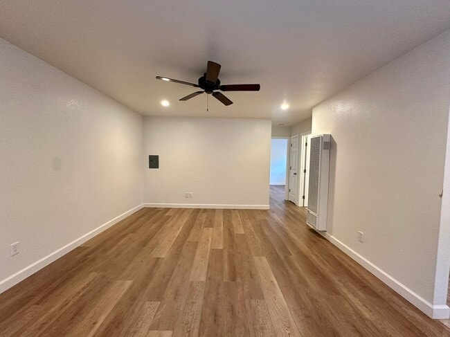
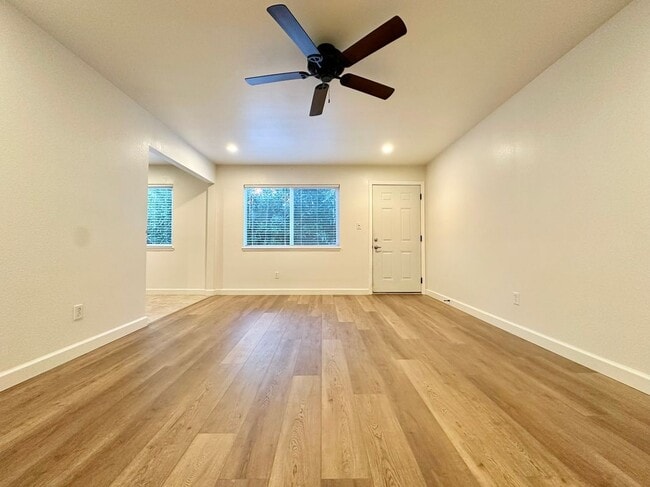
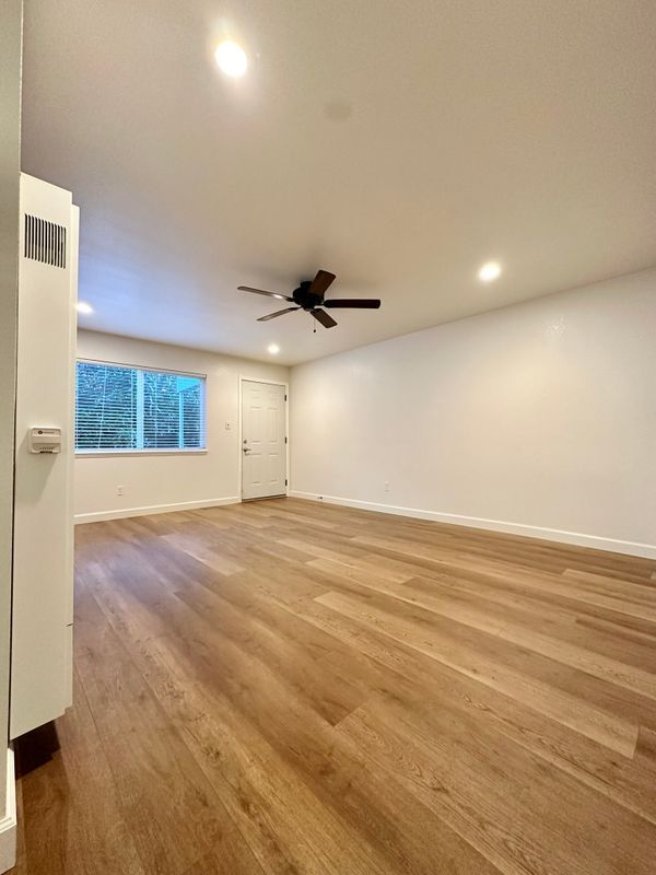
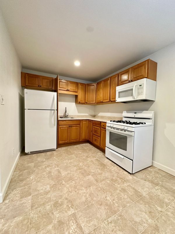
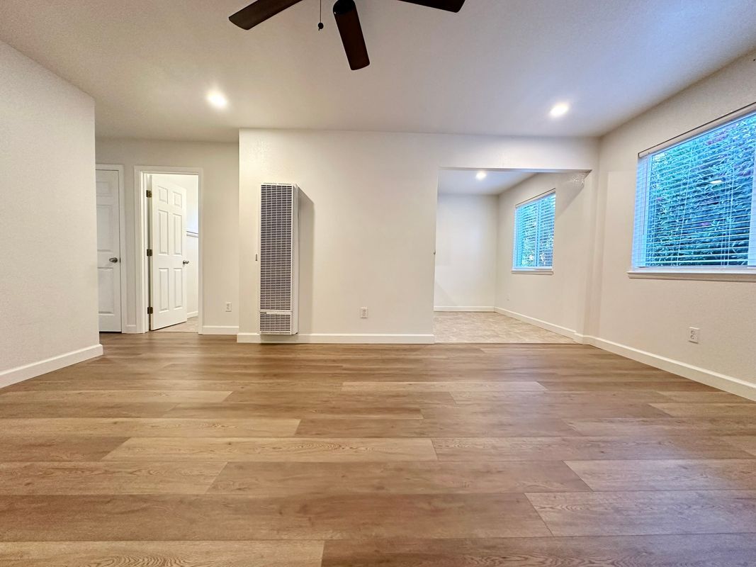
Welcome to this charming 2-bedroom, 1-bath multi-family home in Benicia, CA, perfectly situated for comfortable living. This property features a spacious living area with luxury vinyl flooring and ample natural light, enhancing the welcoming atmosphere of the home. You’ll appreciate the modern kitchen equipped with a gas stove and refrigerator, along with sufficient cabinet space for all your cooking essentials. Enjoy the convenience of included shared amenities, such as on-site laundry facilities and inviting outdoor spaces for relaxation and gathering with friends. With a dedicated parking spot and essential utilities covered like water, trash service, and yard maintenance, this home provides an easy lifestyle. Schedule a tour today and discover the comfortable living this Benicia home has to offer! Experience local parks and convenient access to the Martinez Health Center just minutes away. Don’t miss this opportunity!
443 E L St is an apartment community located in Solano County and the 94510 ZIP Code.
Features
Washer/Dryer
Air Conditioning
Refrigerator
Ceiling Fans
- Washer/Dryer
- Air Conditioning
- Ceiling Fans
- Refrigerator
- Laundry Facilities
- Renters Insurance Program
Fees and Policies
The fees below are based on community-supplied data and may exclude additional fees and utilities.
- Parking
-
Other--Assigned Parking
Details
Utilities Included
-
Water
-
Trash Removal
Lease Options
-
12 Months
Contact
- Phone Number
- Website View Property Website
- Contact
-
Source

- Washer/Dryer
- Air Conditioning
- Ceiling Fans
- Refrigerator
- Laundry Facilities
- Renters Insurance Program
Situated along the Carquinez Strait in the San Francisco Bay Area, Benicia is a scenic waterfront city rich in history, cultural amenities, and sweeping vistas. Benicia boasts an irresistible historic charm, especially in its quaint downtown area, which is brimming with one-of-a-kind shops, delectable eateries, and vibrant artists’ studios.
Founded in 1847, Benicia once served as California’s state capital for 13 months, and now touts the only state capitol building outside of Sacramento. Residents and visitors alike can uncover much of Benicia’s past at the Benicia Historical Museum.
Nearly 500 acres of parkland provides ample green space and tranquil trails for all kinds of outdoor recreation. Benicia’s thriving arts community creates a broad range of art, from glass art and sculptures to theatrical plays and music. Benicia’s friendly community comes together for a variety of events, like the Downtown Farmers Market, Opening Day on the Strait, and artist studio open houses.
Learn more about living in Benicia| Colleges & Universities | Distance | ||
|---|---|---|---|
| Colleges & Universities | Distance | ||
| Drive: | 14 min | 8.9 mi | |
| Drive: | 20 min | 11.5 mi | |
| Drive: | 22 min | 15.7 mi | |
| Drive: | 24 min | 17.8 mi |
Transportation options available in Benicia include North Concord Martinez Station, located 10.0 miles from 443 E L St. 443 E L St is near Metro Oakland International, located 36.4 miles or 48 minutes away, and San Francisco International, located 47.5 miles or 64 minutes away.
| Transit / Subway | Distance | ||
|---|---|---|---|
| Transit / Subway | Distance | ||
|
|
Drive: | 15 min | 10.0 mi |
|
|
Drive: | 15 min | 10.0 mi |
|
|
Drive: | 16 min | 10.5 mi |
|
|
Drive: | 16 min | 11.8 mi |
| Commuter Rail | Distance | ||
|---|---|---|---|
| Commuter Rail | Distance | ||
|
|
Drive: | 8 min | 5.0 mi |
|
|
Drive: | 26 min | 19.7 mi |
| Drive: | 29 min | 21.4 mi | |
|
|
Drive: | 32 min | 25.5 mi |
|
|
Drive: | 35 min | 27.3 mi |
| Airports | Distance | ||
|---|---|---|---|
| Airports | Distance | ||
|
Metro Oakland International
|
Drive: | 48 min | 36.4 mi |
|
San Francisco International
|
Drive: | 64 min | 47.5 mi |
Time and distance from 443 E L St.
| Shopping Centers | Distance | ||
|---|---|---|---|
| Shopping Centers | Distance | ||
| Walk: | 5 min | 0.3 mi | |
| Walk: | 10 min | 0.6 mi | |
| Walk: | 13 min | 0.7 mi |
| Parks and Recreation | Distance | ||
|---|---|---|---|
| Parks and Recreation | Distance | ||
|
Benicia Capitol State Historic Park
|
Walk: | 17 min | 0.9 mi |
|
Martinez Regional Shoreline
|
Drive: | 10 min | 4.4 mi |
|
Benicia State Recreation Area
|
Drive: | 9 min | 4.8 mi |
|
Alhambra Creek Watershed
|
Drive: | 8 min | 5.0 mi |
|
Carquinez Strait Regional Shoreline
|
Drive: | 19 min | 11.8 mi |
| Hospitals | Distance | ||
|---|---|---|---|
| Hospitals | Distance | ||
| Drive: | 10 min | 5.7 mi | |
| Drive: | 12 min | 8.5 mi | |
| Drive: | 14 min | 9.5 mi |
| Military Bases | Distance | ||
|---|---|---|---|
| Military Bases | Distance | ||
| Drive: | 3 min | 1.4 mi | |
| Drive: | 30 min | 12.7 mi |
You May Also Like
What Are Walk Score®, Transit Score®, and Bike Score® Ratings?
Walk Score® measures the walkability of any address. Transit Score® measures access to public transit. Bike Score® measures the bikeability of any address.
What is a Sound Score Rating?
A Sound Score Rating aggregates noise caused by vehicle traffic, airplane traffic and local sources
443 E L St
Benicia, CA 94510