
$1,500
/ Month
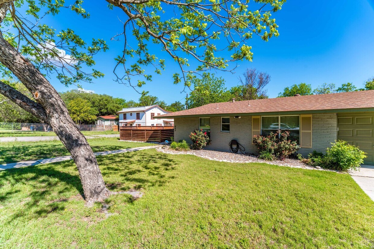
443 Brees Blvd
San Antonio, TX 78209
Favorites
-
Bedrooms
2
-
Bathrooms
1
-
Square Feet
850 sq ft
443 Brees Blvd

Favorites
About This Home
$1,500 deposit
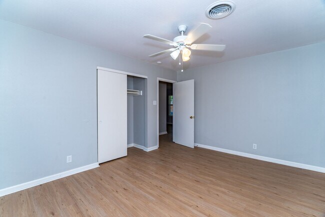
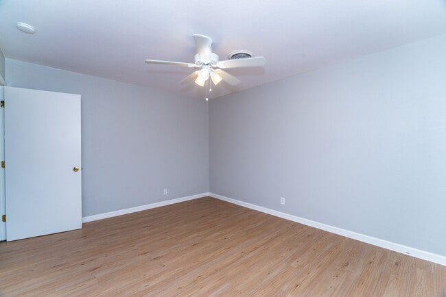
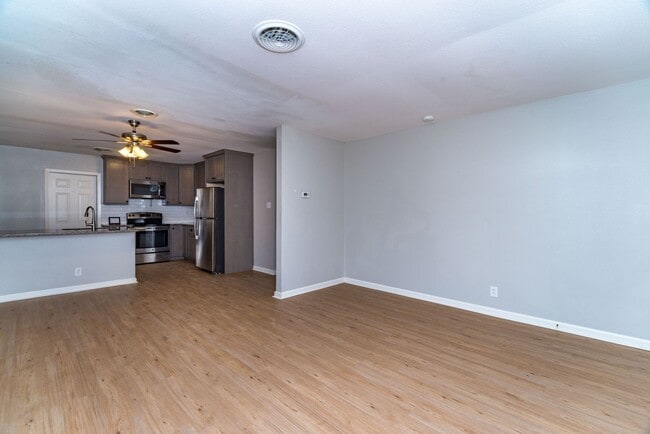
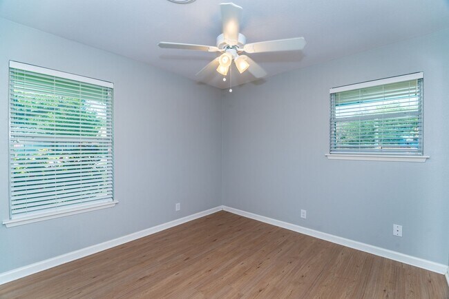
Renovated 2-Bedroom Duplex in Fantastic Terrell Heights Location * Minutes to Shopping & Restaurants along Austin Hwy & Broadway, Quick Access to Downtown, The Pearl, & More * Top-to-Bottom Updates Including Wood-look Tile Flooring, New Kitchen Cabinets & Granite Countertops, Stainless Steel Appliances Included, Updated Bathroom, & Neutral Paint * Enter to Huge Living/Dining Space Open to Kitchen w/ Breakfast Area & Access to Covered Back Patio & PRIVATE YARD * Updated Vanity & Tub/Shower in Bathroom * Large Primary Bedroom, Secondary Bedroom could be Office/Work * Privacy Fence in Backyard, Individual One-Car Attached Garage w/ Opener * Laundry in Garage w/ Washer/Dryer * Recently-Installed Exterior Lighting has Motion Sensor, Porch Lights have Dusk/Dawn Activation * Pets Case-by-Case * Tenant Responsible for Yard Maintenance, Water/Sewer Included * Alamo Heights ISD
Unique Features
- Water/Sewer
443 Brees Blvd is a house located in Bexar County and the 78209 ZIP Code. This area is served by the Alamo Heights Independent School District attendance zone.
* Price shown is base rent. Excludes user-selected optional fees and variable or usage-based fees and required charges due at or prior to move-in or at move-out. Price, availability, fees, and any applicable rent special are subject to change without notice.
* Square footage definitions vary. Displayed square footage is approximate.
House Features
- Dishwasher
Contact
- Listed by DAVIDSON PROPERTIES, INC. | DAVIDSON PROPERTIES, INC.
Location
Get Directions
Terrell Heights is a hidden gem amongst the ever-growing suburban communities of San Antonio. Ideally located, Terrell Heights is just six miles north of Downtown San Antonio and is home to the McNay Art Museum, which houses a diverse collection in a renovated 1920s mansion.
The neighborhood is about two blocks northwest of Fort Sam Houston, making it a great choice for service members who want to be close to work. Some of San Antonio’s most popular attractions are well within reach, too: the San Antonio Zoo, Splashtown San Antonio, the AT&T Center, and San Antonio College. That doesn’t mean there’s nothing to keep you entertained within the boundaries of Terrell Heights. There are restaurants and shopping opportunities on Austin Highway, the community’s west border.
Learn more about living in Terrell Heights
Amenities
- Dishwasher
- Water/Sewer
Education
| Colleges & Universities | Distance | ||
|---|---|---|---|
| Colleges & Universities | Distance | ||
| Drive: | 8 min | 3.2 mi | |
| Drive: | 10 min | 4.5 mi | |
| Drive: | 10 min | 5.5 mi | |
| Drive: | 14 min | 7.6 mi |
443 Brees Blvd is within 8 minutes or 3.2 miles from Univ. of the Incarnate Word. It is also near Trinity University and San Antonio College.
Schools


Public Elementary School
Grades PK-5
53 Students
Nearby
Public Elementary School
Grades K-5
878 Students
Attendance Zone
Public Middle School
Grades 6-8
1,090 Students
Attendance Zone
Public High School
Grades 9-12
1,606 Students
Attendance Zone
Private Elementary & Middle School
Grades PK-8
217 Students
Nearby
Private Elementary, Middle & High School
Grades K-12
27 Students
Nearby
School data provided by
 The GreatSchools Rating helps parents compare schools within a state based on a variety of school quality indicators and provides a helpful picture of how effectively each school serves all of its students. Ratings are on a scale of 1 (below average) to 10 (above average) and can include test scores, college readiness, academic progress, advanced courses, equity, discipline and attendance data. We also advise parents to visit schools, consider other information on school performance and programs, and consider family needs as part of the school selection process.
View GreatSchools Rating Methodology
Data provided by GreatSchools.org © 2026. All rights reserved.
View GreatSchools Rating Methodology
Data provided by GreatSchools.org © 2026. All rights reserved.
Getting Around
 What do Walkability, Transit, Drivability, and Bikeability mean?
Walkability measures the walking distance to day-to-day needs.
Transit measures access to public transportation.
Drivability measures congestion, parking availability, and access to major roads.
Bikeability measures the suitability for cycling.
How It Works
What do Walkability, Transit, Drivability, and Bikeability mean?
Walkability measures the walking distance to day-to-day needs.
Transit measures access to public transportation.
Drivability measures congestion, parking availability, and access to major roads.
Bikeability measures the suitability for cycling.
How It Works
Moderately Walkable
Walkability
60
/ 100
Limited Public Transit
Transit
20
/ 100
Exceptionally Drivable
Drivability
90
/ 100
Fairly Bikeable
Bikeability
40
/ 100
Scores provided by
-
Soundscore™
-
/ 100
Traffic
-Airport
-Businesses
-Scores provided by
HowLoud What is a Sound Score Rating? A Sound Score Rating aggregates noise caused by vehicle traffic, airplane traffic and local sources. How It WorksYou May Also Like
-
Vickery Grove Rental Homes
11518 Dakota Sky
San Antonio, TX 78249
$2,200 - $2,757 Total Monthly Price
3-4 Br 13.3 mi
-
Tricon Abbott Place
5508 Shasta Plz
Saint Hedwig, TX 78152
$1,749 - $2,872
3-4 Br 13.6 mi
-
Victor at Alamo Ranch
12130 Alamo Ranch Pky
San Antonio, TX 78253
$1,762 - $2,987
2-3 Br 17.5 mi
Similar Rentals Nearby
-
-
3 Beds$1,814+4 Beds$2,014+Total Monthly PriceTotal Monthly Price NewPrices include required monthly fees of $115.Base Rent:3 Beds$1,699+4 Beds$1,899+2 Months Free
Pets Allowed Pool Dishwasher Walk-In Closets Stainless Steel Appliances Online Services Playground
-
-
-
-
3 Beds$1,840+4 Beds$1,981+Total Monthly PriceTotal Monthly Price NewPrices include required monthly fees of $115.Base Rent:3 Beds$1,725+4 Beds$1,866+2 Months Free
Pets Allowed Pool Dishwasher Stainless Steel Appliances Online Services Playground Washer & Dryer Hookups
-
3 Beds$1,840+4 Beds$1,914+Total Monthly PriceTotal Monthly Price NewPrices include required monthly fees of $115.Base Rent:3 Beds$1,725+4 Beds$1,799+2 Months Free
Pets Allowed Pool Dishwasher Walk-In Closets Disposal Stainless Steel Appliances Online Services
-
1 / 14
 3 Beds$2,029+4 Beds$2,274+5 Beds$2,455+Total Monthly PriceTotal Monthly Price NewPrices include base rent and required monthly fees of $161. Variable costs based on usage may apply.Base Rent:3 Beds$1,867+4 Beds$2,112+5 Beds$2,293+1 Month Free
 -
1 / 29
 2 Beds$1,856+3 Beds$1,949+4 Beds$2,042+Total Monthly PriceTotal Monthly Price NewPrices include base rent and required monthly fees of $93 - $113. Variable costs based on usage may apply.Base Rent:2 Beds$1,763+3 Beds$1,856+4 Beds$1,949+
 -


What Are Walk Score®, Transit Score®, and Bike Score® Ratings?
Walk Score® measures the walkability of any address. Transit Score® measures access to public transit. Bike Score® measures the bikeability of any address.
What is a Sound Score Rating?
A Sound Score Rating aggregates noise caused by vehicle traffic, airplane traffic and local sources.
443 Brees Blvd
San Antonio, TX 78209