
Presidential Towers
555 W Madison St,
Chicago, IL 60661
$1,800 - $4,982
Studio - 2 Beds
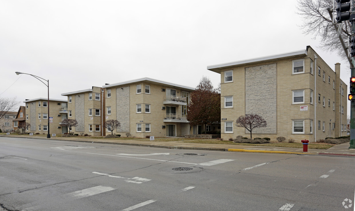
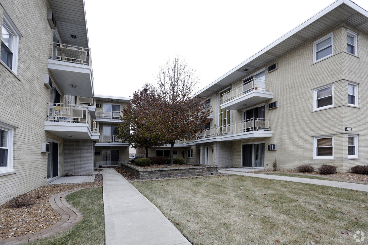
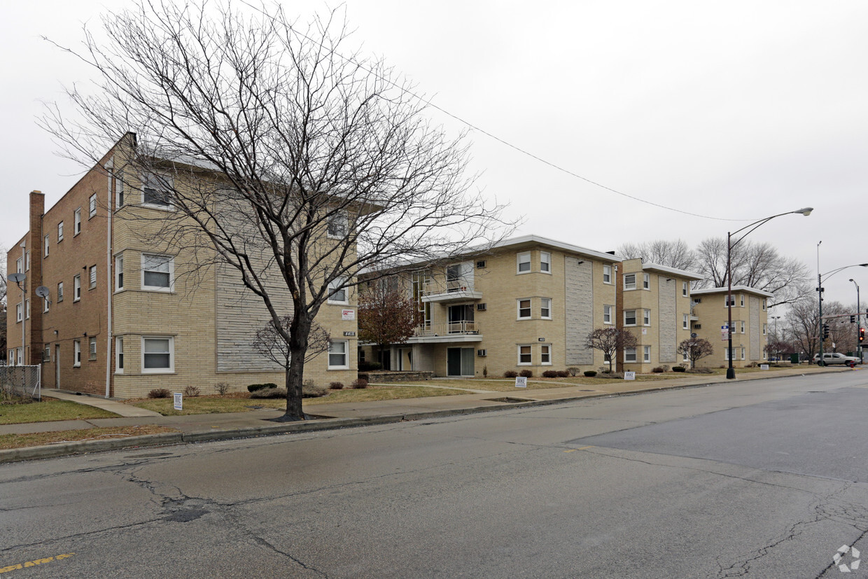
Experience Chicago living at 4400-4418 W 55th St. In a convenient location on W. 55th St. in Chicago's 60632 Zip code, residents can easily connect with a number of points of interest. Make a visit to check out the apartment floorplan options. The leasing staff is waiting to show you all that this community has to offer. Get a head start on moving now. Contact or stop by the 4400-4418 W 55th St leasing office to check the current floorplan availability today.
4400-4418 W 55th St is an apartment community located in Cook County and the 60632 ZIP Code. This area is served by the Chicago Public Schools attendance zone.
Air Conditioning
Refrigerator
Tub/Shower
Heating
Travel eight miles southwest of the Chicago Loop to find the city's West Elsdon neighborhood. Nestled just minutes east of Chicago Midway International Airport, this well-established neighborhood features a mix of multi-unit residences, ranches, bungalows, and Cape Cod-style houses.
Apartments for rent near South Pulaski Road or West 59th Street allow easy access to public transportation, retail establishments, and restaurants, such as local favorites Jacky's Hot Dogs, El Solazo and Positano's Pizza. Neighbors socialize and get exercise at Strohacker Park, which features outdoor athletic fields, a field house, a playground, and green space. On the south side of the neighborhood, 12.5-acre Pasteur Park offers amenities including a gym, indoor game room, tennis courts, and a playground.
Learn more about living in West ElsdonCompare neighborhood and city base rent averages by bedroom.
| West Elsdon | Chicago, IL | |
|---|---|---|
| Studio | $860 | $1,632 |
| 1 Bedroom | $1,255 | $2,023 |
| 2 Bedrooms | $1,485 | $2,543 |
| 3 Bedrooms | $1,877 | $3,064 |
| Colleges & Universities | Distance | ||
|---|---|---|---|
| Colleges & Universities | Distance | ||
| Drive: | 6 min | 3.3 mi | |
| Drive: | 15 min | 6.9 mi | |
| Drive: | 14 min | 8.8 mi | |
| Drive: | 14 min | 9.4 mi |


Transportation options available in Chicago include Midway Terminal, located 0.8 mile from 4400-4418 W 55th St. 4400-4418 W 55th St is near Chicago Midway International, located 1.1 miles or 2 minutes away, and Chicago O'Hare International, located 22.8 miles or 38 minutes away.
| Transit / Subway | Distance | ||
|---|---|---|---|
| Transit / Subway | Distance | ||
|
|
Walk: | 15 min | 0.8 mi |
|
|
Drive: | 3 min | 1.2 mi |
|
|
Drive: | 4 min | 2.3 mi |
|
|
Drive: | 6 min | 3.3 mi |
|
|
Drive: | 8 min | 4.1 mi |
| Commuter Rail | Distance | ||
|---|---|---|---|
| Commuter Rail | Distance | ||
|
|
Drive: | 9 min | 4.3 mi |
|
|
Drive: | 8 min | 4.5 mi |
|
|
Drive: | 9 min | 4.6 mi |
|
|
Drive: | 9 min | 4.6 mi |
|
|
Drive: | 12 min | 6.4 mi |
| Airports | Distance | ||
|---|---|---|---|
| Airports | Distance | ||
|
Chicago Midway International
|
Drive: | 2 min | 1.1 mi |
|
Chicago O'Hare International
|
Drive: | 38 min | 22.8 mi |
Scores provided by
Traffic
-Airport
-Businesses
-Scores provided by
HowLoud What is a Sound Score Rating? A Sound Score Rating aggregates noise caused by vehicle traffic, airplane traffic and local sources. How It WorksTime and distance from 4400-4418 W 55th St.
| Shopping Centers | Distance | ||
|---|---|---|---|
| Shopping Centers | Distance | ||
| Walk: | 15 min | 0.8 mi | |
| Walk: | 15 min | 0.8 mi | |
| Drive: | 3 min | 1.4 mi |
| Parks and Recreation | Distance | ||
|---|---|---|---|
| Parks and Recreation | Distance | ||
|
Gage Park
|
Drive: | 5 min | 2.6 mi |
|
Marquette Park
|
Drive: | 6 min | 3.4 mi |
|
McKinley Park
|
Drive: | 8 min | 3.9 mi |
|
Ogden Park
|
Drive: | 11 min | 5.7 mi |
|
White Eagle Woods-South
|
Drive: | 12 min | 5.8 mi |
| Hospitals | Distance | ||
|---|---|---|---|
| Hospitals | Distance | ||
| Drive: | 8 min | 3.8 mi | |
| Drive: | 12 min | 5.8 mi | |
| Drive: | 11 min | 6.7 mi |
What Are Walk Score®, Transit Score®, and Bike Score® Ratings?
Walk Score® measures the walkability of any address. Transit Score® measures access to public transit. Bike Score® measures the bikeability of any address.
What is a Sound Score Rating?
A Sound Score Rating aggregates noise caused by vehicle traffic, airplane traffic and local sources.

4400-4418 W 55th St
Chicago, IL 60632


