
$2,150
/ Month
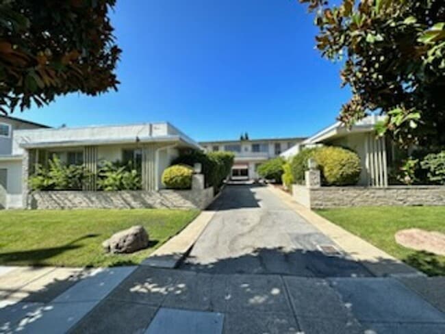
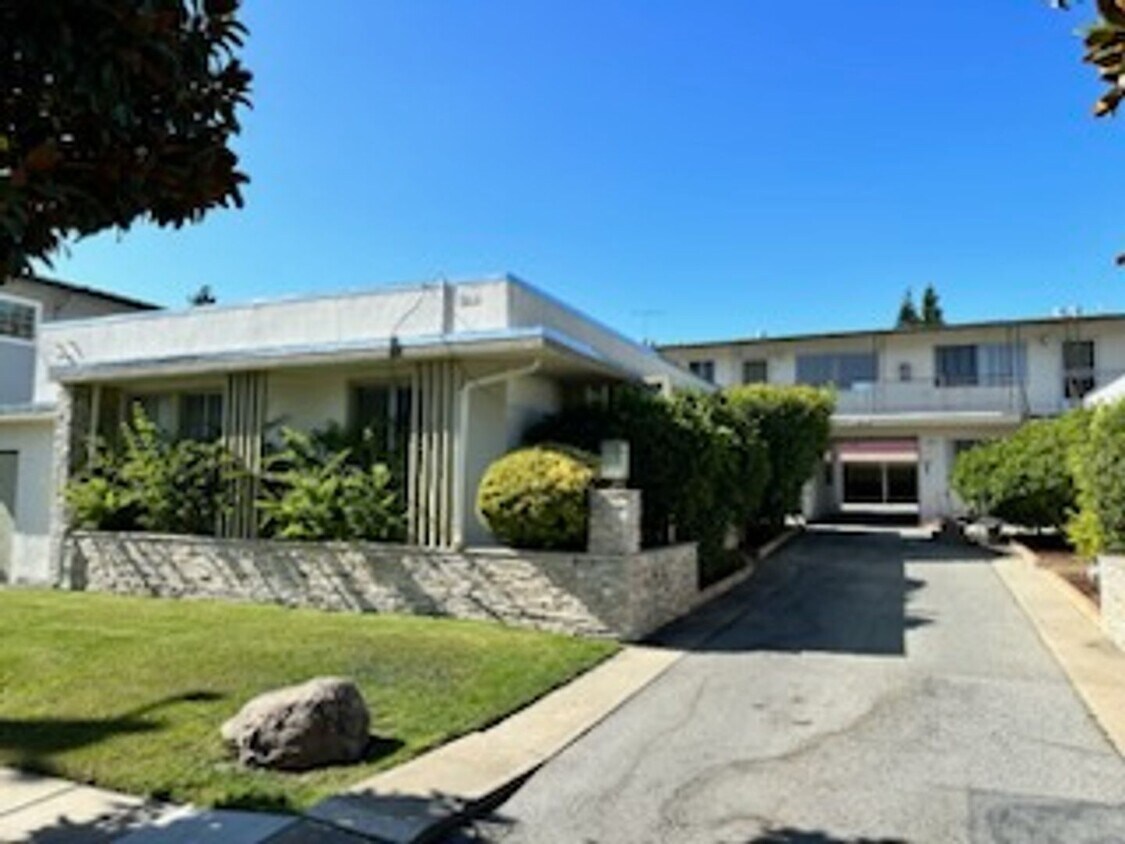
440 Walnut St Unit #1
San Carlos, CA 94070
Favorites
-
Bedrooms
1
-
Bathrooms
1
-
Square Feet
--
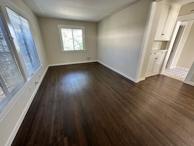
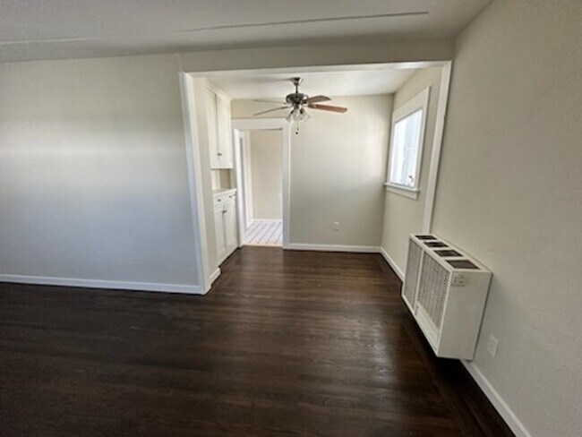
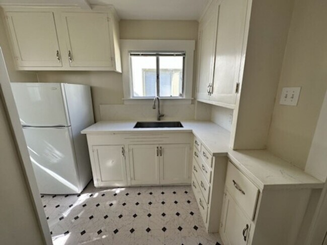
440 Walnut St Unit #1

Favorites
Contact
- Listed by SC Property Management Inc | SC Property Management Inc
Location
Get Directions
San Carlos sits at the heart of the San Francisco Peninsula, tucked between Redwood City and Belmont in San Mateo County, earning its long-held nickname "The City of Good Living" through a mix of quiet residential streets and a walkable downtown core. The city covers just six square miles, yet packs in a strong sense of place anchored by Laurel Street, which serves as the commercial and social hub where coffee shops, wine bars, and local restaurants draw residents out on foot most evenings. A centrally located Caltrain station makes commuting north to San Francisco or south to San Jose straightforward without a car, and proximity to both Highway 101 and Interstate 280 adds flexibility for those who drive.
The housing stock reflects the city's blend of established neighborhoods and newer infill development.
Learn more about living in San Carlos
Education
| Colleges & Universities | Distance | ||
|---|---|---|---|
| Colleges & Universities | Distance | ||
| Drive: | 13 min | 5.6 mi | |
| Drive: | 12 min | 7.9 mi | |
| Drive: | 15 min | 7.9 mi | |
| Drive: | 22 min | 9.1 mi |
440 Walnut St Unit #1 is within 12 minutes or 7.9 miles from College of San Mateo. It is also near Menlo College and Canada College.
Transportation options available in San Carlos include Millbrae (Caltrain Transfer Platform), located 11.2 miles from 440 Walnut St Unit #1. 440 Walnut St Unit #1 is near San Francisco International, located 12.3 miles or 18 minutes away, and Metro Oakland International, located 27.9 miles or 36 minutes away.
| Transit / Subway | Distance | ||
|---|---|---|---|
| Transit / Subway | Distance | ||
|
|
Drive: | 16 min | 11.2 mi |
| Drive: | 17 min | 12.1 mi |
| Commuter Rail | Distance | ||
|---|---|---|---|
| Commuter Rail | Distance | ||
| Walk: | 6 min | 0.3 mi | |
| Drive: | 3 min | 1.4 mi | |
| Drive: | 6 min | 2.5 mi | |
| Drive: | 8 min | 3.4 mi | |
| Drive: | 8 min | 5.1 mi |
| Airports | Distance | ||
|---|---|---|---|
| Airports | Distance | ||
|
San Francisco International
|
Drive: | 18 min | 12.3 mi |
|
Metro Oakland International
|
Drive: | 36 min | 27.9 mi |
Getting Around
 What do Walkability, Transit, Drivability, and Bikeability mean?
Walkability measures the walking distance to day-to-day needs.
Transit measures access to public transportation.
Drivability measures congestion, parking availability, and access to major roads.
Bikeability measures the suitability for cycling.
How It Works
What do Walkability, Transit, Drivability, and Bikeability mean?
Walkability measures the walking distance to day-to-day needs.
Transit measures access to public transportation.
Drivability measures congestion, parking availability, and access to major roads.
Bikeability measures the suitability for cycling.
How It Works
Moderately Walkable
Walkability
60
/ 100
Good Public Transit
Transit
60
/ 100
Exceptionally Drivable
Drivability
90
/ 100
Fairly Bikeable
Bikeability
50
/ 100
Scores provided by
-
Soundscore™
-
/ 100
Traffic
-Airport
-Businesses
-Scores provided by
HowLoud What is a Sound Score Rating? A Sound Score Rating aggregates noise caused by vehicle traffic, airplane traffic and local sources. How It WorksTime and distance from 440 Walnut St Unit #1.
| Shopping Centers | Distance | ||
|---|---|---|---|
| Shopping Centers | Distance | ||
| Walk: | 13 min | 0.7 mi | |
| Walk: | 16 min | 0.9 mi | |
| Drive: | 3 min | 1.1 mi |
440 Walnut St Unit #1 has 3 shopping centers within 1.1 miles, which is about a 3-minute drive. The miles and minutes will be for the farthest away property.
| Parks and Recreation | Distance | ||
|---|---|---|---|
| Parks and Recreation | Distance | ||
|
Edgewood Park & Natural Preserve
|
Drive: | 7 min | 3.6 mi |
|
Red Morton Park
|
Drive: | 9 min | 3.7 mi |
|
Stulsaft Park
|
Drive: | 12 min | 4.6 mi |
|
Pulgas Ridge Open Space Preserve
|
Drive: | 11 min | 5.1 mi |
|
Filoli Gardens
|
Drive: | 16 min | 6.1 mi |
440 Walnut St Unit #1 has 5 parks within 6.1 miles, including Red Morton Park, Edgewood Park & Natural Preserve, and Pulgas Ridge Open Space Preserve.
| Hospitals | Distance | ||
|---|---|---|---|
| Hospitals | Distance | ||
| Drive: | 6 min | 2.6 mi | |
| Drive: | 7 min | 2.9 mi | |
| Drive: | 6 min | 3.0 mi |
440 Walnut St Unit #1 has 3 hospitals within 3.0 miles, the nearest is Sequoia Hospital which is 2.6 miles away and a 6 minute drive.
| Military Bases | Distance | ||
|---|---|---|---|
| Military Bases | Distance | ||
| Drive: | 22 min | 15.1 mi | |
| Drive: | 48 min | 35.4 mi | |
| Drive: | 49 min | 35.6 mi |
440 Walnut St Unit #1 has 3 military bases within 35.6 miles, the nearest is Ames Research Center which is 15.1 miles away and a 22 minute drive.
You May Also Like
Similar Rentals Nearby


What Are Walk Score®, Transit Score®, and Bike Score® Ratings?
Walk Score® measures the walkability of any address. Transit Score® measures access to public transit. Bike Score® measures the bikeability of any address.
What is a Sound Score Rating?
A Sound Score Rating aggregates noise caused by vehicle traffic, airplane traffic and local sources.
440 Walnut St
San Carlos, CA 94070