
Townhome for Rent
3 Beds | 1.5 Baths | 1,155 sq ft


| Beds | Baths | Average SF |
|---|---|---|
| 3 Bedrooms 3 Bedrooms 3 Br | 2 Baths 2 Baths 2 Ba | — |
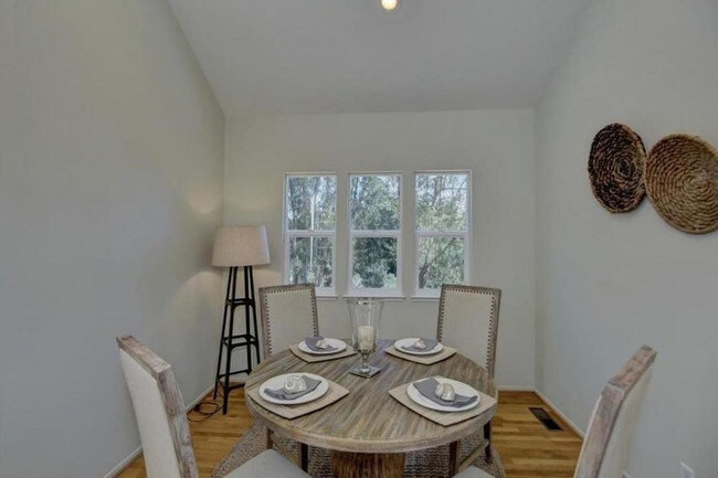
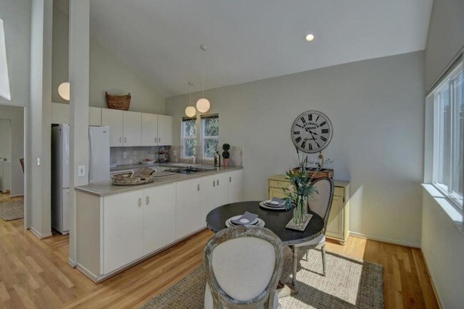
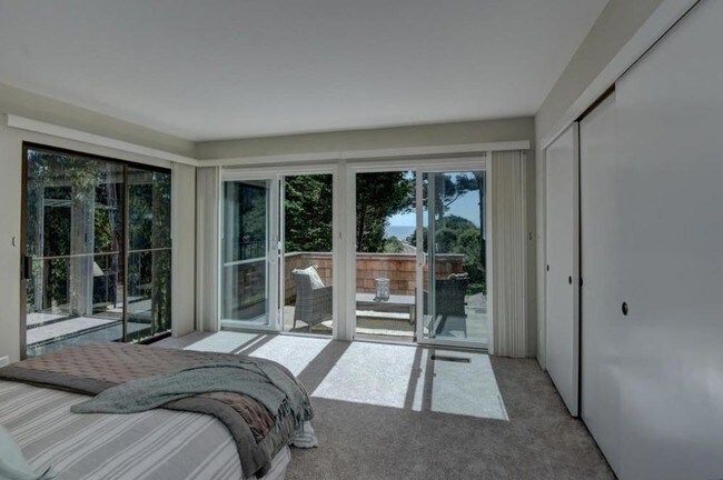
Private Corner end unit. Exquisite Beach Getaway boasting the largest floor plan available in the Trestle Beach Townhouse community with 1873 square feet 3/2. This unique gated community of 21 Cape Cod style townhouses was built on a nine acre site overlooking Monterey Bay. In approaching Trestle Beach, you wind through the private roads of Los Barrancos de Aptos and emerge to a breathtaking miles-wide view of the ocean. Private beach path access, pool, tennis and trails make this the perfect retreat for those looking for a private and unique home away from home. Fantastic open floor plan, hardwood floors, soaring ceilings, French doors to private outside decks. Dual master en-suites, light, bright & airy throughout. Simply Stunning! Hardwood floors, new carpet, updated kitchen & baths... Simply Stunning!
440 Camino Al Mar is a townhome located in Santa Cruz County and the 95076 ZIP Code. This area is served by the Pajaro Valley Unified School District attendance zone.
Watsonville sits at the southern end of Santa Cruz County, where the Pajaro Valley's agricultural fields stretch toward Monterey Bay and the everyday rhythm of life stays rooted in the land. The city has long anchored the region's strawberry and apple industries, earning a reputation as one of California's most productive farming communities. That agricultural identity shapes the city's character in real ways, from the well-attended weekly farmers market to the Santa Cruz County Fair, held here each September and drawing crowds from across the county. Watsonville is compact at roughly seven square miles, yet its downtown core, surrounding residential streets, and outlying areas each carry a distinct feel. Santa Cruz sits about 23 miles to the northwest and Monterey is a comparable drive south, giving residents access to two coastal cities without the price tags those markets carry.
Learn more about living in Watsonville| Colleges & Universities | Distance | ||
|---|---|---|---|
| Colleges & Universities | Distance | ||
| Drive: | 11 min | 6.2 mi | |
| Drive: | 28 min | 16.5 mi | |
| Drive: | 37 min | 27.6 mi | |
| Drive: | 47 min | 32.1 mi |


Scores provided by
Traffic
-Airport
-Businesses
-Scores provided by
HowLoud What is a Sound Score Rating? A Sound Score Rating aggregates noise caused by vehicle traffic, airplane traffic and local sources. How It Works


What Are Walk Score®, Transit Score®, and Bike Score® Ratings?
Walk Score® measures the walkability of any address. Transit Score® measures access to public transit. Bike Score® measures the bikeability of any address.
What is a Sound Score Rating?
A Sound Score Rating aggregates noise caused by vehicle traffic, airplane traffic and local sources.
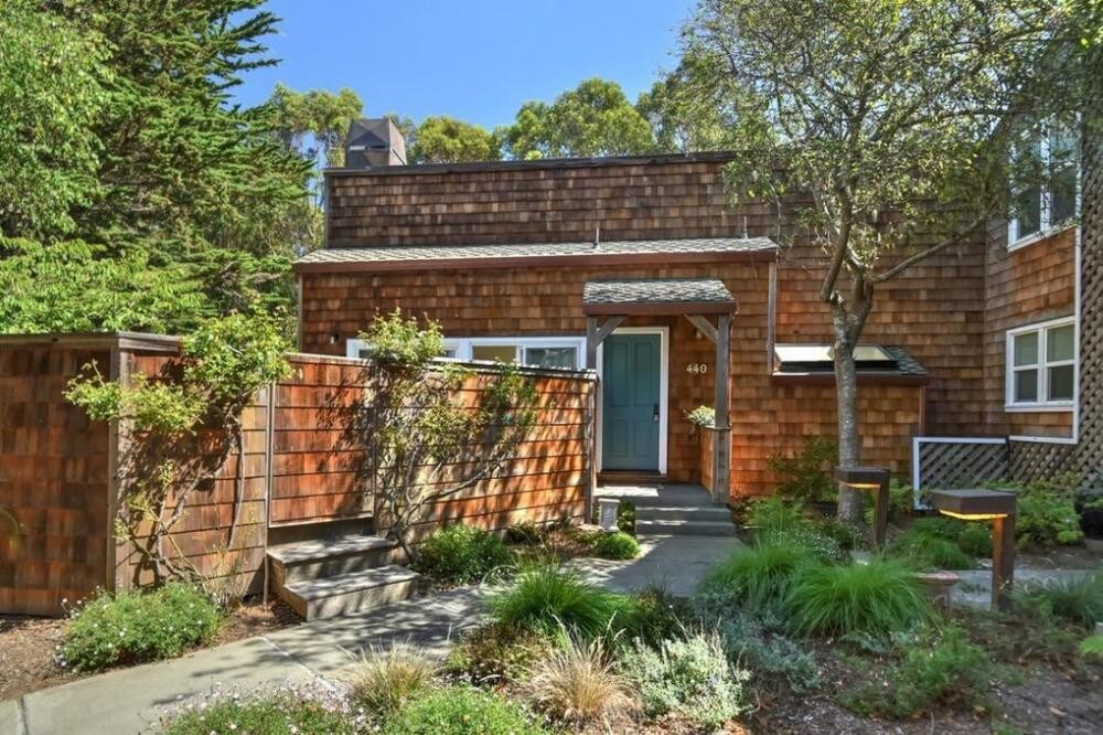
440 Camino Al Mar
Watsonville, CA 95076