
Bridgepointe
1987 Bridgepointe Pky,
San Mateo, CA 94404
$3,141 - $6,426
1-3 Beds
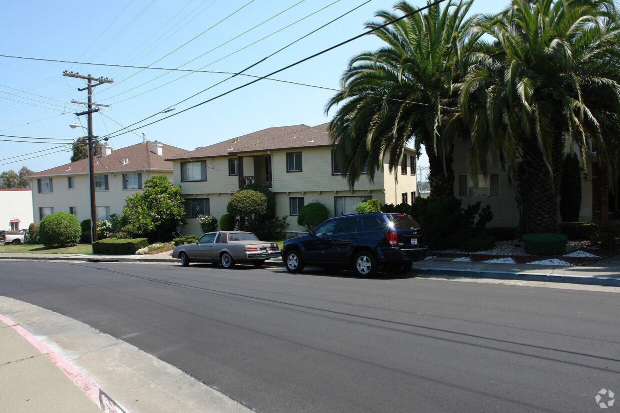
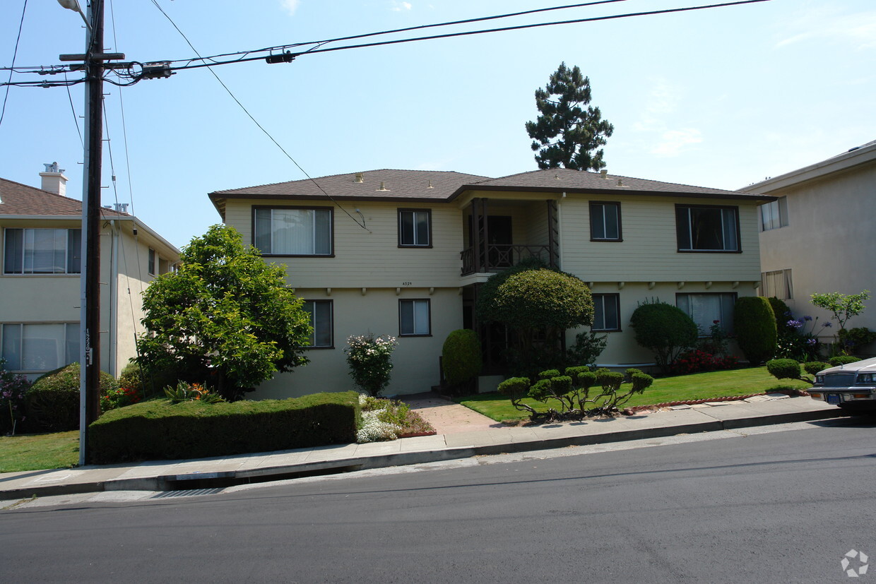

Meet a new place to live at 4325 Beresford. These apartments are located at 4325 Beresford St. in the 94403 area of San Mateo. Come by to check out the current floorplan options. From amenities to floorplan options, the professional leasing team is ready and waiting to help you find your perfect apartment. Drop by 4325 Beresford today.
4325 Beresford is an apartment community located in San Mateo County and the 94403 ZIP Code. This area is served by the San Mateo-Foster City attendance zone.
Air Conditioning
Yard
Heating
Lawn
Located about halfway between San Francisco and San Jose, Sugarloaf is a peaceful, suburban neighborhood in San Mateo. Sugarloaf is predominantly residential, touting an array of single-family houses and apartment buildings atop scenic hillsides. However, Sugarloaf also provides plenty of shopping opportunities, from the extensive retail offerings of the Hillsdale Shopping Center to the unique finds in local shops along 37th Avenue.
Sugarloaf residents enjoy ample outdoor activities at the sprawling Laurelwood Park in addition to quick commutes for those working at the San Mateo Medical Center and the College of San Mateo. Convenience to El Camino Real, J. Arthur Younger Freeway, the Hillsdale CalTrain Station, and San Francisco International Airport makes getting around from Sugarloaf a breeze.
Learn more about living in Sugarloaf| Colleges & Universities | Distance | ||
|---|---|---|---|
| Colleges & Universities | Distance | ||
| Drive: | 8 min | 3.5 mi | |
| Drive: | 18 min | 9.9 mi | |
| Drive: | 20 min | 12.2 mi | |
| Drive: | 26 min | 15.5 mi |


Transportation options available in San Mateo include Millbrae Bart Station, located 9.4 miles from 4325 Beresford. 4325 Beresford is near San Francisco International, located 10.4 miles or 16 minutes away, and Metro Oakland International, located 26.1 miles or 35 minutes away.
| Transit / Subway | Distance | ||
|---|---|---|---|
| Transit / Subway | Distance | ||
|
|
Drive: | 15 min | 9.4 mi |
|
|
Drive: | 15 min | 9.4 mi |
| Drive: | 16 min | 10.1 mi | |
|
|
Drive: | 17 min | 10.3 mi |
|
|
Drive: | 16 min | 10.4 mi |
| Commuter Rail | Distance | ||
|---|---|---|---|
| Commuter Rail | Distance | ||
| Drive: | 3 min | 1.3 mi | |
| Drive: | 3 min | 1.3 mi | |
| Drive: | 4 min | 1.4 mi | |
| Drive: | 6 min | 2.4 mi | |
| Drive: | 6 min | 2.4 mi |
| Airports | Distance | ||
|---|---|---|---|
| Airports | Distance | ||
|
San Francisco International
|
Drive: | 16 min | 10.4 mi |
|
Metro Oakland International
|
Drive: | 35 min | 26.1 mi |
Time and distance from 4325 Beresford.
| Shopping Centers | Distance | ||
|---|---|---|---|
| Shopping Centers | Distance | ||
| Walk: | 1 min | 0.1 mi | |
| Walk: | 5 min | 0.3 mi | |
| Walk: | 10 min | 0.5 mi |
| Parks and Recreation | Distance | ||
|---|---|---|---|
| Parks and Recreation | Distance | ||
|
San Mateo Arboretum
|
Drive: | 7 min | 3.0 mi |
|
Japanese Tea Garden (San Mateo)
|
Drive: | 8 min | 3.4 mi |
|
Shoreline Parks
|
Drive: | 9 min | 5.0 mi |
|
Edgewood Park & Natural Preserve
|
Drive: | 13 min | 6.1 mi |
|
Pulgas Ridge Open Space Preserve
|
Drive: | 16 min | 7.5 mi |
| Hospitals | Distance | ||
|---|---|---|---|
| Hospitals | Distance | ||
| Walk: | 12 min | 0.6 mi | |
| Drive: | 12 min | 5.0 mi | |
| Drive: | 9 min | 5.2 mi |
| Military Bases | Distance | ||
|---|---|---|---|
| Military Bases | Distance | ||
| Drive: | 26 min | 17.4 mi |
What Are Walk Score®, Transit Score®, and Bike Score® Ratings?
Walk Score® measures the walkability of any address. Transit Score® measures access to public transit. Bike Score® measures the bikeability of any address.
What is a Sound Score Rating?
A Sound Score Rating aggregates noise caused by vehicle traffic, airplane traffic and local sources


