$2,600
/ Month
43 Bank Spring Ct
Owings Mills, MD 21117
Today
|
Edit
Favorites
443-534-0301
-
Bedrooms
3
-
Bathrooms
2.5
-
Square Feet
--
-
Available
Available Nov 27
Highlight
- Basement
43 Bank Spring Ct

Favorites
About This Home
Available Nov 27
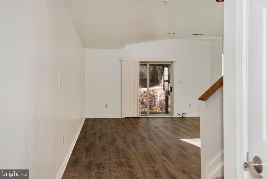
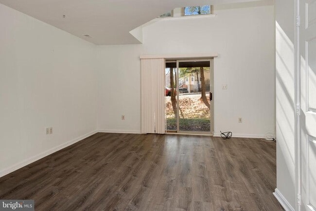
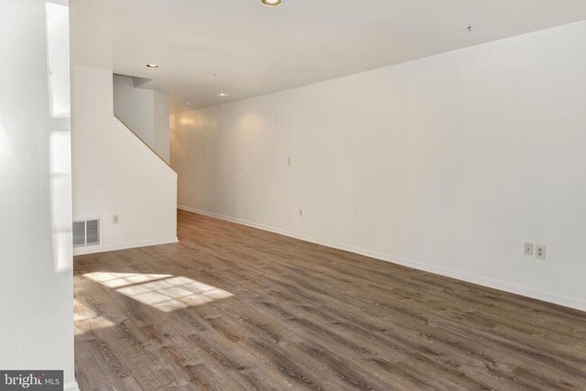
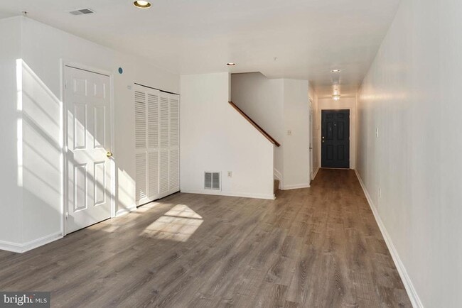
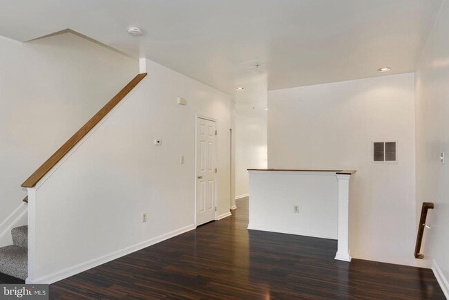
Spacious 4-level townhome in New Town ready for its' new Tenants. Over 1,500 sqft of finished living space featuring a lower level rec room with 2-story ceilings, access from the garage and powder room, open concept family room/kitchen and access to back deck; Upper level 1 comprises of two spacious bedrooms, full bath and separate laundry room. Upper level 2 features a private primary suite with full bath, vaulted ceiling, ceiling fan and 3 closets. Luxury vinyl flooring throughout. Conveniently located near plenty of restaurants, shopping, and major commuter routes. Quick decision after submission of application. No Pets, No Smoking. Min. credit score of 660 and 3.5x rent in income required. Minimum of a 2 year lease.
43 Bank Spring Ct is a townhome located in Baltimore County and the 21117 ZIP Code. This area is served by the Baltimore County Public Schools attendance zone.
* Price shown is base rent. Excludes user-selected optional fees and variable or usage-based fees and required charges due at or prior to move-in or at move-out. Price, availability, fees, and any applicable rent special are subject to change without notice.
* Square footage definitions vary. Displayed square footage is approximate.
Townhome Features
- Dishwasher
- Basement
Contact
- Listed by Kara Clasing | Cummings & Co Realtors
- Phone Number
- Contact
-
Source
 Bright MLS, Inc.
Copyright © 2025 Bright MLS, Inc.
Location
Get Directions
Amenities
- Dishwasher
- Basement
Located in Baltimore County, Owings Mills combines suburban living with easy city access. This community northwest of Baltimore features natural attractions like Soldiers Delight Natural Environment Area, known for its rare serpentinite ecosystem. Residents enjoy convenient transportation via the Baltimore Metro Subway and shopping at Mill Station and Foundry Row, home to Wegmans and Costco. One-bedroom apartments in Owings Mills rent for $1,579 monthly, while two-bedroom units average $1,897, reflecting a 2.5% year-over-year increase.
The area is home to McDonogh School and Stevenson University, while major employers include T. Rowe Price, CareFirst, and the Baltimore Ravens' headquarters. Maryland Public Television studios adds to the community's media presence. With approximately 35,700 residents, Owings Mills offers various housing options from apartment communities to established neighborhoods, all within easy reach of Baltimore's attractions.
Learn more about living in Owings Mills
Education
| Colleges & Universities | Distance | ||
|---|---|---|---|
| Colleges & Universities | Distance | ||
| Drive: | 9 min | 4.4 mi | |
| Drive: | 20 min | 8.9 mi | |
| Drive: | 29 min | 13.9 mi | |
| Drive: | 27 min | 16.7 mi |
43 Bank Spring Ct is within 9 minutes or 4.4 miles from Stevenson Univ., Owings Mills. It is also near Stevenson Univ., Greenspring and Coppin State University.
Schools


Public Elementary School
Grades PK-5
809 Students
Attendance Zone
Public Elementary School
Grades PK-5
414 Students
Nearby
Public Middle School
Grades 6-8
1,322 Students
Attendance Zone
Public High School
Grades 9-12
1,316 Students
Attendance Zone
Private Elementary, Middle & High School
Grades 2-12
167 Students
Nearby
Private Elementary & Middle School
Grades PK-8
95 Students
Nearby
School data provided by
 The GreatSchools Rating helps parents compare schools within a state based on a variety of school quality indicators and provides a helpful picture of how effectively each school serves all of its students. Ratings are on a scale of 1 (below average) to 10 (above average) and can include test scores, college readiness, academic progress, advanced courses, equity, discipline and attendance data. We also advise parents to visit schools, consider other information on school performance and programs, and consider family needs as part of the school selection process.
View GreatSchools Rating Methodology
Data provided by GreatSchools.org © 2025. All rights reserved.
View GreatSchools Rating Methodology
Data provided by GreatSchools.org © 2025. All rights reserved.
Transportation options available in Owings Mills include Old Court, located 6.5 miles from 43 Bank Spring Ct. 43 Bank Spring Ct is near Baltimore/Washington International Thurgood Marshall, located 21.5 miles or 34 minutes away.
| Transit / Subway | Distance | ||
|---|---|---|---|
| Transit / Subway | Distance | ||
| Drive: | 13 min | 6.5 mi | |
| Drive: | 18 min | 8.1 mi | |
| Drive: | 17 min | 10.0 mi | |
| Drive: | 21 min | 11.0 mi | |
| Drive: | 22 min | 11.8 mi |
| Commuter Rail | Distance | ||
|---|---|---|---|
| Commuter Rail | Distance | ||
| Drive: | 26 min | 17.0 mi | |
|
|
Drive: | 26 min | 17.1 mi |
|
|
Drive: | 30 min | 17.2 mi |
|
|
Drive: | 32 min | 20.1 mi |
|
|
Drive: | 34 min | 21.2 mi |
| Airports | Distance | ||
|---|---|---|---|
| Airports | Distance | ||
|
Baltimore/Washington International Thurgood Marshall
|
Drive: | 34 min | 21.5 mi |
Time and distance from 43 Bank Spring Ct.
| Shopping Centers | Distance | ||
|---|---|---|---|
| Shopping Centers | Distance | ||
| Walk: | 10 min | 0.6 mi | |
| Drive: | 4 min | 1.5 mi | |
| Drive: | 4 min | 1.8 mi |
43 Bank Spring Ct has 3 shopping centers within 1.8 miles, which is about a 4-minute walk. The miles and minutes will be for the farthest away property.
| Parks and Recreation | Distance | ||
|---|---|---|---|
| Parks and Recreation | Distance | ||
|
Soldiers Delight Natural Environment Area (NEA)
|
Drive: | 5 min | 2.0 mi |
|
Irvine Nature Center
|
Drive: | 11 min | 5.3 mi |
|
Patapsco Valley State Park
|
Drive: | 22 min | 7.8 mi |
|
Rodgers Farms
|
Drive: | 17 min | 8.2 mi |
|
Mt Pleasant - Howard County Conservancy
|
Drive: | 24 min | 9.8 mi |
43 Bank Spring Ct has 5 parks within 9.8 miles, including Soldiers Delight Natural Environment Area (NEA), Irvine Nature Center, and Patapsco Valley State Park.
| Hospitals | Distance | ||
|---|---|---|---|
| Hospitals | Distance | ||
| Drive: | 10 min | 5.0 mi | |
| Drive: | 17 min | 9.5 mi | |
| Drive: | 21 min | 12.4 mi |
43 Bank Spring Ct has 3 hospitals within 12.4 miles, the nearest is Northwest Hospital Center which is 5.0 miles away and a 10 minute drive.
| Military Bases | Distance | ||
|---|---|---|---|
| Military Bases | Distance | ||
| Drive: | 48 min | 29.5 mi |
43 Bank Spring Ct is 29.5 miles and a 48 minute drive from Fort George Meade.
You May Also Like
Similar Rentals Nearby


What Are Walk Score®, Transit Score®, and Bike Score® Ratings?
Walk Score® measures the walkability of any address. Transit Score® measures access to public transit. Bike Score® measures the bikeability of any address.
What is a Sound Score Rating?
A Sound Score Rating aggregates noise caused by vehicle traffic, airplane traffic and local sources

43 Bank Spring Ct
Owings Mills, MD 21117