
$1,750
Total Monthly Price
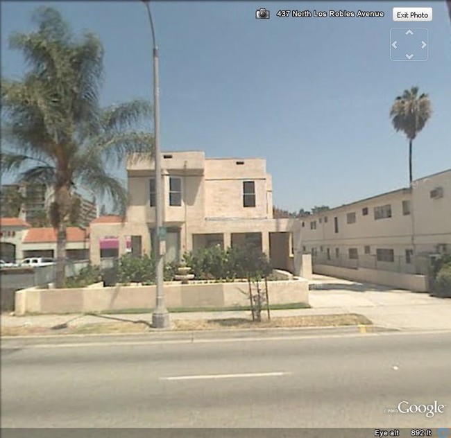
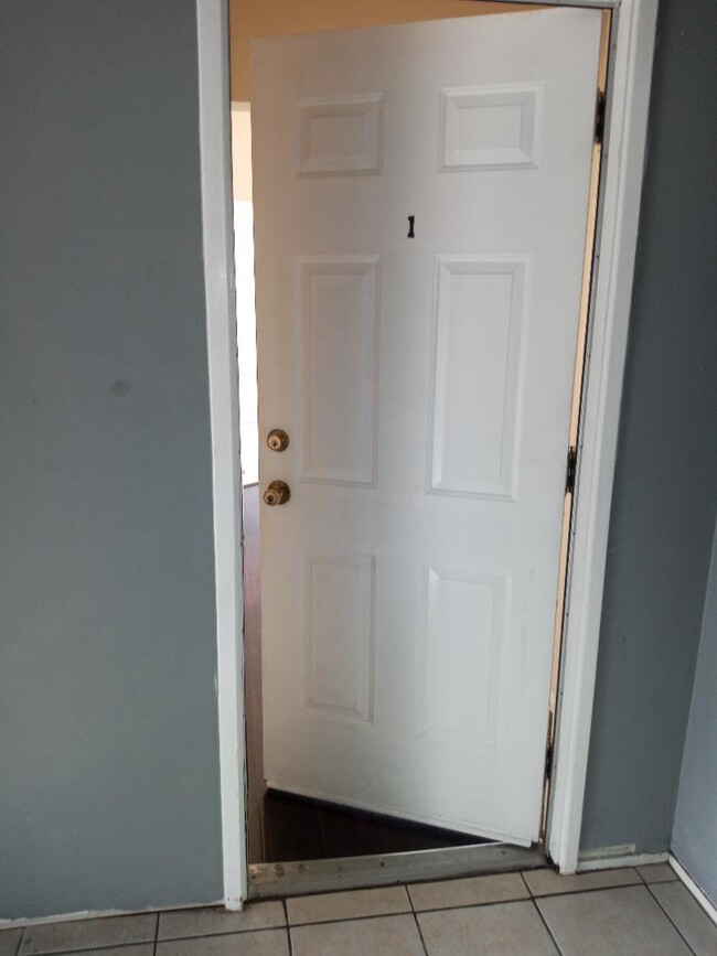
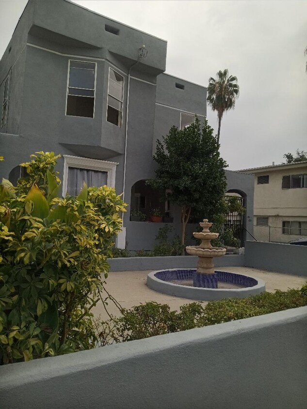
426 N Los Robles Ave Unit 1
Pasadena, CA 91101
Favorites
426 N Los Robles Ave Unit 1

Favorites
Check Back Soon for Upcoming Availability
| Beds | Baths | Average SF |
|---|---|---|
| Studio Studio 0 Br | 1 Bath 1 Bath 1 Ba | 510 SF |
Fees and Policies
The fees listed below are community-provided and may exclude utilities or add-ons. All payments are made directly to the property and are non-refundable unless otherwise specified.
- Parking
-
Surface Lot--
Details
Utilities Included
-
Gas
-
Water
-
Electricity
-
Heat
-
Trash Removal
-
Sewer
Lease Options
-
12 Months
Property Information
-
4 units
About This Property
426 N Los Robles Ave is an apartment community located in Los Angeles County and the 91101 ZIP Code.
Apartment Features
Air Conditioning
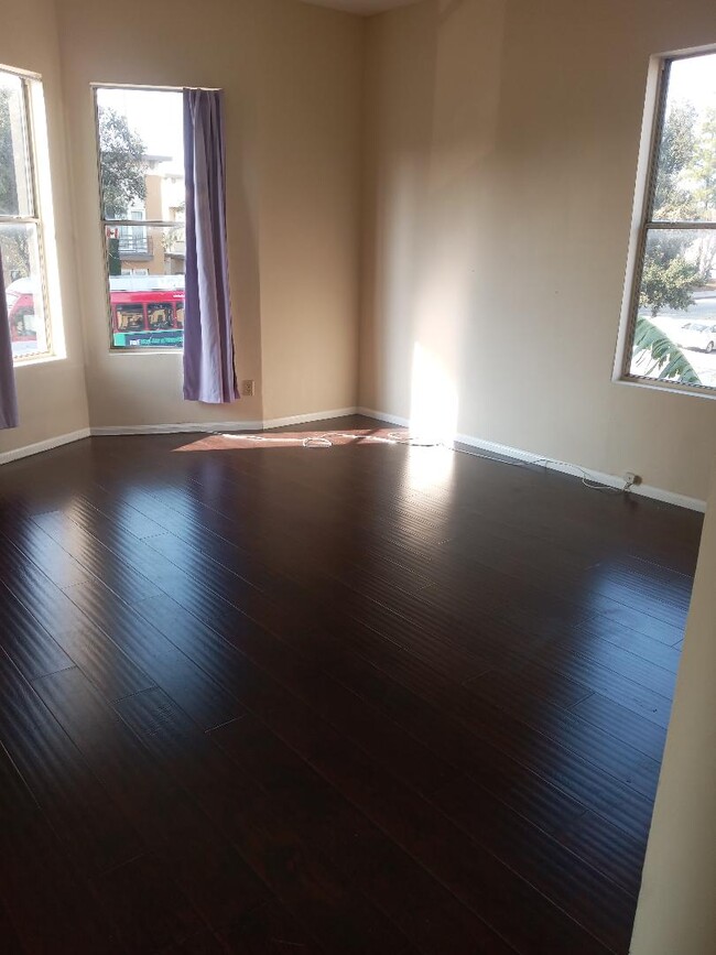
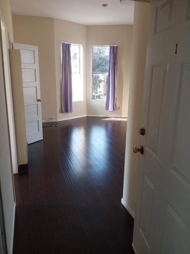
Hardwood Floors
Granite Countertops
Microwave
- Air Conditioning
- Heating
- Smoke Free
- Granite Countertops
- Kitchen
- Microwave
- Range
- Refrigerator
- Hardwood Floors
- Tile Floors
426 N Los Robles Ave,
Pasadena,
CA
91101
Large, attractive homes and sidewalks shaded by a lush canopy of oak trees are the first thing you’ll notice in Pasadena’s Oaks neighborhood. This mainly-residential community enjoys the benefits of a few key resources within walking distance: Madison Elementary School on the north end of the neighborhood is close enough for local students to get to class on foot, and a small cluster of cafes and shops along Los Robles Avenue is an excellent spot to pick up groceries or grab your morning coffee.
The central Pasadena location puts residents just a few blocks north of downtown, making it convenient to walk to the vibrant dining, nightlife, and arts scene along Colorado Boulevard anytime.
Learn more about living in The Oaks PasadenaBelow are rent ranges for similar nearby apartments
Amenities
- Air Conditioning
- Heating
- Smoke Free
- Granite Countertops
- Kitchen
- Microwave
- Range
- Refrigerator
- Hardwood Floors
- Tile Floors
Expenses
Utilities Included
Gas, Water, Electricity, Heat, Trash Removal, Sewer
Included
Education
| Colleges & Universities | Distance | ||
|---|---|---|---|
| Colleges & Universities | Distance | ||
| Walk: | 9 min | 0.5 mi | |
| Drive: | 4 min | 1.9 mi | |
| Drive: | 5 min | 2.2 mi | |
| Drive: | 5 min | 2.5 mi |
426 N Los Robles Ave Unit 1 is within 9 minutes or 0.5 mile from Fuller Theological Seminary. It is also near Pasadena City College and Caltech.
Transportation options available in Pasadena include Memorial Park Station, located 0.7 mile from 426 N Los Robles Ave Unit 1. 426 N Los Robles Ave Unit 1 is near Bob Hope, located 16.8 miles or 22 minutes away, and Los Angeles International, located 25.6 miles or 40 minutes away.
| Transit / Subway | Distance | ||
|---|---|---|---|
| Transit / Subway | Distance | ||
|
|
Walk: | 14 min | 0.7 mi |
|
|
Drive: | 3 min | 1.2 mi |
|
|
Drive: | 2 min | 1.2 mi |
|
|
Drive: | 2 min | 1.7 mi |
|
|
Drive: | 4 min | 2.0 mi |
| Commuter Rail | Distance | ||
|---|---|---|---|
| Commuter Rail | Distance | ||
|
|
Drive: | 12 min | 9.3 mi |
|
|
Drive: | 17 min | 10.5 mi |
|
|
Drive: | 19 min | 10.6 mi |
|
|
Drive: | 19 min | 10.7 mi |
| Drive: | 21 min | 14.6 mi |
| Airports | Distance | ||
|---|---|---|---|
| Airports | Distance | ||
|
Bob Hope
|
Drive: | 22 min | 16.8 mi |
|
Los Angeles International
|
Drive: | 40 min | 25.6 mi |
Walkability Near 426 N Los Robles Ave Pasadena, CA 91101
Getting Around
 What do Walkability, Transit, Drivability, and Bikeability mean?
Walkability measures the walking distance to day-to-day needs.
Transit measures access to public transportation.
Drivability measures congestion, parking availability, and access to major roads.
Bikeability measures the suitability for cycling.
How It Works
What do Walkability, Transit, Drivability, and Bikeability mean?
Walkability measures the walking distance to day-to-day needs.
Transit measures access to public transportation.
Drivability measures congestion, parking availability, and access to major roads.
Bikeability measures the suitability for cycling.
How It Works
Moderately Walkable
Walkability
70
/ 100
Some Public Transit
Transit
50
/ 100
Exceptionally Drivable
Drivability
100
/ 100
Moderately Bikeable
Bikeability
60
/ 100
Scores provided by
-
Soundscore™
-
/ 100
Traffic
-Airport
-Businesses
-Scores provided by
HowLoud What is a Sound Score Rating? A Sound Score Rating aggregates noise caused by vehicle traffic, airplane traffic and local sources. How It WorksTime and distance from 426 N Los Robles Ave Unit 1.
| Shopping Centers | Distance | ||
|---|---|---|---|
| Shopping Centers | Distance | ||
| Walk: | 7 min | 0.4 mi | |
| Walk: | 15 min | 0.8 mi | |
| Walk: | 16 min | 0.9 mi |
426 N Los Robles Ave Unit 1 has 3 shopping centers within 0.9 mile, which is about a 16-minute walk. The miles and minutes will be for the farthest away property.
| Parks and Recreation | Distance | ||
|---|---|---|---|
| Parks and Recreation | Distance | ||
|
Kidspace Children's Museum
|
Drive: | 5 min | 2.3 mi |
|
Huntington Botanical Gardens
|
Drive: | 8 min | 3.3 mi |
|
Jet Propulsion Laboratory
|
Drive: | 6 min | 3.6 mi |
|
Eaton Canyon Nature Center
|
Drive: | 8 min | 4.3 mi |
|
Los Angeles County Arboretum
|
Drive: | 9 min | 6.0 mi |
426 N Los Robles Ave Unit 1 has 5 parks within 6.0 miles, including Kidspace Children's Museum, Huntington Botanical Gardens, and Jet Propulsion Laboratory.
| Hospitals | Distance | ||
|---|---|---|---|
| Hospitals | Distance | ||
| Drive: | 3 min | 1.8 mi | |
| Drive: | 6 min | 3.7 mi | |
| Drive: | 10 min | 5.0 mi |
426 N Los Robles Ave Unit 1 has 3 hospitals within 5.0 miles, the nearest is Huntington Memorial Hospital which is 1.8 miles away and a 3 minute drive.
| Military Bases | Distance | ||
|---|---|---|---|
| Military Bases | Distance | ||
| Drive: | 37 min | 27.1 mi | |
| Drive: | 46 min | 30.4 mi | |
| Drive: | 51 min | 38.0 mi |
426 N Los Robles Ave Unit 1 has 3 military bases within 38.0 miles, the nearest is Los Angeles Air Force Base which is 27.1 miles away and a 37 minute drive.
You May Also Like
Similar Rentals Nearby
-
-
1 Bed$2,393+2 Beds$3,340+Total Monthly PriceTotal Monthly Price NewPrices include base rent and required monthly fees of $45. Variable costs based on usage may apply.Base Rent:1 Bed$2,347+2 Beds$3,294+2 Months Free
Pets Allowed Fitness Center Pool In Unit Washer & Dryer Clubhouse Balcony
-
-
-
-
-
-
-
-
1 Bed$3,161+2 Beds$4,611+Total Monthly Price12 Month LeaseTotal Monthly Price NewPrices include base rent and required monthly fees of $15. Variable costs based on usage may apply.Base Rent:1 Bed$3,145+2 Beds$4,595+1 Month Free
Pets Allowed Fitness Center Pool Maintenance on site High-Speed Internet Controlled Access


What Are Walk Score®, Transit Score®, and Bike Score® Ratings?
Walk Score® measures the walkability of any address. Transit Score® measures access to public transit. Bike Score® measures the bikeability of any address.
What is a Sound Score Rating?
A Sound Score Rating aggregates noise caused by vehicle traffic, airplane traffic and local sources.
426 N Los Robles Ave
Pasadena, CA 91101