
Urbn Edge
3510 Union St,
Flushing, NY 11354
$3,100 - $4,000 Total Monthly Price
1-2 Beds 12 Month Lease

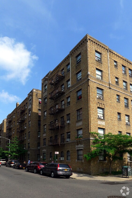
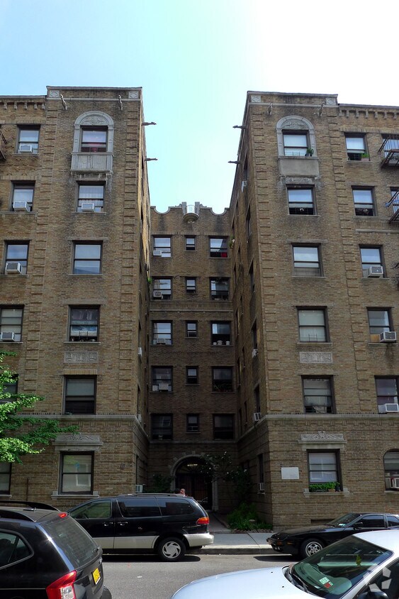
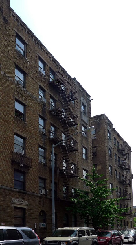

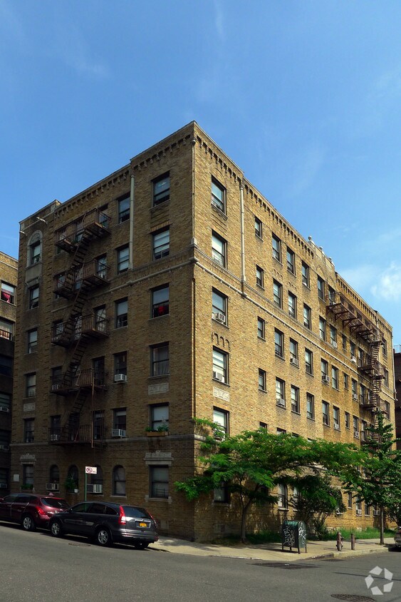
Thanks for visiting 4225 Layton St in Flushing, NY. This community is located on Layton St. in the 11373 area of Flushing. This community offers a variety of featured amenities. These include: smoke-free options and high-speed internet access. From amenities to floor plan options, the professional leasing staff is available to help you find your perfect new place. It's time to come home to 4225 Layton St. Contact us or stop by the leasing office to see available floor plans.
4225 Layton St is an apartment community located in Queens County and the 11373 ZIP Code. This area is served by the New York City Geographic District #24 attendance zone.
Air Conditioning
High Speed Internet Access
Tub/Shower
Smoke Free
Flushing is one of Queens' most commercially active neighborhoods, home to the fourth-largest central business district in all of New York City. Its core intersection at Main Street and Roosevelt Avenue ranks among the busiest in the city, and the energy that radiates outward from there reflects just how much this neighborhood has to offer. Anchored by Queens Botanical Garden and the sprawling Flushing Meadows–Corona Park, the area balances dense urban activity with genuine green space. The New York Mets call this neighborhood home at Citi Field, and USTA Billie Jean King National Tennis Center hosts the U.S. Open each summer nearby. Flushing dates to 1645, making it one of the oldest settlements in the region, and that deep history gives the neighborhood a sense of permanence that newer developments can't replicate.
Learn more about living in Flushing| Colleges & Universities | Distance | ||
|---|---|---|---|
| Colleges & Universities | Distance | ||
| Drive: | 7 min | 2.8 mi | |
| Drive: | 10 min | 4.8 mi | |
| Drive: | 11 min | 5.4 mi | |
| Drive: | 12 min | 5.7 mi |


Transportation options available in Flushing include Elmhurst Avenue, located 0.3 mile from 4225 Layton St. 4225 Layton St is near LaGuardia, located 2.9 miles or 8 minutes away, and John F Kennedy International, located 11.5 miles or 18 minutes away.
| Transit / Subway | Distance | ||
|---|---|---|---|
| Transit / Subway | Distance | ||
|
|
Walk: | 4 min | 0.3 mi |
|
|
Walk: | 5 min | 0.3 mi |
|
|
Walk: | 9 min | 0.5 mi |
|
|
Walk: | 11 min | 0.6 mi |
|
|
Walk: | 12 min | 0.7 mi |
| Commuter Rail | Distance | ||
|---|---|---|---|
| Commuter Rail | Distance | ||
|
|
Walk: | 21 min | 1.1 mi |
|
|
Drive: | 9 min | 3.0 mi |
|
|
Drive: | 9 min | 3.0 mi |
|
|
Drive: | 7 min | 3.4 mi |
|
|
Drive: | 8 min | 3.6 mi |
| Airports | Distance | ||
|---|---|---|---|
| Airports | Distance | ||
|
LaGuardia
|
Drive: | 8 min | 2.9 mi |
|
John F Kennedy International
|
Drive: | 18 min | 11.5 mi |
Scores provided by
Traffic
-Airport
-Businesses
-Scores provided by
HowLoud What is a Sound Score Rating? A Sound Score Rating aggregates noise caused by vehicle traffic, airplane traffic and local sources. How It WorksTime and distance from 4225 Layton St.
| Shopping Centers | Distance | ||
|---|---|---|---|
| Shopping Centers | Distance | ||
| Walk: | 15 min | 0.8 mi |
| Parks and Recreation | Distance | ||
|---|---|---|---|
| Parks and Recreation | Distance | ||
|
Travers Park
|
Walk: | 17 min | 0.9 mi |
|
Linden Park
|
Drive: | 4 min | 1.5 mi |
|
Juniper Valley Park
|
Drive: | 7 min | 2.3 mi |
|
New York Hall of Science
|
Drive: | 6 min | 2.3 mi |
|
Queens Zoo
|
Drive: | 6 min | 2.4 mi |
| Hospitals | Distance | ||
|---|---|---|---|
| Hospitals | Distance | ||
| Walk: | 3 min | 0.2 mi | |
| Drive: | 9 min | 4.2 mi | |
| Drive: | 10 min | 4.3 mi |
| Military Bases | Distance | ||
|---|---|---|---|
| Military Bases | Distance | ||
| Drive: | 16 min | 8.1 mi | |
| Drive: | 24 min | 10.5 mi | |
| Drive: | 37 min | 16.0 mi |
What Are Walk Score®, Transit Score®, and Bike Score® Ratings?
Walk Score® measures the walkability of any address. Transit Score® measures access to public transit. Bike Score® measures the bikeability of any address.
What is a Sound Score Rating?
A Sound Score Rating aggregates noise caused by vehicle traffic, airplane traffic and local sources.
4225 Layton St
Flushing, NY 11373


