
Nova by Gomes
1213-1221 Broad St,
Newark, NJ 07114
$2,054 - $3,000
Studio - 2 Beds


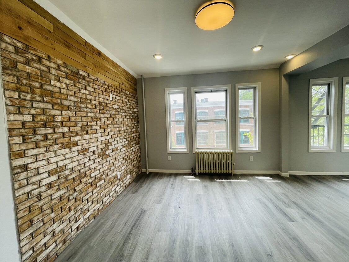
Modern living with a boutique feel. Our spacious 1 bedroom apartment offer a wonderful place for dining, entertainment, and relaxation. Our open layout and sleek design create a welcome atmosphere for residents and guests alike. Located close to Rutgers University, stores and restaurants. Stainless Steel appliances, washer and dryer in unit, Heat and cold water included. OPEN HOUSE Come and preview this apartments on Sunday June 11th at 2:45 PM -3:15 PM
421 Central is an apartment community located in Essex County and the 07107 ZIP Code. This area is served by the The Newark Public School District attendance zone.
The Fairmount neighborhood lies on the upper west side of Newark, tucked between University Heights and Lower Vailsburg. Fairmount is an urban locality made up of multifamily homes as well as the Holy Sepulcher Cemetery and Fairmount — a 150-acre Victorian resting ground with guided tours of mausoleums. The Fairmount community has many local restaurants and boutiques within a 10-minute drive. It's also a short drive to higher-education institutions and a bustling downtown area with retail and recreational options.
There’s a variety of apartments and townhomes here, all set within a convenient, walkable grid that makes it easy to explore the rest of the surrounding area. The Essex Freeway forms the northern border, making it easy to commute as well.
Learn more about living in FairmountCompare neighborhood and city base rent averages by bedroom.
| Fairmount | Newark, NJ | |
|---|---|---|
| Studio | $1,152 | $1,365 |
| 1 Bedroom | $1,070 | $1,611 |
| 2 Bedrooms | $1,399 | $2,024 |
| 3 Bedrooms | $1,553 | $2,121 |
| Colleges & Universities | Distance | ||
|---|---|---|---|
| Colleges & Universities | Distance | ||
| Walk: | 15 min | 0.8 mi | |
| Walk: | 18 min | 1.0 mi | |
| Walk: | 19 min | 1.0 mi | |
| Drive: | 8 min | 3.5 mi |


Transportation options available in Newark include Norfolk Street, located 0.4 mile from 421 Central. 421 Central is near Newark Liberty International, located 6.4 miles or 11 minutes away, and LaGuardia, located 27.6 miles or 41 minutes away.
| Transit / Subway | Distance | ||
|---|---|---|---|
| Transit / Subway | Distance | ||
|
|
Walk: | 8 min | 0.4 mi |
|
|
Walk: | 9 min | 0.5 mi |
|
|
Walk: | 13 min | 0.7 mi |
|
|
Walk: | 17 min | 0.9 mi |
|
|
Drive: | 2 min | 1.2 mi |
| Commuter Rail | Distance | ||
|---|---|---|---|
| Commuter Rail | Distance | ||
|
|
Drive: | 2 min | 1.2 mi |
|
|
Drive: | 2 min | 1.6 mi |
|
|
Drive: | 3 min | 1.9 mi |
|
|
Drive: | 3 min | 2.1 mi |
|
|
Drive: | 5 min | 2.5 mi |
| Airports | Distance | ||
|---|---|---|---|
| Airports | Distance | ||
|
Newark Liberty International
|
Drive: | 11 min | 6.4 mi |
|
LaGuardia
|
Drive: | 41 min | 27.6 mi |
Scores provided by
Traffic
-Airport
-Businesses
-Scores provided by
HowLoud What is a Sound Score Rating? A Sound Score Rating aggregates noise caused by vehicle traffic, airplane traffic and local sources. How It WorksTime and distance from 421 Central.
| Shopping Centers | Distance | ||
|---|---|---|---|
| Shopping Centers | Distance | ||
| Walk: | 9 min | 0.5 mi | |
| Walk: | 15 min | 0.8 mi | |
| Walk: | 16 min | 0.9 mi |
| Parks and Recreation | Distance | ||
|---|---|---|---|
| Parks and Recreation | Distance | ||
|
Newark Museum and Dreyfuss Planetarium
|
Walk: | 20 min | 1.1 mi |
|
Branch Brook Park
|
Drive: | 5 min | 2.2 mi |
|
Kearny Marsh
|
Drive: | 8 min | 4.2 mi |
|
Edison National Historic Site
|
Drive: | 8 min | 4.3 mi |
|
Richard W. DeKorte Park
|
Drive: | 13 min | 6.9 mi |
| Hospitals | Distance | ||
|---|---|---|---|
| Hospitals | Distance | ||
| Walk: | 9 min | 0.5 mi | |
| Walk: | 17 min | 0.9 mi | |
| Drive: | 2 min | 1.3 mi |
| Military Bases | Distance | ||
|---|---|---|---|
| Military Bases | Distance | ||
| Drive: | 16 min | 10.3 mi | |
| Drive: | 27 min | 13.8 mi | |
| Drive: | 32 min | 18.3 mi |
What Are Walk Score®, Transit Score®, and Bike Score® Ratings?
Walk Score® measures the walkability of any address. Transit Score® measures access to public transit. Bike Score® measures the bikeability of any address.
What is a Sound Score Rating?
A Sound Score Rating aggregates noise caused by vehicle traffic, airplane traffic and local sources.
421 Central Ave
Newark, NJ 07107


