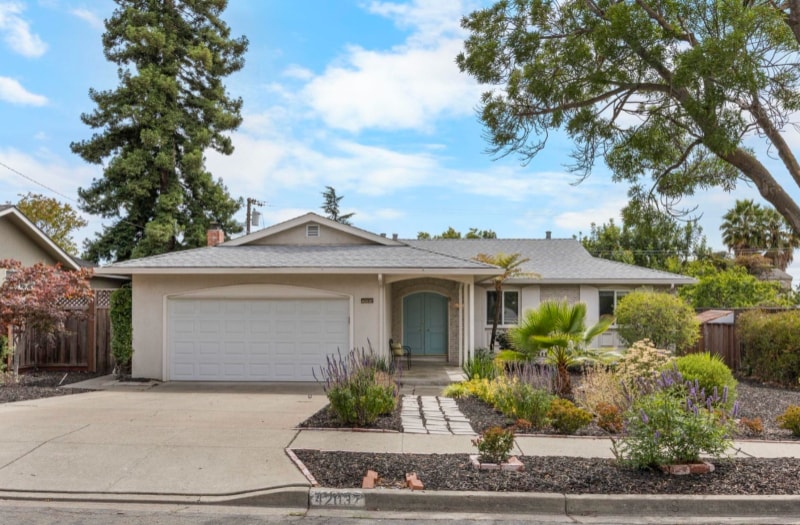
42037 Via San Gabriel
Fremont, CA 94539
-
Bedrooms
3
-
Bathrooms
2
-
Square Feet
1,502 sq ft
-
Available
Available Oct 1
Highlights
- Hardwood Floors
- Fireplace

About This Home
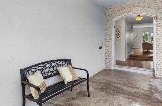
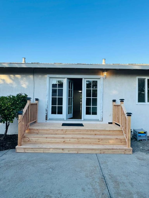
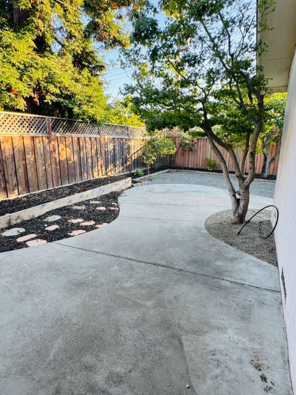
Property Id: 2153927 Welcome to this beautiful home in the Mission Valley neighborhood! WE ARE DOING OPEN HOUSE ON 26th Sep 2025 (FRIDAY) from 6 pm to 7 pm. If you need to visit urgently, please call. This north east facing residence is perfectly positioned in the heart of one of Fremont's most prestigious and award winning school zones, Chadbourne Elementary, Hopkins Middle, and Mission San Jose High, all ranked among the top public schools in California and just a short walk away. Featuring 3 spacious bedrooms and 2 updated bathrooms, this home is filled with natural light and showcases newly refinished hardwood flooring throughout. The bathrooms have been remodeled with a sleek, spa inspired design. Step outside into a peaceful backyard retreat. In addition to top rated schools, you'll be just a short stroll from several beautiful parks, including Mission San Jose Park and Lake Elizabeth. Easy access to the entire Bay area with just 5 minutes from the 680 freeway and only a few more to 880.
42037 Via San Gabriel is a house located in Alameda County and the 94539 ZIP Code.
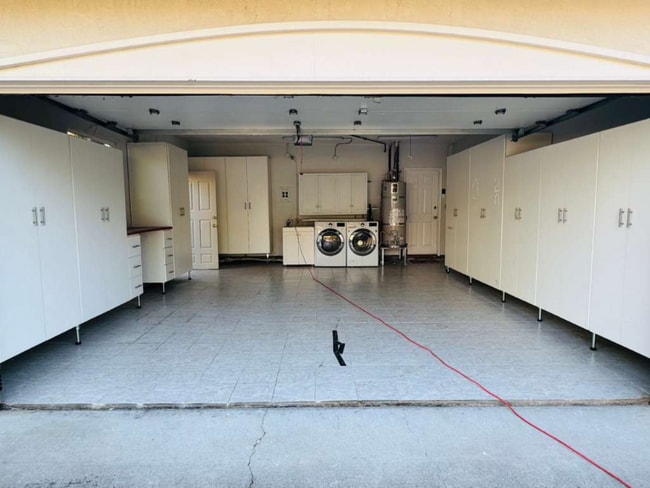
House Features
Washer/Dryer
Dishwasher
Hardwood Floors
Refrigerator
- Washer/Dryer
- Fireplace
- Dishwasher
- Disposal
- Oven
- Refrigerator
- Freezer
- Hardwood Floors
Fees and Policies
The fees below are based on community-supplied data and may exclude additional fees and utilities.
- Parking
-
Garage--
Contact
- Phone Number
- Contact
-
Source

- Washer/Dryer
- Fireplace
- Dishwasher
- Disposal
- Oven
- Refrigerator
- Freezer
- Hardwood Floors
Fremont is a charming city in the San Francisco Bay Area that sits across the Bay from the Silicon Valley. It is known as an ideal destination for families, offering kid-friendly attractions and excellent public schools like the Children’s Natural History Museum and Washington High School. The rapid expansion of the tech industry in recent years has boosted Fremont’s reputation as a commuter-friendly city for those working in the Silicon Valley. Fremont is located directly north of San Jose, and Palo Alto is a short drive across the Dumbarton Bridge on the Bay.
Fremont’s local culture incorporates the area’s rich history and thriving arts scene. Check out the Old Town Niles region that features a popular art walk, antique fair, and a museum celebrating the town’s role in the early days of motion picture production. Exquisite historic architecture is on display around the city, so be sure to explore Fremont’s picturesque streets that blend urban amenities and suburban neighborhoods.
Learn more about living in Fremont| Colleges & Universities | Distance | ||
|---|---|---|---|
| Colleges & Universities | Distance | ||
| Drive: | 4 min | 1.6 mi | |
| Drive: | 12 min | 7.0 mi | |
| Drive: | 23 min | 12.1 mi | |
| Drive: | 18 min | 12.4 mi |
Transportation options available in Fremont include Fremont, located 3.7 miles from 42037 Via San Gabriel. 42037 Via San Gabriel is near Norman Y Mineta San Jose International, located 16.5 miles or 22 minutes away, and Metro Oakland International, located 27.0 miles or 36 minutes away.
| Transit / Subway | Distance | ||
|---|---|---|---|
| Transit / Subway | Distance | ||
|
|
Drive: | 8 min | 3.7 mi |
|
|
Drive: | 8 min | 3.8 mi |
|
|
Drive: | 7 min | 4.0 mi |
|
|
Drive: | 14 min | 7.2 mi |
|
|
Drive: | 16 min | 11.1 mi |
| Commuter Rail | Distance | ||
|---|---|---|---|
| Commuter Rail | Distance | ||
| Drive: | 12 min | 5.5 mi | |
| Drive: | 11 min | 5.6 mi | |
| Drive: | 15 min | 11.4 mi | |
| Drive: | 15 min | 11.4 mi | |
| Drive: | 19 min | 14.1 mi |
| Airports | Distance | ||
|---|---|---|---|
| Airports | Distance | ||
|
Norman Y Mineta San Jose International
|
Drive: | 22 min | 16.5 mi |
|
Metro Oakland International
|
Drive: | 36 min | 27.0 mi |
Time and distance from 42037 Via San Gabriel.
| Shopping Centers | Distance | ||
|---|---|---|---|
| Shopping Centers | Distance | ||
| Drive: | 3 min | 1.1 mi | |
| Drive: | 4 min | 1.8 mi | |
| Drive: | 4 min | 1.9 mi |
| Parks and Recreation | Distance | ||
|---|---|---|---|
| Parks and Recreation | Distance | ||
|
Central Park (Lake Elizabeth)
|
Drive: | 7 min | 3.2 mi |
|
Niles Canyon Railway
|
Drive: | 8 min | 4.3 mi |
|
Mission Peak Regional Preserve
|
Drive: | 17 min | 4.5 mi |
|
Niles Community Park
|
Drive: | 10 min | 4.8 mi |
|
Quarry Lakes Regional Recreation Area
|
Drive: | 13 min | 6.4 mi |
| Hospitals | Distance | ||
|---|---|---|---|
| Hospitals | Distance | ||
| Drive: | 7 min | 3.6 mi | |
| Drive: | 9 min | 4.1 mi |
| Military Bases | Distance | ||
|---|---|---|---|
| Military Bases | Distance | ||
| Drive: | 28 min | 19.3 mi |
You May Also Like
What Are Walk Score®, Transit Score®, and Bike Score® Ratings?
Walk Score® measures the walkability of any address. Transit Score® measures access to public transit. Bike Score® measures the bikeability of any address.
What is a Sound Score Rating?
A Sound Score Rating aggregates noise caused by vehicle traffic, airplane traffic and local sources

42037 Via San Gabriel
Fremont, CA 94539