1 / 13


| Beds | Baths | Average SF |
|---|---|---|
| 2 Bedrooms 2 Bedrooms 2 Br | 2 Baths 2 Baths 2 Ba | 1,583 SF |
The fees below are based on community-supplied data and may exclude additional fees and utilities.
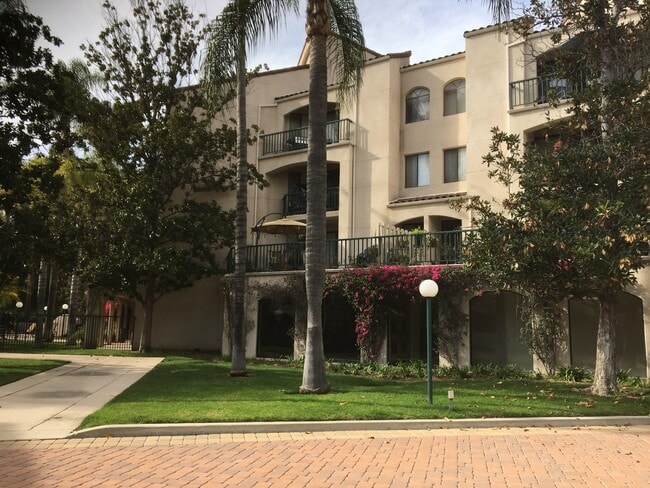
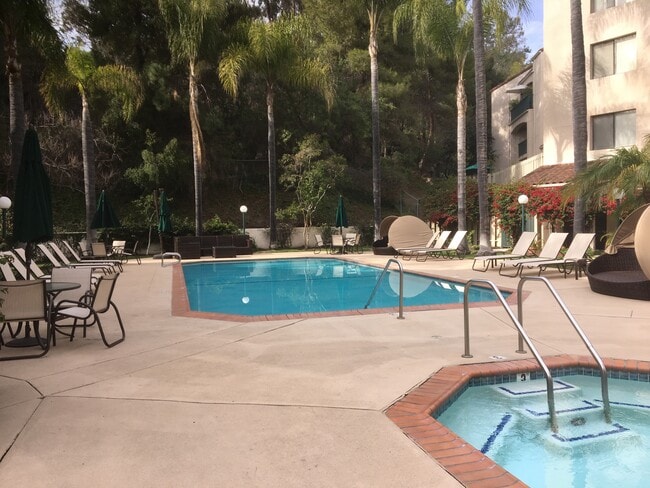
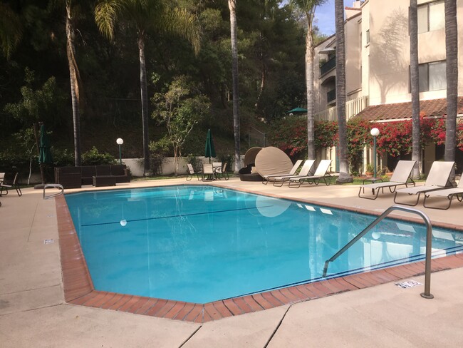
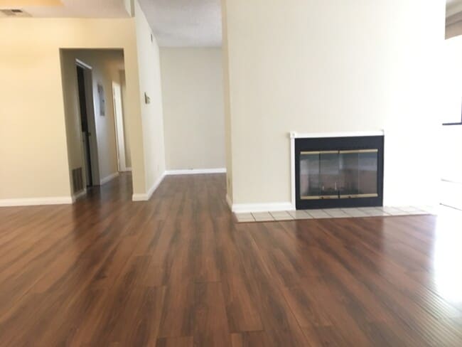
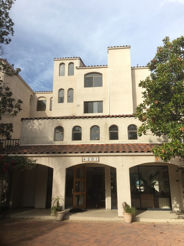
Large 2 bedroom 2 bath in gated community. A large pool, jacuzzi, gym, and underground reserved parking for 2 cars. High ceilings and large patio for outdoor entertaining. Master bedroom includes a huge walk-in closet. Quiet neighborhood, surrounded by trees. Close proximity to Pasadena, Downtown LA, USC, USC Medical Center. Laundry room with lots of storage space. Stainless steel appliances.
4201 Via Marisol Via is a condo located in Los Angeles County and the 90042 ZIP Code.
Washer/Dryer
Air Conditioning
Dishwasher
Walk-In Closets
A quiet suburb outside of Los Angeles, Monterey Hills is known for its rolling hills, winding residential streets, and elevated city views. Check out Elephant Hill, a popular place to bike or hike that offers beautiful views of the neighborhood. Herman Park is nestled along Highway 110 in the north end of the neighborhood, offering tennis courts, playgrounds, and a dog park. And for more outdoor recreation, visit the biking paths and hiking trails at Ernest E. Debs Regional Park, bordering Monterey Hills.
Monterey Hills is a more secluded part of Northeast Los Angeles with larger lots, single-family homes, and tree-lined streets. However, if you cross over Highway 110, you’ll find theatres, restaurants, services, and more. Monterey Hills is located just seven miles northeast of Downtown Los Angeles and eight miles east of major attractions such as Griffith Park, the Los Angeles Zoo, the Greek Theatre, and Glendale Galleria.
Learn more about living in Monterey Hills| Beds | Average Size | Lowest | Typical | Premium |
|---|---|---|---|---|
| Studio Studio Studio | 440 Sq Ft | $1,739 | $2,044 | $2,349 |
| 1 Bed 1 Bed 1 Bed | 581 Sq Ft | $1,300 | $1,932 | $2,350 |
| 2 Beds 2 Beds 2 Beds | 983-991 Sq Ft | $1,647 | $3,101 | $4,695 |
| 3 Beds 3 Beds 3 Beds | 1200 Sq Ft | $1,901 | $3,479 | $4,500 |
| 4 Beds 4 Beds 4 Beds | 889 Sq Ft | $880 | $2,461 | $4,200 |
| Colleges & Universities | Distance | ||
|---|---|---|---|
| Colleges & Universities | Distance | ||
| Drive: | 8 min | 3.7 mi | |
| Drive: | 10 min | 3.9 mi | |
| Drive: | 10 min | 4.0 mi | |
| Drive: | 8 min | 4.3 mi |
Transportation options available in Los Angeles include Highland Park Station, located 1.7 miles from 4201 Via Marisol Via Unit 127. 4201 Via Marisol Via Unit 127 is near Bob Hope, located 18.2 miles or 26 minutes away, and Los Angeles International, located 21.2 miles or 34 minutes away.
| Transit / Subway | Distance | ||
|---|---|---|---|
| Transit / Subway | Distance | ||
|
|
Drive: | 4 min | 1.7 mi |
|
|
Drive: | 6 min | 2.9 mi |
|
|
Drive: | 7 min | 3.2 mi |
|
|
Drive: | 6 min | 3.3 mi |
|
|
Drive: | 7 min | 3.9 mi |
| Commuter Rail | Distance | ||
|---|---|---|---|
| Commuter Rail | Distance | ||
|
|
Drive: | 12 min | 5.2 mi |
|
|
Drive: | 11 min | 5.3 mi |
|
|
Drive: | 13 min | 7.4 mi |
| Drive: | 14 min | 9.2 mi | |
|
|
Drive: | 20 min | 10.0 mi |
| Airports | Distance | ||
|---|---|---|---|
| Airports | Distance | ||
|
Bob Hope
|
Drive: | 26 min | 18.2 mi |
|
Los Angeles International
|
Drive: | 34 min | 21.2 mi |
Time and distance from 4201 Via Marisol Via Unit 127.
| Shopping Centers | Distance | ||
|---|---|---|---|
| Shopping Centers | Distance | ||
| Drive: | 3 min | 1.5 mi | |
| Drive: | 5 min | 2.0 mi | |
| Drive: | 5 min | 2.2 mi |
| Parks and Recreation | Distance | ||
|---|---|---|---|
| Parks and Recreation | Distance | ||
|
Audubon Center at Debs Park
|
Drive: | 5 min | 2.2 mi |
|
Chavez Ravine Arboretum
|
Drive: | 10 min | 5.9 mi |
|
Elysian Park
|
Drive: | 13 min | 5.9 mi |
|
Elyria Canyon Park
|
Drive: | 12 min | 6.2 mi |
|
Marsh Park
|
Drive: | 13 min | 6.5 mi |
| Hospitals | Distance | ||
|---|---|---|---|
| Hospitals | Distance | ||
| Drive: | 7 min | 3.4 mi | |
| Drive: | 8 min | 3.5 mi | |
| Drive: | 8 min | 4.2 mi |
| Military Bases | Distance | ||
|---|---|---|---|
| Military Bases | Distance | ||
| Drive: | 31 min | 22.8 mi | |
| Drive: | 42 min | 26.9 mi |


What Are Walk Score®, Transit Score®, and Bike Score® Ratings?
Walk Score® measures the walkability of any address. Transit Score® measures access to public transit. Bike Score® measures the bikeability of any address.
What is a Sound Score Rating?
A Sound Score Rating aggregates noise caused by vehicle traffic, airplane traffic and local sources
4201 Via Marisol Via
Los Angeles, CA 90042
