
$3,095 / Month
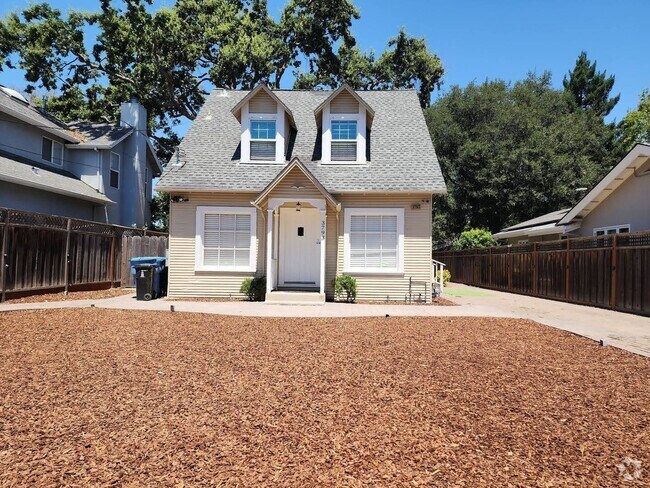
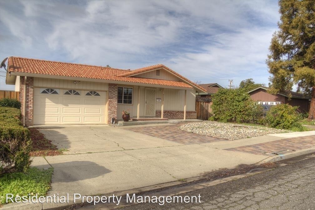
41755 Sherwood St
Fremont, CA 94538
2 Weeks Ago
Favorites
41755 Sherwood St

Favorites
Check Back Soon for Upcoming Availability
| Beds | Baths | Average SF |
|---|---|---|
| 3 Bedrooms 3 Bedrooms 3 Br | 2 Baths 2 Baths 2 Ba | 1,118 SF |
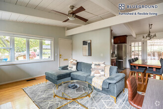
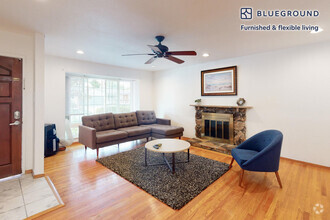
About This Property
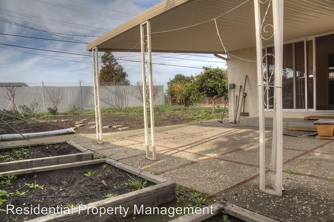
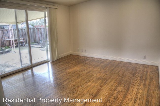
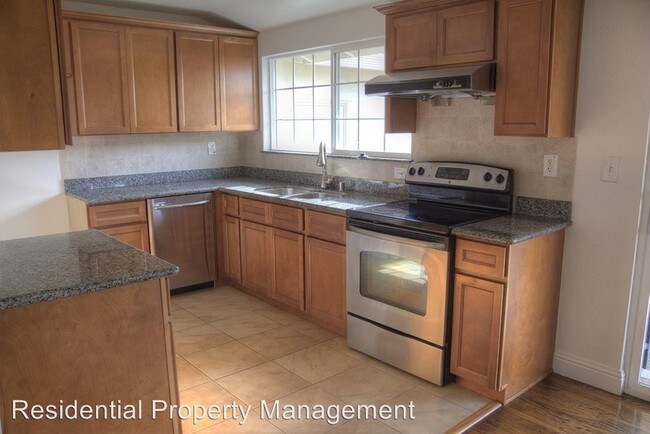
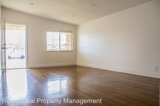
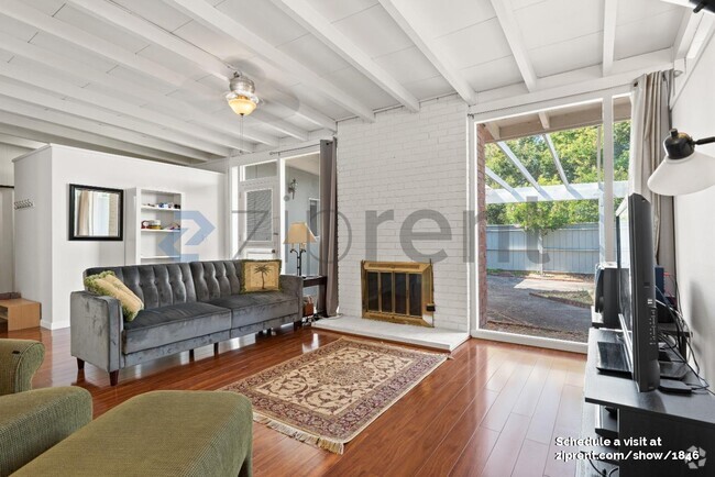
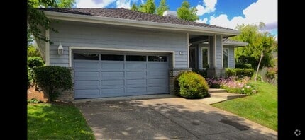
(510) 793-1700 - Irvington Attendance area! email for showing appointment - Irvington attendance area! Nice home Walking distance to Hirsch Elementary, Horner Middle, Irvington High. Cute home in desirable neighborhood. 3 bedroom 2 full bath with hardwood floors, dual pane windows and ready to move in! No section 8, good reference, credit and rental history. Email any questions with contact info for showing instructions. Easy to see! Apply online at www.bayarea-rent.com (RLNE2035126)
41755 Sherwood St is a house located in Alameda County and the 94538 ZIP Code. This area is served by the Fremont Unified attendance zone.
Location
Get Directions
Irvington is a diverse, family-friendly suburb about two miles south of Downtown Fremont. Complemented by palm tree-lined streets, Irvington offers affordable to upscale rentals available in a variety of styles, including single-family homes and apartments. Great for families, Irvington is home to several excellent schools. Although residents certainly enjoy proximity to downtown’s abundant dining and shopping options, Irvington has a small commercial center in the middle of the neighborhood filled with authentic global eateries, boutiques, and grocery stores. This central area is also home to the Irvington Farmers Market and the Fremont Bay Saint Farmers Market. Irvington borders Central Park to the north, providing residents with a day of fun outdoors with its dynamic facilities that include a skate park, golf course, and water park.
Learn more about living in IrvingtonBelow are rent ranges for similar nearby apartments
Education
| Colleges & Universities | Distance | ||
|---|---|---|---|
| Colleges & Universities | Distance | ||
| Drive: | 6 min | 3.2 mi | |
| Drive: | 9 min | 4.3 mi | |
| Drive: | 17 min | 10.9 mi | |
| Drive: | 21 min | 14.9 mi |
41755 Sherwood St is within 6 minutes or 3.2 miles from Ohlone College, Newark. It is also near Ohlone College, Fremont Campus and Palmer College of Chiropractic West Campus.
Schools


Public Elementary School
Grades K-5
270 Students
Nearby
Public Elementary School
Grades K-5
419 Students
Attendance Zone
Public Middle School
Grades 6-8
1,562 Students
Attendance Zone
Public High School
Grades 9-12
2,207 Students
Attendance Zone
Private Elementary School
Grades PK-6
231 Students
Nearby
Private Elementary & Middle School
Grades K-8
190 Students
Nearby
Private Middle & High School
Grades 7-12
27 Students
Nearby
School data provided by
 The GreatSchools Rating helps parents compare schools within a state based on a variety of school quality indicators and provides a helpful picture of how effectively each school serves all of its students. Ratings are on a scale of 1 (below average) to 10 (above average) and can include test scores, college readiness, academic progress, advanced courses, equity, discipline and attendance data. We also advise parents to visit schools, consider other information on school performance and programs, and consider family needs as part of the school selection process.
View GreatSchools Rating Methodology
View GreatSchools Rating Methodology
Transportation options available in Fremont include Warm Springs / South Fremont, located 2.8 miles from 41755 Sherwood St. 41755 Sherwood St is near Norman Y Mineta San Jose International, located 14.9 miles or 21 minutes away, and Metro Oakland International, located 22.8 miles or 30 minutes away.
| Transit / Subway | Distance | ||
|---|---|---|---|
| Transit / Subway | Distance | ||
|
|
Drive: | 5 min | 2.8 mi |
|
|
Drive: | 8 min | 3.4 mi |
|
|
Drive: | 14 min | 8.3 mi |
|
|
Drive: | 14 min | 9.7 mi |
|
|
Drive: | 15 min | 10.1 mi |
| Commuter Rail | Distance | ||
|---|---|---|---|
| Commuter Rail | Distance | ||
| Drive: | 9 min | 4.3 mi | |
| Drive: | 18 min | 12.5 mi | |
| Drive: | 20 min | 14.3 mi | |
| Drive: | 23 min | 15.6 mi | |
| Drive: | 23 min | 16.2 mi |
| Airports | Distance | ||
|---|---|---|---|
| Airports | Distance | ||
|
Norman Y Mineta San Jose International
|
Drive: | 21 min | 14.9 mi |
|
Metro Oakland International
|
Drive: | 30 min | 22.8 mi |
Time and distance from 41755 Sherwood St.
| Shopping Centers | Distance | ||
|---|---|---|---|
| Shopping Centers | Distance | ||
| Walk: | 10 min | 0.5 mi | |
| Walk: | 14 min | 0.7 mi | |
| Drive: | 2 min | 1.2 mi |
41755 Sherwood St has 3 shopping centers within 1.2 miles, which is about a 2-minute walk. The miles and minutes will be for the farthest away property.
| Parks and Recreation | Distance | ||
|---|---|---|---|
| Parks and Recreation | Distance | ||
|
Central Park (Lake Elizabeth)
|
Drive: | 8 min | 3.4 mi |
|
Niles Canyon Railway
|
Drive: | 11 min | 5.8 mi |
|
Niles Community Park
|
Drive: | 13 min | 6.4 mi |
|
Quarry Lakes Regional Recreation Area
|
Drive: | 11 min | 6.6 mi |
|
Alameda Creek Regional Trail
|
Drive: | 11 min | 6.8 mi |
41755 Sherwood St has 5 parks within 6.8 miles, including Central Park (Lake Elizabeth), Niles Canyon Railway, and Quarry Lakes Regional Recreation Area.
| Hospitals | Distance | ||
|---|---|---|---|
| Hospitals | Distance | ||
| Drive: | 6 min | 2.8 mi | |
| Drive: | 8 min | 3.7 mi |
41755 Sherwood St is 2.8 miles from Kaiser Foundation Hospital - Fremont, and is convenient to other hospitals, including Washington Hospital.
| Military Bases | Distance | ||
|---|---|---|---|
| Military Bases | Distance | ||
| Drive: | 26 min | 17.7 mi |
41755 Sherwood St is 17.7 miles and a 26 minute drive from Ames Research Center.
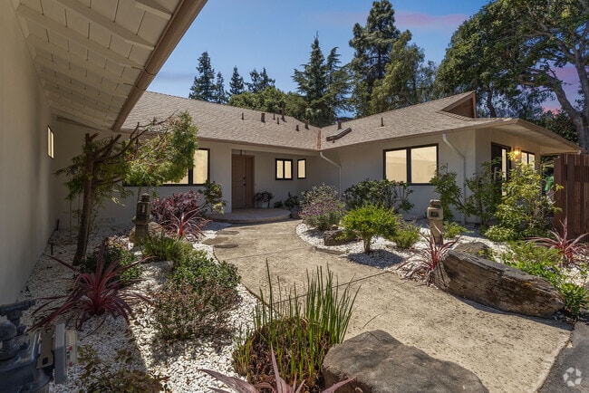
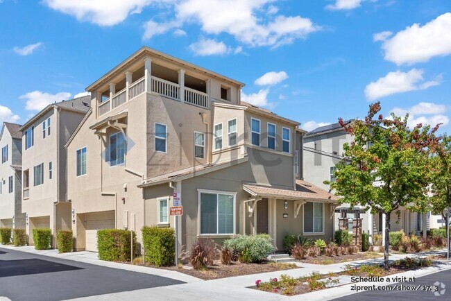
You May Also Like
Similar Rentals Nearby
What Are Walk Score®, Transit Score®, and Bike Score® Ratings?
Walk Score® measures the walkability of any address. Transit Score® measures access to public transit. Bike Score® measures the bikeability of any address.
What is a Sound Score Rating?
A Sound Score Rating aggregates noise caused by vehicle traffic, airplane traffic and local sources
41755 Sherwood St
Fremont, CA 94538