$2,200
/ Month
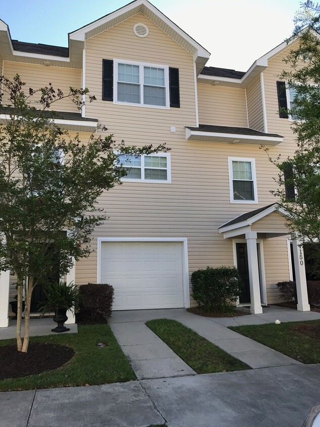
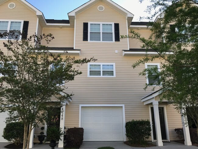
4150 Perrine St
Charleston, SC 29414
Favorites
-
Bedrooms
2
-
Bathrooms
2.5
-
Square Feet
1,525 sq ft
4150 Perrine St

Favorites
About This Home
$2,200 deposit
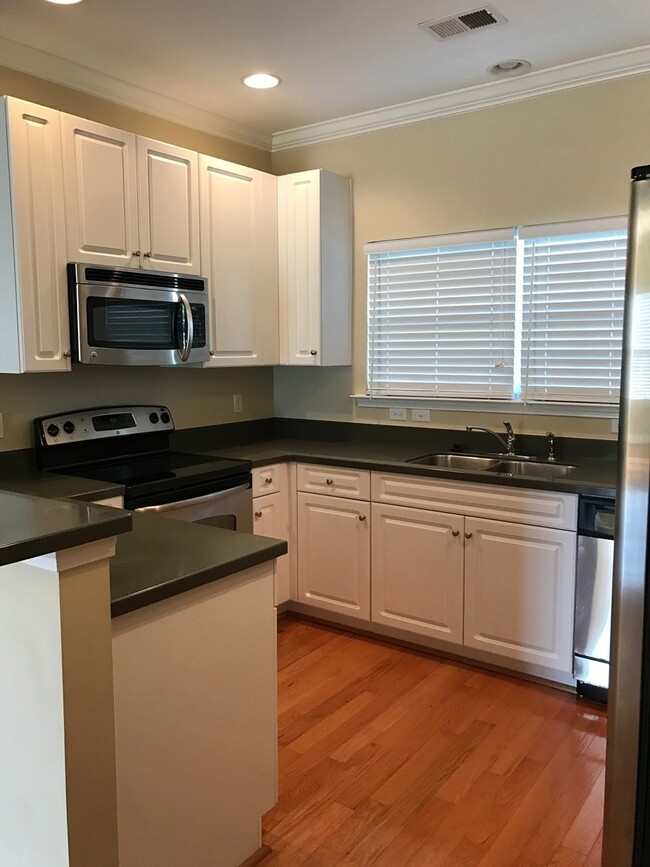
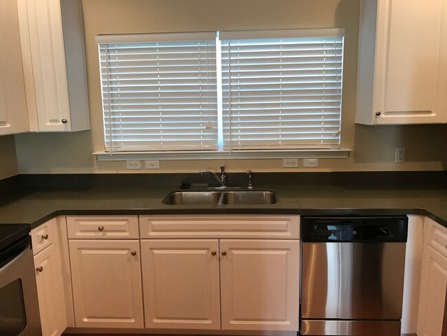
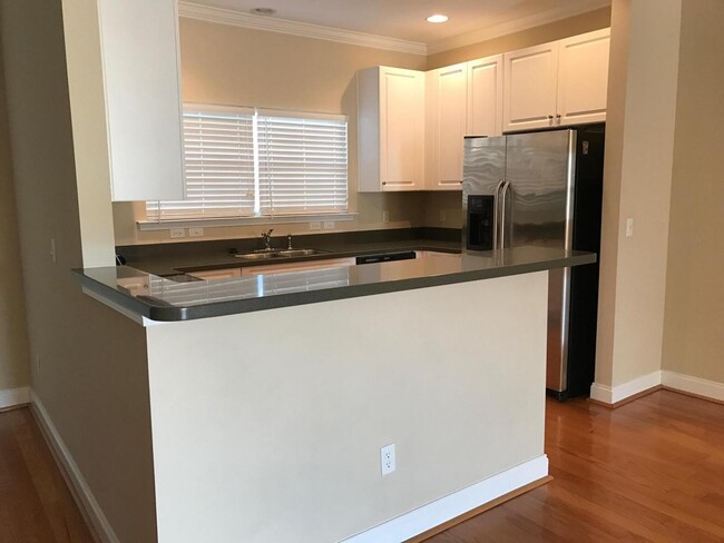
MAY MOVE IN SPECIAL! Move in by May 31st and receive $500 off your first month's rent! Beautiful town home with 2 car tandem garage. Huge over sized garage and foyer entrance complete level one. Level 2 has dining room looking out onto the pond, family room with gas fire place, gourmet kitchen with stainless appliances and a guest bath. There is an office nook at the foot of the stair case on this level. On level 3 are two bedrooms set up as dual masters. Close to shopping, restaurants, I-526, Boeing and so much more. All CREC PM residents are enrolled in the Resident Benefits Package (RBP) for $54.95/month which includes liability insurance, HVAC air filter delivery (for applicable properties), move-in concierge service, on-demand pest control, and more! More details upon application.
4150 Perrine St is a house located in Charleston County and the 29414 ZIP Code. This area is served by the Charleston 01 School District attendance zone.
* Price shown is base rent. Excludes user-selected optional fees and variable or usage-based fees and required charges due at or prior to move-in or at move-out. Price, availability, fees, and any applicable rent special are subject to change without notice.
* Square footage definitions vary. Displayed square footage is approximate.
Contact
- Listed by CREC Property Management | CREC Property Management
Location
Get Directions
West Ashley sits within the city of Charleston and is west of the Ashley River, hence its name, and is the birthplace of Hootie & the Blowfish’s frontman, Darius Rucker. Lined with mossy oaks, the Ashley and Stono Rivers border West Ashley, creating the breathtaking scenery for which Charleston is known. West Ashley residents enjoy close proximity to the area's only indoor mall, the Citadel Mall, and a large number of big-box stores.
Situated seven miles due west of Downtown Charleston, residents can plan on a 15- to 30-minute drive, depending on traffic, to take in all downtown has to offer. Nearby Interstate 526, which feeds directly into Charleston’s Interstate Highway 26, gives residents a fast and easy route in and out of area. Mid- to late-1900s ranch-style homes characterize the housing in outer West Ashley, but neighborhoods built in the 2000s also sprinkle the area.
Learn more about living in West Ashley
Education
| Colleges & Universities | Distance | ||
|---|---|---|---|
| Colleges & Universities | Distance | ||
| Drive: | 11 min | 5.6 mi | |
| Drive: | 16 min | 8.2 mi | |
| Drive: | 19 min | 9.5 mi | |
| Drive: | 19 min | 9.5 mi |
4150 Perrine St is within 11 minutes or 5.6 miles from Southern Wesleyan, Charleston. It is also near Medical Univ. of S.C. and The Citadel.
Schools


Public Elementary School
Grades PK-5
621 Students
Attendance Zone
Public Middle School
Grades 6-8
1,172 Students
Attendance Zone
Public High School
Grades 9-12
1,935 Students
Attendance Zone
Private Elementary, Middle & High School
Grades PK-12
Nearby
Private Elementary, Middle & High School
Grades K-12
64 Students
Nearby
School data provided by
 The GreatSchools Rating helps parents compare schools within a state based on a variety of school quality indicators and provides a helpful picture of how effectively each school serves all of its students. Ratings are on a scale of 1 (below average) to 10 (above average) and can include test scores, college readiness, academic progress, advanced courses, equity, discipline and attendance data. We also advise parents to visit schools, consider other information on school performance and programs, and consider family needs as part of the school selection process.
View GreatSchools Rating Methodology
Data provided by GreatSchools.org © 2026. All rights reserved.
View GreatSchools Rating Methodology
Data provided by GreatSchools.org © 2026. All rights reserved.
Getting Around
 What do Walkability, Transit, Drivability, and Bikeability mean?
Walkability measures the walking distance to day-to-day needs.
Transit measures access to public transportation.
Drivability measures congestion, parking availability, and access to major roads.
Bikeability measures the suitability for cycling.
How It Works
What do Walkability, Transit, Drivability, and Bikeability mean?
Walkability measures the walking distance to day-to-day needs.
Transit measures access to public transportation.
Drivability measures congestion, parking availability, and access to major roads.
Bikeability measures the suitability for cycling.
How It Works
Somewhat Walkable
Walkability
30
/ 100
Limited Public Transit
Transit
30
/ 100
Very Drivable
Drivability
80
/ 100
Fairly Bikeable
Bikeability
40
/ 100
Scores provided by
-
Soundscore™
-
/ 100
Traffic
-Airport
-Businesses
-Scores provided by
HowLoud What is a Sound Score Rating? A Sound Score Rating aggregates noise caused by vehicle traffic, airplane traffic and local sources. How It WorksYou May Also Like
Similar Rentals Nearby
-
-
-
3 Beds$2,265+4 Beds$2,518+5 Beds$2,994Total Monthly Price12 Month LeaseTotal Monthly Price NewPrices include required monthly fees of $95.Base Rent:3 Beds$2,170+4 Beds$2,423+5 Beds$2,899+2 Months Free
-
-
-
 3 Beds$2,110Total Monthly PriceTotal Monthly Price NewPrices include all required monthly fees.House for Rent
 -
 3 Beds$2,095Total Monthly PriceTotal Monthly Price NewPrices include all required monthly fees.House for Rent
 -
 5 Beds$2,655Total Monthly PriceTotal Monthly Price NewPrices include all required monthly fees.House for Rent
 -
 5 Beds$2,765Total Monthly PriceTotal Monthly Price NewPrices include all required monthly fees.House for Rent
 -
 4 Beds$2,860Total Monthly PriceTotal Monthly Price NewPrices include all required monthly fees.House for Rent


What Are Walk Score®, Transit Score®, and Bike Score® Ratings?
Walk Score® measures the walkability of any address. Transit Score® measures access to public transit. Bike Score® measures the bikeability of any address.
What is a Sound Score Rating?
A Sound Score Rating aggregates noise caused by vehicle traffic, airplane traffic and local sources.

4150 Perrine St
Charleston, SC 29414