$2,350
/ Month
4134 Veritas St
Charleston, SC 29414
Favorites
4134 Veritas St

Favorites
Check Back Soon for Upcoming Availability
| Beds | Baths | Average SF |
|---|---|---|
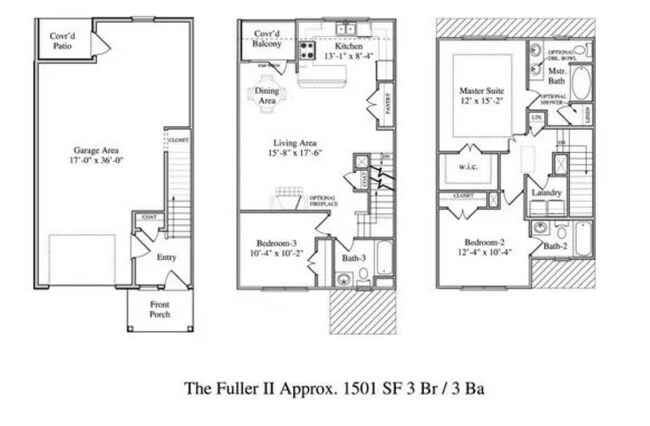
| 3 Bedrooms 3 Bedrooms 3 Br | 3 Baths 3 Baths 3 Ba | 1,501 SF |
Fees and Policies
The fees listed below are community-provided and may exclude utilities or add-ons. All payments are made directly to the property and are non-refundable unless otherwise specified.
- Dogs Allowed
-
Fees not specified
-
Weight limit--
-
Pet Limit--
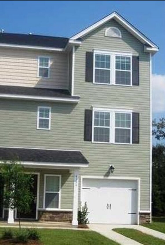
About This Property
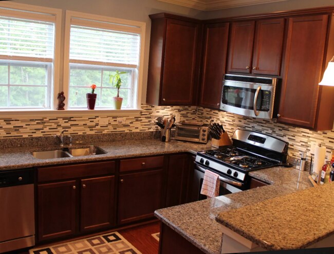
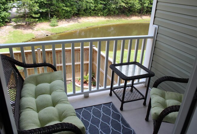
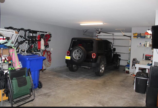
Beautiful End Unit Townhome on a pond, with 2 car garage, lots of storage space, hardwood floors, and stainless appliances. Lovely end unit in a quiet neighborhood, with friendly neighbors. 1500 sqft PLUS a large 2 car garage, fenced in backyard with a patio, front porch, and back balcony. Great outdoor space overlooking a pond, and plenty of closets/storage space. Open concept kitchen/living room/dining area with hardwood floors. Kitchen has granite counters and stainless appliances, gas stove, dishwasher. Spacious master suite. Washer/dryer included and workbench. Close to 526, 10min to airport, 15min to downtown.
4134 Veritas St is a townhome located in Charleston County and the 29414 ZIP Code. This area is served by the Charleston 01 School District attendance zone.
Townhome Features
- Washer/Dryer
- Washer/Dryer Hookup
- Dishwasher
- Balcony
4134 Veritas St,
Charleston,
SC
29414
West Ashley sits within the city of Charleston and is west of the Ashley River, hence its name, and is the birthplace of Hootie & the Blowfish’s frontman, Darius Rucker. Lined with mossy oaks, the Ashley and Stono Rivers border West Ashley, creating the breathtaking scenery for which Charleston is known. West Ashley residents enjoy close proximity to the area's only indoor mall, the Citadel Mall, and a large number of big-box stores.
Situated seven miles due west of Downtown Charleston, residents can plan on a 15- to 30-minute drive, depending on traffic, to take in all downtown has to offer. Nearby Interstate 526, which feeds directly into Charleston’s Interstate Highway 26, gives residents a fast and easy route in and out of area. Mid- to late-1900s ranch-style homes characterize the housing in outer West Ashley, but neighborhoods built in the 2000s also sprinkle the area.
Learn more about living in West AshleyBelow are rent ranges for similar nearby apartments
Amenities
- Washer/Dryer
- Washer/Dryer Hookup
- Dishwasher
- Balcony
Education
| Colleges & Universities | Distance | ||
|---|---|---|---|
| Colleges & Universities | Distance | ||
| Drive: | 11 min | 5.7 mi | |
| Drive: | 16 min | 8.3 mi | |
| Drive: | 19 min | 9.5 mi | |
| Drive: | 19 min | 9.6 mi |
4134 Veritas St is within 11 minutes or 5.7 miles from Southern Wesleyan, Charleston. It is also near Medical Univ. of S.C. and The Citadel.
Schools


Public Elementary School
Grades PK-5
621 Students
Attendance Zone
Public Middle School
Grades 6-8
1,172 Students
Attendance Zone
Public High School
Grades 9-12
1,935 Students
Attendance Zone
Private Elementary, Middle & High School
Grades K-12
64 Students
Nearby
Private Elementary, Middle & High School
Grades PK-12
Nearby
School data provided by
 The GreatSchools Rating helps parents compare schools within a state based on a variety of school quality indicators and provides a helpful picture of how effectively each school serves all of its students. Ratings are on a scale of 1 (below average) to 10 (above average) and can include test scores, college readiness, academic progress, advanced courses, equity, discipline and attendance data. We also advise parents to visit schools, consider other information on school performance and programs, and consider family needs as part of the school selection process.
View GreatSchools Rating Methodology
Data provided by GreatSchools.org © 2026. All rights reserved.
View GreatSchools Rating Methodology
Data provided by GreatSchools.org © 2026. All rights reserved.
Walkability Near 4134 Veritas St Charleston, SC 29414
Getting Around
 What do Walkability, Transit, Drivability, and Bikeability mean?
Walkability measures the walking distance to day-to-day needs.
Transit measures access to public transportation.
Drivability measures congestion, parking availability, and access to major roads.
Bikeability measures the suitability for cycling.
How It Works
What do Walkability, Transit, Drivability, and Bikeability mean?
Walkability measures the walking distance to day-to-day needs.
Transit measures access to public transportation.
Drivability measures congestion, parking availability, and access to major roads.
Bikeability measures the suitability for cycling.
How It Works
Somewhat Walkable
Walkability
30
/ 100
Limited Public Transit
Transit
30
/ 100
Very Drivable
Drivability
80
/ 100
Fairly Bikeable
Bikeability
40
/ 100
Scores provided by
-
Soundscore™
-
/ 100
Traffic
-Airport
-Businesses
-Scores provided by
HowLoud What is a Sound Score Rating? A Sound Score Rating aggregates noise caused by vehicle traffic, airplane traffic and local sources. How It WorksYou May Also Like
-
Shadowmoss Pointe Apartments and Townhomes
1052 Shadow Arbor Cir
Charleston, SC 29414
$2,102 - $3,625
3 Br 1.5 mi
-
Amberwood Townhomes
4995 Lambs Rd
North Charleston, SC 29418
$1,440 - $1,480
3 Br 4.5 mi
-
Bridge Pointe Apartments and Townhomes
100 Bridge Pointe Ln
Summerville, SC 29485
$2,043 - $3,542
3 Br 12.2 mi
Similar Rentals Nearby
-
-
-
-
-
1 / 45

-
-
-
-
-


What Are Walk Score®, Transit Score®, and Bike Score® Ratings?
Walk Score® measures the walkability of any address. Transit Score® measures access to public transit. Bike Score® measures the bikeability of any address.
What is a Sound Score Rating?
A Sound Score Rating aggregates noise caused by vehicle traffic, airplane traffic and local sources.

4134 Veritas St
Charleston, SC 29414