
Woodside Central
6902 Queens Blvd,
Woodside, NY 11377
$2,675 - $4,350
Studio - 2 Beds
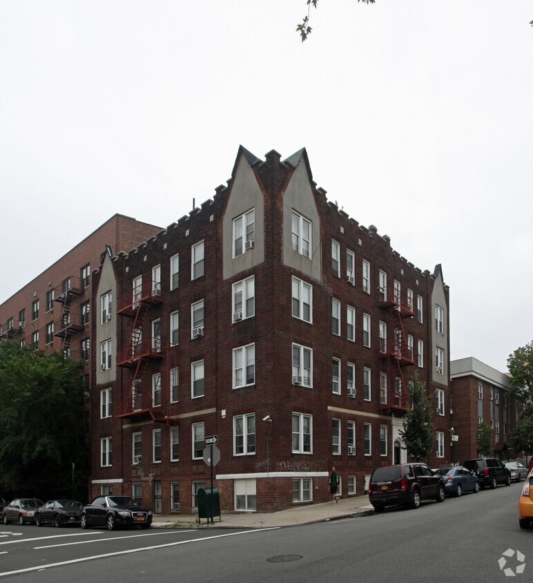
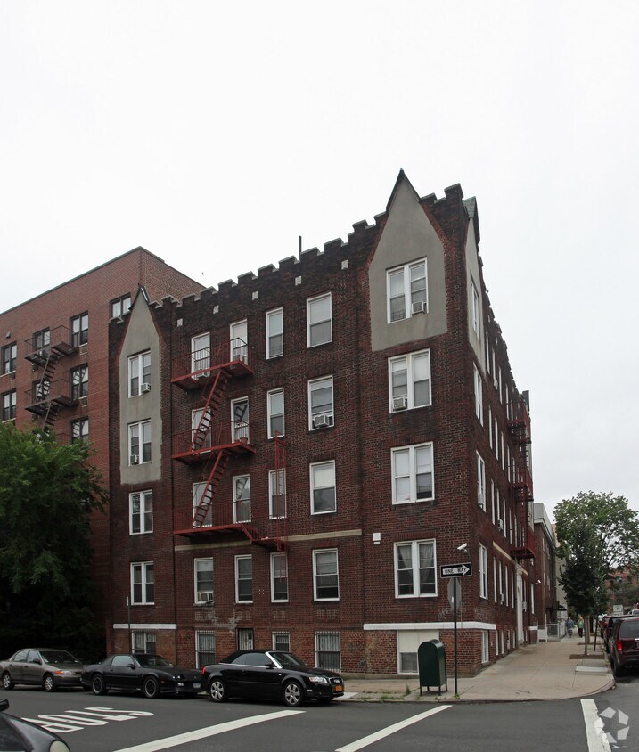

Thanks for your interest in 41-01 67th St. This property is situated on 67th St. in Woodside. The leasing team is excited to help you find your perfect home. Contact us today to learn more about our community and make your move to 41-01 67th St.
41-01 67th St is an apartment community located in Queens County and the 11377 ZIP Code. This area is served by the New York City Geographic District #30 attendance zone.
Woodside is a Queens neighborhood where Roosevelt Avenue hums with energy while the residential blocks just a few streets away stay genuinely quiet. Situated in the western part of the borough, it sits between Sunnyside to the west and Jackson Heights to the east, giving it a geographic ease that makes the rest of the city feel close. The 7 train cuts directly through the neighborhood, offering a reliable connection to Midtown Manhattan and making it a practical base for anyone working in or frequently visiting the city's core.
The housing stock here leans toward low- and mid-rise apartment communities, co-ops, and attached rowhouses that reflect the area's deep residential roots dating back to large-scale development in the 1860s. Studios and one-bedroom units are common, though two- and three-bedroom options exist throughout the neighborhood's quieter corridors.
Learn more about living in WoodsideCompare neighborhood and city base rent averages by bedroom.
| Northwestern Queens | Woodside, NY | |
|---|---|---|
| Studio | $2,393 | $2,400 |
| 1 Bedroom | $3,073 | $2,311 |
| 2 Bedrooms | $4,533 | $3,032 |
| 3 Bedrooms | $6,104 | $3,257 |
| Colleges & Universities | Distance | ||
|---|---|---|---|
| Colleges & Universities | Distance | ||
| Drive: | 5 min | 2.1 mi | |
| Drive: | 10 min | 4.6 mi | |
| Drive: | 11 min | 4.8 mi | |
| Drive: | 11 min | 5.0 mi |


Transportation options available in Woodside include 69 Street, located 0.2 mile from 41-01 67th St. 41-01 67th St is near LaGuardia, located 3.4 miles or 8 minutes away, and John F Kennedy International, located 12.0 miles or 20 minutes away.
| Transit / Subway | Distance | ||
|---|---|---|---|
| Transit / Subway | Distance | ||
|
|
Walk: | 3 min | 0.2 mi |
|
|
Walk: | 7 min | 0.4 mi |
|
|
Walk: | 8 min | 0.4 mi |
|
|
Walk: | 8 min | 0.5 mi |
|
|
Drive: | 3 min | 1.1 mi |
| Commuter Rail | Distance | ||
|---|---|---|---|
| Commuter Rail | Distance | ||
|
|
Walk: | 7 min | 0.4 mi |
|
|
Drive: | 7 min | 2.8 mi |
|
|
Drive: | 11 min | 3.6 mi |
|
|
Drive: | 9 min | 3.7 mi |
|
|
Drive: | 11 min | 3.8 mi |
| Airports | Distance | ||
|---|---|---|---|
| Airports | Distance | ||
|
LaGuardia
|
Drive: | 8 min | 3.4 mi |
|
John F Kennedy International
|
Drive: | 20 min | 12.0 mi |
Scores provided by
Traffic
BusyAirport
BusyBusinesses
BusyScores provided by
HowLoud What is a Sound Score Rating? A Sound Score Rating aggregates noise caused by vehicle traffic, airplane traffic and local sources. How It WorksTime and distance from 41-01 67th St.
| Shopping Centers | Distance | ||
|---|---|---|---|
| Shopping Centers | Distance | ||
| Walk: | 10 min | 0.6 mi | |
| Drive: | 4 min | 1.2 mi | |
| Drive: | 6 min | 1.5 mi |
| Parks and Recreation | Distance | ||
|---|---|---|---|
| Parks and Recreation | Distance | ||
|
Travers Park
|
Drive: | 4 min | 1.4 mi |
|
Linden Park
|
Drive: | 6 min | 2.3 mi |
|
Juniper Valley Park
|
Drive: | 8 min | 2.5 mi |
|
New York Hall of Science
|
Drive: | 8 min | 3.1 mi |
|
Queens Zoo
|
Drive: | 8 min | 3.1 mi |
| Hospitals | Distance | ||
|---|---|---|---|
| Hospitals | Distance | ||
| Walk: | 12 min | 0.6 mi | |
| Drive: | 9 min | 3.8 mi | |
| Drive: | 10 min | 4.7 mi |
| Military Bases | Distance | ||
|---|---|---|---|
| Military Bases | Distance | ||
| Drive: | 18 min | 9.0 mi | |
| Drive: | 22 min | 9.8 mi |
What Are Walk Score®, Transit Score®, and Bike Score® Ratings?
Walk Score® measures the walkability of any address. Transit Score® measures access to public transit. Bike Score® measures the bikeability of any address.
What is a Sound Score Rating?
A Sound Score Rating aggregates noise caused by vehicle traffic, airplane traffic and local sources.


