
39-78-78 47th St
39-78-78 47th St,
Queens, NY 11104
$6,200
2 Beds

Discover your new place at 4039 48th St. This community is located on 48th St. in Sunnyside. From amenities to floor plan options, the professional leasing team is available to help you find your perfect home. Drop by the leasing office to learn more about our community and find your new home at 4039 48th St.
4039 48th St is an apartment community located in Queens County and the 11104 ZIP Code. This area is served by the New York City Geographic District #30 attendance zone.
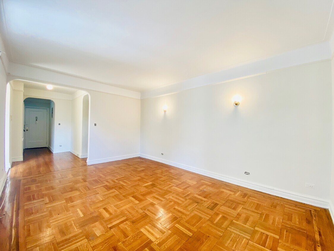
Hardwood Floors
Walk-In Closets
Refrigerator
Tub/Shower
Sunnyside, a historic neighborhood in Queens, has a reputation of being an affordable place to live while still offering convenient access to Manhattan and Brooklyn. Rentals tend to be reasonably priced by New York standards, with numerous apartments, houses, and condos for rent. Great schools paired with peaceful streets make Sunnyside an ideal spot to settle down outside of the big city. Multiple subway stops along Queens Boulevard and another on Roosevelt Avenue make it easy to get around New York without having to walk far for a ride. The ride to Times Square is just fifteen minutes via the 7 Train.
The neighborhood is also known for its progressive nature and artsy vibe with art galleries, studios, and public art lining the streets. Sunnyside’s population is incredibly diverse, displayed through the cultures that make up the community.
Learn more about living in SunnysideCompare neighborhood and city base rent averages by bedroom.
| Northwestern Queens | Sunnyside, NY | |
|---|---|---|
| Studio | $2,459 | $1,892 |
| 1 Bedroom | $3,229 | $2,058 |
| 2 Bedrooms | $4,790 | $2,687 |
| 3 Bedrooms | $7,117 | $3,811 |
| Colleges & Universities | Distance | ||
|---|---|---|---|
| Colleges & Universities | Distance | ||
| Drive: | 3 min | 1.3 mi | |
| Drive: | 8 min | 3.8 mi | |
| Drive: | 9 min | 3.9 mi | |
| Drive: | 9 min | 4.1 mi |


Transportation options available in Sunnyside include 46 Street-Bliss Street, located 0.4 mile from 4039 48th St. 4039 48th St is near LaGuardia, located 3.6 miles or 9 minutes away, and John F Kennedy International, located 13.7 miles or 22 minutes away.
| Transit / Subway | Distance | ||
|---|---|---|---|
| Transit / Subway | Distance | ||
|
|
Walk: | 6 min | 0.4 mi |
|
|
Walk: | 6 min | 0.4 mi |
|
|
Walk: | 12 min | 0.7 mi |
|
|
Walk: | 13 min | 0.7 mi |
|
|
Walk: | 16 min | 0.9 mi |
| Commuter Rail | Distance | ||
|---|---|---|---|
| Commuter Rail | Distance | ||
|
|
Walk: | 14 min | 0.7 mi |
|
|
Drive: | 5 min | 2.0 mi |
|
|
Drive: | 7 min | 2.8 mi |
|
|
Drive: | 10 min | 4.1 mi |
|
|
Drive: | 10 min | 4.3 mi |
| Airports | Distance | ||
|---|---|---|---|
| Airports | Distance | ||
|
LaGuardia
|
Drive: | 9 min | 3.6 mi |
|
John F Kennedy International
|
Drive: | 22 min | 13.7 mi |
Scores provided by
Traffic
BusyAirport
BusyBusinesses
BusyScores provided by
HowLoud What is a Sound Score Rating? A Sound Score Rating aggregates noise caused by vehicle traffic, airplane traffic and local sources. How It WorksTime and distance from 4039 48th St.
| Shopping Centers | Distance | ||
|---|---|---|---|
| Shopping Centers | Distance | ||
| Walk: | 7 min | 0.4 mi | |
| Walk: | 10 min | 0.6 mi | |
| Walk: | 14 min | 0.7 mi |
| Parks and Recreation | Distance | ||
|---|---|---|---|
| Parks and Recreation | Distance | ||
|
Travers Park
|
Drive: | 6 min | 2.1 mi |
|
Socrates Sculpture Park
|
Drive: | 6 min | 2.2 mi |
|
Hallets Cove Playground
|
Drive: | 6 min | 2.4 mi |
|
Queensbridge Park
|
Drive: | 6 min | 2.6 mi |
|
Astoria Park
|
Drive: | 8 min | 2.8 mi |
| Hospitals | Distance | ||
|---|---|---|---|
| Hospitals | Distance | ||
| Drive: | 5 min | 1.8 mi | |
| Drive: | 9 min | 3.8 mi | |
| Drive: | 12 min | 4.3 mi |
| Military Bases | Distance | ||
|---|---|---|---|
| Military Bases | Distance | ||
| Drive: | 23 min | 9.2 mi | |
| Drive: | 19 min | 9.3 mi | |
| Drive: | 31 min | 15.5 mi |
What Are Walk Score®, Transit Score®, and Bike Score® Ratings?
Walk Score® measures the walkability of any address. Transit Score® measures access to public transit. Bike Score® measures the bikeability of any address.
What is a Sound Score Rating?
A Sound Score Rating aggregates noise caused by vehicle traffic, airplane traffic and local sources.
4039 48th St
Sunnyside, NY 11104


