
$1,650
/ Month
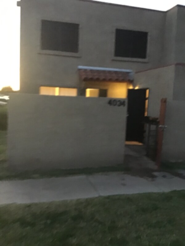
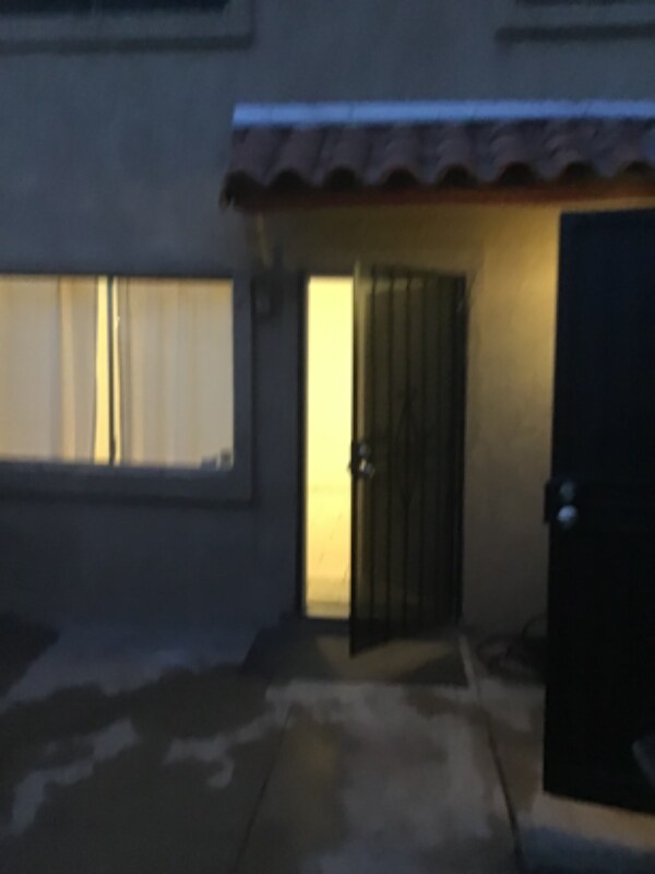
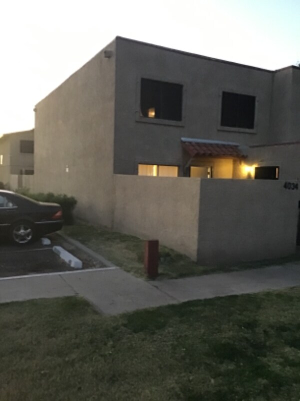
4034 W Mesquite Ln
Phoenix, AZ 85019
2 Weeks Ago
|
Edit
Favorites
4034 W Mesquite Ln

Favorites
Check Back Soon for Upcoming Availability
| Beds | Baths | Average SF |
|---|---|---|
| 2 Bedrooms 2 Bedrooms 2 Br | 1.5 Baths 1.5 Baths 1.5 Ba | — |
Fees and Policies
The fees listed below are community-provided and may exclude utilities or add-ons. All payments are made directly to the property and are non-refundable unless otherwise specified.
Details
Utilities Included
-
Water
-
Trash Removal
-
Sewer
About This Property
Property Id: 795619 Two story home, water, trash, sewer pay by owner. Camelback/40 ave phx az. Close to Grand Canyon university
4034 W Mesquite Ln is a townhome located in Maricopa County and the 85019 ZIP Code. This area is served by the Alhambra Elementary District attendance zone.
Townhome Features
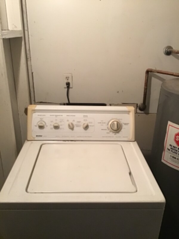
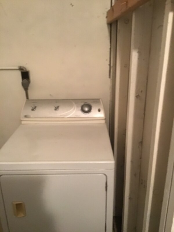
Washer/Dryer
Dishwasher
Refrigerator
Disposal
- Washer/Dryer
- Dishwasher
- Disposal
- Refrigerator
- Tile Floors
- Fenced Lot
4034 W Mesquite Ln,
Phoenix,
AZ
85019
Westside is a neighborhood within Glendale, which was voted “Arizona’s Antique Capital” by Sunset magazine and USA Today. Many higher education schools are located near Westside, including Glendale Community College, Carrington College, and Arizona State University West campus. You’ll discover numerous pocket parks in the area, plus larger ones like Glendale Heroes Regional Park and Grand Canal Linear Park. Shopping and dining destinations are plentiful, especially at Arrowhead Towne Center Mall.
Learn more about living in WestsideBelow are rent ranges for similar nearby apartments
Amenities
- Washer/Dryer
- Dishwasher
- Disposal
- Refrigerator
- Tile Floors
- Fenced Lot
Expenses
Utilities Included
Water, Trash Removal, Sewer
Included
Education
| Colleges & Universities | Distance | ||
|---|---|---|---|
| Colleges & Universities | Distance | ||
| Drive: | 6 min | 1.8 mi | |
| Drive: | 13 min | 5.2 mi | |
| Drive: | 13 min | 7.1 mi | |
| Drive: | 13 min | 7.1 mi |
4034 W Mesquite Ln is within 6 minutes or 1.8 miles from Grand Canyon University. It is also near Phoenix College and Argosy University.
Schools


Public Elementary & Middle School
Grades K-8
661 Students
Attendance Zone
Public Elementary School
Grades PK-5
717 Students
Attendance Zone
Public High School
Grades 9-12
224 Students
Attendance Zone
Public High School
Grades 9-12
2,167 Students
Attendance Zone
Private Elementary & Middle School
Grades PK-8
213 Students
Nearby
Private High School
Grades 9-12
345 Students
Nearby
School data provided by
 The GreatSchools Rating helps parents compare schools within a state based on a variety of school quality indicators and provides a helpful picture of how effectively each school serves all of its students. Ratings are on a scale of 1 (below average) to 10 (above average) and can include test scores, college readiness, academic progress, advanced courses, equity, discipline and attendance data. We also advise parents to visit schools, consider other information on school performance and programs, and consider family needs as part of the school selection process.
View GreatSchools Rating Methodology
Data provided by GreatSchools.org © 2026. All rights reserved.
View GreatSchools Rating Methodology
Data provided by GreatSchools.org © 2026. All rights reserved.
Transportation options available in Phoenix include 19Th Ave/Camelback, located 3.4 miles from 4034 W Mesquite Ln. 4034 W Mesquite Ln is near Phoenix Sky Harbor International, located 12.5 miles or 22 minutes away, and Phoenix-Mesa Gateway, located 39.3 miles or 55 minutes away.
| Transit / Subway | Distance | ||
|---|---|---|---|
| Transit / Subway | Distance | ||
|
|
Drive: | 8 min | 3.4 mi |
|
|
Drive: | 9 min | 4.0 mi |
|
|
Drive: | 8 min | 4.2 mi |
|
|
Drive: | 10 min | 5.1 mi |
|
|
Drive: | 11 min | 5.9 mi |
| Commuter Rail | Distance | ||
|---|---|---|---|
| Commuter Rail | Distance | ||
|
|
Drive: | 54 min | 40.4 mi |
| Airports | Distance | ||
|---|---|---|---|
| Airports | Distance | ||
|
Phoenix Sky Harbor International
|
Drive: | 22 min | 12.5 mi |
|
Phoenix-Mesa Gateway
|
Drive: | 55 min | 39.3 mi |
Walkability Near 4034 W Mesquite Ln Phoenix, AZ 85019
Getting Around
 What do Walkability, Transit, Drivability, and Bikeability mean?
Walkability measures the walking distance to day-to-day needs.
Transit measures access to public transportation.
Drivability measures congestion, parking availability, and access to major roads.
Bikeability measures the suitability for cycling.
How It Works
What do Walkability, Transit, Drivability, and Bikeability mean?
Walkability measures the walking distance to day-to-day needs.
Transit measures access to public transportation.
Drivability measures congestion, parking availability, and access to major roads.
Bikeability measures the suitability for cycling.
How It Works
Fairly Walkable
Walkability
40
/ 100
Limited Public Transit
Transit
30
/ 100
Exceptionally Drivable
Drivability
90
/ 100
Fairly Bikeable
Bikeability
50
/ 100
Scores provided by
-
Soundscore™
-
/ 100
Traffic
-Airport
-Businesses
-Scores provided by
HowLoud What is a Sound Score Rating? A Sound Score Rating aggregates noise caused by vehicle traffic, airplane traffic and local sources. How It WorksTime and distance from 4034 W Mesquite Ln.
| Shopping Centers | Distance | ||
|---|---|---|---|
| Shopping Centers | Distance | ||
| Walk: | 5 min | 0.3 mi | |
| Walk: | 9 min | 0.5 mi | |
| Walk: | 11 min | 0.6 mi |
4034 W Mesquite Ln has 3 shopping centers within 0.6 mile, which is about a 11-minute walk. The miles and minutes will be for the farthest away property.
| Parks and Recreation | Distance | ||
|---|---|---|---|
| Parks and Recreation | Distance | ||
|
Maryvale Park
|
Drive: | 5 min | 2.2 mi |
|
Steele Indian School Park
|
Drive: | 13 min | 5.5 mi |
|
El Oso Park
|
Drive: | 12 min | 5.9 mi |
|
Japanese Friendship Garden
|
Drive: | 13 min | 6.2 mi |
|
Margaret T. Hance Park
|
Drive: | 15 min | 8.0 mi |
4034 W Mesquite Ln has 5 parks within 8.0 miles, including Maryvale Park, El Oso Park, and Steele Indian School Park.
| Hospitals | Distance | ||
|---|---|---|---|
| Hospitals | Distance | ||
| Drive: | 8 min | 3.8 mi | |
| Drive: | 9 min | 4.5 mi | |
| Drive: | 12 min | 5.4 mi |
4034 W Mesquite Ln has 3 hospitals within 5.4 miles, the nearest is Abrazo Central Campus which is 3.8 miles away and a 8 minute drive.
| Military Bases | Distance | ||
|---|---|---|---|
| Military Bases | Distance | ||
| Drive: | 23 min | 12.4 mi | |
| Drive: | 25 min | 13.2 mi | |
| Drive: | 99 min | 72.9 mi |
4034 W Mesquite Ln has 3 military bases within 72.9 miles, the nearest is Phoenix Sky Harbor Airport Air Guard Station which is 12.4 miles away and a 23 minute drive.
You May Also Like
Similar Rentals Nearby
-
-
-
-
2 Beds$1,946+3 Beds$2,285+Total Monthly PriceTotal Monthly Price NewPrices include base rent and required monthly fees of $264. Variable costs based on usage may apply.Base Rent:2 Beds$1,682+3 Beds$2,021+2 Months Free
Pets Allowed Fitness Center Pool Dishwasher Walk-In Closets Stainless Steel Appliances
-
-
2 Beds$1,836+3 Beds$3,158+Total Monthly PriceTotal Monthly Price NewPrices include base rent and required monthly fees of $111. Variable costs based on usage may apply.Base Rent:2 Beds$1,725+3 Beds$3,047+Specials
Pets Allowed Fitness Center Pool Dishwasher In Unit Washer & Dryer Walk-In Closets Balcony
-
-
2 Beds$1,792+Total Monthly Price12 Month LeaseTotal Monthly Price NewPrices include base rent and required monthly fees of $198. Variable costs based on usage may apply.Base Rent:2 Beds$1,594+Specials
Pets Allowed Dishwasher In Unit Washer & Dryer Stainless Steel Appliances Controlled Access Granite Countertops Hardwood Floors
-
-


 - Palm Valley Villas")

What Are Walk Score®, Transit Score®, and Bike Score® Ratings?
Walk Score® measures the walkability of any address. Transit Score® measures access to public transit. Bike Score® measures the bikeability of any address.
What is a Sound Score Rating?
A Sound Score Rating aggregates noise caused by vehicle traffic, airplane traffic and local sources.
4034 W Mesquite Ln
Phoenix, AZ 85019