
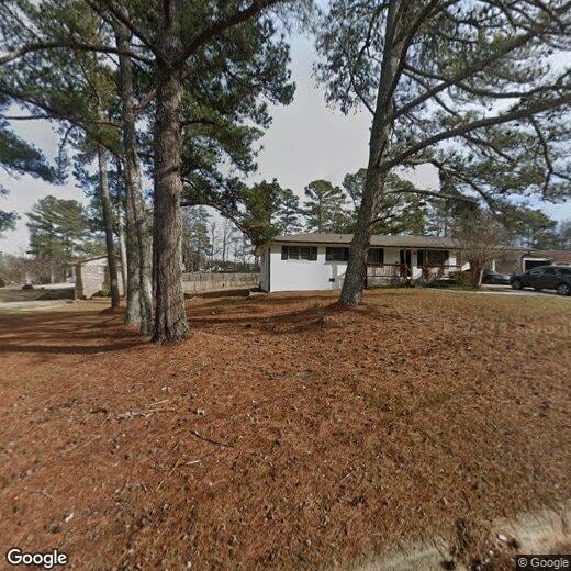
4022 S Shelby Ln
4022 S Shelby Ln
Douglasville, GA 30135
Favorites
4022 S Shelby Ln

Favorites
Check Back Soon for Upcoming Availability
| Beds | Baths | Average SF |
|---|---|---|
| 3 Bedrooms 3 Bedrooms 3 Br | 1.5 Baths 1.5 Baths 1.5 Ba | — |
4022 S Shelby Ln,
Douglasville,
GA
30135
Located 20 miles west of Atlanta, Douglasville combines suburban living with historic charm. The downtown district, listed on the National Register of Historic Places, showcases Romanesque, Italianate, and Queen Anne architecture alongside local shops and restaurants. Housing options include apartment communities near Arbor Place Mall and residential properties throughout established neighborhoods. Current market data shows average rents of $1,271 for one-bedroom units. The rental market reflects varying trends, with one and two-bedroom units seeing decreases of 7.2% and 3.9% respectively over the past year, while three and four-bedroom homes show modest increases.
Douglasville's Hunter Park features an 18-hole disc golf course and athletic facilities. Sweetwater Creek State Park, 7 miles east of downtown, offers 9 miles of hiking trails and a 215-acre lake for fishing and canoeing.
Learn more about living in Douglasville
Education
| Colleges & Universities | Distance | ||
|---|---|---|---|
| Colleges & Universities | Distance | ||
| Drive: | 26 min | 16.3 mi | |
| Drive: | 34 min | 20.6 mi | |
| Drive: | 33 min | 24.3 mi | |
| Drive: | 33 min | 24.3 mi |
4022 S Shelby Ln is within 26 minutes or 16.3 miles from Chatt. Tech, Austell. It is also near Chatt. Tech, Paulding and Morehouse School of Medicine.
Walkability Near 4022 S Shelby Ln Douglasville, GA 30135
Getting Around
 What do Walkability, Transit, Drivability, and Bikeability mean?
Walkability measures the walking distance to day-to-day needs.
Transit measures access to public transportation.
Drivability measures congestion, parking availability, and access to major roads.
Bikeability measures the suitability for cycling.
How It Works
What do Walkability, Transit, Drivability, and Bikeability mean?
Walkability measures the walking distance to day-to-day needs.
Transit measures access to public transportation.
Drivability measures congestion, parking availability, and access to major roads.
Bikeability measures the suitability for cycling.
How It Works
Somewhat Walkable
Walkability
30
/ 100
Exceptionally Drivable
Drivability
100
/ 100
Somewhat Bikeable
Bikeability
20
/ 100
Scores provided by
Active
Soundscore™
79
/ 100
Traffic
ActiveAirport
CalmBusinesses
CalmScores provided by
HowLoud What is a Sound Score Rating? A Sound Score Rating aggregates noise caused by vehicle traffic, airplane traffic and local sources. How It WorksYou May Also Like
Similar Rentals Nearby
-
-

-
-
-
 Total Monthly Price New3 Beds$2,610+4 Beds$2,709+Total Monthly PricePrices include base rent and required monthly fees of $133. Variable costs based on usage may apply.Base Rent:3 Beds$2,476+4 Beds$2,575+
 -

-
-

-
-


What Are Walk Score®, Transit Score®, and Bike Score® Ratings?
Walk Score® measures the walkability of any address. Transit Score® measures access to public transit. Bike Score® measures the bikeability of any address.
What is a Sound Score Rating?
A Sound Score Rating aggregates noise caused by vehicle traffic, airplane traffic and local sources.
4022 S Shelby Ln
Douglasville, GA 30135