

$5,450 / Month
4 Merrill Ave
Belmont, MA 02478
Today
Favorites
808-913-7252
-
Bedrooms
3
-
Bathrooms
3
-
Square Feet
1,800 sq ft
-
Available
Available Jul 1
Highlights
- Medical Services
- Spa
- Property is near public transit
- Covered patio or porch
- Jogging Path
- Fenced Yard
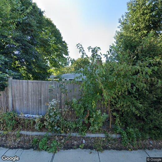
4 Merrill Ave

Favorites
About This Home
$5,450 deposit,
Available Jul 1
Tucked into Belmont’s desirable Payson Park area,near the Cambridge line,this stunning single-family home offers the perfect blend of privacy,space,and comfort. Enjoy beautiful hardwood floors,a sun-filled living room,formal dining room,and a spacious kitchen with granite counters,hardwood cabinets,and stainless steel appliances. The layout includes 3 beds,3 full baths,a sunroom off the dining area,and direct garage access. A finished basement adds bonus living space with a jacuzzi! Step onto the deck with awning,or relax in the large,private backyard oasis—complete with garden space and beautiful trees. The front yard,driveway for 2+ cars,and indoor garage offer added convenience. With fresh paint,ceiling fans,ample storage,a jacuzzi tub,and thoughtful finishes throughout,this home feels like a retreat. Close to parks,shops,and public transit—truly a gem! MLS# 73391082
4 Merrill Ave is a house located in Middlesex County and the 02478 ZIP Code. This area is served by the Belmont attendance zone.
* Price shown is base rent and may not include non-optional fees and utilities.
Price, availability, fees, and any applicable rent special are subject to change without notice.
* Square footage definitions vary. Displayed square footage is approximate.
Home Details
Home Type
Single Family Detached Home
Accessible Home Design
Entry on the 1st floor
Bedrooms and Bathrooms
3 Full Bathrooms
3 Bedrooms
Interior Spaces
1,800 Sq Ft Home
Laundry
Laundry in unit
Listing and Financial Details
Security Deposit $5,450
Property Available on 7/1/25
12 Month Lease Term
Rent includes water
Location
Property is near public transit
Property is near schools
Lot Details
9,000 Sq Ft Lot
Fenced Yard
Garden
Fenced
Outdoor Features
Covered patio or porch
Covered Deck
Outdoor Storage
Parking
1 Car Garage
Pool
Spa
Utilities
No Cooling
Heating Available
Community Details
Amenities
Medical Services
Shops
Overview
No Home Owners Association
Pet Policy
Call for details about the types of pets allowed
Recreation
Jogging Path
Park
Bike Trail
Fees and Policies
The fees below are based on community-supplied data and may exclude additional fees and utilities.
Pet policies are negotiable.
Contact
- Listed by Paulina Mauras | Coldwell Banker Realty - Cambridge
- Phone Number
-
Source
 MLS Property Information Network
The property listing data and information set forth herein were provided to MLS Property Information Network, Inc. from third party sources, including sellers, lessors and public records, and were compiled by MLS Property Information Network, Inc. The property listing data and information are for the personal, non-commercial use of consumers having a good faith interest in purchasing or leasing listed properties of the type displayed to them and may not be used for any purpose other than to identify prospective properties which such consumers may have a good faith interest in purchasing or leasing. MLS Property Information Network, Inc. and its subscribers disclaim any and all representations and warranties as to the accuracy of the property listing data and information set forth herein. All properties are subject to prior sale, change or withdrawal. Copyright © 2025 MLS Property Information Network, Inc. All rights reserved.
Location
Get Directions
Amenities
- Fenced Lot
- Patio
- Deck
Situated on Cambridge’s western border, about eight miles from Downtown Boston, Belmont is a picturesque suburb boasting a close-knit, small-town feel. Primarily a residential community, Belmont is known to locals as “the Town of Homes” with beautiful houses lining the Pleasant Street Historic District. Local businesses and popular chains also populate Leonard Street’s commercial corridor in Belmont.
Belmont offers residents easy access to Downtown Boston via the T and major roadways in addition to scenic natural surroundings. Convenience to Beaver Brook North Reservation, Rock Meadow Conservation Area, Lone Tree Hill, Claypit Pond, and Robbins Farm Park allows Belmont residents the opportunity to connect with nature at any time while nearby Harvard Square and Downtown Boston present endless options for metropolitan endeavors as well.
Learn more about living in Belmont
Education
| Colleges & Universities | Distance | ||
|---|---|---|---|
| Colleges & Universities | Distance | ||
| Drive: | 5 min | 2.2 mi | |
| Drive: | 6 min | 2.4 mi | |
| Drive: | 6 min | 3.1 mi | |
| Drive: | 6 min | 3.4 mi |
4 Merrill Ave is within 5 minutes or 2.2 miles from Lesley University. It is also near Lesley University, Porter and Harvard University.
Schools


Public Elementary School
Grades K-4
336 Students
Attendance Zone
Public Elementary & Middle School
Grades 5-8
1,371 Students
Attendance Zone
Public Elementary School
Grades PK-4
539 Students
Nearby
Public High School
Grades 9-12
1,364 Students
Attendance Zone
Private Elementary & Middle School
Grades PK-8
193 Students
Nearby
Private Elementary, Middle & High School
Grades 4-12
47 Students
Nearby
School data provided by
 The GreatSchools Rating helps parents compare schools within a state based on a variety of school quality indicators and provides a helpful picture of how effectively each school serves all of its students. Ratings are on a scale of 1 (below average) to 10 (above average) and can include test scores, college readiness, academic progress, advanced courses, equity, discipline and attendance data. We also advise parents to visit schools, consider other information on school performance and programs, and consider family needs as part of the school selection process.
View GreatSchools Rating Methodology
Data provided by GreatSchools.org © 2025. All rights reserved.
View GreatSchools Rating Methodology
Data provided by GreatSchools.org © 2025. All rights reserved.
Transportation options available in Belmont include Alewife, located 1.4 miles from 4 Merrill Ave. 4 Merrill Ave is near General Edward Lawrence Logan International, located 11.3 miles or 20 minutes away.
| Transit / Subway | Distance | ||
|---|---|---|---|
| Transit / Subway | Distance | ||
| Drive: | 2 min | 1.4 mi | |
|
|
Drive: | 3 min | 1.6 mi |
|
|
Drive: | 5 min | 2.5 mi |
|
|
Drive: | 7 min | 2.9 mi |
|
|
Drive: | 5 min | 3.0 mi |
| Commuter Rail | Distance | ||
|---|---|---|---|
| Commuter Rail | Distance | ||
|
|
Drive: | 2 min | 1.1 mi |
|
|
Drive: | 4 min | 2.3 mi |
|
|
Drive: | 6 min | 2.5 mi |
|
|
Drive: | 7 min | 3.7 mi |
| Drive: | 12 min | 6.2 mi |
| Airports | Distance | ||
|---|---|---|---|
| Airports | Distance | ||
|
General Edward Lawrence Logan International
|
Drive: | 20 min | 11.3 mi |
Time and distance from 4 Merrill Ave.
| Shopping Centers | Distance | ||
|---|---|---|---|
| Shopping Centers | Distance | ||
| Walk: | 16 min | 0.9 mi | |
| Walk: | 19 min | 1.0 mi | |
| Drive: | 3 min | 1.5 mi |
4 Merrill Ave has 3 shopping centers within 1.5 miles, which is about a 3-minute walk. The miles and minutes will be for the farthest away property.
| Parks and Recreation | Distance | ||
|---|---|---|---|
| Parks and Recreation | Distance | ||
|
Harvard-Smithsonian Center for Astrophysics
|
Drive: | 4 min | 1.8 mi |
|
Longfellow National Historic Site
|
Drive: | 5 min | 2.2 mi |
|
Mass Audubon's Habitat Education Center and Wildlife Sanctuary
|
Drive: | 6 min | 2.3 mi |
|
Harvard Museum of Natural History
|
Drive: | 7 min | 2.6 mi |
|
Beaver Brook Reservation
|
Drive: | 5 min | 2.7 mi |
4 Merrill Ave has 5 parks within 2.7 miles, including Harvard-Smithsonian Center for Astrophysics, Mass Audubon's Habitat Education Center and Wildlife Sanctuary, and Longfellow National Historic Site.
| Hospitals | Distance | ||
|---|---|---|---|
| Hospitals | Distance | ||
| Drive: | 4 min | 2.3 mi | |
| Drive: | 5 min | 2.6 mi | |
| Drive: | 7 min | 3.1 mi |
4 Merrill Ave has 3 hospitals within 3.1 miles, the nearest is Mount Auburn Hospital which is 2.3 miles away and a 4 minute drive.
| Military Bases | Distance | ||
|---|---|---|---|
| Military Bases | Distance | ||
| Drive: | 18 min | 9.1 mi | |
| Drive: | 28 min | 15.4 mi |
4 Merrill Ave is 9.1 miles from Hanscom Air Force Base, and is convenient to other military bases, including US Military Reservation.
You May Also Like
Similar Rentals Nearby


What Are Walk Score®, Transit Score®, and Bike Score® Ratings?
Walk Score® measures the walkability of any address. Transit Score® measures access to public transit. Bike Score® measures the bikeability of any address.
What is a Sound Score Rating?
A Sound Score Rating aggregates noise caused by vehicle traffic, airplane traffic and local sources
4 Merrill Ave
Belmont, MA 02478