

$799
/ Month
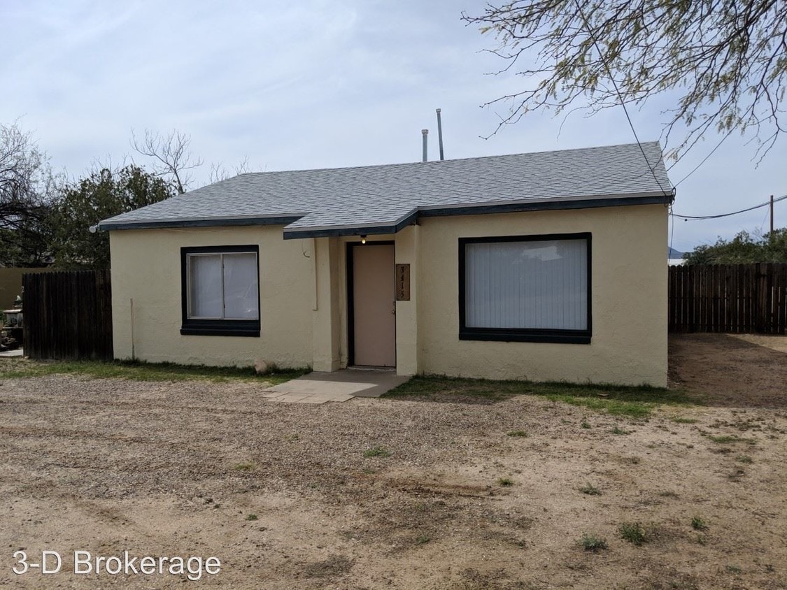
3415 N Los Altos Ave
Tucson, AZ 85705
2 Weeks Ago
|
Edit
Favorites
3415 N Los Altos Ave

Favorites
Check Back Soon for Upcoming Availability
| Beds | Baths | Average SF |
|---|---|---|
| 4 Bedrooms 4 Bedrooms 4 Br | 1 Bath 1 Bath 1 Ba | 1,350 SF |
About This Property
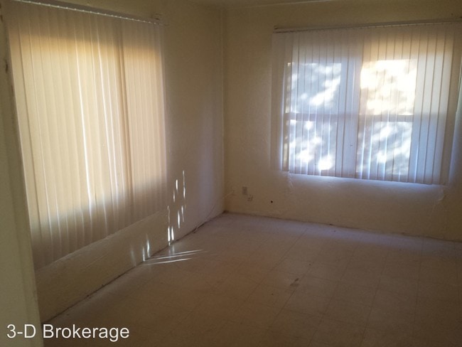
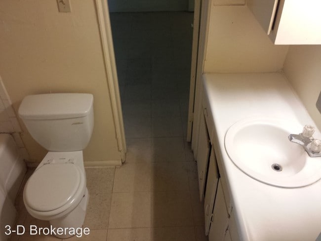
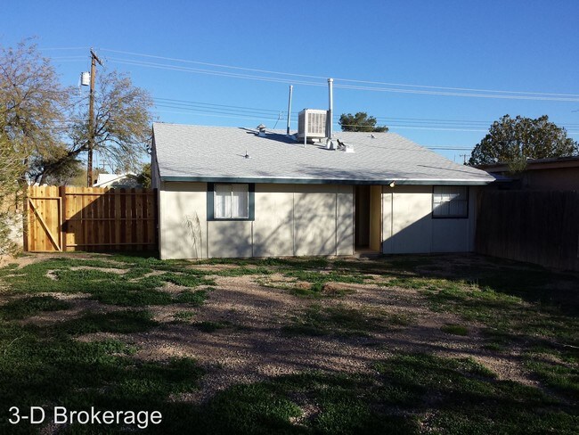
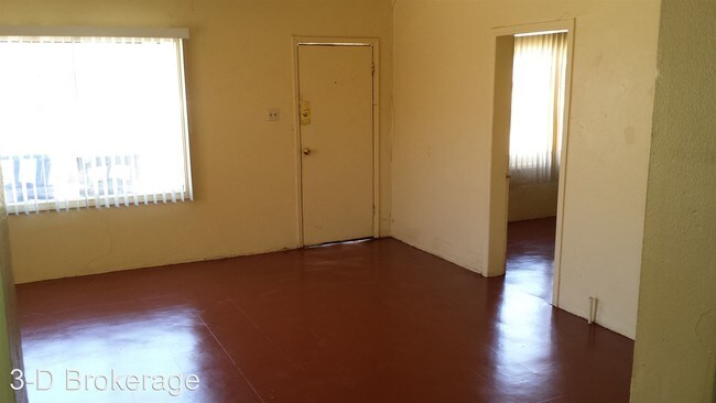
(520) 325-1523 - 3415 N. Los Altos - Washer/Dryer Hook-ups - Fenced Yard - 4 Bedrooms! - Very Cute house located on Prince/ 1st Ave. 2 bedrooms, 1 bath; 2 full size bedrooms with bathroom in between, and two small rooms in the rear of house. Large Kitchen and Living-room. Water is split with the guest house. Tenant will pay 75% of monthly water bill. Gas and Electric are also tenant's responsibility. Approximately 1350 sq ft. Amphitheater Unified School District Prince Elementary School Amphitheater Middle School Amphitheater High School (RLNE1911443) Other Amenities: Yard. Appliances: Washer & Dryer Hookup.
3415 N Los Altos Ave is a condo located in Pima County and the 85705 ZIP Code. This area is served by the Amphitheater Unified District attendance zone.
Unique Features
- Yard
Location
Get Directions
Amphi is a small neighborhood about five miles north of Downtown Tucson. Amphi has several schools, restaurants, and stores, but many residents head about a mile north to go to Tucson Mall for a wider variety of options. Along with a small neighborhood park, Amphi is also near several parks like Rillito Regional Park, which hosts a farmers market and other special events. Amphi is more affordable compared to other Tucson neighborhoods, so there are rental options available for every budget and taste. Residents also appreciate proximity to the Tucson Botanical Gardens, the University of Arizona, and Reid Park Zoo. Highway 77 runs through the western edge of the neighborhood, making traveling throughout the city easy.
Learn more about living in AmphiBelow are rent ranges for similar nearby apartments
Amenities
- Yard
Education
| Colleges & Universities | Distance | ||
|---|---|---|---|
| Colleges & Universities | Distance | ||
| Drive: | 7 min | 2.9 mi | |
| Drive: | 6 min | 3.0 mi | |
| Drive: | 10 min | 4.5 mi | |
| Drive: | 15 min | 6.4 mi |
3415 N Los Altos Ave is within 7 minutes or 2.9 miles from Pima C.C., Downtown Campus. It is also near University of Arizona and Pima C.C., Community Campus.
Schools


Public Elementary School
Grades PK-5
466 Students
Attendance Zone
Public Middle School
Grades 6-8
564 Students
Attendance Zone
Public High School
Grades 9-12
1,163 Students
Attendance Zone
Private Elementary & Middle School
Grades PK-8
Nearby
Private Elementary, Middle & High School
Grades 2-7 & 9-11
Nearby
Private High School
Grades 9-12
1,171 Students
Nearby
School data provided by
 The GreatSchools Rating helps parents compare schools within a state based on a variety of school quality indicators and provides a helpful picture of how effectively each school serves all of its students. Ratings are on a scale of 1 (below average) to 10 (above average) and can include test scores, college readiness, academic progress, advanced courses, equity, discipline and attendance data. We also advise parents to visit schools, consider other information on school performance and programs, and consider family needs as part of the school selection process.
View GreatSchools Rating Methodology
Data provided by GreatSchools.org © 2025. All rights reserved.
View GreatSchools Rating Methodology
Data provided by GreatSchools.org © 2025. All rights reserved.
Transportation options available in Tucson include Sl/University/Tyndall, located 2.9 miles from 3415 N Los Altos Ave. 3415 N Los Altos Ave is near Tucson International, located 11.5 miles or 24 minutes away.
| Transit / Subway | Distance | ||
|---|---|---|---|
| Transit / Subway | Distance | ||
| Drive: | 6 min | 2.9 mi | |
| Drive: | 7 min | 2.9 mi | |
| Drive: | 7 min | 3.0 mi | |
| Drive: | 7 min | 3.1 mi | |
| Drive: | 7 min | 3.1 mi |
| Commuter Rail | Distance | ||
|---|---|---|---|
| Commuter Rail | Distance | ||
|
|
Drive: | 9 min | 3.9 mi |
| Airports | Distance | ||
|---|---|---|---|
| Airports | Distance | ||
|
Tucson International
|
Drive: | 24 min | 11.5 mi |
Time and distance from 3415 N Los Altos Ave.
| Shopping Centers | Distance | ||
|---|---|---|---|
| Shopping Centers | Distance | ||
| Walk: | 4 min | 0.2 mi | |
| Walk: | 5 min | 0.3 mi | |
| Walk: | 5 min | 0.3 mi |
3415 N Los Altos Ave has 3 shopping centers within 0.3 mile, which is about a 5-minute walk. The miles and minutes will be for the farthest away property.
| Parks and Recreation | Distance | ||
|---|---|---|---|
| Parks and Recreation | Distance | ||
|
Keeling Park
|
Walk: | 20 min | 1.1 mi |
|
Mitchell Park
|
Drive: | 3 min | 1.4 mi |
|
Jacobs Park
|
Drive: | 4 min | 1.8 mi |
|
Mansfield Park
|
Drive: | 5 min | 2.2 mi |
|
North 6th Avenue Dog Park
|
Drive: | 5 min | 2.2 mi |
3415 N Los Altos Ave has 5 parks within 2.2 miles, including Keeling Park, Mitchell Park, and Mansfield Park.
| Hospitals | Distance | ||
|---|---|---|---|
| Hospitals | Distance | ||
| Drive: | 6 min | 3.0 mi | |
| Drive: | 10 min | 4.9 mi | |
| Drive: | 12 min | 6.1 mi |
3415 N Los Altos Ave has 3 hospitals within 6.1 miles, the nearest is Banner - University Medical Center Tucson Campus which is 3.0 miles away and a 6 minute drive.
| Military Bases | Distance | ||
|---|---|---|---|
| Military Bases | Distance | ||
| Drive: | 23 min | 10.4 mi | |
| Drive: | 25 min | 14.0 mi | |
| Drive: | 94 min | 78.4 mi |
3415 N Los Altos Ave has 3 military bases within 78.4 miles, the nearest is Tucson Airport Air Guard Station which is 10.4 miles away and a 23 minute drive.
You May Also Like
Similar Rentals Nearby
-
-
 Apartment for Rent4 Beds | 2 Baths | 1,700 sq ft
 -

-

-
 Apartment for Rent4 Beds | 3.5 Baths | 1,960 sq ft
 -

-

-

-

-

What Are Walk Score®, Transit Score®, and Bike Score® Ratings?
Walk Score® measures the walkability of any address. Transit Score® measures access to public transit. Bike Score® measures the bikeability of any address.
What is a Sound Score Rating?
A Sound Score Rating aggregates noise caused by vehicle traffic, airplane traffic and local sources
3415 N Los Altos Ave
Tucson, AZ 85705