
$1,395
/ Month
3955 W Palomino Rd Unit 3955
Phoenix, AZ 85019
2 Weeks Ago
|
Edit
Favorites
3955 W Palomino Rd Unit 3955

Favorites
Check Back Soon for Upcoming Availability
| Beds | Baths | Average SF |
|---|---|---|
| 2 Bedrooms 2 Bedrooms 2 Br | 1 Bath 1 Bath 1 Ba | 924 SF |
Fees and Policies
The fees below are based on community-supplied data and may exclude additional fees and utilities.
Details
Utilities Included
-
Trash Removal
Lease Options
-
12 Months
About This Property
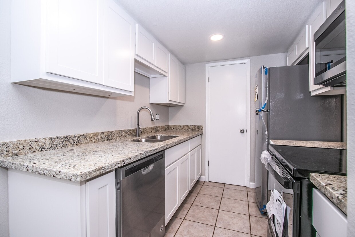
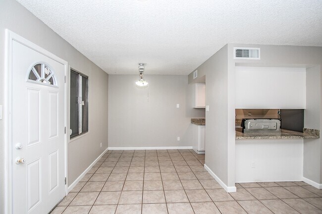
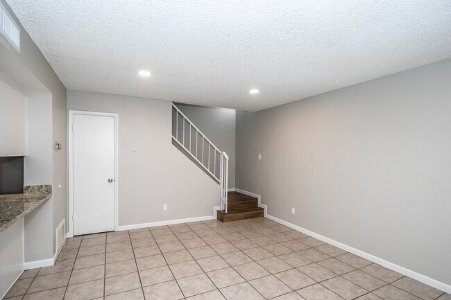
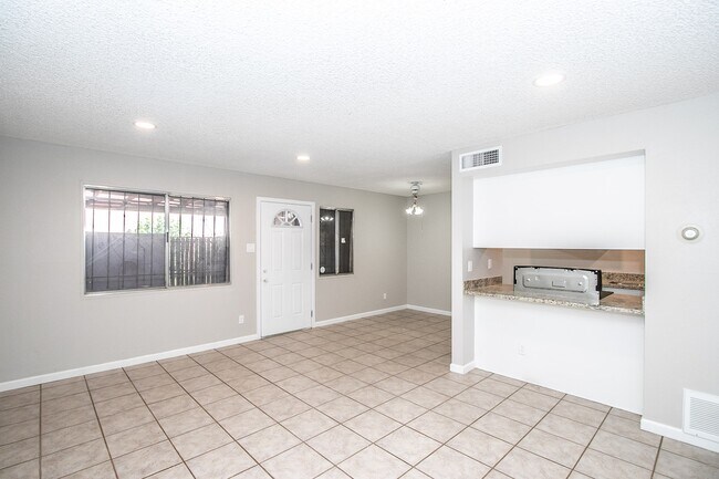
Come enjoy this fully renovated 2 Bedroom townhome in Phoenix. Open floor plan, prime location( Less then a mile from GCU), additional storage unit with your own private front patio, washer dryer hookup, 2 parking spots
3955 W Palomino Rd is a condo located in Maricopa County and the 85019 ZIP Code. This area is served by the Alhambra Elementary District attendance zone.
Condo Features
Air Conditioning
Dishwasher
Washer/Dryer Hookup
Microwave
- Washer/Dryer Hookup
- Air Conditioning
- Dishwasher
- Disposal
- Microwave
- Range
- Refrigerator
Location
Get Directions
Westside is a neighborhood within Glendale, which was voted “Arizona’s Antique Capital” by Sunset magazine and USA Today. Many higher education schools are located near Westside, including Glendale Community College, Carrington College, and Arizona State University West campus. You’ll discover numerous pocket parks in the area, plus larger ones like Glendale Heroes Regional Park and Grand Canal Linear Park. Shopping and dining destinations are plentiful, especially at Arrowhead Towne Center Mall.
Learn more about living in WestsideBelow are rent ranges for similar nearby apartments
Amenities
- Washer/Dryer Hookup
- Air Conditioning
- Dishwasher
- Disposal
- Microwave
- Range
- Refrigerator
Expenses
Utilities Included
Trash Removal
Included
Education
| Colleges & Universities | Distance | ||
|---|---|---|---|
| Colleges & Universities | Distance | ||
| Drive: | 4 min | 1.4 mi | |
| Drive: | 12 min | 4.9 mi | |
| Drive: | 12 min | 6.7 mi | |
| Drive: | 11 min | 6.7 mi |
3955 W Palomino Rd Unit 3955 is within 4 minutes or 1.4 miles from Grand Canyon University. It is also near Phoenix College and Argosy University.
Schools


Public Elementary & Middle School
Grades 5-8
667 Students
Attendance Zone
Public Elementary School
Grades PK-4
768 Students
Attendance Zone
Public High School
Grades 9-12
276 Students
Attendance Zone
Public High School
Grades 9-12
2,282 Students
Attendance Zone
Private Elementary & Middle School
Grades PK-8
252 Students
Nearby
Private High School
Grades 9-12
372 Students
Nearby
School data provided by
 The GreatSchools Rating helps parents compare schools within a state based on a variety of school quality indicators and provides a helpful picture of how effectively each school serves all of its students. Ratings are on a scale of 1 (below average) to 10 (above average) and can include test scores, college readiness, academic progress, advanced courses, equity, discipline and attendance data. We also advise parents to visit schools, consider other information on school performance and programs, and consider family needs as part of the school selection process.
View GreatSchools Rating Methodology
Data provided by GreatSchools.org © 2025. All rights reserved.
View GreatSchools Rating Methodology
Data provided by GreatSchools.org © 2025. All rights reserved.
Transportation options available in Phoenix include 19Th Ave/Camelback, located 3.1 miles from 3955 W Palomino Rd Unit 3955. 3955 W Palomino Rd Unit 3955 is near Phoenix Sky Harbor International, located 12.2 miles or 21 minutes away, and Phoenix-Mesa Gateway, located 38.9 miles or 53 minutes away.
| Transit / Subway | Distance | ||
|---|---|---|---|
| Transit / Subway | Distance | ||
|
|
Drive: | 6 min | 3.1 mi |
|
|
Drive: | 8 min | 3.7 mi |
|
|
Drive: | 7 min | 3.8 mi |
|
|
Drive: | 8 min | 4.7 mi |
|
|
Drive: | 10 min | 5.6 mi |
| Commuter Rail | Distance | ||
|---|---|---|---|
| Commuter Rail | Distance | ||
|
|
Drive: | 53 min | 40.0 mi |
| Airports | Distance | ||
|---|---|---|---|
| Airports | Distance | ||
|
Phoenix Sky Harbor International
|
Drive: | 21 min | 12.2 mi |
|
Phoenix-Mesa Gateway
|
Drive: | 53 min | 38.9 mi |
Time and distance from 3955 W Palomino Rd Unit 3955.
| Shopping Centers | Distance | ||
|---|---|---|---|
| Shopping Centers | Distance | ||
| Walk: | 4 min | 0.2 mi | |
| Walk: | 8 min | 0.4 mi | |
| Walk: | 10 min | 0.5 mi |
3955 W Palomino Rd Unit 3955 has 3 shopping centers within 0.5 mile, which is about a 10-minute walk. The miles and minutes will be for the farthest away property.
| Parks and Recreation | Distance | ||
|---|---|---|---|
| Parks and Recreation | Distance | ||
|
Maryvale Park
|
Drive: | 5 min | 2.2 mi |
|
Steele Indian School Park
|
Drive: | 12 min | 5.1 mi |
|
Japanese Friendship Garden
|
Drive: | 12 min | 5.8 mi |
|
El Oso Park
|
Drive: | 12 min | 5.9 mi |
|
Margaret T. Hance Park
|
Drive: | 14 min | 7.6 mi |
3955 W Palomino Rd Unit 3955 has 5 parks within 7.6 miles, including Maryvale Park, Steele Indian School Park, and El Oso Park.
| Hospitals | Distance | ||
|---|---|---|---|
| Hospitals | Distance | ||
| Drive: | 7 min | 3.5 mi | |
| Drive: | 8 min | 4.1 mi | |
| Drive: | 11 min | 5.0 mi |
3955 W Palomino Rd Unit 3955 has 3 hospitals within 5.0 miles, the nearest is Abrazo Central Campus which is 3.5 miles away and a 7 minute drive.
| Military Bases | Distance | ||
|---|---|---|---|
| Military Bases | Distance | ||
| Drive: | 21 min | 12.0 mi | |
| Drive: | 25 min | 13.3 mi | |
| Drive: | 98 min | 72.9 mi |
3955 W Palomino Rd Unit 3955 has 3 military bases within 72.9 miles, the nearest is Phoenix Sky Harbor Airport Air Guard Station which is 12.0 miles away and a 21 minute drive.
You May Also Like
Similar Rentals Nearby


What Are Walk Score®, Transit Score®, and Bike Score® Ratings?
Walk Score® measures the walkability of any address. Transit Score® measures access to public transit. Bike Score® measures the bikeability of any address.
What is a Sound Score Rating?
A Sound Score Rating aggregates noise caused by vehicle traffic, airplane traffic and local sources

3955 W Palomino Rd
Phoenix, AZ 85019