
Presidential Towers
555 W Madison St,
Chicago, IL 60661
$1,631 - $6,387
Studio - 2 Beds
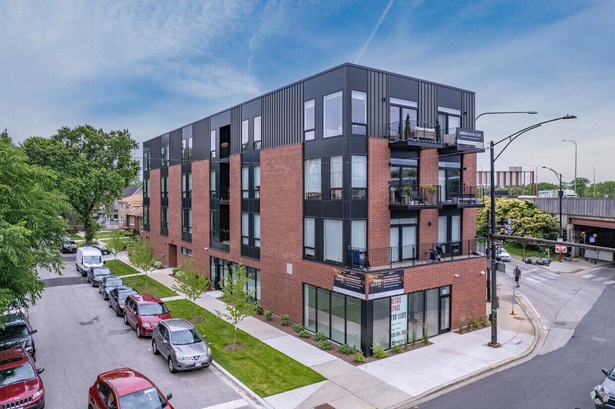

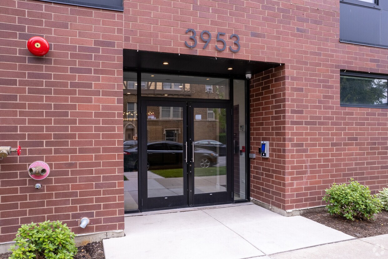

Experience Chicago living at 3953 W Dakin St. This property is situated in the Irving Park area of Chicago. Let the professional leasing staff show you everything this community has to offer. It's time to find your new home. Contact or stop by 3953 W Dakin St to discuss your new apartment!
3953 W Dakin St is an apartment community located in Cook County and the 60641 ZIP Code. This area is served by the Chicago Public Schools attendance zone.
Air Conditioning
Dishwasher
Microwave
Refrigerator
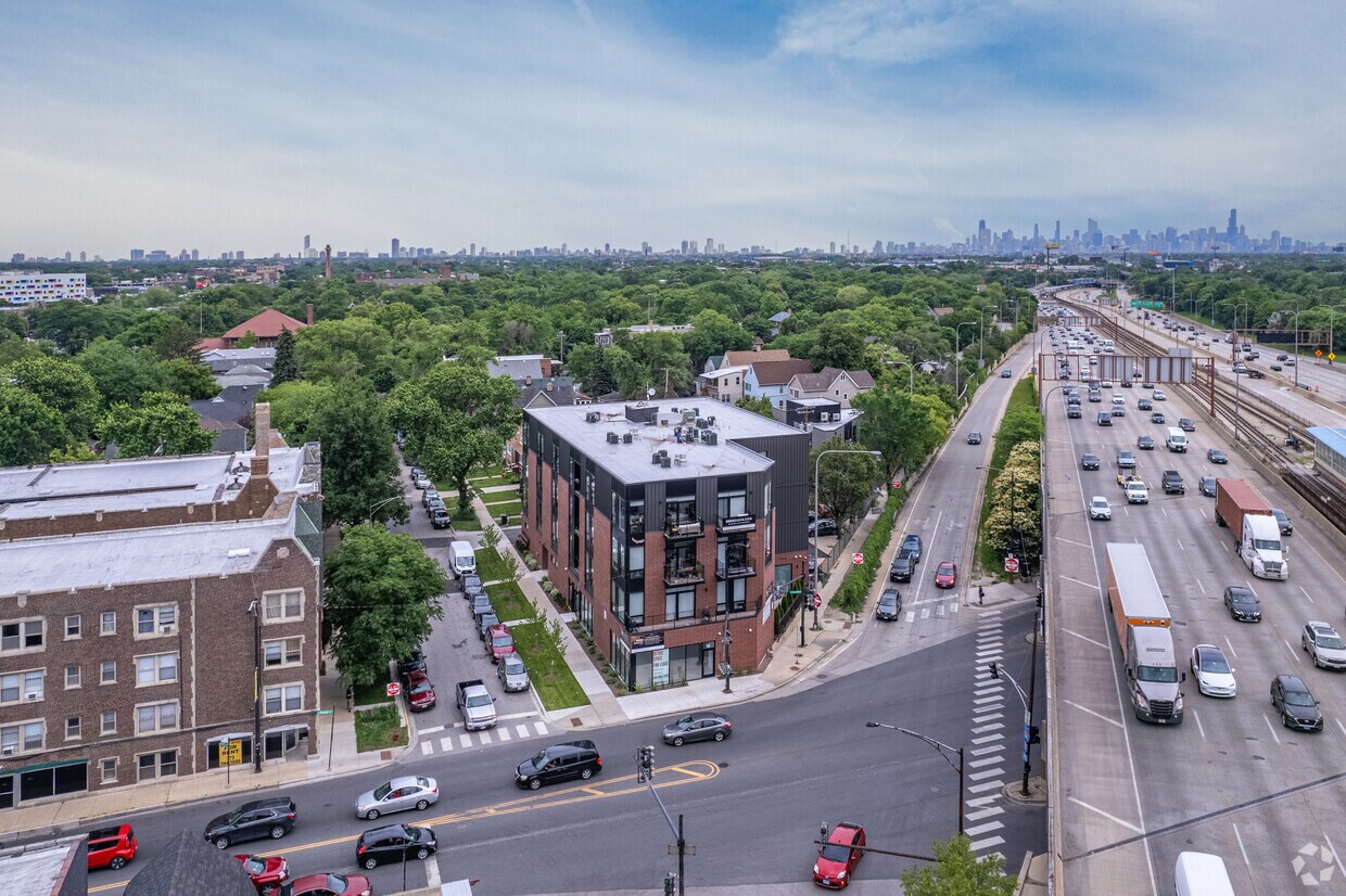
Located about eight miles northwest of Chicago’s Loop, Irving Park offers residents a strong sense of community along with access to a host of world-class amenities. Irving Park is known for its historic architecture, some of which predate the Great Fire of 1871.
Often situated along tree-lined streets, homes in Irving Park come in a broad range of stylings—from sprawling family estates to the quaint bungalows of the Villa Historic District. Irving Park also contains an array of apartments available for rent in charming brick buildings.
Irving Park residents enjoy the outdoors at numerous scenic parks in the neighborhood, including Horner Park, Independence Park, and Kilbourn Park. International cuisine abounds in Irving Park, from delicious Thai fare at Arun’s to down-home eats at Smoque BBQ and everything in between. Getting around from Irving Park is easy with access to several Metrarail stations, the Blue Line, and the Kennedy Expressway.
Learn more about living in Irving ParkCompare neighborhood and city base rent averages by bedroom.
| Irving Park | Chicago, IL | |
|---|---|---|
| Studio | $900 | $1,644 |
| 1 Bedroom | $1,103 | $2,046 |
| 2 Bedrooms | $1,944 | $2,581 |
| 3 Bedrooms | $2,143 | $3,091 |
| Colleges & Universities | Distance | ||
|---|---|---|---|
| Colleges & Universities | Distance | ||
| Drive: | 5 min | 2.6 mi | |
| Drive: | 5 min | 2.6 mi | |
| Drive: | 7 min | 3.1 mi | |
| Drive: | 8 min | 3.8 mi |


Transportation options available in Chicago include Montrose Station (Blue Line), located 1.1 miles from 3953 W Dakin St. 3953 W Dakin St is near Chicago O'Hare International, located 10.3 miles or 16 minutes away, and Chicago Midway International, located 12.6 miles or 23 minutes away.
| Transit / Subway | Distance | ||
|---|---|---|---|
| Transit / Subway | Distance | ||
|
|
Drive: | 2 min | 1.1 mi |
|
|
Drive: | 2 min | 1.3 mi |
|
|
Drive: | 2 min | 1.4 mi |
|
|
Drive: | 3 min | 1.8 mi |
|
|
Drive: | 3 min | 1.9 mi |
| Commuter Rail | Distance | ||
|---|---|---|---|
| Commuter Rail | Distance | ||
|
|
Walk: | 5 min | 0.3 mi |
|
|
Drive: | 3 min | 1.2 mi |
|
|
Drive: | 3 min | 1.6 mi |
|
|
Drive: | 4 min | 2.1 mi |
|
|
Drive: | 6 min | 3.4 mi |
| Airports | Distance | ||
|---|---|---|---|
| Airports | Distance | ||
|
Chicago O'Hare International
|
Drive: | 16 min | 10.3 mi |
|
Chicago Midway International
|
Drive: | 23 min | 12.6 mi |
Scores provided by
Traffic
-Airport
-Businesses
-Scores provided by
HowLoud What is a Sound Score Rating? A Sound Score Rating aggregates noise caused by vehicle traffic, airplane traffic and local sources. How It WorksTime and distance from 3953 W Dakin St.
| Shopping Centers | Distance | ||
|---|---|---|---|
| Shopping Centers | Distance | ||
| Walk: | 12 min | 0.7 mi | |
| Walk: | 19 min | 1.0 mi | |
| Drive: | 2 min | 1.1 mi |
| Parks and Recreation | Distance | ||
|---|---|---|---|
| Parks and Recreation | Distance | ||
|
Kilbourn Park
|
Drive: | 3 min | 1.2 mi |
|
Gompers Park
|
Drive: | 4 min | 1.9 mi |
|
North Park Village Nature Center
|
Drive: | 4 min | 2.3 mi |
|
Labagh Woods
|
Drive: | 6 min | 2.5 mi |
|
Portage Park
|
Drive: | 5 min | 2.6 mi |
| Hospitals | Distance | ||
|---|---|---|---|
| Hospitals | Distance | ||
| Drive: | 6 min | 2.7 mi | |
| Drive: | 5 min | 3.1 mi | |
| Drive: | 8 min | 4.2 mi |
| Military Bases | Distance | ||
|---|---|---|---|
| Military Bases | Distance | ||
| Drive: | 25 min | 18.0 mi | |
| Drive: | 37 min | 28.9 mi | |
| Drive: | 46 min | 30.2 mi |
What Are Walk Score®, Transit Score®, and Bike Score® Ratings?
Walk Score® measures the walkability of any address. Transit Score® measures access to public transit. Bike Score® measures the bikeability of any address.
What is a Sound Score Rating?
A Sound Score Rating aggregates noise caused by vehicle traffic, airplane traffic and local sources.

3953 W Dakin St
Chicago, IL 60641


